The CH7 3 postcode sector is within the county of Clwyd.
Did you know? According to the 2021 Census, the CH7 3 postcode sector is home to a bustling 7,406 residents!
Given that each sector allows for 400 unique postcode combinations. Letters C, I, K, M, O and V are not allowed in the last two letters of a postcode. With 203 postcodes already in use, this leaves 197 units available.
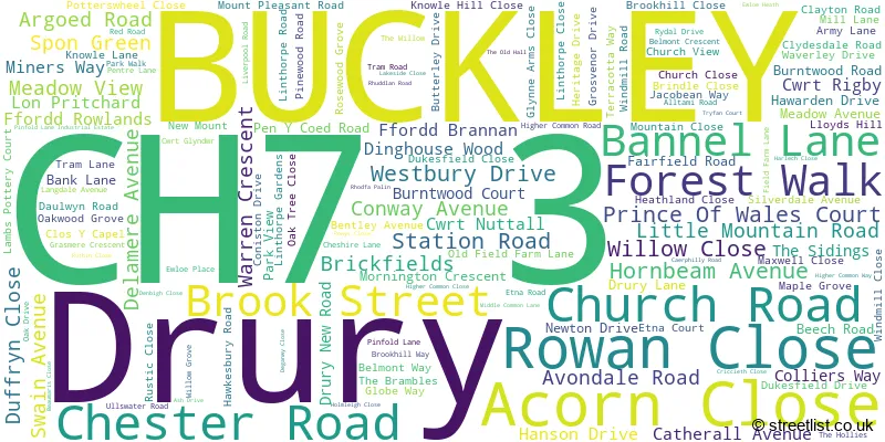
The largest settlement in the CH7 3 postal code is BUCKLEY followed by DRURY, and BURNTWOOD.
The CH7 3 Postcode shares a border with CH4 0 (BROUGHTON, PENYFFORDD, PENYMYNYDD), CH7 4 (LEESWOOD, TREUDDYN, LLANARMON YN IAL), CH7 6 (MYNYDD ISA, NORTHOP HALL, NORTHOP), CH5 3 (Hawarden, Ewloe, DOBSHILL) and CH7 2 (BUCKLEY).
The sector is within the post town of BUCKLEY.
CH7 3 is a postcode sector within the CH7 postcode district which is within the CH Chester postcode area.
The Royal Mail delivery office for the CH7 3 postal sector is the Mold Delivery Office.
The area of the CH7 3 postcode sector is 2.23 square miles which is 5.77 square kilometres or 1,425.39 square acres.

Map of the CH7 3 Postcode Sector
Explore the CH7 3 postcode sector by using our free interactive map.
| C | H | 7 | - | 3 | X | X |
| C | H | 7 | Space | 3 | Letter | Letter |
Official List of Streets
BUCKLEY (137 Streets)
Unofficial Streets or Alternative Spellings
BUCKLEY
BEECHTREE ROAD BRUNSWICK ROAD COTTAGE GARDENS JUBILEE ROAD LYME GROVE L�N PRITCHARD PEMBA DRIVE VICTORIA AVENUE VICTORIA ROADHawarden
HOLLINS LANE VALE AVENUE WOOD LANE WOODLANDS DRIVE BANK ROW BAY TREE COURT BELMONT ROAD BUCKLEY HERITAGE TRAIL CLOS ALLT Y NANT CLOS BRITH CONNISTON DRIVE CROSS TREE COURT DINGHOUSE DIRTY MILE DUKES FIELD DRIVE FFORDD ARGOED FFORDD ROWLAND FFORDD Y FELIN WYNT FFORDD Y GOEDWIG / FOREST WALK GWIBFFORDD GOGLEDD CYMRU / NORTH WALES EXPRESSWAY HOEL CLAYTON KNOWLHILL CLOSE LON BUTTERLY LON IAGO LON Y GLOWYR MEGS LANE PEN-Y-COED ROAD QUARRY BANK RHODFA CATHERALL RHODFA HANSON ST JOHNS CLOSE STANDARD ROAD THE MEWS WOOD CROFTAlltami
ALLTAMI ROAD BRYN ROAD MOLD ROAD PINFOLD LANE WHITE FARM ROADDobshill
CHESTER ROADEwloe
SMITHY LANE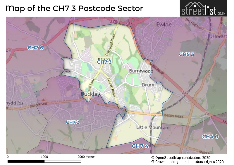
House Prices in the CH7 3 Postcode Sector
| Type of Property | 2018 Average | 2018 Sales | 2017 Average | 2017 Sales | 2016 Average | 2016 Sales | 2015 Average | 2015 Sales |
|---|---|---|---|---|---|---|---|---|
| Detached | £232,710 | 64 | £227,376 | 80 | £235,521 | 93 | £229,367 | 103 |
| Semi-Detached | £156,647 | 29 | £158,719 | 36 | £152,025 | 51 | £155,780 | 53 |
| Terraced | £141,277 | 28 | £135,426 | 25 | £137,385 | 32 | £139,197 | 29 |
| Flats | £103,429 | 7 | £104,524 | 3 | £117,857 | 7 | £113,124 | 4 |
Important Postcodes CH7 3 in the Postcode Sector
CH7 3AJ is the postcode for Natural Resources Wales, Chester Road, and Cyfoeth Naturiol Cymru / Natural Resources Wales, Chester Road
CH7 3EG is the postcode for Drury Primary School, Beech Road
CH7 3HB is the postcode for Marches Medical Centre, Buckley Surgery, 46 Mill Lane
CH7 3HQ is the postcode for Buckley Swimming Pool, Mill Lane, and Elfed High School, Mill Lane
CH7 3JA is the postcode for Mountain Lane Primary School, Knowle Lane
CH7 3PG is the postcode for Buckley Medical Centre, Alltami Road
| The CH7 3 Sector is within these Local Authorities |
|
|---|---|
| The CH7 3 Sector is within these Counties |
|
| The CH7 3 Sector is within these Water Company Areas |
|