The IP19 0 postcode sector is within the county of Suffolk.
Did you know? According to the 2021 Census, the IP19 0 postcode sector is home to a bustling 2,229 residents!
Given that each sector allows for 400 unique postcode combinations. Letters C, I, K, M, O and V are not allowed in the last two letters of a postcode. With 195 postcodes already in use, this leaves 205 units available.
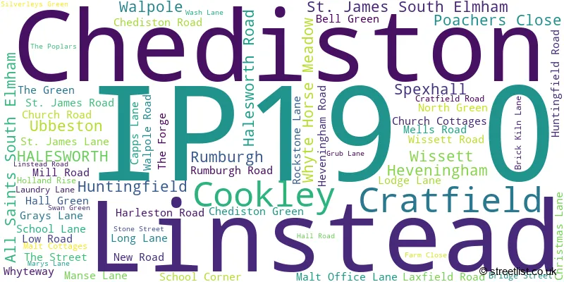
The largest settlement in the IP19 0 postal code is Cratfield followed by Chediston, and Wissett.
The IP19 0 Postcode shares a border with NR34 8 (Wangford, Brampton, Ilketshall St. Andrew), NR35 1 (BUNGAY, Flixton, Mettingham), IP13 8 (Laxfield, Badingham, Dennington), IP17 2 (Kelsale, Peasenhall, Sibton), IP19 8 (HALESWORTH, Holton, Westhall), IP19 9 (Wenhaston, Bramfield, Blythburgh), IP20 0 (Alburgh, Metfield, Denton) and IP21 5 (Stradbroke, Fressingfield, Hoxne).
The sector is within the post town of HALESWORTH.
IP19 0 is a postcode sector within the IP19 postcode district which is within the IP Ipswich postcode area.
The Royal Mail delivery office for the IP19 0 postal sector is the Halesworth Delivery Office.
The area of the IP19 0 postcode sector is 32.30 square miles which is 83.65 square kilometres or 20,670.43 square acres.
Waterways within the IP19 0 postcode sector include the Blyth.

Map of the IP19 0 Postcode Sector
Explore the IP19 0 postcode sector by using our free interactive map.
| I | P | 1 | 9 | - | 0 | X | X |
| I | P | 1 | 9 | Space | 0 | Letter | Letter |
Official List of Streets
Cratfield (12 Streets)
Huntingfield (9 Streets)
All Saints South Elmham (2 Streets)
Chediston (5 Streets)
Wissett (9 Streets)
Linstead (3 Streets)
Heveningham (6 Streets)
Spexhall (6 Streets)
Cookley (2 Streets)
St. James South Elmham (3 Streets)
Rumburgh (7 Streets)
Walpole (1 Streets)
HALESWORTH (1 Streets)
Unofficial Streets or Alternative Spellings
Ilketshall St. Lawrence
HALESWORTH ROAD HOG LANEHALESWORTH
CHEDISTON STREET WISSETT ROADWalpole
HALESWORTH ROAD PEASENHALL ROAD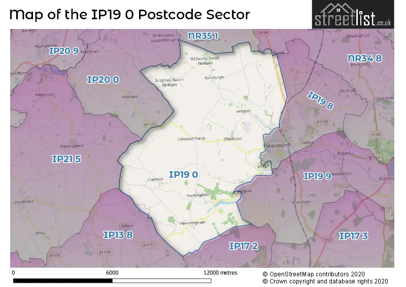
House Prices in the IP19 0 Postcode Sector
| Type of Property | 2018 Average | 2018 Sales | 2017 Average | 2017 Sales | 2016 Average | 2016 Sales | 2015 Average | 2015 Sales |
|---|---|---|---|---|---|---|---|---|
| Detached | £402,182 | 22 | £439,878 | 22 | £450,192 | 13 | £429,648 | 27 |
| Semi-Detached | £243,000 | 8 | £271,375 | 8 | £165,625 | 4 | £211,000 | 8 |
| Terraced | £305,000 | 3 | £278,000 | 2 | £0 | 0 | £118,000 | 1 |
| Flats | £95,000 | 1 | £0 | 0 | £0 | 0 | £0 | 0 |
| The IP19 0 Sector is within these Local Authorities |
|
|---|---|
| The IP19 0 Sector is within these Counties |
|
| The IP19 0 Sector is within these Water Company Areas |
|