The L19 0 postcode sector is within the county of Merseyside.
Did you know? According to the 2021 Census, the L19 0 postcode sector is home to a bustling 2,414 residents!
Given that each sector allows for 400 unique postcode combinations. Letters C, I, K, M, O and V are not allowed in the last two letters of a postcode. With 64 postcodes already in use, this leaves 336 units available.
The largest settlement in the L19 0 postal code is LIVERPOOL followed by Garston, and Cressington.
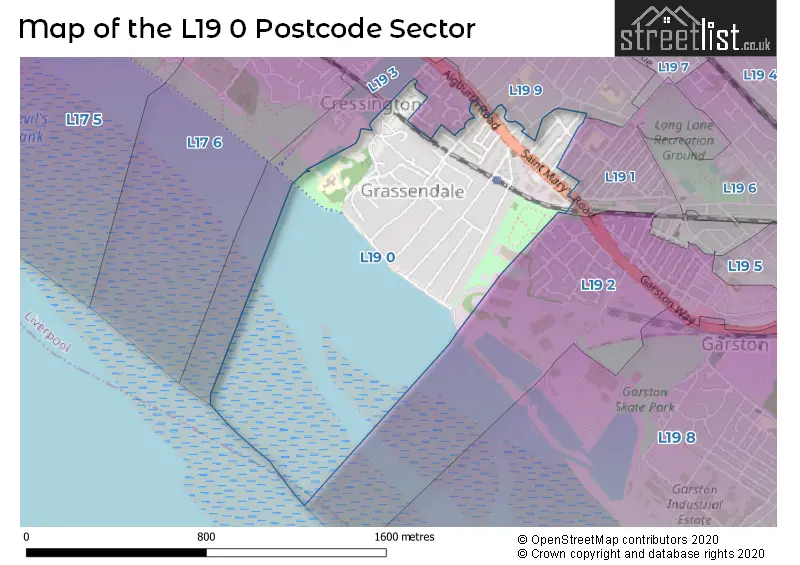
The L19 0 Postcode shares a border with L19 1 (LIVERPOOL, Garston), L19 2 (LIVERPOOL, Garston), L19 3 (LIVERPOOL, Aigburth) and L19 9 (LIVERPOOL, Garston).
The sector is within the post town of LIVERPOOL.
L19 0 is a postcode sector within the L1 postcode district which is within the L Liverpool postcode area.
The Royal Mail delivery office for the L19 0 postal sector is the Liverpool 1-3.
The area of the L19 0 postcode sector is 0.27 square miles which is 0.71 square kilometres or 175.78 square acres.

Map of the L19 0 Postcode Sector
Explore the L19 0 postcode sector by using our free interactive map.
| L | 1 | 9 | - | 0 | X | X |
| L | 1 | 9 | Space | 0 | Letter | Letter |
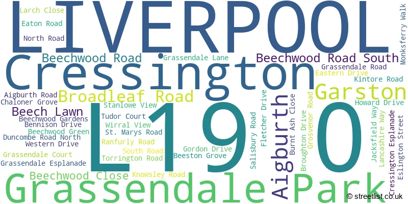
Official List of Streets
LIVERPOOL (32 Streets)
Cressington (3 Streets)
Aigburth (2 Streets)
Garston (2 Streets)
Grassendale Park (1 Streets)
Unofficial Streets or Alternative Spellings
Weather Forecast for L19 0
Press Button to Show Forecast for Grassendale
| Time Period | Icon | Description | Temperature | Rain Probability | Wind |
|---|---|---|---|---|---|
| 03:00 to 06:00 | Cloudy | 10.0°C (feels like 7.0°C) | 5.00% | SE 16 mph | |
| 06:00 to 09:00 | Cloudy | 10.0°C (feels like 6.0°C) | 5.00% | SE 18 mph | |
| 09:00 to 12:00 | Cloudy | 12.0°C (feels like 8.0°C) | 8.00% | SE 18 mph | |
| 12:00 to 15:00 | Cloudy | 15.0°C (feels like 11.0°C) | 9.00% | SSE 18 mph | |
| 15:00 to 18:00 | Cloudy | 15.0°C (feels like 11.0°C) | 15.00% | SSE 16 mph | |
| 18:00 to 21:00 | Light rain shower (day) | 13.0°C (feels like 11.0°C) | 35.00% | SSE 11 mph | |
| 21:00 to 00:00 | Overcast | 11.0°C (feels like 10.0°C) | 16.00% | SE 9 mph |
Press Button to Show Forecast for Grassendale
| Time Period | Icon | Description | Temperature | Rain Probability | Wind |
|---|---|---|---|---|---|
| 00:00 to 03:00 | Cloudy | 10.0°C (feels like 9.0°C) | 7.00% | SE 9 mph | |
| 03:00 to 06:00 | Cloudy | 9.0°C (feels like 8.0°C) | 4.00% | SE 7 mph | |
| 06:00 to 09:00 | Cloudy | 9.0°C (feels like 7.0°C) | 4.00% | SE 7 mph | |
| 09:00 to 12:00 | Cloudy | 12.0°C (feels like 10.0°C) | 5.00% | ESE 7 mph | |
| 12:00 to 15:00 | Cloudy | 14.0°C (feels like 13.0°C) | 8.00% | SE 7 mph | |
| 15:00 to 18:00 | Cloudy | 15.0°C (feels like 14.0°C) | 13.00% | SSE 7 mph | |
| 18:00 to 21:00 | Cloudy | 15.0°C (feels like 13.0°C) | 12.00% | WNW 7 mph | |
| 21:00 to 00:00 | Cloudy | 13.0°C (feels like 12.0°C) | 11.00% | WNW 7 mph |
Press Button to Show Forecast for Grassendale
| Time Period | Icon | Description | Temperature | Rain Probability | Wind |
|---|---|---|---|---|---|
| 00:00 to 03:00 | Cloudy | 12.0°C (feels like 10.0°C) | 12.00% | N 7 mph | |
| 03:00 to 06:00 | Cloudy | 11.0°C (feels like 10.0°C) | 9.00% | NNW 7 mph | |
| 06:00 to 09:00 | Cloudy | 11.0°C (feels like 10.0°C) | 7.00% | NNW 7 mph | |
| 09:00 to 12:00 | Cloudy | 13.0°C (feels like 12.0°C) | 8.00% | N 9 mph | |
| 12:00 to 15:00 | Sunny day | 16.0°C (feels like 14.0°C) | 5.00% | N 9 mph | |
| 15:00 to 18:00 | Sunny day | 18.0°C (feels like 15.0°C) | 3.00% | N 11 mph | |
| 18:00 to 21:00 | Sunny day | 17.0°C (feels like 14.0°C) | 4.00% | N 11 mph | |
| 21:00 to 00:00 | Clear night | 14.0°C (feels like 12.0°C) | 3.00% | NNE 9 mph |
House Prices in the L19 0 Postcode Sector
| Type of Property | 2018 Average | 2018 Sales | 2017 Average | 2017 Sales | 2016 Average | 2016 Sales | 2015 Average | 2015 Sales |
|---|---|---|---|---|---|---|---|---|
| Detached | £600,279 | 9 | £501,227 | 11 | £440,042 | 12 | £403,125 | 8 |
| Semi-Detached | £265,317 | 15 | £347,029 | 10 | £280,842 | 13 | £309,283 | 12 |
| Terraced | £270,222 | 9 | £116,640 | 5 | £143,322 | 9 | £159,483 | 3 |
| Flats | £70,700 | 10 | £83,438 | 12 | £170,436 | 16 | £94,712 | 13 |
Important Postcodes L19 0 in the Postcode Sector
L19 0NF is the postcode for Jobcentre Plus, Cressington House, 249 St. Marys Road
| The L19 0 Sector is within these Local Authorities |
|
|---|---|
| The L19 0 Sector is within these Counties |
|
| The L19 0 Sector is within these Water Company Areas |
|