The L19 2 postcode sector is within the county of Merseyside.
Did you know? According to the 2021 Census, the L19 2 postcode sector is home to a bustling 3,459 residents!
Given that each sector allows for 400 unique postcode combinations. Letters C, I, K, M, O and V are not allowed in the last two letters of a postcode. With 79 postcodes already in use, this leaves 321 units available.
The largest settlements in the L19 2 postal code are LIVERPOOL and Garston.
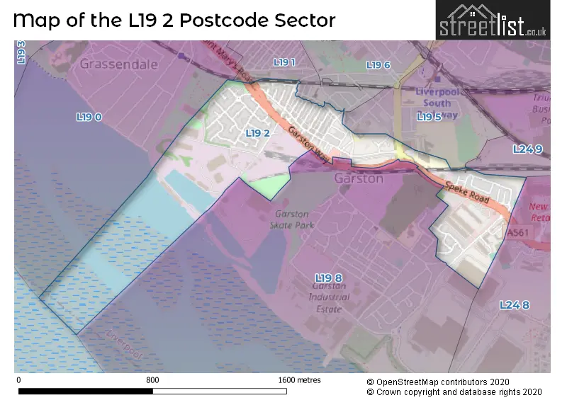
The L19 2 Postcode shares a border with L19 0 (LIVERPOOL, Garston, Cressington), L24 9 (LIVERPOOL, Speke, Halewood), L19 1 (LIVERPOOL, Garston), L19 5 (LIVERPOOL, Allerton, Garston), L19 8 (LIVERPOOL, Garston) and L24 8 (Speke).
The sector is within the post town of LIVERPOOL.
L19 2 is a postcode sector within the L1 postcode district which is within the L Liverpool postcode area.
The Royal Mail delivery office for the L19 2 postal sector is the Liverpool 1-3.
The area of the L19 2 postcode sector is 0.35 square miles which is 0.91 square kilometres or 224.31 square acres.

Map of the L19 2 Postcode Sector
Explore the L19 2 postcode sector by using our free interactive map.
| L | 1 | 9 | - | 2 | X | X |
| L | 1 | 9 | Space | 2 | Letter | Letter |
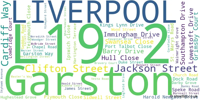
Official List of Streets
LIVERPOOL (40 Streets)
Garston (12 Streets)
Unofficial Streets or Alternative Spellings
Weather Forecast for L19 2
Press Button to Show Forecast for Grassendale
| Time Period | Icon | Description | Temperature | Rain Probability | Wind |
|---|---|---|---|---|---|
| 06:00 to 09:00 | Cloudy | 10.0°C (feels like 6.0°C) | 5.00% | SE 18 mph | |
| 09:00 to 12:00 | Cloudy | 12.0°C (feels like 8.0°C) | 8.00% | SE 18 mph | |
| 12:00 to 15:00 | Cloudy | 15.0°C (feels like 11.0°C) | 9.00% | SSE 18 mph | |
| 15:00 to 18:00 | Cloudy | 15.0°C (feels like 11.0°C) | 15.00% | SSE 16 mph | |
| 18:00 to 21:00 | Light rain shower (day) | 13.0°C (feels like 11.0°C) | 35.00% | SSE 11 mph | |
| 21:00 to 00:00 | Overcast | 11.0°C (feels like 10.0°C) | 16.00% | SE 9 mph |
Press Button to Show Forecast for Grassendale
| Time Period | Icon | Description | Temperature | Rain Probability | Wind |
|---|---|---|---|---|---|
| 00:00 to 03:00 | Cloudy | 10.0°C (feels like 9.0°C) | 7.00% | SE 9 mph | |
| 03:00 to 06:00 | Cloudy | 9.0°C (feels like 8.0°C) | 4.00% | SE 7 mph | |
| 06:00 to 09:00 | Cloudy | 9.0°C (feels like 7.0°C) | 4.00% | SE 7 mph | |
| 09:00 to 12:00 | Cloudy | 12.0°C (feels like 10.0°C) | 5.00% | ESE 7 mph | |
| 12:00 to 15:00 | Cloudy | 14.0°C (feels like 13.0°C) | 8.00% | SE 7 mph | |
| 15:00 to 18:00 | Cloudy | 15.0°C (feels like 14.0°C) | 13.00% | SSE 7 mph | |
| 18:00 to 21:00 | Cloudy | 15.0°C (feels like 13.0°C) | 12.00% | WNW 7 mph | |
| 21:00 to 00:00 | Cloudy | 13.0°C (feels like 12.0°C) | 11.00% | WNW 7 mph |
Press Button to Show Forecast for Grassendale
| Time Period | Icon | Description | Temperature | Rain Probability | Wind |
|---|---|---|---|---|---|
| 00:00 to 03:00 | Cloudy | 12.0°C (feels like 10.0°C) | 12.00% | N 7 mph | |
| 03:00 to 06:00 | Cloudy | 11.0°C (feels like 10.0°C) | 9.00% | NNW 7 mph | |
| 06:00 to 09:00 | Cloudy | 11.0°C (feels like 10.0°C) | 7.00% | NNW 7 mph | |
| 09:00 to 12:00 | Cloudy | 13.0°C (feels like 12.0°C) | 8.00% | N 9 mph | |
| 12:00 to 15:00 | Sunny day | 16.0°C (feels like 14.0°C) | 5.00% | N 9 mph | |
| 15:00 to 18:00 | Sunny day | 18.0°C (feels like 15.0°C) | 3.00% | N 11 mph | |
| 18:00 to 21:00 | Sunny day | 17.0°C (feels like 14.0°C) | 4.00% | N 11 mph | |
| 21:00 to 00:00 | Clear night | 14.0°C (feels like 12.0°C) | 3.00% | NNE 9 mph |
Schools and Places of Education Within the L19 2 Postcode Sector
ES Independent School
Other independent school
52 Wellington Street, Merseyside, , L19 2LX
Head: Mrs Gayle Worswick
Ofsted Rating: Good
Inspection: 2023-06-08 (327 days ago)
Website: Visit ES Independent School Website
Phone: 01514274193
Number of Pupils: 17
House Prices in the L19 2 Postcode Sector
| Type of Property | 2018 Average | 2018 Sales | 2017 Average | 2017 Sales | 2016 Average | 2016 Sales | 2015 Average | 2015 Sales |
|---|---|---|---|---|---|---|---|---|
| Detached | £259,750 | 8 | £267,167 | 6 | £292,787 | 12 | £255,171 | 14 |
| Semi-Detached | £132,600 | 5 | £155,855 | 11 | £146,000 | 4 | £189,000 | 6 |
| Terraced | £115,227 | 35 | £116,312 | 34 | £98,131 | 32 | £114,926 | 31 |
| Flats | £73,655 | 10 | £107,367 | 55 | £65,039 | 18 | £71,436 | 7 |
Important Postcodes L19 2 in the Postcode Sector
L19 2JZ is the postcode for Jobcentre Plus, Speke Road
L19 2LW is the postcode for South Liverpool NHS Treatment Centre, 32 Church Road
L19 2NA is the postcode for Moss Mental Health Resource Centre, Moss Street
| The L19 2 Sector is within these Local Authorities |
|
|---|---|
| The L19 2 Sector is within these Counties |
|
| The L19 2 Sector is within these Water Company Areas |
|