The L13 9 postcode sector is within the county of Merseyside.
Did you know? According to the 2021 Census, the L13 9 postcode sector is home to a bustling 2,897 residents!
Given that each sector allows for 400 unique postcode combinations. Letters C, I, K, M, O and V are not allowed in the last two letters of a postcode. With 51 postcodes already in use, this leaves 349 units available.
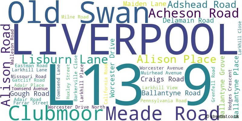
The largest settlements in the L13 9 postal code are LIVERPOOL and Clubmoor.
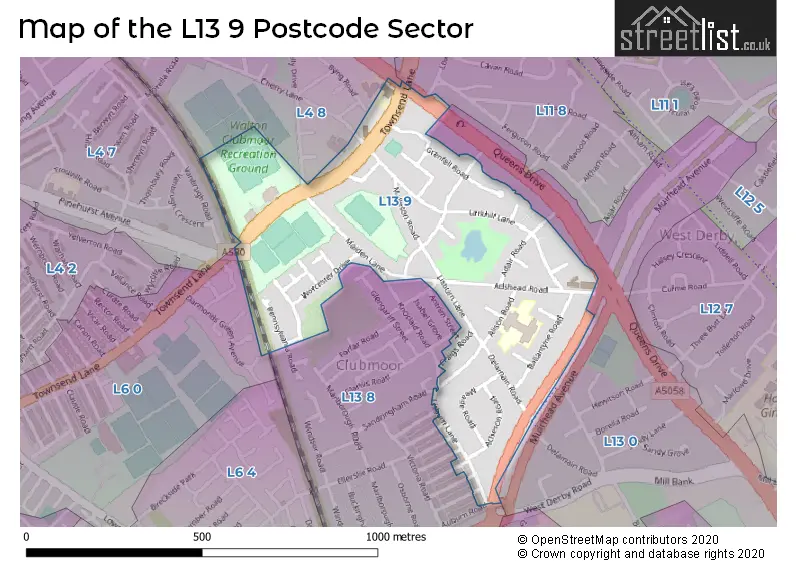
The L13 9 Postcode shares a border with L13 8 (LIVERPOOL, Tuebrook), L4 7 (LIVERPOOL, Anfield), L6 0 (LIVERPOOL, Anfield), L4 8 (LIVERPOOL, Walton, Norris Green), L11 8 (LIVERPOOL, Norris Green, West Derby) and L13 0 (LIVERPOOL, West Derby, Stoneycroft).
The sector is within the post town of LIVERPOOL.
L13 9 is a postcode sector within the L13 postcode district which is within the L Liverpool postcode area.
The Royal Mail delivery office for the L13 9 postal sector is the South Eastern (l) Delivery Office.
The area of the L13 9 postcode sector is 0.23 square miles which is 0.58 square kilometres or 144.25 square acres.

Map of the L13 9 Postcode Sector
Explore the L13 9 postcode sector by using our free interactive map.
| L | 1 | 3 | - | 9 | X | X |
| L | 1 | 3 | Space | 9 | Letter | Letter |
Official List of Streets
LIVERPOOL (33 Streets)
Clubmoor (3 Streets)
Old Swan (1 Streets)
Unofficial Streets or Alternative Spellings
LIVERPOOL
ANTRIM STREET BANKBURN ROAD CHERRY LANE CRAIGBURN ROAD DEANSBURN ROAD ESKBURN ROAD FAIRBURN ROAD FINVOY ROAD GORSEBURN ROAD HEYBURN ROAD KNOCLAID ROAD LONDONDERRY ROAD LOWERSON ROAD RICHARD KELLY DRIVE WEST DERBY ROADTuebrook
SANDRINGHAM ROADAnfield
TOWNSEND LANE QUEENS DRIVE WALTON QUEENS DRIVE WEST DERBYStoneycroft
QUEENS DRIVESchools and Places of Education Within the L13 9 Postcode Sector
Roscoe Primary School
Academy converter
Alison Road, Liverpool, Merseyside, L13 9AD
Head: Mrs P Jones
Ofsted Rating: Requires improvement
Inspection: 2023-11-22 (183 days ago)
Website: Visit Roscoe Primary School Website
Phone: 01512261536
Number of Pupils: 249
House Prices in the L13 9 Postcode Sector
| Type of Property | 2018 Average | 2018 Sales | 2017 Average | 2017 Sales | 2016 Average | 2016 Sales | 2015 Average | 2015 Sales |
|---|---|---|---|---|---|---|---|---|
| Detached | £182,750 | 2 | £0 | 0 | £0 | 0 | £0 | 0 |
| Semi-Detached | £109,882 | 17 | £105,286 | 7 | £95,700 | 10 | £91,955 | 11 |
| Terraced | £84,778 | 9 | £86,419 | 14 | £94,773 | 11 | £80,546 | 13 |
| Flats | £0 | 0 | £72,400 | 5 | £59,333 | 3 | £54,950 | 1 |
Important Postcodes L13 9 in the Postcode Sector
L13 9AD is the postcode for Roscoe Cp School, Alison Road
| The L13 9 Sector is within these Local Authorities |
|
|---|---|
| The L13 9 Sector is within these Counties |
|
| The L13 9 Sector is within these Water Company Areas |
|