The LA20 6 postcode sector is within the county of Cumbria.
Did you know? According to the 2021 Census, the LA20 6 postcode sector is home to a bustling 1,191 residents!
Given that each sector allows for 400 unique postcode combinations. Letters C, I, K, M, O and V are not allowed in the last two letters of a postcode. With 87 postcodes already in use, this leaves 313 units available.
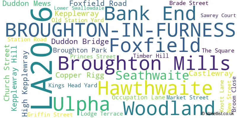
The largest settlement in the LA20 6 postal code is BROUGHTON-IN-FURNESS followed by Ulpha, and Seathwaite.
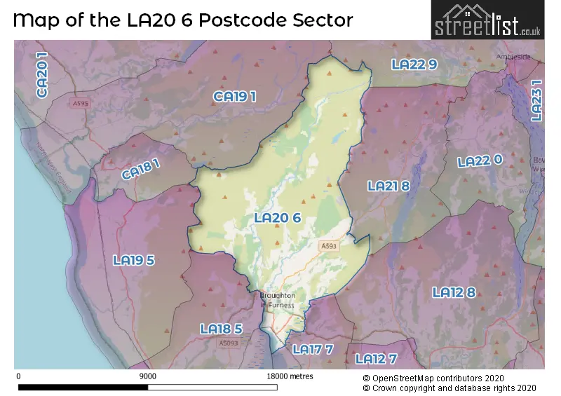
The LA20 6 Postcode shares a border with CA18 1 (RAVENGLASS, Muncaster, Broad Oak), CA19 1 (Drigg, Eskdale, HOLMROOK), LA12 8 (Backbarrow, Newby Bridge, Haverthwaite), LA18 5 (MILLOM, The Green, The Hill), LA19 5 (Bootle, Bootle Station, Waberthwaite), LA21 8 (CONISTON, Torver, Haws Bank), LA22 9 (AMBLESIDE, Grasmere, Chapel Stile) and LA17 7 (KIRKBY-IN-FURNESS, Grizebeck, Soutergate).
The sector is within the post town of BROUGHTON-IN-FURNESS.
LA20 6 is a postcode sector within the LA20 postcode district which is within the LA Lancaster postcode area.
The Royal Mail delivery office for the LA20 6 postal sector is the Broughton-in-furness Scale Payment Delivery Office.
The area of the LA20 6 postcode sector is 52.01 square miles which is 134.70 square kilometres or 33,286.06 square acres.
Waterways within the LA20 6 postcode sector include the River Duddon.

Map of the LA20 6 Postcode Sector
Explore the LA20 6 postcode sector by using our free interactive map.
| L | A | 2 | 0 | - | 6 | X | X |
| L | A | 2 | 0 | Space | 6 | Letter | Letter |
Official List of Streets
BROUGHTON-IN-FURNESS (23 Streets)
Foxfield (2 Streets)
Unofficial Streets or Alternative Spellings
Schools and Places of Education Within the LA20 6 Postcode Sector
Broughton CofE Primary and Nursery School
Voluntary controlled school
Kepplewray, Broughton-in-Furness, Cumbria, LA20 6BJ
Head: Mr Anthony Costa
Ofsted Rating: Good
Inspection: 2023-03-22 (428 days ago)
Website: Visit Broughton CofE Primary and Nursery School Website
Phone: 01229716206
Number of Pupils: 135
House Prices in the LA20 6 Postcode Sector
| Type of Property | 2018 Average | 2018 Sales | 2017 Average | 2017 Sales | 2016 Average | 2016 Sales | 2015 Average | 2015 Sales |
|---|---|---|---|---|---|---|---|---|
| Detached | £259,998 | 2 | £347,045 | 11 | £283,642 | 6 | £296,943 | 7 |
| Semi-Detached | £307,500 | 4 | £500,000 | 1 | £270,079 | 7 | £315,000 | 1 |
| Terraced | £221,167 | 6 | £176,038 | 13 | £184,688 | 8 | £169,243 | 7 |
| Flats | £0 | 0 | £0 | 0 | £0 | 0 | £0 | 0 |
| The LA20 6 Sector is within these Local Authorities |
|
|---|---|
| The LA20 6 Sector is within these Counties |
|
| The LA20 6 Sector is within these Water Company Areas |
|