The M41 8 postcode sector is within the county of Greater Manchester.
Did you know? According to the 2021 Census, the M41 8 postcode sector is home to a bustling 6,709 residents!
Given that each sector allows for 400 unique postcode combinations. Letters C, I, K, M, O and V are not allowed in the last two letters of a postcode. With 163 postcodes already in use, this leaves 237 units available.
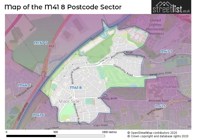
The M41 8 postal code covers the settlement of Urmston.
The M41 8 Postcode shares a border with M41 5 (Urmston), M41 6 (Urmston), M41 7 (Urmston), M30 7 (Eccles) and M44 6 (Irlam).
The sector is within the post town of MANCHESTER.
M41 8 is a postcode sector within the M41 postcode district which is within the M Manchester postcode area.
The Royal Mail delivery office for the M41 8 postal sector is the Urmston Delivery Office.
The area of the M41 8 postcode sector is 0.81 square miles which is 2.10 square kilometres or 519.16 square acres.
Waterways within the M41 8 postcode sector include the Manchester Ship Canal.

Map of the M41 8 Postcode Sector
Explore the M41 8 postcode sector by using our free interactive map.
| M | 4 | 1 | - | 8 | X | X |
| M | 4 | 1 | Space | 8 | Letter | Letter |
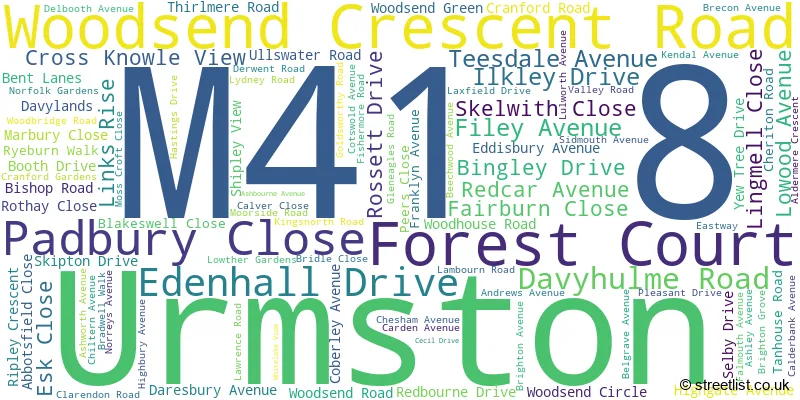
Official List of Streets
Urmston (94 Streets)
Unofficial Streets or Alternative Spellings
Weather Forecast for M41 8
Press Button to Show Forecast for Urmston
| Time Period | Icon | Description | Temperature | Rain Probability | Wind |
|---|---|---|---|---|---|
| 06:00 to 09:00 | Heavy rain | 6.0°C (feels like 3.0°C) | 86.00% | N 9 mph | |
| 09:00 to 12:00 | Heavy rain | 6.0°C (feels like 3.0°C) | 86.00% | NNW 9 mph | |
| 12:00 to 15:00 | Light rain | 7.0°C (feels like 4.0°C) | 56.00% | WNW 11 mph | |
| 15:00 to 18:00 | Cloudy | 9.0°C (feels like 6.0°C) | 41.00% | WNW 11 mph | |
| 18:00 to 21:00 | Partly cloudy (day) | 10.0°C (feels like 7.0°C) | 4.00% | W 11 mph | |
| 21:00 to 00:00 | Partly cloudy (night) | 8.0°C (feels like 5.0°C) | 1.00% | SW 7 mph |
Press Button to Show Forecast for Urmston
| Time Period | Icon | Description | Temperature | Rain Probability | Wind |
|---|---|---|---|---|---|
| 00:00 to 03:00 | Partly cloudy (night) | 6.0°C (feels like 4.0°C) | 1.00% | SSW 7 mph | |
| 03:00 to 06:00 | Cloudy | 5.0°C (feels like 3.0°C) | 38.00% | S 9 mph | |
| 06:00 to 09:00 | Cloudy | 6.0°C (feels like 4.0°C) | 7.00% | S 9 mph | |
| 09:00 to 12:00 | Partly cloudy (day) | 10.0°C (feels like 8.0°C) | 7.00% | S 13 mph | |
| 12:00 to 15:00 | Light rain shower (day) | 13.0°C (feels like 10.0°C) | 34.00% | S 16 mph | |
| 15:00 to 18:00 | Cloudy | 14.0°C (feels like 11.0°C) | 14.00% | S 16 mph | |
| 18:00 to 21:00 | Cloudy | 13.0°C (feels like 11.0°C) | 12.00% | S 13 mph | |
| 21:00 to 00:00 | Cloudy | 11.0°C (feels like 9.0°C) | 6.00% | SSE 11 mph |
Press Button to Show Forecast for Urmston
| Time Period | Icon | Description | Temperature | Rain Probability | Wind |
|---|---|---|---|---|---|
| 00:00 to 03:00 | Cloudy | 10.0°C (feels like 8.0°C) | 5.00% | SSE 11 mph | |
| 03:00 to 06:00 | Partly cloudy (night) | 9.0°C (feels like 7.0°C) | 3.00% | SE 11 mph | |
| 06:00 to 09:00 | Sunny day | 9.0°C (feels like 7.0°C) | 2.00% | SE 11 mph | |
| 09:00 to 12:00 | Sunny day | 13.0°C (feels like 11.0°C) | 2.00% | SE 13 mph | |
| 12:00 to 15:00 | Cloudy | 16.0°C (feels like 13.0°C) | 7.00% | SE 16 mph | |
| 15:00 to 18:00 | Cloudy | 17.0°C (feels like 14.0°C) | 10.00% | SE 13 mph | |
| 18:00 to 21:00 | Light rain shower (day) | 15.0°C (feels like 14.0°C) | 31.00% | ESE 9 mph | |
| 21:00 to 00:00 | Partly cloudy (night) | 13.0°C (feels like 12.0°C) | 7.00% | E 7 mph |
Press Button to Show Forecast for Urmston
| Time Period | Icon | Description | Temperature | Rain Probability | Wind |
|---|---|---|---|---|---|
| 00:00 to 03:00 | Cloudy | 12.0°C (feels like 10.0°C) | 9.00% | E 7 mph | |
| 03:00 to 06:00 | Cloudy | 11.0°C (feels like 10.0°C) | 10.00% | E 7 mph | |
| 06:00 to 09:00 | Cloudy | 11.0°C (feels like 10.0°C) | 15.00% | ENE 7 mph | |
| 09:00 to 12:00 | Cloudy | 14.0°C (feels like 13.0°C) | 14.00% | E 7 mph | |
| 12:00 to 15:00 | Cloudy | 16.0°C (feels like 15.0°C) | 16.00% | E 9 mph | |
| 15:00 to 18:00 | Cloudy | 18.0°C (feels like 16.0°C) | 17.00% | E 7 mph | |
| 18:00 to 21:00 | Cloudy | 17.0°C (feels like 15.0°C) | 13.00% | NE 7 mph | |
| 21:00 to 00:00 | Cloudy | 14.0°C (feels like 12.0°C) | 11.00% | NE 7 mph |
House Prices in the M41 8 Postcode Sector
| Type of Property | 2018 Average | 2018 Sales | 2017 Average | 2017 Sales | 2016 Average | 2016 Sales | 2015 Average | 2015 Sales |
|---|---|---|---|---|---|---|---|---|
| Detached | £427,708 | 19 | £421,238 | 19 | £306,591 | 22 | £290,860 | 21 |
| Semi-Detached | £252,507 | 66 | £226,033 | 68 | £214,320 | 56 | £197,858 | 46 |
| Terraced | £182,907 | 22 | £184,283 | 34 | £193,458 | 22 | £146,816 | 16 |
| Flats | £132,467 | 6 | £117,333 | 3 | £110,279 | 7 | £165,875 | 4 |
Important Postcodes M41 8 in the Postcode Sector
M41 8AA is the postcode for Urmston Group Practice, 6 Woodsend Crescent Road
M41 8BH is the postcode for Woodsend Clinic, Woodsend Crescent Road
M41 8GN is the postcode for Trafford Council, Woodsend Library, Woodsend Road
M41 8RN is the postcode for Trafford High School, Lydney Road
| The M41 8 Sector is within these Local Authorities |
|
|---|---|
| The M41 8 Sector is within these Counties |
|
| The M41 8 Sector is within these Water Company Areas |
|