The NR5 8 postcode sector is within the county of Norfolk.
Did you know? According to the 2021 Census, the NR5 8 postcode sector is home to a bustling 13,707 residents!
Given that each sector allows for 400 unique postcode combinations. Letters C, I, K, M, O and V are not allowed in the last two letters of a postcode. With 225 postcodes already in use, this leaves 175 units available.
The NR5 8 postal code covers the settlement of NORWICH.
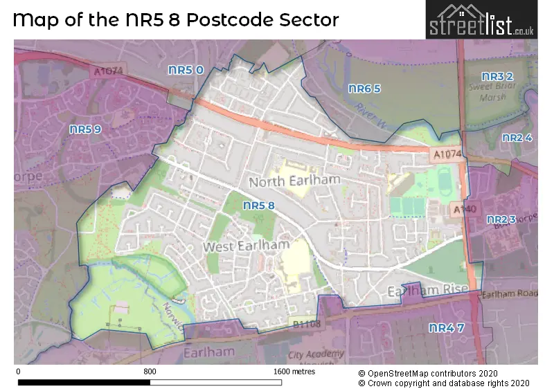
The NR5 8 Postcode shares a border with NR4 7 (NORWICH, Cringleford, Colney), NR2 3 (NORWICH), NR2 4 (NORWICH), NR3 2 (NORWICH, Sweet Briar Road Industrial Estate), NR6 5 (NORWICH, Hellesdon), NR5 0 (NORWICH, New Costessey) and NR5 9 (NORWICH).
The sector is within the post town of NORWICH.
NR5 8 is a postcode sector within the NR5 postcode district which is within the NR Norwich postcode area.
The Royal Mail delivery office for the NR5 8 postal sector is the Bowthorpe Delivery Office.
The area of the NR5 8 postcode sector is 1.09 square miles which is 2.81 square kilometres or 694.93 square acres.
Waterways within the NR5 8 postcode sector include the River Wensum, River Yare.

Map of the NR5 8 Postcode Sector
Explore the NR5 8 postcode sector by using our free interactive map.
| N | R | 5 | - | 8 | X | X |
| N | R | 5 | Space | 8 | Letter | Letter |
Official List of Streets
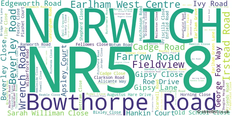
NORWICH (100 Streets)
Unofficial Streets or Alternative Spellings
NORWICH
BROOMSFIELD CLOVER HILL ROAD EARLES GARDENS EARLHAM ROAD GUNTON LANE HELLESDON ROAD NORWICH ROAD OVAL AVENUE SAXONCOTE AVENUE SWEET BRIAR ROAD WATERMAN ROAD WHEATLEY ROAD WOODHILL RISE BETSY CLOSE BOATMAN WAY BRIAR COURT CADGE MEWS CAMERON COURT CHARGE ROAD CHRISTOPHER COURT JAMES ALEXANDER MEWS JORDANS CLOSE LINK ROAD MARL PITT ROAD PETO COURT SAINT MILDREDS ROAD SALVIN COURT STANFORD COURT TOLLGATE WAY VILLAGE CLOSE WILKINS COURTEaston
DEREHAM ROADBarford
WATTON ROADSchools and Places of Education Within the NR5 8 Postcode Sector
Earlham Nursery School
Local authority nursery school
Cadge Road, Norwich, Norfolk, NR5 8DB
Head: Ms Carole Jacques
Ofsted Rating: Good
Inspection: 2022-06-22 (713 days ago)
Website: Visit Earlham Nursery School Website
Phone: 01603454271
Number of Pupils: 85
Henderson Green Primary School
Academy sponsor led
Earlham Grove, Norwich, Norfolk, NR5 8DX
Head: Mrs Clair Gribble
Ofsted Rating: Good
Inspection: 2018-11-21 (2022 days ago)
Website: Visit Henderson Green Primary School Website
Phone: 01603628030
Number of Pupils: 190
Norwich Primary Academy
Academy sponsor led
Clarkson Road, Norwich, Norfolk, NR5 8ED
Head: Ms Tanya Blake
Ofsted Rating: Good
Inspection: 2019-11-27 (1651 days ago)
Website: Visit Norwich Primary Academy Website
Phone: 01603454423
Number of Pupils: 315
Valley Primary Academy
Academy sponsor led
Gentry Place, Norwich, Norfolk, NR5 8XZ
Head: Ms Sara Bush
Ofsted Rating: Requires improvement
Inspection: 2023-06-07 (363 days ago)
Website: Visit Valley Primary Academy Website
Phone: 01603742969
Number of Pupils: 176
West Earlham Infant and Nursery School
Community school
Scarnell Road, Norwich, Norfolk, NR5 8HT
Head: Mrs Jade Hunter
Ofsted Rating: Outstanding
Inspection: 2017-10-04 (2435 days ago)
Website: Visit West Earlham Infant and Nursery School Website
Phone: 01603451299
Number of Pupils: 261
West Earlham Junior School
Community school
Scarnell Road, Norwich, Norfolk, NR5 8HT
Head: Mrs C Eyers
Ofsted Rating: Good
Inspection: 2019-07-16 (1785 days ago)
Website: Visit West Earlham Junior School Website
Phone: 01603454569
Number of Pupils: 234
House Prices in the NR5 8 Postcode Sector
| Type of Property | 2018 Average | 2018 Sales | 2017 Average | 2017 Sales | 2016 Average | 2016 Sales | 2015 Average | 2015 Sales |
|---|---|---|---|---|---|---|---|---|
| Detached | £231,364 | 11 | £235,967 | 14 | £224,329 | 7 | £224,154 | 13 |
| Semi-Detached | £221,784 | 44 | £212,857 | 54 | £190,115 | 55 | £177,096 | 40 |
| Terraced | £202,803 | 38 | £180,343 | 38 | £173,731 | 52 | £150,847 | 40 |
| Flats | £131,667 | 3 | £124,603 | 14 | £85,950 | 10 | £104,500 | 14 |
Important Postcodes NR5 8 in the Postcode Sector
NR5 8DB is the postcode for Earlham Early Years Centre, Cadge Road
NR5 8DX is the postcode for Henderson Green Primary Academy, Irstead Road
NR5 8DZ is the postcode for Henderson Green Primary Academy, Irstead Road, and Henderson Green Primary Academy,, Irstead Road
NR5 8ED is the postcode for Norwich Primary Academy, Clarkson Road, and Larkman Middle School, Clarkson Road
NR5 8HT is the postcode for MAIN SCHOOL BUILDING, West Earlham Infant School, Scarnell Road, MAIN SCHOOL BUILDING, West Earlham Junior School, Scarnell Road, and Main School building, West Earlham Infant School
NR5 8XZ is the postcode for KNOWLAND GROVE BLOCK, Valley Primary Academy, Gentry Place, Valley Primary School, Gentry Place, and GENTRY PLACE BLOCK, Valley Primary Academy, Gentry Place
| The NR5 8 Sector is within these Local Authorities |
|
|---|---|
| The NR5 8 Sector is within these Counties |
|
| The NR5 8 Sector is within these Water Company Areas |
|