The SO32 postcode district is a postal district located in the SO Southampton postcode area with a population of 23,672 residents according to the 2021 England and Wales Census.
The area of the SO32 postcode district is 55.08 square miles which is 142.65 square kilometres or 35,249.44 acres.
Currently, the SO32 district has about 606 postcode units spread across 3 geographic postcode sectors.
Given that each sector allows for 400 unique postcode combinations, the district has a capacity of 1,200 postcodes. With 606 postcodes already in use, this leaves 594 units available.
The largest settlement in the SO32 postal code is Bishops Waltham followed by Botley, and Swanmore.
The SO32 Postcode shares a border with SO21 (Colden Common, Sutton Scotney, Twyford), SO30 (Hedge End, West End, Botley), SO50 (EASTLEIGH, Bishopstoke, Fair Oak), SO24 (ALRESFORD, Ropley, Cheriton), GU32 (PETERSFIELD, East Meon, West Meon), PO17 (Wickham, Knowle, North Boarhunt) and PO7 (WATERLOOVILLE, Denmead, Hambledon).
The primary settlement in the SO32 postcode district is Bishops Waltham in Hampshire, the county of Hampshire lies in England. Other significant settlements in the district include Lower Upham, Upham, Botley, Curdridge, Durley, Hedge End, Shedfield, Shirrell Heath, Swanmore, and Waltham Chase. The post town associated with the district is Southampton.
For the district SO32, we have data on 3 postcode sectors. Here's a breakdown: The sector SO32 1, covers Bishops Waltham and Upham in Hampshire. The sector SO32 2, covers Swanmore and Waltham Chase and Botley in Hampshire. The sector SO32 3, covers Droxford and Soberton and Meonstoke and Corhampton in Hampshire.

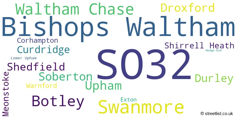
Map of the SO32 Postcode District
Explore the SO32 postcode district by using our free interactive map.

When it comes to local government, postal geography often disregards political borders. However, for a breakdown in the SO32 District: the district mostly encompasses the Winchester District (B) (570 postcodes), and finally, the Eastleigh District (B) area (73 postcodes).
Recent House Sales in SO32
| Date | Price | Address |
|---|---|---|
| 29/09/2023 | £375,000 | Appleby Drive, Botley, Southampton, SO32 2GE |
| 27/09/2023 | £345,000 | Gunners Park, Bishops Waltham, Southampton, SO32 1PD |
| 18/09/2023 | £250,000 | Pine Lea, Bishops Waltham, Southampton, SO32 1NZ |
| 18/09/2023 | £475,000 | Garfield Road, Bishops Waltham, Southampton, SO32 1AT |
| 15/09/2023 | £690,000 | Maddoxford Lane, Botley, Southampton, SO32 2DG |
| 08/09/2023 | £1,235,000 | Durley Street, Durley, Southampton, SO32 2AA |
| 08/09/2023 | £385,000 | Albany Drive, Bishops Waltham, Southampton, SO32 1GE |
| 08/09/2023 | £290,000 | Churchill Avenue, Bishops Waltham, Southampton, SO32 1DA |
| 05/09/2023 | £578,000 | Chapel Road, Swanmore, Southampton, SO32 2QA |
| 01/09/2023 | £257,500 | Provene Gardens, Waltham Chase, Southampton, SO32 2LE |
Weather Forecast for SO32
Press Button to Show Forecast for Bishop's Waltham
| Time Period | Icon | Description | Temperature | Rain Probability | Wind |
|---|---|---|---|---|---|
| 03:00 to 06:00 | Cloudy | 6.0°C (feels like 4.0°C) | 5.00% | ENE 7 mph | |
| 06:00 to 09:00 | Cloudy | 6.0°C (feels like 3.0°C) | 9.00% | ENE 9 mph | |
| 09:00 to 12:00 | Cloudy | 8.0°C (feels like 5.0°C) | 10.00% | ENE 9 mph | |
| 12:00 to 15:00 | Overcast | 10.0°C (feels like 8.0°C) | 17.00% | E 9 mph | |
| 15:00 to 18:00 | Overcast | 11.0°C (feels like 9.0°C) | 17.00% | E 7 mph | |
| 18:00 to 21:00 | Cloudy | 10.0°C (feels like 9.0°C) | 12.00% | E 4 mph | |
| 21:00 to 00:00 | Cloudy | 7.0°C (feels like 5.0°C) | 12.00% | E 7 mph |
Press Button to Show Forecast for Bishop's Waltham
| Time Period | Icon | Description | Temperature | Rain Probability | Wind |
|---|---|---|---|---|---|
| 00:00 to 03:00 | Overcast | 6.0°C (feels like 4.0°C) | 16.00% | ENE 7 mph | |
| 03:00 to 06:00 | Light rain | 6.0°C (feels like 3.0°C) | 49.00% | ENE 9 mph | |
| 06:00 to 09:00 | Cloudy | 6.0°C (feels like 3.0°C) | 18.00% | ENE 9 mph | |
| 09:00 to 12:00 | Cloudy | 9.0°C (feels like 7.0°C) | 15.00% | ENE 11 mph | |
| 12:00 to 15:00 | Overcast | 12.0°C (feels like 10.0°C) | 22.00% | E 11 mph | |
| 15:00 to 18:00 | Light rain | 12.0°C (feels like 10.0°C) | 50.00% | ENE 11 mph | |
| 18:00 to 21:00 | Heavy rain | 11.0°C (feels like 8.0°C) | 73.00% | ENE 11 mph | |
| 21:00 to 00:00 | Heavy rain | 10.0°C (feels like 7.0°C) | 75.00% | ENE 13 mph |
Press Button to Show Forecast for Bishop's Waltham
| Time Period | Icon | Description | Temperature | Rain Probability | Wind |
|---|---|---|---|---|---|
| 00:00 to 03:00 | Heavy rain | 9.0°C (feels like 6.0°C) | 73.00% | ENE 11 mph | |
| 03:00 to 06:00 | Heavy rain | 9.0°C (feels like 6.0°C) | 76.00% | E 9 mph | |
| 06:00 to 09:00 | Light rain | 9.0°C (feels like 7.0°C) | 46.00% | ESE 9 mph | |
| 09:00 to 12:00 | Light rain shower (day) | 11.0°C (feels like 9.0°C) | 42.00% | SSE 7 mph | |
| 12:00 to 15:00 | Heavy rain shower (day) | 12.0°C (feels like 10.0°C) | 58.00% | SW 11 mph | |
| 15:00 to 18:00 | Light rain shower (day) | 12.0°C (feels like 10.0°C) | 39.00% | WSW 13 mph | |
| 18:00 to 21:00 | Cloudy | 11.0°C (feels like 9.0°C) | 16.00% | WSW 11 mph | |
| 21:00 to 00:00 | Partly cloudy (night) | 8.0°C (feels like 7.0°C) | 6.00% | WSW 7 mph |
Where is the SO32 Postcode District?
The data shows that the postcode district for SO32 is located in Southampton. Southampton is surrounded by several nearby towns, including Eastleigh to the West, Fareham to the South, Waterlooville to the South East, Winchester to the North West, and Alresford to the North. Additionally, Southampton is approximately 59.27 miles away from the center of London.
The district is within the post town of SOUTHAMPTON.
The sector has postcodes within the nation of England.
The SO32 Postcode District is covers the following regions.
- Central Hampshire - Hampshire and Isle of Wight - South East (England)
- South Hampshire - Hampshire and Isle of Wight - South East (England)
| Postcode Sector | Delivery Office |
|---|---|
| SO32 1 | Bishops Waltham Scale Payment Delivery Office |
| SO32 1 | Hedge End Delivery Office |
| SO32 2 | Hedge End Delivery Office |
| SO32 2 | Waltham Chase Scale Payment Delivery Office |
| SO32 2 | Swanmore Scale Payment Delivery Office |
| SO32 3 | Hedge End Delivery Office |
| SO32 3 | Swanmore Scale Payment Delivery Office |
| S | O | 3 | 2 | - | X | X | X |
| S | O | 3 | 2 | Space | Numeric | Letter | Letter |
Current Monthly Rental Prices
| # Bedrooms | Min Price | Max Price | Avg Price |
|---|---|---|---|
| 1 | £700 | £700 | £700 |
| 2 | £950 | £1,650 | £1,284 |
| 3 | £1,550 | £2,750 | £2,082 |
| 4 | £1,950 | £2,000 | £1,967 |
| 5 | £3,750 | £4,750 | £4,250 |
| 6 | £7,950 | £7,950 | £7,950 |
| 7 | £6,000 | £6,000 | £6,000 |
| 8 | £6,950 | £6,950 | £6,950 |
Current House Prices
| # Bedrooms | Min Price | Max Price | Avg Price |
|---|---|---|---|
| £70,000 | £645,000 | £307,778 | |
| 1 | £99,950 | £315,000 | £193,325 |
| 2 | £57,500 | £595,000 | £309,504 |
| 3 | £200,000 | £1,200,000 | £508,592 |
| 4 | £435,000 | £1,750,000 | £680,460 |
| 5 | £550,000 | £2,500,000 | £1,269,912 |
| 6 | £1,250,000 | £7,950,000 | £2,520,714 |
| 9 | £1,850,000 | £1,850,000 | £1,850,000 |
Estate Agents who Operate in the SO32 District
| Logo | Name | Brand Name | Address | Contact Number | Total Properties |
|---|---|---|---|---|---|
 | Bishops Waltham | Charters | St. George's Square Bishops Waltham Hampshire SO32 1AF | 01489 357113 | 51 |
 | Bishops Waltham | White & Guard Estate Agents | Brook House Brook Street Bishops Waltham SO32 1GQ | 01489 358557 | 29 |
 | Bishops Waltham | Weller Patrick Estate Agents | High Street, Bishops Waltham, SO32 1AA | 01489 358553 | 22 |
 | Bishops Waltham | Pearsons | Cross Street, Bishops Waltham, SO32 1EZ | 01489 660860 | 18 |
 | Hampshire | The Country House Company | Southern England | 0239 263 2275 | 7 |
- Bishop's Waltham
- Boorley Green
- Botley
- Corhampton
- Curdridge
- Dean
- Droxford
- Durley
- Durley Street
- Exton
- Hambledon
- Hedge End
- Hill Grove
- Horton Heath
- Kilmeston
- Lane End
- Lower Upham
- Meonstoke
- Mislingford
- Newtown
- Owslebury
- Shedfield
- Shirrell Heath
- Soberton Heath
- Soberton
- Southend
- Swanmore
- Upham
- Upper Swanmore
- Waltham Chase
- Warnford
- Wickham
| Type of Property | 2018 Average | 2018 Sales | 2017 Average | 2017 Sales | 2016 Average | 2016 Sales | 2015 Average | 2015 Sales |
|---|---|---|---|---|---|---|---|---|
| Detached | £557,351 | 263 | £584,979 | 228 | £542,284 | 182 | £549,582 | 166 |
| Semi-Detached | £359,867 | 138 | £377,359 | 138 | £379,422 | 88 | £341,440 | 82 |
| Terraced | £327,853 | 64 | £302,134 | 58 | £300,641 | 80 | £263,392 | 62 |
| Flats | £261,316 | 32 | £288,434 | 35 | £271,685 | 77 | £144,490 | 48 |