The SW3 postcode district is a postal district located in the SW London - SW postcode area with a population of 19,002 residents according to the 2021 England and Wales Census.
The area of the SW3 postcode district is 0.73 square miles which is 1.90 square kilometres or 469.25 acres.
Currently, the SW3 district has about 870 postcode units spread across 6 geographic postcode sectors.
Given that each sector allows for 400 unique postcode combinations, the district has a capacity of 2,400 postcodes. With 870 postcodes already in use, this leaves 1530 units available.
The SW3 postal code covers the settlement of LONDON.
The postcode area has a boundary with Tidal Thames.
The SW3 Postcode shares a border with SW1X (LONDON), SW11 (LONDON), SW1W (LONDON), SW10 (LONDON) and SW7 (LONDON).
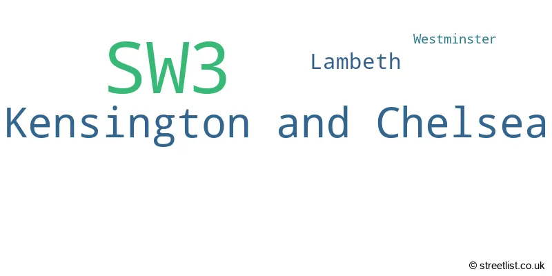
The primary settlement in the SW3 postcode district is Kensington and Chelsea, located in Greater London. Other significant settlements in the district include Lambeth and Westminster. The county within which these settlements lie is the county of Greater London, which is part of England. The most significant post town within the SW3 district is London.
For the district SW3, we have data on 7 postcode sectors. Here's a breakdown: The sector SW3 1, covers Kensington And Chelsea in Greater London. The sector SW3 2, covers Kensington And Chelsea in Greater London. The sector SW3 3, covers Kensington And Chelsea in Greater London. The sector SW3 4, covers Kensington And Chelsea in Greater London. The sector SW3 5, covers Kensington And Chelsea in Greater London. The sector SW3 6, covers Kensington And Chelsea in Greater London. The sector SW3 9 is non-geographic. It's often designated for PO Boxes, large organisations, or special services.

Map of the SW3 Postcode District
Explore the SW3 postcode district by using our free interactive map.

When it comes to local government, postal geography often disregards political borders. However, for a breakdown in the SW3 District: the district mostly encompasses the Kensington and Chelsea London Boro (831 postcodes), followed by the Lambeth London Boro area (26 postcodes), and finally, the City of Westminster London Boro area (6 postcodes).
Recent House Sales in SW3
| Date | Price | Address |
|---|---|---|
| 11/10/2023 | £420,000 | Elystan Place, London, SW3 3LD |
| 10/10/2023 | £250,000 | Sloane Avenue, London, SW3 3EJ |
| 06/10/2023 | £604,500 | Beaufort Street, London, SW3 6BU |
| 20/09/2023 | £226,950 | Basil Street, London, SW3 1AX |
| 15/09/2023 | £682,000 | Mallord Street, London, SW3 6AL |
| 15/09/2023 | £850,000 | Egerton Gardens, London, SW3 2DG |
| 12/09/2023 | £2,310,000 | Milner Street, London, SW3 2QD |
| 12/09/2023 | £795,000 | Kings Road, London, SW3 5ES |
| 07/09/2023 | £350,000 | Sydney Close, London, SW3 6HN |
| 01/09/2023 | £1,185,000 | Oakley Street, London, SW3 5NR |
Weather Forecast for SW3
Press Button to Show Forecast for Chelsea
| Time Period | Icon | Description | Temperature | Rain Probability | Wind |
|---|---|---|---|---|---|
| 00:00 to 03:00 | Cloudy | 7.0°C (feels like 5.0°C) | 5.00% | ENE 7 mph | |
| 03:00 to 06:00 | Cloudy | 6.0°C (feels like 4.0°C) | 5.00% | NE 7 mph | |
| 06:00 to 09:00 | Cloudy | 5.0°C (feels like 3.0°C) | 5.00% | NE 7 mph | |
| 09:00 to 12:00 | Cloudy | 8.0°C (feels like 6.0°C) | 5.00% | ENE 7 mph | |
| 12:00 to 15:00 | Cloudy | 11.0°C (feels like 9.0°C) | 10.00% | ENE 7 mph | |
| 15:00 to 18:00 | Cloudy | 11.0°C (feels like 10.0°C) | 13.00% | ENE 7 mph | |
| 18:00 to 21:00 | Cloudy | 11.0°C (feels like 9.0°C) | 13.00% | NE 7 mph | |
| 21:00 to 00:00 | Cloudy | 8.0°C (feels like 6.0°C) | 11.00% | E 7 mph |
Press Button to Show Forecast for Chelsea
| Time Period | Icon | Description | Temperature | Rain Probability | Wind |
|---|---|---|---|---|---|
| 00:00 to 03:00 | Cloudy | 6.0°C (feels like 4.0°C) | 17.00% | ENE 7 mph | |
| 03:00 to 06:00 | Cloudy | 5.0°C (feels like 3.0°C) | 18.00% | NE 7 mph | |
| 06:00 to 09:00 | Cloudy | 6.0°C (feels like 4.0°C) | 20.00% | ENE 7 mph | |
| 09:00 to 12:00 | Cloudy | 10.0°C (feels like 8.0°C) | 15.00% | ENE 9 mph | |
| 12:00 to 15:00 | Overcast | 12.0°C (feels like 10.0°C) | 17.00% | E 9 mph | |
| 15:00 to 18:00 | Light rain | 13.0°C (feels like 11.0°C) | 52.00% | E 11 mph | |
| 18:00 to 21:00 | Light rain | 11.0°C (feels like 9.0°C) | 54.00% | ENE 9 mph | |
| 21:00 to 00:00 | Light rain | 10.0°C (feels like 8.0°C) | 54.00% | NE 11 mph |
Press Button to Show Forecast for Chelsea
| Time Period | Icon | Description | Temperature | Rain Probability | Wind |
|---|---|---|---|---|---|
| 00:00 to 03:00 | Heavy rain | 10.0°C (feels like 7.0°C) | 74.00% | NE 9 mph | |
| 03:00 to 06:00 | Light rain shower (night) | 10.0°C (feels like 8.0°C) | 45.00% | ESE 9 mph | |
| 06:00 to 09:00 | Light rain | 10.0°C (feels like 8.0°C) | 52.00% | SE 7 mph | |
| 09:00 to 12:00 | Heavy rain shower (day) | 11.0°C (feels like 9.0°C) | 61.00% | SE 9 mph | |
| 12:00 to 15:00 | Heavy rain shower (day) | 12.0°C (feels like 11.0°C) | 61.00% | S 9 mph | |
| 15:00 to 18:00 | Light rain shower (day) | 14.0°C (feels like 12.0°C) | 37.00% | SSW 11 mph | |
| 18:00 to 21:00 | Partly cloudy (day) | 12.0°C (feels like 10.0°C) | 15.00% | SW 11 mph | |
| 21:00 to 00:00 | Partly cloudy (night) | 11.0°C (feels like 9.0°C) | 8.00% | SW 7 mph |
Where is the SW3 Postcode District?
The postcode district SW3 is located in LONDON. It is approximately 2.06 miles away from the center of London. The district is surrounded by several nearby towns including ST GEORGE'S to the East, CHELSEA HARBOUR to the South West, KNIGHTSBRIDGE AND BELGRAVIA to the North West, ST JAMES'S to the North East, MARYLEBONE to the North, and BROOK GREEN to the West.
The district is within the post town of LONDON.
The sector has postcodes within the nation of England.
The SW3 Postcode District is covers the following regions.
- Kensington & Chelsea and Hammersmith & Fulham - Inner London - West - London
- Westminster - Inner London - West - London
- Lambeth - Inner London - East - London
| Postcode Sector | Delivery Office |
|---|---|
| SW3 1 | Chelsea Sdelivery Office |
| SW3 2 | Chelsea Sdelivery Office |
| SW3 3 | Chelsea Sdelivery Office |
| SW3 4 | Chelsea Sdelivery Office |
| SW3 5 | Chelsea Sdelivery Office |
| SW3 6 | Chelsea Sdelivery Office |
| S | W | 3 | - | X | X | X |
| S | W | 3 | Space | Numeric | Letter | Letter |
Tourist Attractions within the Postcode Area
We found 1 visitor attractions within the SW3 postcode area
| Carlyle's House |
|---|
| Historic Properties |
| Historic House / House and Garden / Palace |
| View Carlyle's House on Google Maps |
Current Monthly Rental Prices
| # Bedrooms | Min Price | Max Price | Avg Price |
|---|---|---|---|
| £542 | £88,833 | £3,236 | |
| 1 | £1,297 | £18,200 | £3,481 |
| 2 | £2,700 | £42,467 | £5,771 |
| 3 | £3,684 | £60,667 | £12,087 |
| 4 | £5,200 | £58,500 | £16,760 |
| 5 | £15,167 | £36,833 | £25,383 |
| 6 | £10,833 | £88,833 | £30,333 |
| 8 | £86,450 | £241,150 | £163,800 |
Current House Prices
| # Bedrooms | Min Price | Max Price | Avg Price |
|---|---|---|---|
| £265,000 | £13,500,000 | £813,128 | |
| 1 | £160,000 | £2,999,950 | £935,539 |
| 2 | £80,000 | £5,900,000 | £1,775,689 |
| 3 | £775,000 | £14,500,000 | £3,631,179 |
| 4 | £1,795,000 | £22,500,000 | £5,763,621 |
| 5 | £2,950,000 | £12,950,000 | £7,389,583 |
| 6 | £4,500,000 | £16,500,000 | £9,011,765 |
| 7 | £9,500,000 | £14,950,000 | £12,225,000 |
| 8 | £4,750,000 | £14,950,000 | £8,862,500 |
Estate Agents who Operate in the SW3 District
| Logo | Name | Brand Name | Address | Contact Number | Total Properties |
|---|---|---|---|---|---|
 | Sloane Square | Foxtons | Sloane Avenue London SW3 (By appointment only) | 020 3908 8522 | 126 |
 | Chelsea & Belgravia | Dexters | 45 Sloane Avenue Chelsea London SW3 3DH | 020 7590 9500 | 61 |
 | Chelsea Green | John D Wood & Co. Sales | 9 Cale Street, London, SW3 3QS | 020 3835 4101 | 54 |
 | Knightsbridge | Knight Frank | 52-54 Sloane Avenue, London, SW3 3DD | 020 3835 5027 | 41 |
 | Sloane Square | Draker Lettings | 1 Holbein Place, London, SW1W 8NS | 020 3834 8718 | 30 |
| Type of Property | 2018 Average | 2018 Sales | 2017 Average | 2017 Sales | 2016 Average | 2016 Sales | 2015 Average | 2015 Sales |
|---|---|---|---|---|---|---|---|---|
| Detached | £19,800,000 | 1 | £24,200,000 | 1 | £0 | 0 | £3,525,000 | 1 |
| Semi-Detached | £6,942,000 | 5 | £5,960,000 | 5 | £5,564,286 | 7 | £7,162,500 | 2 |
| Terraced | £4,679,348 | 82 | £4,277,988 | 81 | £4,485,721 | 71 | £4,788,055 | 107 |
| Flats | £1,270,493 | 218 | £1,428,748 | 245 | £1,452,602 | 259 | £1,549,856 | 352 |