The SW7 4 postcode sector is within the county of Greater London.
Did you know? According to the 2021 Census, the SW7 4 postcode sector is home to a bustling 4,004 residents!
Given that each sector allows for 400 unique postcode combinations. Letters C, I, K, M, O and V are not allowed in the last two letters of a postcode. With 137 postcodes already in use, this leaves 263 units available.
The SW7 4 postal code covers the settlement of LONDON .
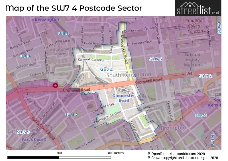
The SW7 4 Postcode shares a border with SW5 0 (LONDON ), SW7 3 (LONDON ), SW7 5 (LONDON ) and W8 5 (LONDON ).
The sector is within the post town of LONDON.
SW7 4 is a postcode sector within the SW7 postcode district which is within the SW South West London postcode area.
The Royal Mail delivery office for the SW7 4 postal sector is the South Kensington Sdelivery Office.
The area of the SW7 4 postcode sector is 0.11 square miles which is 0.28 square kilometres or 69.30 square acres.

Map of the SW7 4 Postcode Sector
Explore the SW7 4 postcode sector by using our free interactive map.
| S | W | 7 | - | 4 | X | X |
| S | W | 7 | Space | 4 | Letter | Letter |
Official List of Streets
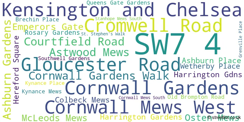
Kensington and Chelsea (27 Streets)
Unofficial Streets or Alternative Spellings
Kensington and Chelsea
ATHERSTONE MEWS CLAREVILLE STREET COLLINGHAM GARDENS COLLINGHAM PLACE COLLINGHAM ROAD COURTFIELD GARDENS CRANLEY MEWS EAGLE PLACE ELVASTON PLACE GASPAR CLOSE KELSO PLACE LAUNCESTON PLACE LEXHAM GARDENS LEXHAM GARDENS MEWS LEXHAM WALK PETERSHAM LANE PETERSHAM MEWS PETERSHAM PLACE QUEENS GATE MEWS ROLAND GARDENS STANFORD ROAD STANHOPE MEWS WEST THISTLE GROVE VICTORIA GROVE VICTORIA ROAD WETHERBY GARDENS POINT W ACCESS ROADWeather Forecast for SW7 4
Press Button to Show Forecast for Earl's Court Youth Hostel
| Time Period | Icon | Description | Temperature | Rain Probability | Wind |
|---|---|---|---|---|---|
| 09:00 to 12:00 | Sunny day | 15.0°C (feels like 13.0°C) | 1.00% | SSE 9 mph | |
| 12:00 to 15:00 | Partly cloudy (day) | 17.0°C (feels like 15.0°C) | 4.00% | SSE 11 mph | |
| 15:00 to 18:00 | Cloudy | 17.0°C (feels like 15.0°C) | 13.00% | S 11 mph | |
| 18:00 to 21:00 | Partly cloudy (day) | 15.0°C (feels like 14.0°C) | 8.00% | SSE 7 mph | |
| 21:00 to 00:00 | Partly cloudy (night) | 12.0°C (feels like 11.0°C) | 9.00% | SE 4 mph |
Press Button to Show Forecast for Earl's Court Youth Hostel
| Time Period | Icon | Description | Temperature | Rain Probability | Wind |
|---|---|---|---|---|---|
| 00:00 to 03:00 | Cloudy | 11.0°C (feels like 10.0°C) | 11.00% | SSE 4 mph | |
| 03:00 to 06:00 | Cloudy | 10.0°C (feels like 9.0°C) | 9.00% | S 4 mph | |
| 06:00 to 09:00 | Cloudy | 10.0°C (feels like 10.0°C) | 9.00% | SSE 4 mph | |
| 09:00 to 12:00 | Cloudy | 13.0°C (feels like 13.0°C) | 9.00% | NNW 2 mph | |
| 12:00 to 15:00 | Overcast | 15.0°C (feels like 15.0°C) | 15.00% | NE 2 mph | |
| 15:00 to 18:00 | Cloudy | 16.0°C (feels like 15.0°C) | 15.00% | NNE 4 mph | |
| 18:00 to 21:00 | Cloudy | 15.0°C (feels like 15.0°C) | 15.00% | NNE 7 mph | |
| 21:00 to 00:00 | Cloudy | 13.0°C (feels like 13.0°C) | 18.00% | NNE 4 mph |
Press Button to Show Forecast for Earl's Court Youth Hostel
| Time Period | Icon | Description | Temperature | Rain Probability | Wind |
|---|---|---|---|---|---|
| 00:00 to 03:00 | Light rain | 12.0°C (feels like 11.0°C) | 48.00% | N 4 mph | |
| 03:00 to 06:00 | Cloudy | 11.0°C (feels like 10.0°C) | 13.00% | NNW 7 mph | |
| 06:00 to 09:00 | Overcast | 11.0°C (feels like 10.0°C) | 16.00% | NW 7 mph | |
| 09:00 to 12:00 | Overcast | 14.0°C (feels like 13.0°C) | 15.00% | NW 7 mph | |
| 12:00 to 15:00 | Cloudy | 17.0°C (feels like 15.0°C) | 10.00% | NW 9 mph | |
| 15:00 to 18:00 | Partly cloudy (day) | 18.0°C (feels like 17.0°C) | 7.00% | NW 9 mph | |
| 18:00 to 21:00 | Cloudy | 17.0°C (feels like 16.0°C) | 10.00% | NW 9 mph | |
| 21:00 to 00:00 | Partly cloudy (night) | 14.0°C (feels like 13.0°C) | 5.00% | NW 9 mph |
Schools and Places of Education Within the SW7 4 Postcode Sector
St Philip's School
Other independent school
6 Wetherby Place, London, , SW7 4NE
Head: Mr A Thomas
Ofsted Rating: Good
Inspection: 2022-03-10 (782 days ago)
Website: Visit St Philip's School Website
Phone: 02073733944
Number of Pupils: 74
House Prices in the SW7 4 Postcode Sector
| Type of Property | 2018 Average | 2018 Sales | 2017 Average | 2017 Sales | 2016 Average | 2016 Sales | 2015 Average | 2015 Sales |
|---|---|---|---|---|---|---|---|---|
| Detached | £0 | 0 | £0 | 0 | £0 | 0 | £0 | 0 |
| Semi-Detached | £0 | 0 | £0 | 0 | £0 | 0 | £0 | 0 |
| Terraced | £4,156,250 | 4 | £5,100,000 | 4 | £5,158,358 | 7 | £4,165,111 | 9 |
| Flats | £1,522,791 | 56 | £1,479,893 | 64 | £1,452,513 | 76 | £1,168,743 | 90 |
| The SW7 4 Sector is within these Local Authorities |
|
|---|---|
| The SW7 4 Sector is within these Counties |
|
| The SW7 4 Sector is within these Water Company Areas |
|