The TN25 postcode district is a postal district located in the TN Tonbridge postcode area with a population of 19,285 residents according to the 2021 England and Wales Census.
The area of the TN25 postcode district is 70.89 square miles which is 183.59 square kilometres or 45,367.17 acres.
Currently, the TN25 district has about 712 postcode units spread across 4 geographic postcode sectors.
Given that each sector allows for 400 unique postcode combinations, the district has a capacity of 1,600 postcodes. With 712 postcodes already in use, this leaves 888 units available.
The largest settlement in the TN25 postal code is Wye followed by Sellindge, and ASHFORD.
The TN25 Postcode shares a border with TN26 (Bethersden, Woodchurch, High Halden), TN27 (Headcorn, Biddenden, Charing), CT4 (Chartham, Bridge, Barham), TN23 (ASHFORD, Kingsnorth, Great Chart), TN24 (ASHFORD, Willesborough, Kennington), CT21 (HYTHE, Lympne, Saltwood) and ME13 (FAVERSHAM, Boughton-under-Blean, Dunkirk).
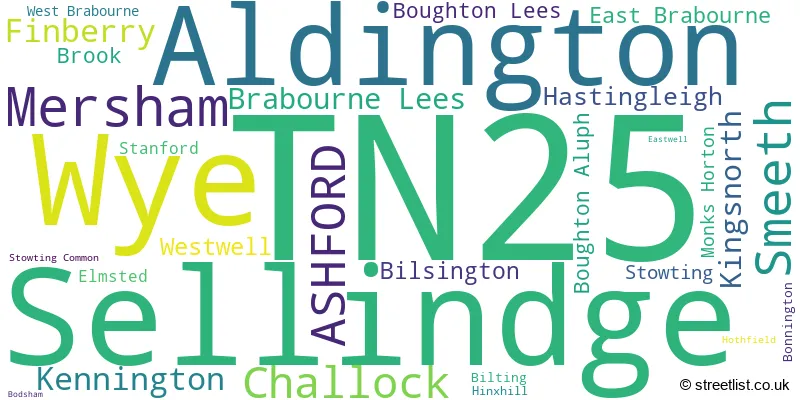
In the TN25 postcode district, the primary settlement is Ashford, located in Kent, the county of Kent in England. Other significant settlements in this district include Challock, Kennington, Westwell, Boughton Aluph, Boughton Lees, Bilting, Hothfield, Eastwell, Bodsham, Brook, East Brabourne, Elmsted, Hastingleigh, Hinxhill, West Brabourne, Wye, Brabourne Lees, Mersham, Monks Horton, Sellindge, Smeeth, Stanford, Stowting, Stowting Common, Aldington, Bilsington, Bonnington, Finberry and Kingsnorth. The primary post town associated with this district is also Ashford.
For the district TN25, we have data on 4 postcode sectors. Here's a breakdown: The sector TN25 4, covers Ashford and Challock and Kennington and Westwell in Kent. The sector TN25 5, covers Wye and Hastingleigh and Brook in Kent. The sector TN25 6, covers Sellindge and Smeeth and Mersham and Brabourne Lees in Kent. The sector TN25 7, covers Aldington and Finberry and Kingsnorth and Mersham and Bilsington in Kent.

Map of the TN25 Postcode District
Explore the TN25 postcode district by using our free interactive map.

When it comes to local government, postal geography often disregards political borders. However, for a breakdown in the TN25 District: the district mostly encompasses the Ashford District (B) (602 postcodes), and finally, the Folkestone and Hythe District area (149 postcodes).
Recent House Sales in TN25
| Date | Price | Address |
|---|---|---|
| 29/09/2023 | £476,500 | Sandyhurst Lane, Ashford, TN25 4NT |
| 28/09/2023 | £595,000 | Bern Hurst Close, Sellindge, Ashford, TN25 6LN |
| 21/09/2023 | £370,000 | Plain Road, Smeeth, Ashford, TN25 6QL |
| 18/09/2023 | £205,000 | Finn Farm Road, Kingsnorth, Ashford, TN25 7AB |
| 11/09/2023 | £400,000 | Aylesbury Road, Kennington, Ashford, TN25 4QH |
| 01/09/2023 | £260,000 | Calland, Smeeth, Ashford, TN25 6QD |
| 01/09/2023 | £621,500 | Hazel Heights, Ashford, TN25 4GF |
| 31/08/2023 | £250,000 | Broadview Close, Kingsnorth, Ashford, TN25 7AQ |
| 25/08/2023 | £350,000 | Heritage Road, Kingsnorth, Ashford, TN25 7LF |
| 25/08/2023 | £725,000 | Goldwell Lane, Aldington, Ashford, TN25 7DX |
Weather Forecast for TN25
Press Button to Show Forecast for Wye
| Time Period | Icon | Description | Temperature | Rain Probability | Wind |
|---|---|---|---|---|---|
| 21:00 to 00:00 | Overcast | 8.0°C (feels like 5.0°C) | 23.00% | ENE 9 mph |
Press Button to Show Forecast for Wye
| Time Period | Icon | Description | Temperature | Rain Probability | Wind |
|---|---|---|---|---|---|
| 00:00 to 03:00 | Heavy rain | 7.0°C (feels like 5.0°C) | 84.00% | ENE 9 mph | |
| 03:00 to 06:00 | Heavy rain | 8.0°C (feels like 5.0°C) | 85.00% | ENE 9 mph | |
| 06:00 to 09:00 | Light rain | 8.0°C (feels like 6.0°C) | 48.00% | ENE 7 mph | |
| 09:00 to 12:00 | Cloudy | 11.0°C (feels like 9.0°C) | 13.00% | ESE 7 mph | |
| 12:00 to 15:00 | Cloudy | 13.0°C (feels like 11.0°C) | 10.00% | ESE 7 mph | |
| 15:00 to 18:00 | Cloudy | 12.0°C (feels like 11.0°C) | 16.00% | E 9 mph | |
| 18:00 to 21:00 | Light rain | 11.0°C (feels like 8.0°C) | 56.00% | ENE 11 mph | |
| 21:00 to 00:00 | Heavy rain | 10.0°C (feels like 8.0°C) | 90.00% | ENE 9 mph |
Press Button to Show Forecast for Wye
| Time Period | Icon | Description | Temperature | Rain Probability | Wind |
|---|---|---|---|---|---|
| 00:00 to 03:00 | Heavy rain | 11.0°C (feels like 9.0°C) | 85.00% | E 9 mph | |
| 03:00 to 06:00 | Heavy rain | 10.0°C (feels like 8.0°C) | 76.00% | SSE 13 mph | |
| 06:00 to 09:00 | Heavy rain | 10.0°C (feels like 7.0°C) | 78.00% | SSW 13 mph | |
| 09:00 to 12:00 | Light rain shower (day) | 11.0°C (feels like 8.0°C) | 42.00% | SSW 16 mph | |
| 12:00 to 15:00 | Light rain shower (day) | 11.0°C (feels like 8.0°C) | 43.00% | WSW 18 mph | |
| 15:00 to 18:00 | Cloudy | 11.0°C (feels like 8.0°C) | 16.00% | WSW 16 mph | |
| 18:00 to 21:00 | Partly cloudy (day) | 10.0°C (feels like 8.0°C) | 8.00% | WSW 9 mph | |
| 21:00 to 00:00 | Clear night | 8.0°C (feels like 6.0°C) | 4.00% | SW 9 mph |
Press Button to Show Forecast for Wye
| Time Period | Icon | Description | Temperature | Rain Probability | Wind |
|---|---|---|---|---|---|
| 00:00 to 03:00 | Clear night | 7.0°C (feels like 5.0°C) | 3.00% | SW 7 mph | |
| 03:00 to 06:00 | Clear night | 6.0°C (feels like 4.0°C) | 2.00% | SSW 7 mph | |
| 06:00 to 09:00 | Sunny day | 9.0°C (feels like 7.0°C) | 1.00% | S 7 mph | |
| 09:00 to 12:00 | Partly cloudy (day) | 12.0°C (feels like 10.0°C) | 3.00% | S 9 mph | |
| 12:00 to 15:00 | Partly cloudy (day) | 13.0°C (feels like 11.0°C) | 3.00% | S 11 mph | |
| 15:00 to 18:00 | Sunny day | 13.0°C (feels like 12.0°C) | 2.00% | S 9 mph | |
| 18:00 to 21:00 | Sunny day | 12.0°C (feels like 11.0°C) | 3.00% | SSE 7 mph | |
| 21:00 to 00:00 | Cloudy | 10.0°C (feels like 8.0°C) | 6.00% | ESE 7 mph |
Press Button to Show Forecast for Wye
| Time Period | Icon | Description | Temperature | Rain Probability | Wind |
|---|---|---|---|---|---|
| 00:00 to 03:00 | Partly cloudy (night) | 10.0°C (feels like 8.0°C) | 5.00% | ESE 9 mph | |
| 03:00 to 06:00 | Clear night | 9.0°C (feels like 7.0°C) | 6.00% | ESE 7 mph | |
| 06:00 to 09:00 | Cloudy | 10.0°C (feels like 9.0°C) | 9.00% | SE 7 mph | |
| 09:00 to 12:00 | Cloudy | 12.0°C (feels like 11.0°C) | 9.00% | SE 9 mph | |
| 12:00 to 15:00 | Cloudy | 14.0°C (feels like 12.0°C) | 11.00% | SE 9 mph | |
| 15:00 to 18:00 | Cloudy | 15.0°C (feels like 13.0°C) | 10.00% | SE 9 mph | |
| 18:00 to 21:00 | Cloudy | 13.0°C (feels like 12.0°C) | 16.00% | E 7 mph | |
| 21:00 to 00:00 | Overcast | 12.0°C (feels like 10.0°C) | 17.00% | E 7 mph |
Where is the TN25 Postcode District?
The TN25 postcode district is located in the town of Ashford. Ashford is near several towns, including Hythe to the South East, Folkestone to the East, Canterbury to the North East, Faversham to the North, and Tenterden to the South West. The distance from Ashford to central London is approximately 52.57 miles.
The district is within the post town of ASHFORD.
The sector has postcodes within the nation of England.
The TN25 Postcode District is covers the following regions.
- Mid Kent - Kent - South East (England)
- East Kent - Kent - South East (England)
| Postcode Sector | Delivery Office |
|---|---|
| TN25 4 | Ashford (tn) Delivery Office |
| TN25 5 | Ashford (tn) Delivery Office |
| TN25 5 | Brabourne Lees Scale Payment Delivery Office |
| TN25 6 | Ashford (tn) Delivery Office |
| TN25 6 | Brabourne Lees Scale Payment Delivery Office |
| TN25 7 | Ashford (tn) Delivery Office |
| T | N | 2 | 5 | - | X | X | X |
| T | N | 2 | 5 | Space | Numeric | Letter | Letter |
Tourist Attractions within the Postcode Area
We found 1 visitor attractions within the TN25 postcode area
| Agricultural Museum, Brook |
|---|
| Museums & Art Galleries |
| Museum and / or Art Gallery |
| View Agricultural Museum, Brook on Google Maps |
Current Monthly Rental Prices
| # Bedrooms | Min Price | Max Price | Avg Price |
|---|---|---|---|
| 2 | £950 | £1,100 | £1,040 |
| 3 | £1,200 | £1,750 | £1,500 |
| 4 | £1,950 | £1,950 | £1,950 |
Current House Prices
| # Bedrooms | Min Price | Max Price | Avg Price |
|---|---|---|---|
| £150,000 | £645,000 | £388,000 | |
| 1 | £220,000 | £250,000 | £230,000 |
| 2 | £115,000 | £700,000 | £302,878 |
| 3 | £325,000 | £895,000 | £477,464 |
| 4 | £275,000 | £1,575,000 | £711,895 |
| 5 | £380,000 | £1,875,000 | £931,110 |
| 6 | £750,000 | £1,500,000 | £1,074,000 |
| 7 | £1,250,000 | £1,350,000 | £1,300,000 |
Estate Agents who Operate in the TN25 District
| Logo | Name | Brand Name | Address | Contact Number | Total Properties |
|---|---|---|---|---|---|
 | Ashford | Hobbs Parker Estate Agents | Romney House Monument Way, Orbital Park, Ashford, TN24 0HB | 01233 542521 | 26 |
 | Ashford | Gould & Harrison Estate Agents | 1 Middle Row, Ashford, TN24 8SQ | 01233 660077 | 15 |
 | Ashford | Andrew & Co Estate Agents | 5 Kings Parade, Ashford, Kent, TN24 8TA | 01233 632383 | 13 |
 | Ashford | Steven J Moore Estate Agents | Lees Road Brabourne Lees Nr Ashford, Kent TN25 6QB | 01233 542398 | 11 |
 | Canterbury | Finn's | 82 Castle Street, Canterbury, Kent, CT1 2QD | 01227 532491 | 11 |
- Aldington
- Aldington Frith
- Ashford
- Barrowhill
- Bilsington
- Bilting
- Bircholt Forstal
- Bonnington
- Boughton Aluph
- Boughton Corner
- Boughton Lees
- Brabourne
- Brabourne Lees
- Broad Oak
- Broad Street
- Brook
- Challock
- Clap Hill
- Court-at-Street
- Crundale
- Dunn Street
- Finberry
- Folly Town
- Hassell Street
- Hastingleigh
- Hill Street
- Hinxhill
- Kempe's Corner
- Lilyvale
- Lympne
- Mersham
- Moorstock
- Naccolt
- Newchurch
- Paddock
- Potters Corner
- Ram Lane
- Rhodes Minnis
- Ridgeway
- Ruckinge
- Sellindge
- Smeeth
- Stanford
- Stone Cross
- Stone Hill
- Stonestreet Green
- Stowting
- Westwell
- Westwell Leacon
- Wye
| Type of Property | 2018 Average | 2018 Sales | 2017 Average | 2017 Sales | 2016 Average | 2016 Sales | 2015 Average | 2015 Sales |
|---|---|---|---|---|---|---|---|---|
| Detached | £478,727 | 188 | £464,829 | 239 | £426,606 | 230 | £402,688 | 194 |
| Semi-Detached | £337,495 | 95 | £297,137 | 83 | £273,953 | 100 | £272,226 | 119 |
| Terraced | £269,721 | 78 | £269,257 | 83 | £257,360 | 108 | £231,842 | 79 |
| Flats | £195,427 | 24 | £180,461 | 42 | £155,934 | 25 | £172,704 | 45 |