The TW8 8 postcode sector is within the county of Greater London.
Did you know? According to the 2021 Census, the TW8 8 postcode sector is home to a bustling 6,118 residents!
Given that each sector allows for 400 unique postcode combinations. Letters C, I, K, M, O and V are not allowed in the last two letters of a postcode. With 143 postcodes already in use, this leaves 257 units available.
The largest settlements in the TW8 8 postal code are BRENTFORD and ISLEWORTH .
The TW8 8 Postcode shares a border with TW7 5 (ISLEWORTH , BRENTFORD ), TW8 0 (BRENTFORD ), TW7 6 (ISLEWORTH ) and TW8 9 (BRENTFORD ).
The sector is within the post town of BRENTFORD.
TW8 8 is a postcode sector within the TW8 postcode district which is within the TW Twickenham postcode area.
The Royal Mail delivery office for the TW8 8 postal sector is the Brentford & Isleworth Delivery Office.
The area of the TW8 8 postcode sector is 0.51 square miles which is 1.31 square kilometres or 323.87 square acres.
Waterways within the TW8 8 postcode sector include the Brent, Grand Union Canal (Brentford Branch).

Map of the TW8 8 Postcode Sector
Explore the TW8 8 postcode sector by using our free interactive map.
| T | W | 8 | - | 8 | X | X |
| T | W | 8 | Space | 8 | Letter | Letter |
Official List of Streets
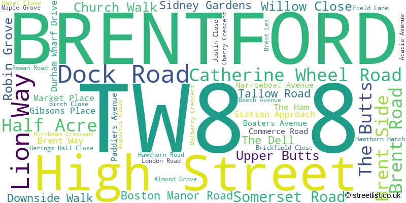
BRENTFORD (49 Streets)
Unofficial Streets or Alternative Spellings
BRENTFORD
BOSTON PARK ROAD GLENHURST ROAD ORCHARD ROAD BRENTFORD HIGH STREET CAXTON MEWS DOWNSIDE ROAD GRAND UNION CANAL TOWPATH HALF ACRE MEWS LIME AVENUE ST PAULS ROAD STATION ROAD THAMES PATH - NORTHERN BANK THE MALLBRENTFORD,
LONDON ROADHammersmith and Fulham
GREAT WEST ROADEaling
WINDMILL ROAD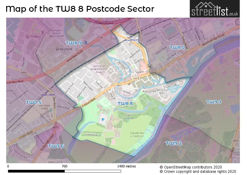
House Prices in the TW8 8 Postcode Sector
| Type of Property | 2018 Average | 2018 Sales | 2017 Average | 2017 Sales | 2016 Average | 2016 Sales | 2015 Average | 2015 Sales |
|---|---|---|---|---|---|---|---|---|
| Detached | £855,000 | 1 | £0 | 0 | £538,000 | 1 | £2,000,000 | 1 |
| Semi-Detached | £559,375 | 4 | £625,000 | 7 | £497,500 | 3 | £573,955 | 11 |
| Terraced | £477,500 | 5 | £704,056 | 9 | £627,283 | 6 | £611,814 | 14 |
| Flats | £454,304 | 128 | £476,129 | 86 | £432,090 | 99 | £435,456 | 139 |
Important Postcodes TW8 8 in the Postcode Sector
TW8 8AP is the postcode for Royal Mail, Brentford & Isleworth Delivery Office, 50 London Road
TW8 8BH is the postcode for METROPOLITAN POLICE, Metropolitan Police, Brentford Police Station, and Metropolitan Police, Brentford Police Station
TW8 8DH is the postcode for Metropolitan Police, Half Acre
TW8 8DS is the postcode for Brentford Health Centre, Boston Manor Road
TW8 8DW is the postcode for London Borough of Hounslow, Brentford Library, Boston Manor Road, and Brentford Library, Boston Manor Road
TW8 8JJ is the postcode for ACTON LODGE, 84, London Road
| The TW8 8 Sector is within these Local Authorities |
|
|---|---|
| The TW8 8 Sector is within these Counties |
|
| The TW8 8 Sector is within these Water Company Areas |
|