The UB9 postcode district is a postal district located in the UB Uxbridge postcode area with a population of 15,734 residents according to the 2021 England and Wales Census.
The area of the UB9 postcode district is 12.27 square miles which is 31.78 square kilometres or 7,853.25 acres.
Currently, the UB9 district has about 432 postcode units spread across 3 geographic postcode sectors.
Given that each sector allows for 400 unique postcode combinations, the district has a capacity of 1,200 postcodes. With 432 postcodes already in use, this leaves 768 units available.
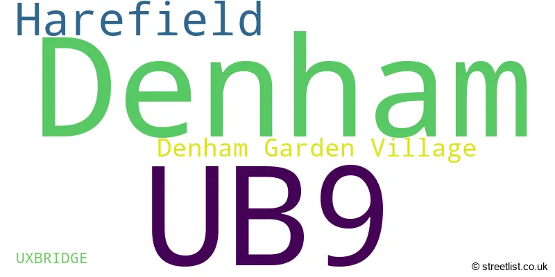
The largest settlement in the UB9 postal code is HAREFIELD followed by DENHAM, and DENHAM GREEN.
The UB9 Postcode shares a border with SL9 (GERRARDS CROSS, CHALFONT ST PETER, Chalfont St. Peter), WD3 (CROXLEY GREEN, RICKMANSWORTH, CHORLEYWOOD), HA6 (NORTHWOOD), UB10 (UXBRIDGE, ICKENHAM), SL0 (IVER, IVER HEATH) and UB8 (UXBRIDGE).
The primary settlement in the UB9 postcode district is Denham, located in Buckinghamshire. Other significant settlements in the district include Uxbridge and Denham Garden Village. The post town for this district is Uxbridge.
For the district UB9, we have data on 3 postcode sectors. Here's a breakdown: The sector UB9 4, covers Denham in Buckinghamshire. The sector UB9 5, covers Denham and Denham Garden Village in Buckinghamshire. The sector UB9 6, covers Harefield in Greater London.

Map of the UB9 Postcode District
Explore the UB9 postcode district by using our free interactive map.

When it comes to local government, postal geography often disregards political borders. However, for a breakdown in the UB9 District: the district mostly encompasses the Buckinghamshire (228 postcodes), and finally, the Hillingdon London Boro area (203 postcodes).
Recent House Sales in UB9
| Date | Price | Address |
|---|---|---|
| 06/10/2023 | £288,000 | Green Tiles, Denham, Uxbridge, UB9 5HX |
| 04/10/2023 | £725,000 | Middle Road, Denham, Uxbridge, UB9 5EG |
| 28/09/2023 | £700,000 | Pond Close, Harefield, Uxbridge, UB9 6NG |
| 26/09/2023 | £350,000 | Kings Mill Way, Denham, Uxbridge, UB9 4BT |
| 11/09/2023 | £565,000 | Patrons Way West, Denham Garden Village, Uxbridge, UB9 5PL |
| 06/09/2023 | £594,000 | Green Tiles Lane, Denham, Uxbridge, UB9 5HT |
| 06/09/2023 | £750,000 | Bowyer Crescent, Denham, Uxbridge, UB9 5JE |
| 31/08/2023 | £320,000 | Ash Grove, Harefield, Uxbridge, UB9 6EZ |
| 25/08/2023 | £333,000 | Orchard Close, Denham, Uxbridge, UB9 4BB |
| 25/08/2023 | £710,000 | Barrington Drive, Harefield, Uxbridge, UB9 6RJ |
Where is the UB9 Postcode District?
The postcode district UB9 is located in Uxbridge, a town in West London. It is approximately 16.54 miles away from the center of London. Uxbridge is surrounded by several nearby towns, including Denham Garden Village to the west (0.56 miles), Denham to the southwest (1.08 miles), Harefield to the northeast (1.25 miles), South Bucks to the south (1.81 miles), West Hyde to the northwest (1.95 miles), and Ickenham to the southeast (2.21 miles).
The district is within the post town of UXBRIDGE.
The sector has postcodes within the nation of England.
The UB9 Postcode District is in the Harrow and Hillingdon region of Outer London - West and North West within the London.
Weather Forecast for UB9
Press Button to Show Forecast for Gerrards Cross
| Time Period | Icon | Description | Temperature | Rain Probability | Wind |
|---|---|---|---|---|---|
| 12:00 to 15:00 | Partly cloudy (day) | 18.0°C (feels like 17.0°C) | 4.00% | NNE 7 mph | |
| 15:00 to 18:00 | Cloudy | 18.0°C (feels like 16.0°C) | 9.00% | NNE 9 mph | |
| 18:00 to 21:00 | Sunny day | 16.0°C (feels like 15.0°C) | 1.00% | NNE 9 mph | |
| 21:00 to 00:00 | Clear night | 12.0°C (feels like 11.0°C) | 0.00% | NE 7 mph |
Press Button to Show Forecast for Gerrards Cross
| Time Period | Icon | Description | Temperature | Rain Probability | Wind |
|---|---|---|---|---|---|
| 00:00 to 03:00 | Clear night | 9.0°C (feels like 8.0°C) | 0.00% | NE 4 mph | |
| 03:00 to 06:00 | Cloudy | 9.0°C (feels like 8.0°C) | 4.00% | NE 4 mph | |
| 06:00 to 09:00 | Cloudy | 9.0°C (feels like 8.0°C) | 5.00% | NE 4 mph | |
| 09:00 to 12:00 | Partly cloudy (day) | 12.0°C (feels like 12.0°C) | 1.00% | ENE 4 mph | |
| 12:00 to 15:00 | Partly cloudy (day) | 17.0°C (feels like 16.0°C) | 0.00% | E 2 mph | |
| 15:00 to 18:00 | Partly cloudy (day) | 19.0°C (feels like 18.0°C) | 1.00% | E 4 mph | |
| 18:00 to 21:00 | Partly cloudy (day) | 18.0°C (feels like 18.0°C) | 1.00% | ESE 4 mph | |
| 21:00 to 00:00 | Partly cloudy (night) | 13.0°C (feels like 13.0°C) | 1.00% | SSE 4 mph |
Press Button to Show Forecast for Gerrards Cross
| Time Period | Icon | Description | Temperature | Rain Probability | Wind |
|---|---|---|---|---|---|
| 00:00 to 03:00 | Cloudy | 11.0°C (feels like 11.0°C) | 3.00% | S 4 mph | |
| 03:00 to 06:00 | Cloudy | 10.0°C (feels like 10.0°C) | 3.00% | SSW 4 mph | |
| 06:00 to 09:00 | Sunny day | 11.0°C (feels like 11.0°C) | 1.00% | SW 2 mph | |
| 09:00 to 12:00 | Partly cloudy (day) | 16.0°C (feels like 16.0°C) | 1.00% | SSW 2 mph | |
| 12:00 to 15:00 | Cloudy | 19.0°C (feels like 19.0°C) | 4.00% | S 2 mph | |
| 15:00 to 18:00 | Cloudy | 20.0°C (feels like 20.0°C) | 4.00% | ESE 2 mph | |
| 18:00 to 21:00 | Cloudy | 19.0°C (feels like 20.0°C) | 5.00% | ESE 2 mph | |
| 21:00 to 00:00 | Cloudy | 15.0°C (feels like 15.0°C) | 4.00% | ESE 4 mph |
Press Button to Show Forecast for Gerrards Cross
| Time Period | Icon | Description | Temperature | Rain Probability | Wind |
|---|---|---|---|---|---|
| 00:00 to 03:00 | Cloudy | 12.0°C (feels like 12.0°C) | 4.00% | SSE 4 mph | |
| 03:00 to 06:00 | Cloudy | 11.0°C (feels like 11.0°C) | 4.00% | SSW 2 mph | |
| 06:00 to 09:00 | Cloudy | 12.0°C (feels like 12.0°C) | 4.00% | ESE 2 mph | |
| 09:00 to 12:00 | Cloudy | 17.0°C (feels like 17.0°C) | 4.00% | ESE 2 mph | |
| 12:00 to 15:00 | Cloudy | 20.0°C (feels like 19.0°C) | 4.00% | ESE 4 mph | |
| 15:00 to 18:00 | Cloudy | 21.0°C (feels like 21.0°C) | 4.00% | ESE 4 mph | |
| 18:00 to 21:00 | Cloudy | 20.0°C (feels like 19.0°C) | 5.00% | E 7 mph | |
| 21:00 to 00:00 | Cloudy | 16.0°C (feels like 15.0°C) | 4.00% | E 4 mph |
Press Button to Show Forecast for Gerrards Cross
| Time Period | Icon | Description | Temperature | Rain Probability | Wind |
|---|---|---|---|---|---|
| 00:00 to 03:00 | Clear night | 13.0°C (feels like 12.0°C) | 1.00% | E 4 mph | |
| 03:00 to 06:00 | Clear night | 11.0°C (feels like 11.0°C) | 0.00% | ENE 4 mph | |
| 06:00 to 09:00 | Sunny day | 12.0°C (feels like 12.0°C) | 1.00% | E 2 mph | |
| 09:00 to 12:00 | Sunny day | 17.0°C (feels like 17.0°C) | 0.00% | ESE 4 mph | |
| 12:00 to 15:00 | Partly cloudy (day) | 21.0°C (feels like 20.0°C) | 1.00% | SE 4 mph | |
| 15:00 to 18:00 | Partly cloudy (day) | 22.0°C (feels like 21.0°C) | 3.00% | SSE 4 mph | |
| 18:00 to 21:00 | Sunny day | 20.0°C (feels like 20.0°C) | 2.00% | SE 7 mph | |
| 21:00 to 00:00 | Clear night | 15.0°C (feels like 15.0°C) | 1.00% | SE 7 mph |
| Postcode Sector | Delivery Office |
|---|---|
| UB9 4 | Uxbridge Delivery Office |
| UB9 5 | Uxbridge Delivery Office |
| UB9 6 | Uxbridge Delivery Office |
| U | B | 9 | - | X | X | X |
| U | B | 9 | Space | Numeric | Letter | Letter |
Current Monthly Rental Prices
| # Bedrooms | Min Price | Max Price | Avg Price |
|---|---|---|---|
| 1 | £750 | £1,400 | £1,140 |
| 2 | £1,425 | £3,200 | £2,018 |
| 3 | £1,800 | £3,500 | £3,132 |
| 4 | £2,100 | £3,500 | £3,150 |
Current House Prices
| # Bedrooms | Min Price | Max Price | Avg Price |
|---|---|---|---|
| £235,000 | £1,925,000 | £766,000 | |
| 1 | £182,750 | £329,950 | £267,903 |
| 2 | £180,000 | £1,500,000 | £413,342 |
| 3 | £310,000 | £900,000 | £601,423 |
| 4 | £500,000 | £2,350,000 | £867,394 |
| 5 | £770,000 | £6,750,000 | £2,203,889 |
| 6 | £735,000 | £2,500,000 | £1,255,000 |
| 7 | £1,500,000 | £6,750,000 | £4,125,000 |
| 12 | £2,800,000 | £75,000,000 | £50,933,333 |
Estate Agents who Operate in the UB9 District
| Logo | Name | Brand Name | Address | Contact Number | Total Properties |
|---|---|---|---|---|---|
 | Denham | Carter Duthie | 34 Station Parade, Denham, UB9 5ET | 01895 543359 | 19 |
 | Ruislip Sales | Gibbs Gillespie | 172-174 High Street, Ruislip, HA4 8LJ | 01895 542621 | 18 |
 | Harefield | Rodgers Estate Agents | 5 Park Lane, Harefield, UB9 6BJ | 01895 546141 | 14 |
 | Gerrards Cross Sales | Gibbs Gillespie | 26 Packhorse Road, Gerrards Cross, SL9 7DA | 01753 387510 | 11 |
 | Bournemouth | McCarthy & Stone Resales | 100 Holdenhurst Road, Bournemouth, BH8 8AQ | 03455 564122 | 7 |
Yearly House Price Averages for the UB9 Postcode District
| Type of Property | 2018 Average | 2018 Sales | 2017 Average | 2017 Sales | 2016 Average | 2016 Sales | 2015 Average | 2015 Sales |
|---|---|---|---|---|---|---|---|---|
| Detached | £810,392 | 37 | £863,413 | 40 | £779,423 | 52 | £700,644 | 65 |
| Semi-Detached | £470,841 | 52 | £471,795 | 68 | £464,728 | 64 | £420,645 | 69 |
| Terraced | £390,577 | 48 | £452,439 | 49 | £447,678 | 64 | £350,496 | 46 |
| Flats | £349,236 | 100 | £351,770 | 132 | £324,882 | 80 | £286,994 | 93 |