The W10 postcode district is a postal district located in the W London - W postcode area with a population of 35,161 residents according to the 2021 England and Wales Census.
The area of the W10 postcode district is 1.00 square miles which is 2.60 square kilometres or 641.86 acres.
Currently, the W10 district has about 677 postcode units spread across 3 geographic postcode sectors.
Given that each sector allows for 400 unique postcode combinations, the district has a capacity of 1,200 postcodes. With 677 postcodes already in use, this leaves 523 units available.
The W10 postal code covers the settlement of LONDON.
The W10 Postcode shares a border with NW6 (LONDON), W9 (LONDON), NW10 (LONDON), W11 (LONDON) and W12 (LONDON).
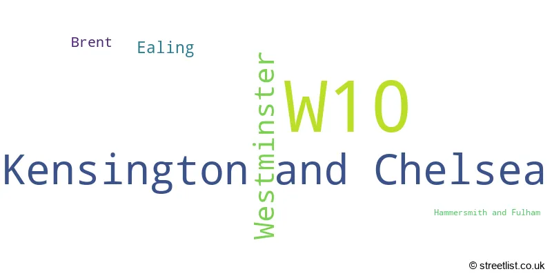
The primary settlement in the W10 postcode district is Westminster, in the county of Greater London. Other significant settlements in the district include Kensington and Chelsea, Hammersmith and Fulham, and Brent. The most significant Post Town in the W10 district is London.
For the district W10, we have data on 4 postcode sectors. Here's a breakdown: The sector W10 4, covers Westminster in Greater London. The sector W10 5, covers Kensington And Chelsea in Greater London. The sector W10 6, covers Kensington And Chelsea in Greater London. The sector W10 9 is non-geographic. It's often designated for PO Boxes, large organisations, or special services.

Map of the W10 Postcode District
Explore the W10 postcode district by using our free interactive map.

When it comes to local government, postal geography often disregards political borders. However, for a breakdown in the W10 District: the district mostly encompasses the Kensington and Chelsea London Boro (476 postcodes), followed by the City of Westminster London Boro area (171 postcodes), followed by the Ealing London Boro area (19 postcodes), followed by the Brent London Boro area (15 postcodes), and finally, the Hammersmith and Fulham London Boro area (3 postcodes).
Recent House Sales in W10
| Date | Price | Address |
|---|---|---|
| 14/09/2023 | £565,000 | Latimer Road, London, W10 6QN |
| 08/09/2023 | £660,000 | St Charles Square, London, W10 6EN |
| 06/09/2023 | £790,000 | Bonchurch Road, London, W10 5NS |
| 31/08/2023 | £1,600,000 | Pangbourne Avenue, London, W10 6DJ |
| 30/08/2023 | £827,000 | Ladbroke Grove, London, W10 6HE |
| 29/08/2023 | £590,000 | Bassett Road, London, W10 6JL |
| 29/08/2023 | £646,000 | St Charles Square, London, W10 6EN |
| 25/08/2023 | £2,300,000 | Kingsbridge Road, London, W10 6PU |
| 23/08/2023 | £612,500 | Ladbroke Grove, London, W10 6HG |
| 11/08/2023 | £1,495,000 | Highlever Road, London, W10 6PS |
Weather Forecast for W10
Press Button to Show Forecast for Qpr F.C.
| Time Period | Icon | Description | Temperature | Rain Probability | Wind |
|---|---|---|---|---|---|
| 09:00 to 12:00 | Cloudy | 8.0°C (feels like 6.0°C) | 4.00% | ENE 7 mph | |
| 12:00 to 15:00 | Cloudy | 11.0°C (feels like 9.0°C) | 10.00% | ENE 7 mph | |
| 15:00 to 18:00 | Cloudy | 11.0°C (feels like 10.0°C) | 13.00% | ENE 7 mph | |
| 18:00 to 21:00 | Cloudy | 11.0°C (feels like 9.0°C) | 13.00% | NE 7 mph | |
| 21:00 to 00:00 | Cloudy | 8.0°C (feels like 5.0°C) | 11.00% | E 7 mph |
Press Button to Show Forecast for Qpr F.C.
| Time Period | Icon | Description | Temperature | Rain Probability | Wind |
|---|---|---|---|---|---|
| 00:00 to 03:00 | Cloudy | 6.0°C (feels like 4.0°C) | 17.00% | ENE 7 mph | |
| 03:00 to 06:00 | Cloudy | 5.0°C (feels like 3.0°C) | 18.00% | NE 7 mph | |
| 06:00 to 09:00 | Overcast | 6.0°C (feels like 4.0°C) | 24.00% | ENE 7 mph | |
| 09:00 to 12:00 | Cloudy | 10.0°C (feels like 8.0°C) | 15.00% | ENE 9 mph | |
| 12:00 to 15:00 | Overcast | 12.0°C (feels like 10.0°C) | 17.00% | E 9 mph | |
| 15:00 to 18:00 | Light rain | 13.0°C (feels like 11.0°C) | 52.00% | E 11 mph | |
| 18:00 to 21:00 | Light rain | 11.0°C (feels like 9.0°C) | 54.00% | ENE 9 mph | |
| 21:00 to 00:00 | Light rain | 10.0°C (feels like 8.0°C) | 54.00% | NE 11 mph |
Press Button to Show Forecast for Qpr F.C.
| Time Period | Icon | Description | Temperature | Rain Probability | Wind |
|---|---|---|---|---|---|
| 00:00 to 03:00 | Heavy rain | 10.0°C (feels like 7.0°C) | 72.00% | NE 9 mph | |
| 03:00 to 06:00 | Light rain shower (night) | 10.0°C (feels like 8.0°C) | 45.00% | ESE 9 mph | |
| 06:00 to 09:00 | Light rain | 10.0°C (feels like 8.0°C) | 51.00% | SE 7 mph | |
| 09:00 to 12:00 | Light rain shower (day) | 11.0°C (feels like 9.0°C) | 45.00% | SE 9 mph | |
| 12:00 to 15:00 | Heavy rain shower (day) | 12.0°C (feels like 11.0°C) | 61.00% | S 9 mph | |
| 15:00 to 18:00 | Light rain shower (day) | 14.0°C (feels like 12.0°C) | 37.00% | SSW 11 mph | |
| 18:00 to 21:00 | Partly cloudy (day) | 12.0°C (feels like 10.0°C) | 15.00% | SW 11 mph | |
| 21:00 to 00:00 | Partly cloudy (night) | 11.0°C (feels like 9.0°C) | 8.00% | SW 7 mph |
Where is the W10 Postcode District?
The W10 postcode district is located in LONDON. It is in close proximity to several nearby towns. North Kensington is the closest town to W10, located approximately 0.58 miles away. Maida Hill is situated to the North East of W10, approximately 0.84 miles away. White City Estate is to the South West, approximately 1.02 miles away. Knightsbridge and Belgravia are situated to the South East, approximately 1.52 miles away. Little Venice is to the East, approximately 1.57 miles away. Harlesden is located to the North West, approximately 1.74 miles away. The W10 postcode district is approximately 3.96 miles from the centre of London.
The district is within the post town of LONDON.
The sector has postcodes within the nation of England.
The W10 Postcode District is covers the following regions.
- Westminster - Inner London - West - London
- Brent - Outer London - West and North West - London
- Kensington & Chelsea and Hammersmith & Fulham - Inner London - West - London
- Ealing - Outer London - West and North West - London
| Postcode Sector | Delivery Office |
|---|---|
| W10 4 | North Kensington Sdelivery Office |
| W10 5 | North Kensington Sdelivery Office |
| W10 6 | North Kensington Sdelivery Office |
| W | 1 | 0 | - | X | X | X |
| W | 1 | 0 | Space | Numeric | Letter | Letter |
Current Monthly Rental Prices
| # Bedrooms | Min Price | Max Price | Avg Price |
|---|---|---|---|
| £1,275 | £2,816 | £1,919 | |
| 1 | £993 | £4,333 | £2,505 |
| 2 | £1,995 | £6,998 | £2,939 |
| 3 | £3,012 | £6,717 | £4,419 |
| 4 | £3,600 | £23,833 | £9,388 |
| 5 | £6,284 | £21,667 | £10,574 |
| 6 | £6,500 | £10,833 | £9,750 |
Current House Prices
| # Bedrooms | Min Price | Max Price | Avg Price |
|---|---|---|---|
| £265,000 | £1,600,000 | £472,995 | |
| 1 | £300,000 | £770,000 | £525,206 |
| 2 | £426,000 | £2,450,000 | £861,356 |
| 3 | £525,000 | £3,150,000 | £1,174,756 |
| 4 | £1,000,000 | £3,350,000 | £2,140,000 |
| 5 | £1,995,000 | £12,950,000 | £4,024,375 |
| 6 | £4,000,000 | £4,000,000 | £4,000,000 |
Estate Agents who Operate in the W10 District
| Logo | Name | Brand Name | Address | Contact Number | Total Properties |
|---|---|---|---|---|---|
 | Notting Hill | Foxtons | 90 Notting Hill Gate, London, W11 3HP | 020 3905 2317 | 33 |
 | North Kensington | Marsh & Parsons | 136 Lancaster Road North, North Kensington, London, W11 1QU | 020 7313 8351 | 23 |
 | North Kensington | Rigby And Marchant | Finstock Road, North Kensington, West London, W10 6LU | 020 7221 7210 | 22 |
 | North Kensington | Winkworth | 141 Ladbroke Grove, London, W10 6HJ | 020 3866 5557 | 19 |
 | North Kensington | Mountgrange Heritage | 59 St. Helen's Gardens, London, W10 6LN | 020 3834 8382 | 18 |
| Type of Property | 2018 Average | 2018 Sales | 2017 Average | 2017 Sales | 2016 Average | 2016 Sales | 2015 Average | 2015 Sales |
|---|---|---|---|---|---|---|---|---|
| Detached | £7,850,000 | 1 | £0 | 0 | £4,700,000 | 1 | £4,643,333 | 3 |
| Semi-Detached | £3,406,000 | 5 | £0 | 0 | £650,000 | 1 | £826,250 | 1 |
| Terraced | £1,313,219 | 57 | £1,491,146 | 48 | £1,234,187 | 66 | £1,335,156 | 65 |
| Flats | £667,459 | 141 | £672,203 | 195 | £664,592 | 215 | £599,569 | 279 |