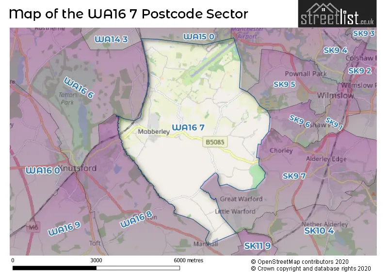
The WA16 7 postcode sector stands on the Cheshire and Greater Manchester border.
Did you know? According to the 2021 Census, the WA16 7 postcode sector is home to a bustling 3,267 residents!
Given that each sector allows for 400 unique postcode combinations. Letters C, I, K, M, O and V are not allowed in the last two letters of a postcode. With 198 postcodes already in use, this leaves 202 units available.
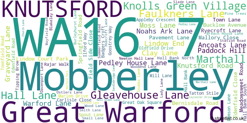
The largest settlement in the WA16 7 postal code is Mobberley followed by Marthall, and KNUTSFORD.
The WA16 7 Postcode shares a border with SK9 5 (WILMSLOW), SK9 6 (WILMSLOW), WA14 3 (Bowdon, Hale, Ashley), WA16 6 (KNUTSFORD, High Legh, Mere), SK9 4 (WILMSLOW, Styal), SK9 7 (ALDERLEY EDGE), WA15 0 (Hale Barns, Hale, Ashley) and WA16 8 (KNUTSFORD, Ollerton, Over Peover).
The sector is within the post town of KNUTSFORD.
WA16 7 is a postcode sector within the WA16 postcode district which is within the WA Warrington postcode area.
The Royal Mail delivery office for the WA16 7 postal sector is the Knutsford Delivery Office.
The area of the WA16 7 postcode sector is 9.38 square miles which is 24.31 square kilometres or 6,006.27 square acres.
Waterways within the WA16 7 postcode sector include the River Bollin.

Map of the WA16 7 Postcode Sector
Explore the WA16 7 postcode sector by using our free interactive map.
| W | A | 1 | 6 | - | 7 | X | X |
| W | A | 1 | 6 | Space | 7 | Letter | Letter |
Official List of Streets
Mobberley (60 Streets)
KNUTSFORD (2 Streets)
Marthall (5 Streets)
Knolls Green Village (1 Streets)
Great Warford (1 Streets)
Unofficial Streets or Alternative Spellings
WILMSLOW
MOOR LANEALDERLEY EDGE
EDGE VIEW LANE FODEN LANE BEECH HILL BROADOAK LANE CROFT PARK DICKEN BRIDGE OAK ROAD PADDOCK HILL LANE PADDOCKHILL LANE ROWAN TREE ROAD SANDLE BRIDGE LANE WILLOW CLOSEKNUTSFORD
MOBBERLEY ROADWeather Forecast for WA16 7
Press Button to Show Forecast for Knutsford
| Time Period | Icon | Description | Temperature | Rain Probability | Wind |
|---|---|---|---|---|---|
| 09:00 to 12:00 | Cloudy | 12.0°C (feels like 9.0°C) | 4.00% | SSE 18 mph | |
| 12:00 to 15:00 | Cloudy | 15.0°C (feels like 12.0°C) | 6.00% | SSE 18 mph | |
| 15:00 to 18:00 | Cloudy | 16.0°C (feels like 13.0°C) | 9.00% | SSE 16 mph | |
| 18:00 to 21:00 | Cloudy | 14.0°C (feels like 12.0°C) | 11.00% | S 9 mph | |
| 21:00 to 00:00 | Cloudy | 11.0°C (feels like 10.0°C) | 14.00% | SE 4 mph |
Press Button to Show Forecast for Knutsford
| Time Period | Icon | Description | Temperature | Rain Probability | Wind |
|---|---|---|---|---|---|
| 00:00 to 03:00 | Cloudy | 10.0°C (feels like 9.0°C) | 12.00% | SE 7 mph | |
| 03:00 to 06:00 | Cloudy | 9.0°C (feels like 8.0°C) | 11.00% | SE 4 mph | |
| 06:00 to 09:00 | Cloudy | 9.0°C (feels like 8.0°C) | 6.00% | SE 4 mph | |
| 09:00 to 12:00 | Cloudy | 12.0°C (feels like 11.0°C) | 6.00% | SE 4 mph | |
| 12:00 to 15:00 | Cloudy | 14.0°C (feels like 14.0°C) | 9.00% | SE 4 mph | |
| 15:00 to 18:00 | Cloudy | 15.0°C (feels like 15.0°C) | 10.00% | ESE 4 mph | |
| 18:00 to 21:00 | Cloudy | 15.0°C (feels like 14.0°C) | 8.00% | NW 4 mph | |
| 21:00 to 00:00 | Cloudy | 12.0°C (feels like 11.0°C) | 9.00% | NW 7 mph |
Press Button to Show Forecast for Knutsford
| Time Period | Icon | Description | Temperature | Rain Probability | Wind |
|---|---|---|---|---|---|
| 00:00 to 03:00 | Cloudy | 11.0°C (feels like 10.0°C) | 13.00% | N 7 mph | |
| 03:00 to 06:00 | Cloudy | 11.0°C (feels like 10.0°C) | 12.00% | N 4 mph | |
| 06:00 to 09:00 | Light rain shower (day) | 11.0°C (feels like 10.0°C) | 29.00% | NNW 7 mph | |
| 09:00 to 12:00 | Light rain shower (day) | 13.0°C (feels like 11.0°C) | 29.00% | NNW 9 mph | |
| 12:00 to 15:00 | Partly cloudy (day) | 16.0°C (feels like 14.0°C) | 4.00% | NNW 11 mph | |
| 15:00 to 18:00 | Partly cloudy (day) | 17.0°C (feels like 15.0°C) | 4.00% | NNW 11 mph | |
| 18:00 to 21:00 | Sunny day | 15.0°C (feels like 13.0°C) | 4.00% | NNW 11 mph | |
| 21:00 to 00:00 | Partly cloudy (night) | 12.0°C (feels like 10.0°C) | 2.00% | N 9 mph |
Schools and Places of Education Within the WA16 7 Postcode Sector
Mobberley CofE Primary School
Voluntary controlled school
Church Lane, Knutsford, Cheshire, WA16 7RA
Head: Mr Damien Stenson
Ofsted Rating: Outstanding
Inspection: 2012-06-22 (4330 days ago)
Website: Visit Mobberley CofE Primary School Website
Phone: 01625800920
Number of Pupils: 197
House Prices in the WA16 7 Postcode Sector
| Type of Property | 2018 Average | 2018 Sales | 2017 Average | 2017 Sales | 2016 Average | 2016 Sales | 2015 Average | 2015 Sales |
|---|---|---|---|---|---|---|---|---|
| Detached | £689,833 | 12 | £519,176 | 18 | £702,595 | 31 | £569,960 | 31 |
| Semi-Detached | £365,856 | 18 | £371,808 | 13 | £277,143 | 7 | £333,475 | 12 |
| Terraced | £311,053 | 19 | £272,923 | 13 | £245,616 | 24 | £261,477 | 22 |
| Flats | £222,007 | 18 | £183,571 | 7 | £227,314 | 18 | £194,965 | 17 |
Important Postcodes WA16 7 in the Postcode Sector
WA16 7RA is the postcode for Mobberley C of E Primary School, Church Lane
| The WA16 7 Sector is within these Local Authorities |
|
|---|---|
| The WA16 7 Sector is within these Counties |
|
| The WA16 7 Sector is within these Water Company Areas |
|