The WD4 8 postcode sector is within the county of Hertfordshire.
Did you know? According to the 2021 Census, the WD4 8 postcode sector is home to a bustling 8,062 residents!
Given that each sector allows for 400 unique postcode combinations. Letters C, I, K, M, O and V are not allowed in the last two letters of a postcode. With 216 postcodes already in use, this leaves 184 units available.
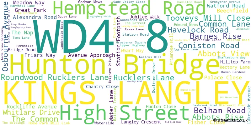
The largest settlement in the WD4 8 postal code is KINGS LANGLEY followed by HUNTON BRIDGE , and ABBOTS LANGLEY .
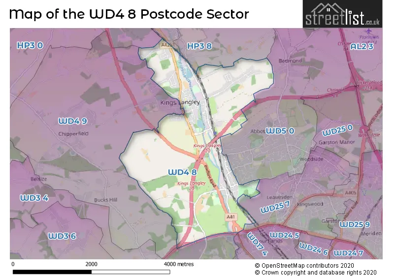
The WD4 8 Postcode shares a border with WD17 3 (WATFORD ), WD4 9 (CHIPPERFIELD , KINGS LANGLEY , SARRATT ), WD5 0 (ABBOTS LANGLEY , BEDMOND ), HP3 0 (BOVINGDON, HEMEL HEMPSTEAD, Felden), WD3 4 (RICKMANSWORTH , LOUDWATER , CROXLEY GREEN ), WD17 4 (WATFORD ), WD25 7 (WATFORD , LEAVESDEN , ABBOTS LANGLEY ), HP3 8 (HEMEL HEMPSTEAD, NASH MILLS, Pimlico) and HP3 9 (HEMEL HEMPSTEAD, Nash Mills Wharf, APSLEY).
The sector is within the post town of KINGS LANGLEY.
WD4 8 is a postcode sector within the WD4 postcode district which is within the WD Watford postcode area.
The Royal Mail delivery office for the WD4 8 postal sector is the Kings Langley Delivery Office.
The area of the WD4 8 postcode sector is 4.29 square miles which is 11.12 square kilometres or 2,747.15 square acres.
The WD4 8 postcode sector is crossed by the M25 motorway.
Waterways within the WD4 8 postcode sector include the Grand Union Canal.

Map of the WD4 8 Postcode Sector
Explore the WD4 8 postcode sector by using our free interactive map.
| W | D | 4 | - | 8 | X | X |
| W | D | 4 | Space | 8 | Letter | Letter |
Official List of Streets
KINGS LANGLEY (74 Streets)
Hunton Bridge (10 Streets)
Schools and Places of Education Within the WD4 8 Postcode Sector
Kings Langley Primary School
Community school
Common Lane, Kings Langley, Hertfordshire, WD4 8DQ
Head: Mrs Paula Harris
Ofsted Rating: Good
Inspection: 2023-11-15 (193 days ago)
Website: Visit Kings Langley Primary School Website
Phone: 01923263321
Number of Pupils: 449
St Paul's Church of England Primary School, Langleybury
Voluntary aided school
Langleybury Lane, Kings Langley, Hertfordshire, WD4 8RJ
Head: Miss Michelle Cohen
Ofsted Rating: Good
Inspection: 2023-07-14 (317 days ago)
Website: Visit St Paul's Church of England Primary School, Langleybury Website
Phone: 01923263641
Number of Pupils: 202
House Prices in the WD4 8 Postcode Sector
| Type of Property | 2018 Average | 2018 Sales | 2017 Average | 2017 Sales | 2016 Average | 2016 Sales | 2015 Average | 2015 Sales |
|---|---|---|---|---|---|---|---|---|
| Detached | £648,357 | 21 | £742,069 | 36 | £774,828 | 38 | £560,425 | 40 |
| Semi-Detached | £525,497 | 38 | £559,973 | 37 | £494,369 | 44 | £446,529 | 34 |
| Terraced | £447,500 | 18 | £422,526 | 17 | £432,921 | 19 | £391,605 | 37 |
| Flats | £270,300 | 35 | £299,459 | 37 | £273,957 | 64 | £249,918 | 61 |
Important Postcodes WD4 8 in the Postcode Sector
WD4 8DH is the postcode for West Herts College - Construction and Engineering Centre, Langley Waters
WD4 8DQ is the postcode for Kings Langley Jmi School, Common Lane, KINGS LANGLEY JMI SCHOOL, COMMON LANE, KINGS LANGLEY, and Kings Langley Primary School, Common Lane
WD4 8RJ is the postcode for St. Paul's C of E Primary School, Langleybury
| The WD4 8 Sector is within these Local Authorities |
|
|---|---|
| The WD4 8 Sector is within these Counties |
|
| The WD4 8 Sector is within these Water Company Areas |
|