The WV4 postcode district is a postal district located in the WV Wolverhampton postcode area with a population of 34,836 residents according to the 2021 England and Wales Census.
The area of the WV4 postcode district is 7.37 square miles which is 19.10 square kilometres or 4,719.56 acres.
Currently, the WV4 district has about 739 postcode units spread across 3 geographic postcode sectors.
Given that each sector allows for 400 unique postcode combinations, the district has a capacity of 1,200 postcodes. With 739 postcodes already in use, this leaves 461 units available.
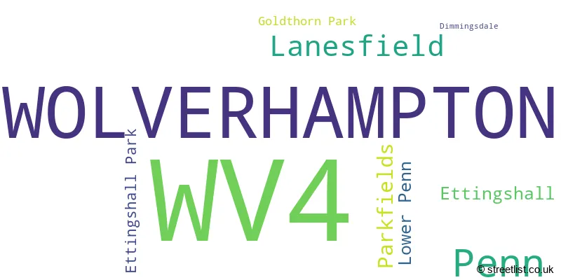
The largest settlement in the WV4 postal code is WOLVERHAMPTON followed by Penn, and Lanesfield.
The WV4 Postcode shares a border with DY3 (DUDLEY, Sedgley, Swindon), WV14 (BILSTON, Coseley), WV5 (Wombourne, Claverley, Seisdon), WV6 (WOLVERHAMPTON, Perton, Pattingham), WV2 (WOLVERHAMPTON, Ettingshall) and WV3 (WOLVERHAMPTON, Bradmore).
The primary settlement in the WV4 postcode district is Wolverhampton, located in the county of Staffordshire. Other notable settlements in the district include Dimmingsdale, Lower Penn, Goldthorn Park, Ettingshall, Ettingshall Park, Lanesfield, and Parkfields. The most significant post town in the district is Wolverhampton.
For the district WV4, we have data on 3 postcode sectors. Here's a breakdown: The sector WV4 4, covers Wolverhampton in West Midlands. The sector WV4 4, covers Wolverhampton in Staffordshire. The sector WV4 5, covers Wolverhampton and Penn in West Midlands. The sector WV4 5, covers Wolverhampton in Staffordshire. The sector WV4 6, covers Wolverhampton and Lanesfield in West Midlands.

Map of the WV4 Postcode District
Explore the WV4 postcode district by using our free interactive map.

When it comes to local government, postal geography often disregards political borders. However, for a breakdown in the WV4 District: the district mostly encompasses the City of Wolverhampton District (B) (660 postcodes), followed by the South Staffordshire District area (75 postcodes), and finally, the Dudley District (B) area (4 postcodes).
Recent House Sales in WV4
| Date | Price | Address |
|---|---|---|
| 20/10/2023 | £305,000 | Westminster Avenue, Wolverhampton, WV4 5TE |
| 12/09/2023 | £192,000 | Wynchcombe Avenue, Penn, Wolverhampton, WV4 4JG |
| 06/09/2023 | £180,000 | Mount Road, Penn, Wolverhampton, WV4 5RU |
| 25/08/2023 | £157,000 | Hilton Road, Lanesfield, Wolverhampton, WV4 6DR |
| 25/08/2023 | £185,000 | Swan Bank, Penn, Wolverhampton, WV4 5PZ |
| 24/08/2023 | £155,000 | Ryecroft Avenue, Wolverhampton, WV4 5UQ |
| 24/08/2023 | £161,500 | Alexandra Road, Wolverhampton, WV4 5UA |
| 21/08/2023 | £447,500 | Springhill Park, Wolverhampton, WV4 4TS |
| 18/08/2023 | £150,000 | Spring Road Industrial Estate, Wolverhampton, WV4 6UA |
| 18/08/2023 | £285,000 | Church Hill, Penn, Wolverhampton, WV4 5NP |
Weather Forecast for WV4
Press Button to Show Forecast for Spring Hill
| Time Period | Icon | Description | Temperature | Rain Probability | Wind |
|---|---|---|---|---|---|
| 09:00 to 12:00 | Cloudy | 6.0°C (feels like 4.0°C) | 6.00% | ENE 7 mph | |
| 12:00 to 15:00 | Overcast | 8.0°C (feels like 7.0°C) | 9.00% | ENE 4 mph | |
| 15:00 to 18:00 | Cloudy | 9.0°C (feels like 8.0°C) | 9.00% | ENE 4 mph | |
| 18:00 to 21:00 | Cloudy | 9.0°C (feels like 8.0°C) | 10.00% | ENE 4 mph | |
| 21:00 to 00:00 | Partly cloudy (night) | 6.0°C (feels like 3.0°C) | 8.00% | ENE 7 mph |
Press Button to Show Forecast for Spring Hill
| Time Period | Icon | Description | Temperature | Rain Probability | Wind |
|---|---|---|---|---|---|
| 00:00 to 03:00 | Partly cloudy (night) | 4.0°C (feels like 1.0°C) | 8.00% | ENE 7 mph | |
| 03:00 to 06:00 | Cloudy | 3.0°C (feels like 1.0°C) | 12.00% | NE 4 mph | |
| 06:00 to 09:00 | Cloudy | 3.0°C (feels like 1.0°C) | 10.00% | NE 7 mph | |
| 09:00 to 12:00 | Cloudy | 7.0°C (feels like 4.0°C) | 15.00% | ENE 9 mph | |
| 12:00 to 15:00 | Overcast | 9.0°C (feels like 7.0°C) | 21.00% | ENE 9 mph | |
| 15:00 to 18:00 | Overcast | 10.0°C (feels like 8.0°C) | 23.00% | ENE 9 mph | |
| 18:00 to 21:00 | Overcast | 9.0°C (feels like 7.0°C) | 20.00% | ENE 9 mph | |
| 21:00 to 00:00 | Cloudy | 7.0°C (feels like 4.0°C) | 20.00% | NE 11 mph |
Press Button to Show Forecast for Spring Hill
| Time Period | Icon | Description | Temperature | Rain Probability | Wind |
|---|---|---|---|---|---|
| 00:00 to 03:00 | Cloudy | 6.0°C (feels like 3.0°C) | 19.00% | NE 11 mph | |
| 03:00 to 06:00 | Cloudy | 6.0°C (feels like 3.0°C) | 25.00% | NNE 11 mph | |
| 06:00 to 09:00 | Heavy rain | 6.0°C (feels like 3.0°C) | 75.00% | NNE 11 mph | |
| 09:00 to 12:00 | Heavy rain | 7.0°C (feels like 4.0°C) | 77.00% | NNE 11 mph | |
| 12:00 to 15:00 | Light rain | 9.0°C (feels like 5.0°C) | 53.00% | N 13 mph | |
| 15:00 to 18:00 | Light rain | 9.0°C (feels like 7.0°C) | 54.00% | NNE 11 mph | |
| 18:00 to 21:00 | Light rain shower (day) | 9.0°C (feels like 7.0°C) | 39.00% | N 9 mph | |
| 21:00 to 00:00 | Clear night | 7.0°C (feels like 5.0°C) | 11.00% | N 7 mph |
Where is the WV4 Postcode District?
The postcode district for WV4 is located in Wolverhampton. It is nearby the towns of Bilston (3.6 miles to the East), Dudley (3.9 miles to the South East), Kingswinford (4.3 miles to the South), and Willenhall (5.3 miles to the North East). Additionally, the distance from WV4 to the center of London is approximately 113.3 miles.
The district is within the post town of WOLVERHAMPTON.
The sector has postcodes within the nation of England.
The WV4 Postcode District is covers the following regions.
- Wolverhampton - West Midlands - West Midlands (England)
- Staffordshire CC - Shropshire and Staffordshire - West Midlands (England)
- Dudley - West Midlands - West Midlands (England)
| Postcode Sector | Delivery Office |
|---|---|
| WV4 4 | Wolverhampton Delivery Office |
| WV4 5 | Wolverhampton Delivery Office |
| WV4 6 | Wolverhampton Delivery Office |
| W | V | 4 | - | X | X | X |
| W | V | 4 | Space | Numeric | Letter | Letter |
Current Monthly Rental Prices
| # Bedrooms | Min Price | Max Price | Avg Price |
|---|---|---|---|
| £525 | £525 | £525 | |
| 1 | £625 | £843 | £723 |
| 2 | £750 | £950 | £877 |
| 3 | £995 | £1,500 | £1,195 |
| 5 | £1,850 | £3,500 | £2,400 |
Current House Prices
| # Bedrooms | Min Price | Max Price | Avg Price |
|---|---|---|---|
| £40,000 | £750,000 | £222,500 | |
| 1 | £32,000 | £169,950 | £69,128 |
| 2 | £79,950 | £349,950 | £203,334 |
| 3 | £72,000 | £500,000 | £281,300 |
| 4 | £264,000 | £750,000 | £414,961 |
| 5 | £290,000 | £1,495,000 | £541,782 |
| 6 | £459,000 | £995,000 | £757,250 |
| 7 | £300,000 | £300,000 | £300,000 |
Estate Agents who Operate in the WV4 District
| Logo | Name | Brand Name | Address | Contact Number | Total Properties |
|---|---|---|---|---|---|
 | Wolverhampton | Connells | 81-83 Darlington Street, Wolverhampton, WV1 4EX | 01902 943827 | 37 |
 | Wombourne | Berriman Eaton | High Street, Wombourne, WV5 9DP | 01902 943980 | 14 |
 | Wolverhampton | Sanders, Wright & Freeman | 13 Waterloo Road, Wolverhampton, WV1 4DJ | 01902 943372 | 12 |
 | Wolverhampton | D B Roberts & Partners | 18 Darlington Street, Wolverhampton, WV1 4HW | 01902 943715 | 12 |
 | Tettenhall | Thomas Harvey | 1 The Arcade, High Street, Tettenhall, Wolverhampton, WV6 8QS | 01902 943555 | 11 |
| Type of Property | 2018 Average | 2018 Sales | 2017 Average | 2017 Sales | 2016 Average | 2016 Sales | 2015 Average | 2015 Sales |
|---|---|---|---|---|---|---|---|---|
| Detached | £290,083 | 75 | £268,640 | 115 | £255,805 | 126 | £235,678 | 113 |
| Semi-Detached | £169,202 | 212 | £166,430 | 212 | £149,395 | 240 | £147,634 | 234 |
| Terraced | £152,706 | 74 | £142,324 | 86 | £135,938 | 62 | £132,443 | 59 |
| Flats | £93,583 | 49 | £111,120 | 60 | £121,765 | 89 | £82,524 | 46 |