The B15 1 postcode sector is within the county of West Midlands.
Did you know? According to the 2021 Census, the B15 1 postcode sector is home to a bustling 2,888 residents!
Given that each sector allows for 400 unique postcode combinations. Letters C, I, K, M, O and V are not allowed in the last two letters of a postcode. With 89 postcodes already in use, this leaves 311 units available.
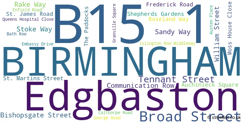
The largest settlements in the B15 1 postal code are BIRMINGHAM and Edgbaston.
The B15 1 Postcode shares a border with B1 2 (BIRMINGHAM), B1 1 (BIRMINGHAM), B15 2 (BIRMINGHAM, Edgbaston), B15 3 (Edgbaston, BIRMINGHAM) and B16 8 (BIRMINGHAM, Edgbaston, Ladywood).
The sector is within the post town of BIRMINGHAM.
B15 1 is a postcode sector within the B1 postcode district which is within the B Birmingham postcode area.
The Royal Mail delivery office for the B15 1 postal sector is the Birmingham Central Delivery Office.
The area of the B15 1 postcode sector is 0.19 square miles which is 0.50 square kilometres or 124.16 square acres.
Waterways within the B15 1 postcode sector include the Worcester & Birmingham Canal.

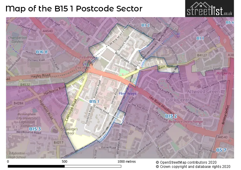
Map of the B15 1 Postcode Sector
Explore the B15 1 postcode sector by using our free interactive map.
| B | 1 | 5 | - | 1 | X | X |
| B | 1 | 5 | Space | 1 | Letter | Letter |
Official List of Streets
BIRMINGHAM (18 Streets)
Edgbaston (7 Streets)
Unofficial Streets or Alternative Spellings
House Prices in the B15 1 Postcode Sector
| Type of Property | 2018 Average | 2018 Sales | 2017 Average | 2017 Sales | 2016 Average | 2016 Sales | 2015 Average | 2015 Sales |
|---|---|---|---|---|---|---|---|---|
| Detached | £475,000 | 1 | £0 | 0 | £1,250,000 | 2 | £588,167 | 3 |
| Semi-Detached | £915,000 | 1 | £845,000 | 1 | £815,000 | 2 | £490,000 | 1 |
| Terraced | £0 | 0 | £161,000 | 1 | £278,000 | 4 | £565,000 | 2 |
| Flats | £205,639 | 121 | £182,470 | 17 | £157,365 | 26 | £151,430 | 15 |
Important Postcodes B15 1 in the Postcode Sector
B15 1AU is the postcode for Jobcentre Plus, Centennial House, 100 Broad Street
B15 1BG is the postcode for Valuation Office Agency, 2 Broadway, Broad Street, H M Revenue & Customs, 2 Broadway, and H M Customs & Excise, 2 Broadway, Broad Street
B15 1DL is the postcode for Tribunals Service, Auchinleck House, Broad Street
B15 1LZ is the postcode for Bath Row Medical Practice, Colston Health Centre, 10 Bath Row, Attwood Green Health Care Centre, 30 Bath Row, Attwood Green Health Centre, 30 Bath Row, and Midland Heart, 20 Bath Row
B15 1NU is the postcode for University Hospitals Birmingham, 14-17 George Road, Edgbaston, Valuation Office Agency, 14-17 George Road, University Hospitals Birmingham, 14-17 George Road, and Regent Court, George Road
B15 1PL is the postcode for 38 George Road, Edgbaston
B15 1SL is the postcode for Department for Work & Pensions, Five Ways House, Islington Row Middleway, and Five Ways House, Islington Row Middleway
| The B15 1 Sector is within these Local Authorities |
|
|---|---|
| The B15 1 Sector is within these Counties |
|
| The B15 1 Sector is within these Water Company Areas |
|