Map of Hollyhock Road
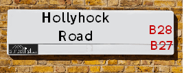
| Postcodes | ||
|---|---|---|
| Icon | Postcodes for Hollyhock Road | |
| Walking Distances | ||
| Distance Info | Green Circle = 10 Minutes Walk (800 metres) | |
About Hollyhock Road
Hollyhock Road is a street located in the city of Birmingham. The street has a length of approximately 480 metres.
Hollyhock Road is located within the Birmingham District (B) Council's jurisdiction. They provide various services, like refuse collection, and manage council tax collection. It's situated in the West Midlands region of the UK.
Hollyhock Road has been assigned the Unique Street Reference Number of 2706811 in the National Street Gazetteer.
Hollyhock Road is located within the county of West Midlands, situated in the West Midlands region of the UK. It's 98.42 miles North West from central London., 3.74 miles South East from Birmingham, 14.12 miles West from Coventry and 23.55 miles North East from Worcester.

Do you know why this road is called Hollyhock Road?
What's it like to live here?
Ask the community a question about Hollyhock Road.
Do you have any questions, memories to share or know any facts about Hollyhock Road? We'd love to know more.
Also on streetlist.co.uk, can you help?
Swing Swang Lane
28th April 2024
I am trying to find out why the lane is named Swing Swang?
It has been known known this since at least 1905 when hedge making contents used to be held here.
Swing Swang is often used to describe a fairground ride. I remember Swing Boats. Were they a bit like this or is Swing Swang another name for swings?
Swing Swangs are also mentioned in connection to orchards. Or were orchards just good places to have swings?
Eldroth Road
15th April 2024
I wondered if anyone has any old pictures of Wenning Bank House in the 1940’s and also Lane Side before of the same era .. we visited today with my Mum in law as she used to live at both these properties. Also any photos of the schools around that time .. thank you.
Can You Help?Napps Way
15th April 2024
Why is the road called Napps Way (belonging to Napp, but minus an
apostrophe as is usual with such nomenclature)? Moreover, who or
what is, or was, “Napp” in the respective, possessive case?
Several years ago, I met an elderly man (probably in his late-eighties)
who lives on Bentham Drive, Liverpool 16, and during a conversation
with him whilst in a Northwest Passenger Transport Ambulance on the
way to the former RLUH (Royal Liverpool University Hospital), he told
me that he could remember (when he was a boy, living in Childwall,
Liverpool 16) that, “Where Napps Way is now, during WW2, there was
a two-man gun emplacement on the, then, open land to protect the
railway line passing over Childwall Valley Road - next to the railway
bridge - when suddenly, as they were loading a live “shell” into the gun’s
breach, the aforementioned “shell” accidentally exploded in the gun’s
breach killing both of the two soldiers, that had been manning the gun,
instantly! (Very sad, of course, but could - perhaps - two ghosts relating
to those two, very unfortunately and prematurely-killed soldiers have
haunted that place of their deaths ever since - and have any residents
of Napps Way - formerly and in its latest incarnation - seen two, WW2
(uniformed) soldiers unexpectedly appear in or near their homes?)
Estate Agents near Hollyhock Road
| Name | Address | Website |
|---|---|---|
| Citizen Housing - Bonneville Place | Bonnveville Place, Birmingham,B28 8BA | |
| Paul and Sons | 1130 Stratford Road, Hall Green, Birmingham,B28 8AE | Visit Website |
| Move With Us Estate Agents | 1098 Stratford Road, Birmingham,B28 8AD | Visit Website |
Location Details
| Hollyhock Road | |
|---|---|

| |
| Latitude | 52.440763 |
| Longitude | -1.838838 |
| OS Easting (X): | 410953 |
| OS Northing (Y): | 282586 |
| OS Grid Reference: | SP110826 |
Neighbourhood Policing |
| Police Force: West Midlands |
 View Neighbourhood Crime and Policing View Neighbourhood Crime and Policing |
| Find a Local Neighbourhood Watch Scheme |
Frequently asked Questions for Hollyhock Road
What Council (Local Authority) is Hollyhock Road in?
Hollyhock Road is located within the local authority area of Birmingham Council which is a Metropolitan District.
What Parish Council is Hollyhock Road in?
Hollyhock Road is in an unparished area.
What Electoral Ward is Hollyhock Road in?
Hollyhock Road is located within the ward of Tyseley & Hay Mills.
What County is Hollyhock Road in?
Hollyhock Road is located within the ceremonial county of West Midlands.
What Constituency is Hollyhock Road in?
Hollyhock Road is located within the constituency of Birmingham &Yardley.
What Part of the UK is Hollyhock Road in?
Hollyhock Road is located within the West Midlands (England) region of the United Kingdom.
What County Council area is Hollyhock Road in?
Hollyhock Road is located within the West Midlands Council area.
What Police Force area is Hollyhock Road in?
Hollyhock Road is located within the West Midlands Police area.
Roads that have a Junction with Hollyhock Road
| Street | Junction Type |
|---|---|
| Pemberly Road | junction |
| Fox Green Crescent | junction |
| The Link | junction |
| York Road | junction |
Sunset and Sunrise times for Hollyhock Road
| Sunrise | 05:18 |
|---|---|
| Sunset | 20:49 |
Latest Weather Conditions for Hollyhock Road
| Observed at Weather Station: | Coleshill 9 May 2024 at 15:00 (6.87 miles away) |
|---|---|
| Current Weather: | Sunny day |
| Temperature and Humidity: | 22.6°C (44.6%) |
| Wind Direction and Speed: | WNW (3 mph) |
Population Statistics
| ONS Area Code | E00045752 & E00045757 |
|---|---|
| ONS Area Name | Private Renting Young Families & Multi-Ethnic Hardship |
| Average Age | 42.86 |
| Area Population | 1559.00 |
| Male Population | 777.00 (50%) |
| Female Population | 782.00 (50%) |
| Benefit Claimants | 52 (3%) |
| LSOA Code: | E01009016 |
|---|---|
| LSOA Name: | Birmingham 098A |
| SOA Code: | 7a |
| SOA Name: | |
| MSOA Code: | E02001924 |
| MSOA Name: | Birmingham 098 |
Nearest Supermarkets
| Tesco Hall Green Stratford Express |
|---|
| 1184 Stratford Rd, Hall Green, Birmingham, B28 8AB |
| 0345 610 6344 |
| Distance: 0.4 Miles |
| Directions from Hollyhock Road to Tesco Hall Green Stratford Express |
| Iceland Acocks Green |
|---|
| 1133 Warwick Road, Acocks Green, Birmingham, B27 6RA |
| 01217077977 |
| Distance: 0.82 Miles |
| Directions from Hollyhock Road to Iceland Acocks Green |
| Waitrose Hall Green |
|---|
| 1332 Stratford Road, Hall Green, Birmingham, West Midlands, B28 9EF |
| 01217 784253 |
| Distance: 0.87 Miles |
| Directions from Hollyhock Road to Waitrose Hall Green |
| Tesco Solihull Esso Express |
|---|
| 11 Warwick Rd, Olton, Solihull, B92 7HS |
| 0345 677 9809 |
| Distance: 1.17 Miles |
| Directions from Hollyhock Road to Tesco Solihull Esso Express |
Telephone Information
| Area Code |
|---|
| Area Code: 0121 - Birmingham |
| Area Code: 01675 - Coleshill |
| Area Code: 01564 - Lapworth |
| Area Code: 01676 - Meriden |
Broadband Information
| Speed | Average Speed | Median Speed | Maximum Speed | Next-generation access (NGA) | Number of Connections |
|---|---|---|---|---|---|
| Greater than 2 Mbps | 15.9 | 13.3 | >=30 | Y | 6 |
Local Government
| Local Council Details |
|---|
| Within the area of Birmingham |
| Visit the Council's Website |
| Council House, Victoria Square, Birmingham &B1 1BB |
| Send email |
| Telephone Number: 0121 303 1111 |
| Local Member of Parliament |
|---|
| Within the Westminster Parliamentary Constituency of Birmingham &Yardley |
| The Member of Parliament is Jess Phillips |
| Details for the MP Jess Phillips on parliament.uk |
| Details for the MP Jess Phillips on theyworkforyou.com |
| In the 2019 General Election Jess Phillips won with a majority of 10,659 the result was Lab hold. The total electorate was 74,704 |
| Wards, Parish Councils and County Councils |
|---|
| Ward: Tyseley & Hay Mills Ward |
| Ceremonial County: West Midlands |
Nearest Schools
England Primary Schools
Cottesbrooke Junior School
Address: Cottesbrooke Junior School, Cedars Avenue, Birmingham, West Midlands, B27 6JL
Distance: 1.16 miles
Contact:
Holy Souls Catholic Primary School
Address: Holy Souls Catholic Primary School, Mallard Close, Acocks Green, Birmingham, West Midlands, B27 6BN
Distance: 0.93 miles
Contact:
Severne Junior Infant and Nursery School
Address: Severne Junior Infant and Nursery School, Severne Road, Acocks Green, Birmingham, West Midlands, B27 7HR
Distance: 0.83 miles
Contact: 01217062743
Lakey Lane Junior and Infant School
Address: Lakey Lane Junior and Infant School, Lakey Lane, Hall Green, Birmingham, West Midlands, B28 8RY
Distance: 0.72 miles
Contact: 01214641990
Redhill Primary School
Address: Redhill Primary School, Redhill Road, Hay Mills, Birmingham, West Midlands, B25 8HQ
Distance: 1.45 miles
Contact: 01214646322
St Ambrose Barlow Catholic Primary School
Address: St Ambrose Barlow Catholic Primary School, 841 Shirley Road, Hall Green, Birmingham, West Midlands, B28 9JJ
Distance: 1.16 miles
Contact: 01214642791
Hall Green Junior School
Address: Hall Green Junior School, Stratford Road, Hall Green, Birmingham, West Midlands, B28 9AJ
Distance: 0.70 miles
Contact: 01214643840
Greet Primary School
Address: Greet Primary School, Percy Road, Sparkhill, Birmingham, West Midlands, B11 3ND
Distance: 1.17 miles
Contact:
Yorkmead Junior and Infant School
Address: Yorkmead Junior and Infant School, York Road, Hall Green, Birmingham, West Midlands, B28 8BB
Distance: 0.26 miles
Contact: 01214644215
Hall Green Infant School
Address: Hall Green Infant School, Petersfield Road, Hall Green, Birmingham, West Midlands, B28 0AR
Distance: 0.71 miles
Contact: 01214643082
English Martyrs' Catholic Primary School
Address: English Martyrs' Catholic Primary School, Evelyn Road, Sparkhill, English Martyrs Rc Junior & Infant School, Birmingham, West Midlands, B11 3JW
Distance: 1.26 miles
Contact: 01214643150
St Bernard's Catholic Primary School
Address: St Bernard's Catholic Primary School, Wake Green Road, Moseley, Birmingham, West Midlands, B13 9QE
Distance: 1.02 miles
Contact: 01214643795
Our Lady of Lourdes Catholic Primary School
Address: Our Lady of Lourdes Catholic Primary School, Trittiford Road, Yardley Wood, Birmingham, West Midlands, B13 0EU
Distance: 1.57 miles
Contact: 01214442684
Arden Primary School
Address: Arden Primary School, Baker Street, Sparkhill, Birmingham, West Midlands, B11 4SF
Distance: 1.46 miles
Contact: 01216757702
Cottesbrooke Infant and Nursery School
Address: Cottesbrooke Infant and Nursery School, Yardley Road, Acocks Green, Birmingham, West Midlands, B27 6LG
Distance: 1.19 miles
Contact: 01217062742
St Margaret's Church of England Voluntary Aided Primary School
Address: St Margaret's Church of England Voluntary Aided Primary School, Richmond Road, Olton, Solihull, West Midlands, B92 7RR
Distance: 1.53 miles
Contact:
Kineton Green Primary School
Address: Kineton Green Primary School, Kineton Green Road, Olton, Solihull, West Midlands, B92 7EB
Distance: 1.21 miles
Contact: 01217063873
Our Lady of Compassion Catholic Primary School
Address: Our Lady of Compassion Catholic Primary School, Kineton Green Road, Solihull, West Midlands, B92 7EG
Distance: 1.30 miles
Contact:
Cedars Academy
Address: Cedars Academy, Cedars Avenue, Birmingham, West Midlands, B27 6JL
Distance: 1.16 miles
Contact: 01214643178
The Oaklands Primary School
Address: The Oaklands Primary School, Dolphin Lane, Acocks Green, Birmingham, West Midlands, B27 7BT
Distance: 0.79 miles
Contact: 01217062168
Acocks Green Primary School
Address: Acocks Green Primary School, Westley Road, Acocks Green, Birmingham, West Midlands, B27 7UQ
Distance: 0.66 miles
Contact:
Yarnfield Primary School
Address: Yarnfield Primary School, Yarnfield Road, Tyseley, Birmingham, West Midlands, B11 3PJ
Distance: 0.41 miles
Contact: 01216930362
Robin Hood Academy
Address: Robin Hood Academy, Pitmaston Road, Hall Green, Birmingham, West Midlands, B28 9PP
Distance: 1.09 miles
Contact: 01214642187
The Olive School, Birmingham
Address: The Olive School, Birmingham, 215 Reddings Lane, Birmingham, West Midlands, B11 3EY
Distance: 0.70 miles
Contact: 01216577100
Al-Furqan Primary School
Address: Al-Furqan Primary School, Reddings Lane, Tyseley, Birmingham, West Midlands, B11 3EY
Distance: 0.70 miles
Contact: 01217772222
Greet Primary School
Address: Greet Primary School, Percy Road, Sparkhill, Birmingham, West Midlands, B11 3ND
Distance: 1.17 miles
Contact: 01214643360
St John's CofE Primary School
Address: St John's CofE Primary School, Stratford Road, Sparkhill, Birmingham, West Midlands, B11 4EA
Distance: 1.24 miles
Contact: 01216751469
Springfield Primary Academy
Address: Springfield Primary Academy, Springfield Road, Moseley, Birmingham, West Midlands, B13 9NY
Distance: 0.90 miles
Contact: 01214643618
Springfield Primary School
Address: Springfield Primary School, Springfield Road, Moseley, Birmingham, West Midlands, B13 9NY
Distance: 0.90 miles
Contact:
England Secondary Schools
Archbishop Ilsley Catholic School
Address: Archbishop Ilsley Catholic School, Victoria Road, Acocks Green, Birmingham, West Midlands, B27 7XY
Distance: 0.77 miles
Contact:
Yardleys School
Address: Yardleys School, Reddings Lane, Tyseley, Birmingham, West Midlands, B11 3EY
Distance: 0.70 miles
Contact:
Moseley School and Sixth Form
Address: Moseley School and Sixth Form, Wake Green Road, Moseley, Birmingham, West Midlands, B13 9UU
Distance: 1.07 miles
Contact: 01215666444
Ark Boulton Academy
Address: Ark Boulton Academy, Golden Hillock Road, Sparkhill, Birmingham, West Midlands, B11 2QG
Distance: 1.53 miles
Contact: 01217738156
Ninestiles, an Academy
Address: Ninestiles, an Academy, Hartfield Crescent, Acocks Green, Birmingham, West Midlands, B27 7QG
Distance: 0.28 miles
Contact: 01216281311
Yardleys School
Address: Yardleys School, Reddings Lane, Tyseley, Birmingham, West Midlands, B11 3EY
Distance: 0.70 miles
Contact: 01214646821
Hall Green School
Address: Hall Green School, Southam Road, Hall Green, Birmingham, West Midlands, B28 0AA
Distance: 0.65 miles
Contact: 01216288787
Nearest Hospitals
| Name | Address | Postcode | Distance | Map |
|---|
Nearest Dentists
Dentists near Hollyhock Road
| Name | Address | Postcode | Distance | Map |
|---|
Nearest GP Surgeries
Doctors near Hollyhock Road
HALL GREEN HC - COVID LOCAL VACCINATION SERVICE 2
Address: 979 STRATFORD ROAD, HALL GREEN, BIRMINGHAM, B28 8BG
Distance: 0.46 miles
Contact: :
HALL GREEN HC - COVID LOCAL VACCINATION SERVICE
Address: 979 STRATFORD ROAD, HALL GREEN, BIRMINGHAM, B28 8BG
Distance: 0.46 miles
Contact: :
HALL GREEN HEALTH
Address: 979 STRATFORD ROAD, HALL GREEN, BIRMINGHAM, WEST MIDLANDS, B28 8BG
Distance: 0.46 miles
Contact: tel: 0121 7773500
SHIRLEY ROAD HEALTH CENTRE
Address: 189 SHIRLEY ROAD, ACOCKS GREEN, BIRMINGHAM, WEST MIDLANDS, B27 7NP
Distance: 0.51 miles
Contact: :
ACOCKS GREEN MEDICAL CENTRE
Address: 999 WARWICK ROAD, ACOCKS GREEN, BIRMINGHAM, WEST MIDLANDS, B27 6QJ
Distance: 0.72 miles
Contact: tel: 0121 7060501
DUDLEY PARK MEDICAL CENTRE
Address: 28 DUDLEY PARK ROAD, BIRMINGHAM, WEST MIDLANDS, B27 6QR
Distance: 0.82 miles
Contact: :
Nearest Dispensing Chemists
Pharmacies near Hollyhock Road
| Name | Address | Postcode | Telephone | Map | Distance in Km |
|---|
Nearest Opticians
Opticians near Hollyhock Road
VS5 LIMITED - ACOCKS GREEN
Address: 291 FOX HOLLIES ROAD, ACOCKS GREEN, BIRMINGHAM, B27 7PS
Distance: 0.24 miles
Contact: :
MR MANOJ BECTOR (RUSSELL ROAD)
Address: 1 RUSSELL ROAD, HALL GREEN, BIRMINGHAM, B28 8SE
Distance: 0.34 miles
Contact: :
EAGLE EYES OPTICIANS
Address: 1132 STRATFORD ROAD, HALL GREEN, BIRMINGHAM, WEST MIDLANDS, B28 8AE
Distance: 0.39 miles
Contact: :
MATTOO DAVINDER (STRATFORD ROAD)
Address: HALL GREEN HEALTH CENTRE, 977-979 STRATFORD ROAD, HALL GREEN, BIRMINGHAM, WEST MIDLANDS, B28 8BG
Distance: 0.46 miles
Contact: :
MIDLANDS COMMUNITY EYECARE LIMITED (KINGS COURT)
Address: KINGS COURT, 17 SCHOOL ROAD, HALL GREEN, BIRMINGHAM, B28 8JG
Distance: 0.46 miles
Contact: :
SPECSAVERS (ACOCKS GREEN)
Address: SPECSAVERS OPTICIANS, 1086 WARWICK ROAD, ACOCKS GREEN, BIRMINGHAM, WEST MIDLANDS, B27 6BH
Distance: 0.80 miles
Contact: :
Transport
Nearest Rail Stations
Spring Road Station is 0.19 miles away.
Address: Spring Road station, Spring Road, Tyseley, West Midlands, B11 3DP
Spring Road is situated on the North Warwickshire (Shakespeare Line) Line.
Spring Road Station is staffed on a part time basis.
Hall Green Station is 0.39 miles away.
Address: Hall Green station, off Stratford Road, Hall Green, West Midlands, B28 8AA
Hall Green is situated on the North Warwickshire (Shakespeare Line) Line.
Hall Green Station is staffed on a part time basis.