The CH49 8 postcode sector is within the county of Merseyside.
Did you know? According to the 2021 Census, the CH49 8 postcode sector is home to a bustling 2,348 residents!
Given that each sector allows for 400 unique postcode combinations. Letters C, I, K, M, O and V are not allowed in the last two letters of a postcode. With 48 postcodes already in use, this leaves 352 units available.
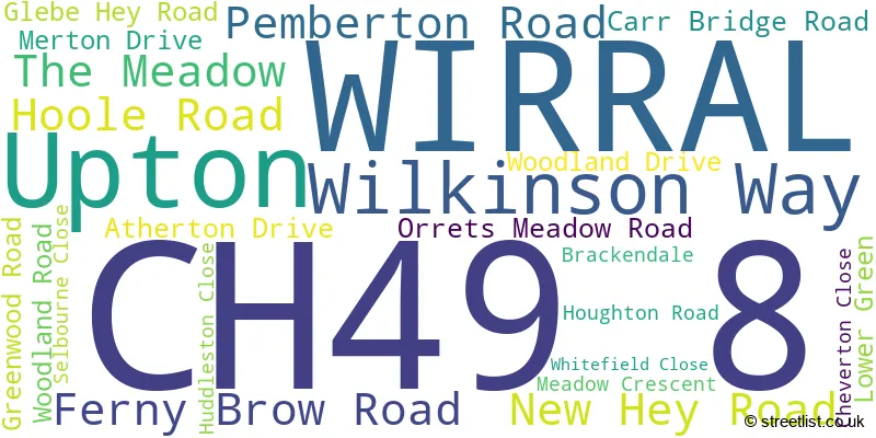
The largest settlements in the CH49 8 postal code are WIRRAL and Upton.
The CH49 8 Postcode shares a border with CH49 5 (WIRRAL, Upton), CH49 0 (WIRRAL), CH49 9 (WIRRAL), CH43 9 (PRENTON) and CH49 7 (WIRRAL, Upton, Woodchurch).
The sector is within the post town of WIRRAL.
CH49 8 is a postcode sector within the CH49 postcode district which is within the CH Chester postcode area.
The Royal Mail delivery office for the CH49 8 postal sector is the Upton (ch) Delivery Office.
The area of the CH49 8 postcode sector is 0.18 square miles which is 0.47 square kilometres or 116.91 square acres.
The CH49 8 postcode sector is crossed by the M53 motorway.

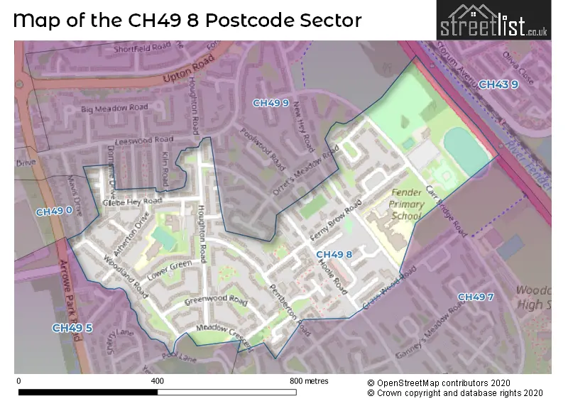
Map of the CH49 8 Postcode Sector
Explore the CH49 8 postcode sector by using our free interactive map.
| C | H | 4 | 9 | - | 8 | X | X |
| C | H | 4 | 9 | Space | 8 | Letter | Letter |
Official List of Streets
WIRRAL (19 Streets)
Unofficial Streets or Alternative Spellings
Weather Forecast for CH49 8
Press Button to Show Forecast for Noctorum
| Time Period | Icon | Description | Temperature | Rain Probability | Wind |
|---|---|---|---|---|---|
| 18:00 to 21:00 | Cloudy | 20.0°C (feels like 19.0°C) | 4.00% | NE 7 mph | |
| 21:00 to 00:00 | Clear night | 16.0°C (feels like 16.0°C) | 0.00% | SW 4 mph |
Press Button to Show Forecast for Noctorum
| Time Period | Icon | Description | Temperature | Rain Probability | Wind |
|---|---|---|---|---|---|
| 00:00 to 03:00 | Partly cloudy (night) | 16.0°C (feels like 15.0°C) | 1.00% | S 4 mph | |
| 03:00 to 06:00 | Cloudy | 15.0°C (feels like 14.0°C) | 4.00% | E 4 mph | |
| 06:00 to 09:00 | Cloudy | 15.0°C (feels like 14.0°C) | 4.00% | SE 7 mph | |
| 09:00 to 12:00 | Cloudy | 18.0°C (feels like 17.0°C) | 4.00% | SE 9 mph | |
| 12:00 to 15:00 | Cloudy | 21.0°C (feels like 19.0°C) | 4.00% | SE 9 mph | |
| 15:00 to 18:00 | Cloudy | 22.0°C (feels like 19.0°C) | 3.00% | SE 11 mph | |
| 18:00 to 21:00 | Cloudy | 21.0°C (feels like 19.0°C) | 4.00% | SSE 9 mph | |
| 21:00 to 00:00 | Cloudy | 18.0°C (feels like 17.0°C) | 4.00% | SE 9 mph |
Press Button to Show Forecast for Noctorum
| Time Period | Icon | Description | Temperature | Rain Probability | Wind |
|---|---|---|---|---|---|
| 00:00 to 03:00 | Cloudy | 17.0°C (feels like 15.0°C) | 4.00% | SE 9 mph | |
| 03:00 to 06:00 | Cloudy | 15.0°C (feels like 13.0°C) | 4.00% | SE 11 mph | |
| 06:00 to 09:00 | Cloudy | 14.0°C (feels like 13.0°C) | 4.00% | SE 9 mph | |
| 09:00 to 12:00 | Cloudy | 17.0°C (feels like 15.0°C) | 4.00% | SE 11 mph | |
| 12:00 to 15:00 | Cloudy | 20.0°C (feels like 17.0°C) | 7.00% | SE 11 mph | |
| 15:00 to 18:00 | Light rain shower (day) | 19.0°C (feels like 17.0°C) | 37.00% | S 11 mph | |
| 18:00 to 21:00 | Heavy rain shower (day) | 17.0°C (feels like 16.0°C) | 61.00% | SE 7 mph | |
| 21:00 to 00:00 | Light rain | 16.0°C (feels like 15.0°C) | 48.00% | SE 7 mph |
Press Button to Show Forecast for Noctorum
| Time Period | Icon | Description | Temperature | Rain Probability | Wind |
|---|---|---|---|---|---|
| 00:00 to 03:00 | Cloudy | 15.0°C (feels like 14.0°C) | 17.00% | SSE 7 mph | |
| 03:00 to 06:00 | Cloudy | 14.0°C (feels like 13.0°C) | 15.00% | S 4 mph | |
| 06:00 to 09:00 | Cloudy | 14.0°C (feels like 12.0°C) | 16.00% | S 7 mph | |
| 09:00 to 12:00 | Cloudy | 15.0°C (feels like 13.0°C) | 19.00% | SSE 9 mph | |
| 12:00 to 15:00 | Light rain | 16.0°C (feels like 15.0°C) | 53.00% | SSE 11 mph | |
| 15:00 to 18:00 | Cloudy | 16.0°C (feels like 14.0°C) | 56.00% | SSE 11 mph | |
| 18:00 to 21:00 | Light rain | 15.0°C (feels like 14.0°C) | 58.00% | SSE 9 mph | |
| 21:00 to 00:00 | Light rain | 14.0°C (feels like 12.0°C) | 51.00% | SE 9 mph |
Press Button to Show Forecast for Noctorum
| Time Period | Icon | Description | Temperature | Rain Probability | Wind |
|---|---|---|---|---|---|
| 00:00 to 03:00 | Cloudy | 13.0°C (feels like 11.0°C) | 21.00% | SE 11 mph | |
| 03:00 to 06:00 | Cloudy | 12.0°C (feels like 11.0°C) | 16.00% | SE 11 mph | |
| 06:00 to 09:00 | Cloudy | 12.0°C (feels like 10.0°C) | 10.00% | SE 11 mph | |
| 09:00 to 12:00 | Partly cloudy (day) | 14.0°C (feels like 12.0°C) | 14.00% | SE 13 mph | |
| 12:00 to 15:00 | Light rain shower (day) | 15.0°C (feels like 13.0°C) | 36.00% | SSE 13 mph | |
| 15:00 to 18:00 | Light rain shower (day) | 16.0°C (feels like 13.0°C) | 39.00% | SSE 13 mph | |
| 18:00 to 21:00 | Light rain shower (day) | 15.0°C (feels like 12.0°C) | 36.00% | SSE 11 mph | |
| 21:00 to 00:00 | Cloudy | 13.0°C (feels like 11.0°C) | 13.00% | SE 11 mph |
Schools and Places of Education Within the CH49 8 Postcode Sector
Fender Primary School
Community school
New Hey Road, Wirral, Merseyside, CH49 8HB
Head: Louise Seargeant
Ofsted Rating: Good
Inspection: 2022-06-22 (688 days ago)
Website: Visit Fender Primary School Website
Phone: 01516770425
Number of Pupils: 237
Ganneys Meadow Nursery School and Family Centre
Local authority nursery school
New Hey Road, Wirral, Merseyside, CH49 8HB
Head: Mrs Kathryn Kennedy
Ofsted Rating: Outstanding
Inspection: 2017-09-20 (2424 days ago)
Website: Visit Ganneys Meadow Nursery School and Family Centre Website
Phone: 01516779255
Number of Pupils: 135
Gilbrook School
Community special school
Glebe Hey Road, , Merseyside, CH49 8HE
Head: Mrs Kirsten Brown
Ofsted Rating: Outstanding
Inspection: 2017-11-02 (2381 days ago)
Website: Visit Gilbrook School Website
Phone: 01515223900
Number of Pupils: 60
House Prices in the CH49 8 Postcode Sector
| Type of Property | 2018 Average | 2018 Sales | 2017 Average | 2017 Sales | 2016 Average | 2016 Sales | 2015 Average | 2015 Sales |
|---|---|---|---|---|---|---|---|---|
| Detached | £179,250 | 4 | £250,000 | 1 | £180,833 | 3 | £220,000 | 1 |
| Semi-Detached | £107,919 | 13 | £100,714 | 7 | £107,929 | 7 | £128,650 | 3 |
| Terraced | £92,148 | 20 | £87,869 | 16 | £88,184 | 19 | £97,883 | 6 |
| Flats | £73,000 | 3 | £50,000 | 1 | £42,667 | 3 | £0 | 0 |
Important Postcodes CH49 8 in the Postcode Sector
CH49 8EU is the postcode for Woodchurch Leisure Centre, Carr Bridge Road
CH49 8HB is the postcode for GANNEYS MEADOW PRIMARY SCHOOL FENDER PRIMARY SCHOOL, Fender Primary School, New Hey Road, and Fender Primary School, New Hey Road
CH49 8HE is the postcode for Gilbrook School, Glebe Hey Road
| The CH49 8 Sector is within these Local Authorities |
|
|---|---|
| The CH49 8 Sector is within these Counties |
|
| The CH49 8 Sector is within these Water Company Areas |
|