The CH63 8 postcode sector is within the county of Merseyside.
Did you know? According to the 2021 Census, the CH63 8 postcode sector is home to a bustling 2,922 residents!
Given that each sector allows for 400 unique postcode combinations. Letters C, I, K, M, O and V are not allowed in the last two letters of a postcode. With 87 postcodes already in use, this leaves 313 units available.
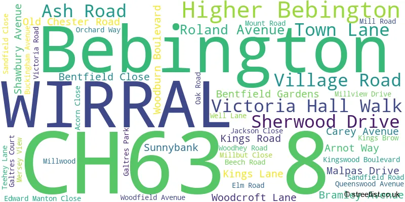
The largest settlement in the CH63 8 postal code is WIRRAL followed by Bebington, and Higher Bebington.
The CH63 8 Postcode shares a border with CH42 4 (BIRKENHEAD), CH63 2 (WIRRAL, Bebington, Higher Bebington), CH63 5 (WIRRAL, Bebington, Higher Bebington) and CH63 7 (WIRRAL, Bebington).
The sector is within the post town of WIRRAL.
CH63 8 is a postcode sector within the CH6 postcode district which is within the CH Chester postcode area.
The Royal Mail delivery office for the CH63 8 postal sector is the unknown.
The area of the CH63 8 postcode sector is 0.36 square miles which is 0.95 square kilometres or 233.55 square acres.

Map of the CH63 8 Postcode Sector
Explore the CH63 8 postcode sector by using our free interactive map.
| C | H | 6 | 3 | - | 8 | X | X |
| C | H | 6 | 3 | Space | 8 | Letter | Letter |
Official List of Streets
WIRRAL (29 Streets)
Bebington (12 Streets)
Unofficial Streets or Alternative Spellings
Bebington
MOUNT ROADWIRRAL
BERWYN BOULEVARD BICKERTON AVENUE CONVILLE BOULEVARD GARTH BOULEVARD HEATHER BANK HIGHER BEBINGTON ROAD LINKSIDE MILL BROW MILLFIELD CLOSE PRINCES BOULEVARD ROSEFIELD AVENUE TEEHEY CLOSE TOWNFIELD LANEBIRKENHEAD
WOODLAND ROAD REST HILL ROAD VILLAGE MEWS WOODHEY GROVEHigher Bebington
SCHOOL LANE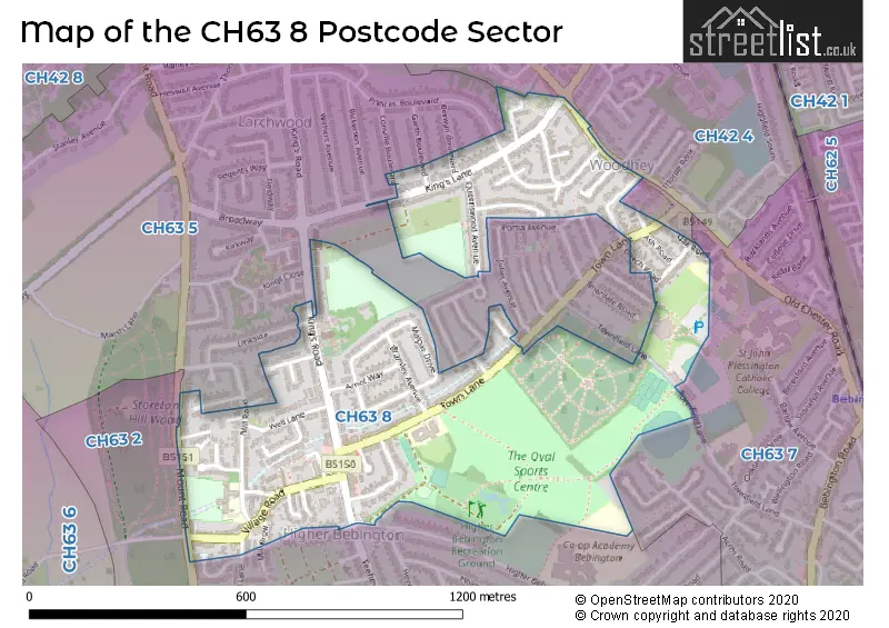
House Prices in the CH63 8 Postcode Sector
| Type of Property | 2018 Average | 2018 Sales | 2017 Average | 2017 Sales | 2016 Average | 2016 Sales | 2015 Average | 2015 Sales |
|---|---|---|---|---|---|---|---|---|
| Detached | £264,000 | 5 | £246,167 | 6 | £243,333 | 6 | £188,250 | 4 |
| Semi-Detached | £201,565 | 36 | £170,644 | 34 | £179,573 | 40 | £169,497 | 41 |
| Terraced | £166,667 | 6 | £158,833 | 9 | £141,542 | 6 | £137,132 | 11 |
| Flats | £112,486 | 7 | £114,688 | 8 | £89,049 | 5 | £121,808 | 6 |
Important Postcodes CH63 8 in the Postcode Sector
CH63 8LD is the postcode for Town Lane Infant School, Town Lane, and Town Lane Infant School, Town Lane, Bebington
CH63 8QE is the postcode for Higher Bebington Junior School, Mill Road
| The CH63 8 Sector is within these Local Authorities |
|
|---|---|
| The CH63 8 Sector is within these Counties |
|
| The CH63 8 Sector is within these Water Company Areas |
|