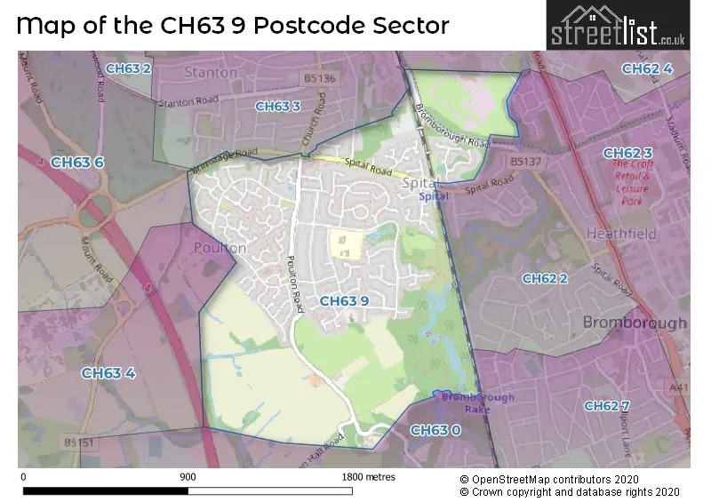
The CH63 9 postcode sector is within the county of Merseyside.
Did you know? According to the 2021 Census, the CH63 9 postcode sector is home to a bustling 4,278 residents!
Given that each sector allows for 400 unique postcode combinations. Letters C, I, K, M, O and V are not allowed in the last two letters of a postcode. With 124 postcodes already in use, this leaves 276 units available.
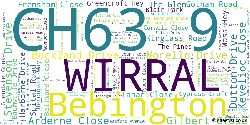
The largest settlements in the CH63 9 postal code are WIRRAL and Bebington.
The CH63 9 Postcode shares a border with CH62 2 (WIRRAL, Bromborough), CH62 4 (WIRRAL, Bromborough Pool, Port Sunlight), CH63 4 (WIRRAL, Thornton Hough), CH63 6 (WIRRAL, Higher Bebington, Brimstage), CH62 7 (WIRRAL, Bromborough), CH63 0 (WIRRAL, Bromborough, Raby Mere) and CH63 3 (WIRRAL, Bebington).
The sector is within the post town of WIRRAL.
CH63 9 is a postcode sector within the CH63 postcode district which is within the CH Chester postcode area.
The Royal Mail delivery office for the CH63 9 postal sector is the New Ferry Delivery Office.
The area of the CH63 9 postcode sector is 0.94 square miles which is 2.44 square kilometres or 602.69 square acres.
The CH63 9 postcode sector is crossed by the M53 motorway.
Waterways within the CH63 9 postcode sector include the Farfield Pond, Dibbinsdale brook.

Map of the CH63 9 Postcode Sector
Explore the CH63 9 postcode sector by using our free interactive map.
| C | H | 6 | 3 | - | 9 | X | X |
| C | H | 6 | 3 | Space | 9 | Letter | Letter |
Official List of Streets
WIRRAL (89 Streets)
Bebington (2 Streets)
Unofficial Streets or Alternative Spellings
WIRRAL
BEECHWAY BROMBOROUGH ROAD DIBBINSDALE ROAD LANCELYN COURT NEEDWOOD DRIVE OLD CLATTERBRIDGE ROAD CUT THROUGH TO GOTHAM ROAD HEATH DALE MILLFIELD MOSS HAY COURT MOSS HEY COURT OTTER TUNNEL POULTON HALL ROAD SPITAL STATION FOOTBRIDGE STEPHENSON DRIVE WESTGATE ROADBebington
BRIMSTAGE ROAD CHURCH ROADWeather Forecast for CH63 9
Press Button to Show Forecast for Bromborough
| Time Period | Icon | Description | Temperature | Rain Probability | Wind |
|---|---|---|---|---|---|
| 15:00 to 18:00 | Thunder | 22.0°C (feels like 20.0°C) | 65.00% | S 11 mph | |
| 18:00 to 21:00 | Light rain shower (day) | 19.0°C (feels like 19.0°C) | 34.00% | SSE 4 mph | |
| 21:00 to 00:00 | Partly cloudy (night) | 17.0°C (feels like 16.0°C) | 6.00% | NE 7 mph |
Press Button to Show Forecast for Bromborough
| Time Period | Icon | Description | Temperature | Rain Probability | Wind |
|---|---|---|---|---|---|
| 00:00 to 03:00 | Light rain shower (night) | 15.0°C (feels like 14.0°C) | 25.00% | SW 4 mph | |
| 03:00 to 06:00 | Cloudy | 13.0°C (feels like 13.0°C) | 6.00% | WSW 4 mph | |
| 06:00 to 09:00 | Overcast | 13.0°C (feels like 13.0°C) | 9.00% | NNE 4 mph | |
| 09:00 to 12:00 | Cloudy | 16.0°C (feels like 14.0°C) | 5.00% | SSE 11 mph | |
| 12:00 to 15:00 | Cloudy | 19.0°C (feels like 15.0°C) | 6.00% | SSE 13 mph | |
| 15:00 to 18:00 | Cloudy | 20.0°C (feels like 16.0°C) | 7.00% | SSE 13 mph | |
| 18:00 to 21:00 | Cloudy | 18.0°C (feels like 15.0°C) | 11.00% | SSE 13 mph | |
| 21:00 to 00:00 | Cloudy | 16.0°C (feels like 14.0°C) | 21.00% | SE 11 mph |
Press Button to Show Forecast for Bromborough
| Time Period | Icon | Description | Temperature | Rain Probability | Wind |
|---|---|---|---|---|---|
| 00:00 to 03:00 | Light rain | 15.0°C (feels like 13.0°C) | 56.00% | SE 11 mph | |
| 03:00 to 06:00 | Light rain | 14.0°C (feels like 12.0°C) | 58.00% | ESE 11 mph | |
| 06:00 to 09:00 | Light rain | 14.0°C (feels like 12.0°C) | 57.00% | ESE 11 mph | |
| 09:00 to 12:00 | Heavy rain | 15.0°C (feels like 13.0°C) | 81.00% | ESE 11 mph | |
| 12:00 to 15:00 | Heavy rain | 16.0°C (feels like 14.0°C) | 85.00% | ESE 11 mph | |
| 15:00 to 18:00 | Light rain | 17.0°C (feels like 15.0°C) | 60.00% | SE 11 mph | |
| 18:00 to 21:00 | Light rain | 16.0°C (feels like 14.0°C) | 55.00% | S 9 mph | |
| 21:00 to 00:00 | Cloudy | 14.0°C (feels like 13.0°C) | 15.00% | ESE 9 mph |
Press Button to Show Forecast for Bromborough
| Time Period | Icon | Description | Temperature | Rain Probability | Wind |
|---|---|---|---|---|---|
| 00:00 to 03:00 | Cloudy | 13.0°C (feels like 11.0°C) | 7.00% | ESE 9 mph | |
| 03:00 to 06:00 | Partly cloudy (night) | 12.0°C (feels like 10.0°C) | 3.00% | ESE 9 mph | |
| 06:00 to 09:00 | Sunny day | 13.0°C (feels like 11.0°C) | 1.00% | ESE 9 mph | |
| 09:00 to 12:00 | Partly cloudy (day) | 16.0°C (feels like 14.0°C) | 6.00% | ESE 11 mph | |
| 12:00 to 15:00 | Light rain shower (day) | 18.0°C (feels like 16.0°C) | 33.00% | SE 9 mph | |
| 15:00 to 18:00 | Partly cloudy (day) | 18.0°C (feels like 17.0°C) | 14.00% | SE 9 mph | |
| 18:00 to 21:00 | Sunny day | 17.0°C (feels like 16.0°C) | 11.00% | ESE 7 mph | |
| 21:00 to 00:00 | Clear night | 15.0°C (feels like 14.0°C) | 6.00% | SSE 7 mph |
Press Button to Show Forecast for Bromborough
| Time Period | Icon | Description | Temperature | Rain Probability | Wind |
|---|---|---|---|---|---|
| 00:00 to 03:00 | Clear night | 13.0°C (feels like 12.0°C) | 1.00% | SE 7 mph | |
| 03:00 to 06:00 | Clear night | 12.0°C (feels like 11.0°C) | 2.00% | ESE 4 mph | |
| 06:00 to 09:00 | Sunny day | 13.0°C (feels like 12.0°C) | 2.00% | SSE 4 mph | |
| 09:00 to 12:00 | Sunny day | 16.0°C (feels like 16.0°C) | 3.00% | SSE 4 mph | |
| 12:00 to 15:00 | Cloudy | 18.0°C (feels like 18.0°C) | 10.00% | E 7 mph | |
| 15:00 to 18:00 | Cloudy | 18.0°C (feels like 17.0°C) | 15.00% | NW 7 mph | |
| 18:00 to 21:00 | Light rain shower (day) | 16.0°C (feels like 15.0°C) | 30.00% | WNW 7 mph | |
| 21:00 to 00:00 | Light rain shower (night) | 14.0°C (feels like 13.0°C) | 29.00% | NW 7 mph |
Schools and Places of Education Within the CH63 9 Postcode Sector
Poulton Lancelyn Primary School
Academy converter
Venables Drive, Wirral, Merseyside, CH63 9LY
Head: Mr Andy Milne
Ofsted Rating: Good
Inspection: 2021-09-29 (956 days ago)
Website: Visit Poulton Lancelyn Primary School Website
Phone: 01513345021
Number of Pupils: 472
House Prices in the CH63 9 Postcode Sector
| Type of Property | 2018 Average | 2018 Sales | 2017 Average | 2017 Sales | 2016 Average | 2016 Sales | 2015 Average | 2015 Sales |
|---|---|---|---|---|---|---|---|---|
| Detached | £289,245 | 36 | £273,668 | 41 | £270,089 | 44 | £233,637 | 36 |
| Semi-Detached | £201,125 | 12 | £226,655 | 19 | £204,102 | 17 | £182,321 | 14 |
| Terraced | £155,250 | 2 | £227,317 | 3 | £193,825 | 6 | £138,983 | 3 |
| Flats | £123,875 | 8 | £100,238 | 4 | £121,667 | 3 | £107,790 | 5 |
Important Postcodes CH63 9 in the Postcode Sector
CH63 9LY is the postcode for Poulton Lancelyn Primary School, Venables Drive
| The CH63 9 Sector is within these Local Authorities |
|
|---|---|
| The CH63 9 Sector is within these Counties |
|
| The CH63 9 Sector is within these Water Company Areas |
|