The DE55 6 postcode sector is within the county of Derbyshire.
Did you know? According to the 2021 Census, the DE55 6 postcode sector is home to a bustling 7,986 residents!
Given that each sector allows for 400 unique postcode combinations. Letters C, I, K, M, O and V are not allowed in the last two letters of a postcode. With 184 postcodes already in use, this leaves 216 units available.
The largest settlement in the DE55 6 postal code is Shirland followed by Stonebroom, and Morton.
The DE55 6 Postcode shares a border with S45 0 (Ashover), S45 8 (Pilsley, Lower Pilsley), S45 9 (Clay Cross, Danesmoor), DE4 5 (Crich, Tansley, Whatstandwell), DE55 5 (Tibshelf, Newton, Blackwell) and DE55 7 (ALFRETON, South Wingfield, Oakerthorpe).
The sector is within the post town of ALFRETON.
DE55 6 is a postcode sector within the DE5 postcode district which is within the DE Derby postcode area.
The Royal Mail delivery office for the DE55 6 postal sector is the unknown.
The area of the DE55 6 postcode sector is 12.29 square miles which is 31.84 square kilometres or 7,867.51 square acres.
Waterways within the DE55 6 postcode sector include the River Rother, River Amber, Westwood Brook, Alfreton Brook.

Map of the DE55 6 Postcode Sector
Explore the DE55 6 postcode sector by using our free interactive map.
| D | E | 5 | 5 | - | 6 | X | X |
| D | E | 5 | 5 | Space | 6 | Letter | Letter |
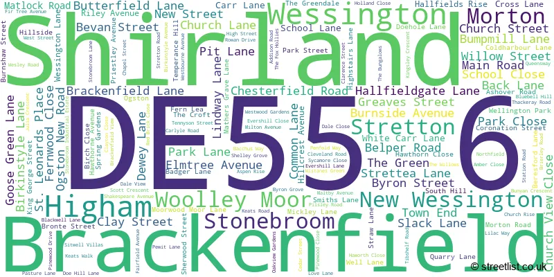
Official List of Streets
Stonebroom (32 Streets)
Shirland (39 Streets)
Stretton (23 Streets)
Morton (24 Streets)
Brackenfield (15 Streets)
Wessington (19 Streets)
Woolley Moor (6 Streets)
Higham (5 Streets)
New Wessington (1 Streets)
Unofficial Streets or Alternative Spellings
Tibshelf
ALFRETON ROADWesthouses
TIBSHELF ROAD ALFRETON ROAD ASHOVER NEW ROAD BIRKENSTYLE LANE CROW LANE DAM LANE DANESMOOR FOOTBRIDGE DE PEVEREL COURT DOG LANE DOUBLE VILLAS FRONT TERRACE HIGHAM LANE HILL CREST AVENUE HOME LANE HURST LANE LOWER CHAPEL STREET MATHERSGRAVE LANE MEADOW VIEW MOORWOODMOOR LANE OAK VIEW GARDENS OGSTON LANE OLD COLLIERY YARD PEGGY LANE SHEEP LANE SOUTH HILL LANE WHITECARR LANEALFRETON
CHESTERFIELD ROADPilsley
MORTON ROAD PADLEY WOOD LANEClay Cross
HANDLEY LANE STRETTON ROADWoolley Moor
ASHOVER ROADSouth Wingfield
WESSINGTON LANEAshover
BERRIDGE LANE DARK LANEWeather Forecast for DE55 6
Press Button to Show Forecast for Clay Cross
| Time Period | Icon | Description | Temperature | Rain Probability | Wind |
|---|---|---|---|---|---|
| 18:00 to 21:00 | Overcast | 7.0°C (feels like 4.0°C) | 11.00% | NE 9 mph | |
| 21:00 to 00:00 | Overcast | 6.0°C (feels like 3.0°C) | 11.00% | NNE 11 mph |
Press Button to Show Forecast for Clay Cross
| Time Period | Icon | Description | Temperature | Rain Probability | Wind |
|---|---|---|---|---|---|
| 00:00 to 03:00 | Overcast | 5.0°C (feels like 2.0°C) | 25.00% | NNE 11 mph | |
| 03:00 to 06:00 | Heavy rain | 5.0°C (feels like 1.0°C) | 92.00% | N 13 mph | |
| 06:00 to 09:00 | Heavy rain | 5.0°C (feels like 1.0°C) | 94.00% | N 13 mph | |
| 09:00 to 12:00 | Heavy rain | 5.0°C (feels like 1.0°C) | 92.00% | NNW 13 mph | |
| 12:00 to 15:00 | Heavy rain | 6.0°C (feels like 3.0°C) | 84.00% | NW 11 mph | |
| 15:00 to 18:00 | Cloudy | 8.0°C (feels like 5.0°C) | 16.00% | W 13 mph | |
| 18:00 to 21:00 | Sunny day | 8.0°C (feels like 6.0°C) | 1.00% | W 9 mph | |
| 21:00 to 00:00 | Clear night | 5.0°C (feels like 2.0°C) | 1.00% | SW 7 mph |
Press Button to Show Forecast for Clay Cross
| Time Period | Icon | Description | Temperature | Rain Probability | Wind |
|---|---|---|---|---|---|
| 00:00 to 03:00 | Clear night | 4.0°C (feels like 1.0°C) | 0.00% | SW 9 mph | |
| 03:00 to 06:00 | Clear night | 4.0°C (feels like 0.0°C) | 4.00% | SSW 11 mph | |
| 06:00 to 09:00 | Partly cloudy (day) | 5.0°C (feels like 2.0°C) | 3.00% | SSW 11 mph | |
| 09:00 to 12:00 | Cloudy | 10.0°C (feels like 7.0°C) | 9.00% | SSW 16 mph | |
| 12:00 to 15:00 | Cloudy | 13.0°C (feels like 9.0°C) | 12.00% | S 18 mph | |
| 15:00 to 18:00 | Cloudy | 13.0°C (feels like 10.0°C) | 11.00% | S 16 mph | |
| 18:00 to 21:00 | Partly cloudy (day) | 12.0°C (feels like 9.0°C) | 4.00% | S 13 mph | |
| 21:00 to 00:00 | Partly cloudy (night) | 10.0°C (feels like 7.0°C) | 1.00% | S 13 mph |
Press Button to Show Forecast for Clay Cross
| Time Period | Icon | Description | Temperature | Rain Probability | Wind |
|---|---|---|---|---|---|
| 00:00 to 03:00 | Partly cloudy (night) | 8.0°C (feels like 6.0°C) | 2.00% | S 11 mph | |
| 03:00 to 06:00 | Clear night | 7.0°C (feels like 4.0°C) | 1.00% | SSE 9 mph | |
| 06:00 to 09:00 | Sunny day | 7.0°C (feels like 5.0°C) | 2.00% | SE 9 mph | |
| 09:00 to 12:00 | Sunny day | 12.0°C (feels like 10.0°C) | 2.00% | SE 11 mph | |
| 12:00 to 15:00 | Cloudy | 15.0°C (feels like 12.0°C) | 13.00% | SSE 13 mph | |
| 15:00 to 18:00 | Light rain shower (day) | 15.0°C (feels like 13.0°C) | 33.00% | SE 11 mph | |
| 18:00 to 21:00 | Light rain shower (day) | 14.0°C (feels like 13.0°C) | 36.00% | SE 7 mph | |
| 21:00 to 00:00 | Partly cloudy (night) | 11.0°C (feels like 10.0°C) | 9.00% | ESE 7 mph |
Press Button to Show Forecast for Clay Cross
| Time Period | Icon | Description | Temperature | Rain Probability | Wind |
|---|---|---|---|---|---|
| 00:00 to 03:00 | Cloudy | 9.0°C (feels like 8.0°C) | 14.00% | SE 4 mph | |
| 03:00 to 06:00 | Fog | 9.0°C (feels like 8.0°C) | 25.00% | N 4 mph | |
| 06:00 to 09:00 | Mist | 9.0°C (feels like 8.0°C) | 24.00% | N 4 mph | |
| 09:00 to 12:00 | Cloudy | 12.0°C (feels like 11.0°C) | 15.00% | NE 7 mph | |
| 12:00 to 15:00 | Partly cloudy (day) | 15.0°C (feels like 14.0°C) | 13.00% | ENE 7 mph | |
| 15:00 to 18:00 | Cloudy | 17.0°C (feels like 15.0°C) | 17.00% | ENE 7 mph | |
| 18:00 to 21:00 | Cloudy | 15.0°C (feels like 13.0°C) | 13.00% | NE 9 mph | |
| 21:00 to 00:00 | Light rain | 12.0°C (feels like 10.0°C) | 43.00% | NE 9 mph |
Schools and Places of Education Within the DE55 6 Postcode Sector
Mickley Village Primary & Nursery School
Community school
Milton Avenue, Alfreton, Derbyshire, DE55 6GG
Head: Miss Sara Street
Ofsted Rating: Good
Inspection: 2022-05-05 (723 days ago)
Website: Visit Mickley Village Primary & Nursery School Website
Phone: 01773832707
Number of Pupils: 43
Shirland Primary School
Community school
Park Lane, Alfreton, Derbyshire, DE55 6BH
Head: Miss Louise Vessey
Ofsted Rating: Good
Inspection: 2022-01-27 (821 days ago)
Website: Visit Shirland Primary School Website
Phone: 01773832426
Number of Pupils: 166
Stretton Handley Church of England Primary School
Voluntary controlled school
Beresford Lane, Alfreton, Derbyshire, DE55 6FH
Head: Mrs Louise Nicholson
Ofsted Rating: Good
Inspection: 2023-03-14 (410 days ago)
Website: Visit Stretton Handley Church of England Primary School Website
Phone: 01246590418
Number of Pupils: 51
Wessington Primary School
Community school
The Green, Alfreton, Derbyshire, DE55 6DQ
Head: Mrs Karen Maycock
Ofsted Rating: Good
Inspection: 2022-06-21 (676 days ago)
Website: Visit Wessington Primary School Website
Phone: 01773832748
Number of Pupils: 89

House Prices in the DE55 6 Postcode Sector
| Type of Property | 2018 Average | 2018 Sales | 2017 Average | 2017 Sales | 2016 Average | 2016 Sales | 2015 Average | 2015 Sales |
|---|---|---|---|---|---|---|---|---|
| Detached | £314,522 | 63 | £278,813 | 38 | £304,689 | 43 | £275,207 | 35 |
| Semi-Detached | £152,535 | 62 | £135,608 | 38 | £129,834 | 49 | £105,611 | 44 |
| Terraced | £115,012 | 24 | £90,589 | 27 | £126,375 | 20 | £113,300 | 15 |
| Flats | £64,000 | 1 | £0 | 0 | £0 | 0 | £0 | 0 |
Important Postcodes DE55 6 in the Postcode Sector
DE55 6BH is the postcode for Shirland Primary School, Park Lane, and SHIRLAND PRIMARY SCHOOL, PARK LANE, SHIRLAND
DE55 6DQ is the postcode for Wessington Primary School, The Green
DE55 6FH is the postcode for Stretton Handley C of E Controlled Primary School, Beresford Lane
DE55 6GG is the postcode for Mickley Infant School, Milton Avenue
DE55 6HH is the postcode for Morton Primary School, Main Road
DE55 6JY is the postcode for Whole Building, Stonebroom Primary & Nursery School, High Street, Stonebroom Primary & Nursery School, High Street, Stonebroom, and Stonebroom Primary & Nursery School, High Street
| The DE55 6 Sector is within these Local Authorities |
|
|---|---|
| The DE55 6 Sector is within these Counties |
|
| The DE55 6 Sector is within these Water Company Areas |
|