This section of the site is all about the KW Postcode area, also known as the Kirkwall Postal Area. Explore links to the next level to learn more about specific postcode districts such as KW1.
The KW postcode area represents a group of postal districts in the Kirkwall area of the United Kingdom. The area code KW stands for the letters k and w in KirkWall. KW has a population of 53,203 and covers an area of 4,462,585 hectares. Fun fact: 0.08% of the population of Great Britain lives in this area.
The postcode area falls within the following counties: Caithness (49.83%), Orkney (38.56%), Sutherland (11.61%).
Post Towns and Postcode Districts for the KW Postcode
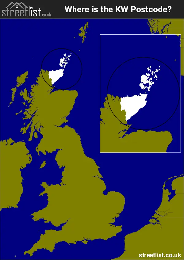
Where is the KW Postcode Area?
The KW Kirkwall Postcode is in Scotland. TheKW postal area borders the following neighbouring postal areas: IV - Inverness, It also borders The North Atlantic Ocean and The Moray Firth.
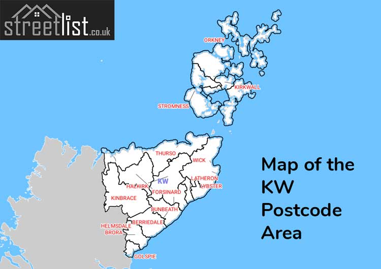
Map of the KW Kirkwall Postcode Area
Explore the KW Kirkwall postcode area by using our interactive map.
How built up is the KW Postcode?
I've calculated the total area covered by building footprints within the KW postcode area.
By analyzing this against the total area, I've determined the percentage of the area that's developed, this will give you an idea of how urban or rural the KW postcode region is.
The higher the percentage the more urban the area is. For example the least urban district is KW11 and the most urban is KW15.
| Postcode District | Total Area (m²) | Footprint Area (m²) | Built Percentage % |
|---|---|---|---|
| KW11 | 595,426,411 | 36,746 | 0.01% |
| KW7 | 206,391,190 | 25,193 | 0.01% |
| KW13 | 351,730,321 | 26,383 | 0.01% |
| KW8 | 258,835,429 | 99,672 | 0.04% |
| KW6 | 146,474,847 | 70,584 | 0.05% |
| KW12 | 419,306,085 | 320,910 | 0.08% |
| KW5 | 63,360,231 | 63,038 | 0.10% |
| KW9 | 159,861,210 | 210,557 | 0.13% |
| KW3 | 73,816,667 | 148,298 | 0.20% |
| KW2 | 8,525,861 | 18,205 | 0.21% |
| KW14 | 662,587,395 | 1,484,798 | 0.22% |
| KW16 | 278,694,142 | 667,003 | 0.24% |
| KW10 | 57,750,621 | 148,553 | 0.26% |
| KW1 | 476,245,869 | 1,342,747 | 0.28% |
| KW17 | 636,287,579 | 2,056,825 | 0.32% |
| KW15 | 57,697,059 | 911,359 | 1.58% |
| KW Total | 4,452,990,917 (m²) | 7,630,871 (m²) | 0.17% |
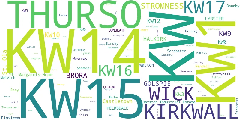
Postcode Districts within the KW Kirkwall Postcode Area
There are 16 postcode districts within the Kirkwall postcode area
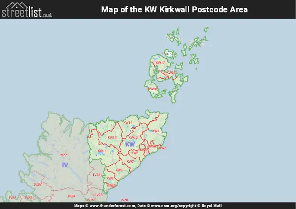
A map showing the boundary of KW in relation to other areas
There are 4 towns within the Kirkwall postcode area.
| Unit | Area² |
|---|---|
| Hectares | 4,462,585² |
| Miles | 17,230² |
| Feet | 480,348,186,815² |
| Kilometres | 44,626² |
Postal Delivery Offices serving the KW Kirkwall Postcode Area
- Balfour Scale Payment Delivery Office
- Bettyhill Scale Payment Delivery Office
- Brora Scale Payment Delivery Office
- Delivery Office Unby Scale Payment Delivery Office
- Dunbeath Scale Payment Delivery Office
- Eday Scale Payment Delivery Office
- Egilsay Scale Payment Delivery Office
- Evie Scale Payment Delivery Office
- Finstown Scale Payment Delivery Office
- Flotta Scale Payment Delivery Office
- Golspie Scale Payment Delivery Office
- Graemsay Scale Payment Delivery Office
- Halkirk Scale Payment Delivery Office
- Helmsdale Scale Payment Delivery Office
- Hoy Scale Payment Delivery Office
- Kirkwall Delivery Office
- Longhope Scale Payment Delivery Office
- Lybster Scale Payment Delivery Office
- Lyness Scale Payment Delivery Office
- Melvich Scale Payment Delivery Office
- North Ronaldsay Scale Payment Delivery Office
- Papa Westray Scale Payment Delivery Office
- Rousay Scale Payment Delivery Office
- Sanday Scale Payment Delivery Office
- Skerray Scale Payment Delivery Office
- St. Margarets Hope Scale Payment Delivery Office
- Stromness Delivery Office
- Stronsay Scale Payment Delivery Office
- Thurso Delivery Office
- Watten Scale Payment Delivery Office
- Westray Scale Payment Delivery Office
- Wick Delivery Office
- Wyre Scale Payment Delivery Office
Postcode Areas Closest to KW
Councils with Postcodes in KW
Towns and Villages within the KW Kirkwall Postcode Area
- Balfour - village
- Balnabruich - village
- Berriedale - otherSettlement
- Bettyhill - village
- Bower - village
- Brora - village
- Burray Village - village
- Cairston - otherSettlement
- Canisbay - village
- Castletown - village
- Clestrain - otherSettlement
- Doll - village
- Dounby - village
- Dunbeath - village
- Dunnet - village
- East Helmsdale - village
- Evie - otherSettlement
- Finstown - village
- Gillock - village
- Glengolly - village
- Golspie - village
- Halkirk - village
- Haster - village
- Hourston - otherSettlement
- John o' Groats - village
- Keiss - village
- Kirkwall - town
- Latheronwheel - village
- Lybster - village
- Lyness - otherSettlement
- Melvich / Meabhaich - village
- Murkle - village
- Pierowall - village
- Portgower - village
- Portskerra - village
- Reay - village
- Reiss - village
- Scrabster - village
- Shebster - otherSettlement
- St Margaret's Hope - village
- St Mary's - village
- Stromness - town
- Tankerness - otherSettlement
- Thrumster - village
- Thurso - town
- Toab - otherSettlement
- Watten - village
- Wick - town