The L10 8 postcode sector is within the county of Merseyside.
Did you know? According to the 2021 Census, the L10 8 postcode sector is home to a bustling 2,145 residents!
Given that each sector allows for 400 unique postcode combinations. Letters C, I, K, M, O and V are not allowed in the last two letters of a postcode. With 39 postcodes already in use, this leaves 361 units available.
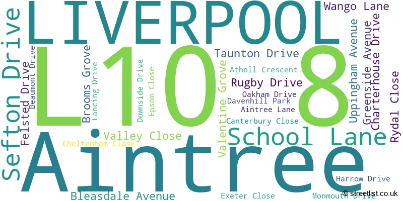
The largest settlements in the L10 8 postal code are LIVERPOOL and Aintree.
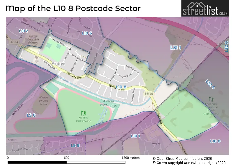
The L10 8 Postcode shares a border with L31 1 (Melling, Maghull, LIVERPOOL), L9 0 (LIVERPOOL, Walton), L10 1 (LIVERPOOL, Fazakerley), L10 2 (LIVERPOOL, Old Roan), L9 9 (LIVERPOOL, Fazakerley, Walton), L10 0 (LIVERPOOL, Fazakerley, Walton), L10 6 (LIVERPOOL, Aintree, Old Roan) and L32 4 (LIVERPOOL, Kirkby).
The sector is within the post town of LIVERPOOL.
L10 8 is a postcode sector within the L1 postcode district which is within the L Liverpool postcode area.
The Royal Mail delivery office for the L10 8 postal sector is the Liverpool 1-3.
The area of the L10 8 postcode sector is 0.42 square miles which is 1.08 square kilometres or 268.01 square acres.
Waterways within the L10 8 postcode sector include the River Alt, Leeds and Liverpool Canal.

Map of the L10 8 Postcode Sector
Explore the L10 8 postcode sector by using our free interactive map.
| L | 1 | 0 | - | 8 | X | X |
| L | 1 | 0 | Space | 8 | Letter | Letter |
Official List of Streets
LIVERPOOL (21 Streets)
Unofficial Streets or Alternative Spellings
LIVERPOOL
ALTWAY BULL BRIDGE LANE DENSTONE AVENUE MELLING ROAD WREKIN DRIVEAintree
NORTH AVENUE BROOMSGROVE SHERWOODS LANE VILLAGE NOOKOld Roan
SHREWSBURY AVENUEWeather Forecast for L10 8
Press Button to Show Forecast for Aintree
| Time Period | Icon | Description | Temperature | Rain Probability | Wind |
|---|---|---|---|---|---|
| 03:00 to 06:00 | Cloudy | 10.0°C (feels like 7.0°C) | 7.00% | SE 16 mph | |
| 06:00 to 09:00 | Cloudy | 10.0°C (feels like 6.0°C) | 4.00% | SE 16 mph | |
| 09:00 to 12:00 | Cloudy | 12.0°C (feels like 9.0°C) | 5.00% | SE 18 mph | |
| 12:00 to 15:00 | Cloudy | 15.0°C (feels like 11.0°C) | 8.00% | SSE 18 mph | |
| 15:00 to 18:00 | Cloudy | 15.0°C (feels like 12.0°C) | 14.00% | SSE 16 mph | |
| 18:00 to 21:00 | Cloudy | 13.0°C (feels like 11.0°C) | 15.00% | SSE 11 mph | |
| 21:00 to 00:00 | Cloudy | 12.0°C (feels like 10.0°C) | 15.00% | SE 9 mph |
Press Button to Show Forecast for Aintree
| Time Period | Icon | Description | Temperature | Rain Probability | Wind |
|---|---|---|---|---|---|
| 00:00 to 03:00 | Cloudy | 11.0°C (feels like 9.0°C) | 9.00% | SE 9 mph | |
| 03:00 to 06:00 | Cloudy | 10.0°C (feels like 8.0°C) | 5.00% | SE 7 mph | |
| 06:00 to 09:00 | Cloudy | 9.0°C (feels like 8.0°C) | 4.00% | SE 7 mph | |
| 09:00 to 12:00 | Cloudy | 12.0°C (feels like 10.0°C) | 5.00% | ESE 7 mph | |
| 12:00 to 15:00 | Cloudy | 14.0°C (feels like 13.0°C) | 7.00% | SSE 7 mph | |
| 15:00 to 18:00 | Cloudy | 15.0°C (feels like 14.0°C) | 10.00% | NNW 7 mph | |
| 18:00 to 21:00 | Cloudy | 14.0°C (feels like 12.0°C) | 11.00% | NW 7 mph | |
| 21:00 to 00:00 | Cloudy | 12.0°C (feels like 11.0°C) | 10.00% | NNW 9 mph |
Press Button to Show Forecast for Aintree
| Time Period | Icon | Description | Temperature | Rain Probability | Wind |
|---|---|---|---|---|---|
| 00:00 to 03:00 | Cloudy | 11.0°C (feels like 10.0°C) | 11.00% | N 7 mph | |
| 03:00 to 06:00 | Cloudy | 11.0°C (feels like 9.0°C) | 8.00% | N 7 mph | |
| 06:00 to 09:00 | Cloudy | 11.0°C (feels like 10.0°C) | 6.00% | N 7 mph | |
| 09:00 to 12:00 | Partly cloudy (day) | 13.0°C (feels like 11.0°C) | 4.00% | N 9 mph | |
| 12:00 to 15:00 | Sunny day | 15.0°C (feels like 14.0°C) | 3.00% | N 11 mph | |
| 15:00 to 18:00 | Partly cloudy (day) | 17.0°C (feels like 14.0°C) | 3.00% | N 11 mph | |
| 18:00 to 21:00 | Sunny day | 16.0°C (feels like 13.0°C) | 3.00% | N 11 mph | |
| 21:00 to 00:00 | Clear night | 13.0°C (feels like 11.0°C) | 3.00% | NNE 11 mph |
Schools and Places of Education Within the L10 8 Postcode Sector
Aintree Davenhill Primary School
Community school
Aintree Lane, Liverpool, Merseyside, L10 8LE
Head: Miss Emma Clay
Ofsted Rating: Good
Inspection: 2023-09-20 (223 days ago)
Website: Visit Aintree Davenhill Primary School Website
Phone: 01515261162
Number of Pupils: 451
House Prices in the L10 8 Postcode Sector
| Type of Property | 2018 Average | 2018 Sales | 2017 Average | 2017 Sales | 2016 Average | 2016 Sales | 2015 Average | 2015 Sales |
|---|---|---|---|---|---|---|---|---|
| Detached | £507,475 | 2 | £249,000 | 1 | £258,000 | 1 | £250,000 | 1 |
| Semi-Detached | £187,964 | 28 | £189,138 | 21 | £171,440 | 21 | £170,476 | 23 |
| Terraced | £206,667 | 3 | £184,000 | 3 | £184,300 | 3 | £0 | 0 |
| Flats | £105,000 | 1 | £116,000 | 1 | £0 | 0 | £0 | 0 |
Important Postcodes L10 8 in the Postcode Sector
L10 8LE is the postcode for Aintree Davenhill Primary School, Aintree Lane
| The L10 8 Sector is within these Local Authorities |
|
|---|---|
| The L10 8 Sector is within these Counties |
|
| The L10 8 Sector is within these Water Company Areas |
|