The L19 1 postcode sector is within the county of Merseyside.
Did you know? According to the 2021 Census, the L19 1 postcode sector is home to a bustling 2,327 residents!
Given that each sector allows for 400 unique postcode combinations. Letters C, I, K, M, O and V are not allowed in the last two letters of a postcode. With 40 postcodes already in use, this leaves 360 units available.
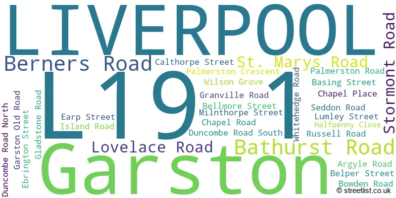
The largest settlements in the L19 1 postal code are LIVERPOOL and Garston.
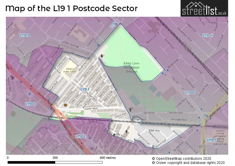
The L19 1 Postcode shares a border with L19 6 (LIVERPOOL, Garston), L19 7 (LIVERPOOL, Garston), L19 0 (LIVERPOOL, Garston, Cressington), L19 5 (LIVERPOOL, Allerton, Garston), L19 2 (LIVERPOOL, Garston) and L19 9 (LIVERPOOL, Garston).
The sector is within the post town of LIVERPOOL.
L19 1 is a postcode sector within the L1 postcode district which is within the L Liverpool postcode area.
The Royal Mail delivery office for the L19 1 postal sector is the Liverpool 1-3.
The area of the L19 1 postcode sector is 0.12 square miles which is 0.30 square kilometres or 73.84 square acres.

Map of the L19 1 Postcode Sector
Explore the L19 1 postcode sector by using our free interactive map.
| L | 1 | 9 | - | 1 | X | X |
| L | 1 | 9 | Space | 1 | Letter | Letter |
Official List of Streets
Garston (8 Streets)
LIVERPOOL (21 Streets)
Unofficial Streets or Alternative Spellings
Weather Forecast for L19 1
Press Button to Show Forecast for Grassendale
| Time Period | Icon | Description | Temperature | Rain Probability | Wind |
|---|---|---|---|---|---|
| 03:00 to 06:00 | Cloudy | 10.0°C (feels like 7.0°C) | 5.00% | SE 16 mph | |
| 06:00 to 09:00 | Cloudy | 10.0°C (feels like 6.0°C) | 5.00% | SE 18 mph | |
| 09:00 to 12:00 | Cloudy | 12.0°C (feels like 8.0°C) | 8.00% | SE 18 mph | |
| 12:00 to 15:00 | Cloudy | 15.0°C (feels like 11.0°C) | 9.00% | SSE 18 mph | |
| 15:00 to 18:00 | Cloudy | 15.0°C (feels like 11.0°C) | 15.00% | SSE 16 mph | |
| 18:00 to 21:00 | Light rain shower (day) | 13.0°C (feels like 11.0°C) | 35.00% | SSE 11 mph | |
| 21:00 to 00:00 | Overcast | 11.0°C (feels like 10.0°C) | 16.00% | SE 9 mph |
Press Button to Show Forecast for Grassendale
| Time Period | Icon | Description | Temperature | Rain Probability | Wind |
|---|---|---|---|---|---|
| 00:00 to 03:00 | Cloudy | 10.0°C (feels like 9.0°C) | 7.00% | SE 9 mph | |
| 03:00 to 06:00 | Cloudy | 9.0°C (feels like 8.0°C) | 4.00% | SE 7 mph | |
| 06:00 to 09:00 | Cloudy | 9.0°C (feels like 7.0°C) | 4.00% | SE 7 mph | |
| 09:00 to 12:00 | Cloudy | 12.0°C (feels like 10.0°C) | 5.00% | ESE 7 mph | |
| 12:00 to 15:00 | Cloudy | 14.0°C (feels like 13.0°C) | 8.00% | SE 7 mph | |
| 15:00 to 18:00 | Cloudy | 15.0°C (feels like 14.0°C) | 13.00% | SSE 7 mph | |
| 18:00 to 21:00 | Cloudy | 15.0°C (feels like 13.0°C) | 12.00% | WNW 7 mph | |
| 21:00 to 00:00 | Cloudy | 13.0°C (feels like 12.0°C) | 11.00% | WNW 7 mph |
Press Button to Show Forecast for Grassendale
| Time Period | Icon | Description | Temperature | Rain Probability | Wind |
|---|---|---|---|---|---|
| 00:00 to 03:00 | Cloudy | 12.0°C (feels like 10.0°C) | 12.00% | N 7 mph | |
| 03:00 to 06:00 | Cloudy | 11.0°C (feels like 10.0°C) | 9.00% | NNW 7 mph | |
| 06:00 to 09:00 | Cloudy | 11.0°C (feels like 10.0°C) | 7.00% | NNW 7 mph | |
| 09:00 to 12:00 | Cloudy | 13.0°C (feels like 12.0°C) | 8.00% | N 9 mph | |
| 12:00 to 15:00 | Sunny day | 16.0°C (feels like 14.0°C) | 5.00% | N 9 mph | |
| 15:00 to 18:00 | Sunny day | 18.0°C (feels like 15.0°C) | 3.00% | N 11 mph | |
| 18:00 to 21:00 | Sunny day | 17.0°C (feels like 14.0°C) | 4.00% | N 11 mph | |
| 21:00 to 00:00 | Clear night | 14.0°C (feels like 12.0°C) | 3.00% | NNE 9 mph |
Schools and Places of Education Within the L19 1 Postcode Sector
Prudentia Education
Other independent school
GAP Centre, Liverpool, Merseyside, L19 1QP
Head: Mr Christian Adeniran
Ofsted Rating: Requires improvement
Inspection: 2022-03-10 (782 days ago)
Website: Visit Prudentia Education Website
Phone: 01514278111
Number of Pupils: 48
House Prices in the L19 1 Postcode Sector
| Type of Property | 2018 Average | 2018 Sales | 2017 Average | 2017 Sales | 2016 Average | 2016 Sales | 2015 Average | 2015 Sales |
|---|---|---|---|---|---|---|---|---|
| Detached | £0 | 0 | £0 | 0 | £0 | 0 | £0 | 0 |
| Semi-Detached | £182,750 | 4 | £205,975 | 2 | £165,233 | 3 | £187,833 | 3 |
| Terraced | £122,392 | 45 | £117,317 | 44 | £125,642 | 51 | £120,282 | 38 |
| Flats | £0 | 0 | £110,000 | 1 | £21,500 | 1 | £0 | 0 |
Important Postcodes L19 1 in the Postcode Sector
L19 1QN is the postcode for Garston Library, Bowden Road
L19 1RD is the postcode for Gilmour Junior School, Whitehedge Road
| The L19 1 Sector is within these Local Authorities |
|
|---|---|
| The L19 1 Sector is within these Counties |
|
| The L19 1 Sector is within these Water Company Areas |
|