The LL23 postcode district is a postal district located in the LL Llandudno postcode area with a population of 4,220 residents according to the 2021 England and Wales Census.
The area of the LL23 postcode district is 144.26 square miles which is 373.63 square kilometres or 92,325.45 acres.
Currently, the LL23 district has about 198 postcode units spread across 1 geographic postcode sectors.
Given that each sector allows for 400 unique postcode combinations, the district has a capacity of 400 postcodes. With 198 postcodes already in use, this leaves 202 units available.
The largest settlement in the LL23 postal code is Y BALA followed by LLANUWCHLLYN, and LLANDDERFEL.
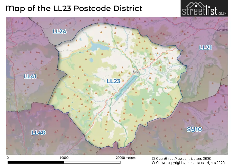
The LL23 Postcode shares a border with LL24 (BETWS Y COED, PENMACHNO, PENTREFOELAS), LL41 (BLAENAU FFESTINIOG, TRAWSFYNYDD, LLAN FFESTINIOG), LL21 (CORWEN, LLANDRILLO, CYNWYD), SY10 (Weston Rhyn, Morda, OSWESTRY), SY20 (MACHYNLLETH, PENNAL, CORRIS) and LL40 (DOLGELLAU, LLANFACHRETH, LLANELLTYD).
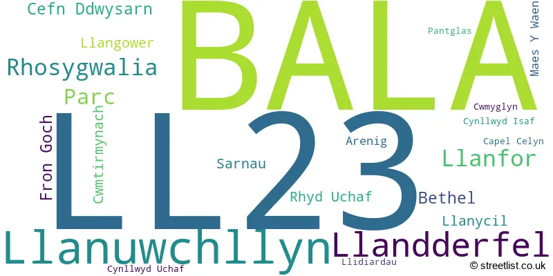
The primary settlement in the LL23 postcode district is Bala, a town in the county of Gwynedd, Wales. Other significant settlements in this postcode district include Arenig, Bethel, Capel Celyn, Cefn Ddwysarn, Cwmtirmynach, Cwmyglyn, Cynllwyd Isaf, Cynllwyd Uchaf, Fron Goch, Llandderfel, Llanfor, Llangower, Llanuwchllyn, Llanycil, Llidiardau, Maes Y Waen, Pantglas, Parc, Rhosygwalia, Rhyd Uchaf, and Sarnau. The most significant post town in the LL23 postcode district is Bala.
For the district LL23, we have data on 1 postcode sectors. Here's a breakdown: The sector LL23 7, covers Bala and Llanuwchllyn and Llandderfel in Gwynedd.
LL23 Postcode Sectors

Map of the LL23 Postcode District
Explore the LL23 postcode district by using our free interactive map.
When it comes to local government, postal geography often disregards political borders. However, for a breakdown in the LL23 District: the district mostly encompasses the Gwynedd - Gwynedd area with a total of 200 postcodes.
Recent House Sales in LL23
| Date | Price | Address |
|---|---|---|
| 20/10/2023 | £432,500 | Llandderfel, Bala, LL23 7HT |
| 13/09/2023 | £370,000 | Maes Tegid, Bala, LL23 7BF |
| 31/08/2023 | £250,000 | Sarnau, Bala, LL23 7LG |
| 31/08/2023 | £195,000 | Trem Y Ffridd, Bala, LL23 7DG |
| 21/08/2023 | £241,000 | Cwmyglyn, Bala, LL23 7BU |
| 15/08/2023 | £87,500 | Station Road, Bala, LL23 7NG |
| 14/07/2023 | £80,000 | Arenig Row, Bala, LL23 7AJ |
| 14/07/2023 | £95,000 | Arenig Street, Bala, LL23 7AL |
| 03/07/2023 | £162,000 | High Street, Bala, LL23 7AE |
| 30/06/2023 | £142,000 | Cysgod Y Coleg, Bala, LL23 7BD |
Weather Forecast for LL23
Press Button to Show Forecast for Llyn Tegid
| Time Period | Icon | Description | Temperature | Rain Probability | Wind |
|---|---|---|---|---|---|
| 00:00 to 03:00 | Cloudy | 4.0°C (feels like 2.0°C) | 8.00% | ENE 4 mph | |
| 03:00 to 06:00 | Cloudy | 4.0°C (feels like 2.0°C) | 9.00% | ENE 7 mph | |
| 06:00 to 09:00 | Cloudy | 5.0°C (feels like 3.0°C) | 12.00% | ENE 7 mph | |
| 09:00 to 12:00 | Cloudy | 7.0°C (feels like 4.0°C) | 10.00% | E 9 mph | |
| 12:00 to 15:00 | Light rain | 7.0°C (feels like 5.0°C) | 51.00% | ENE 9 mph | |
| 15:00 to 18:00 | Cloudy | 8.0°C (feels like 5.0°C) | 18.00% | NE 9 mph | |
| 18:00 to 21:00 | Overcast | 8.0°C (feels like 5.0°C) | 13.00% | NE 9 mph | |
| 21:00 to 00:00 | Cloudy | 6.0°C (feels like 4.0°C) | 9.00% | NE 7 mph |
Press Button to Show Forecast for Llyn Tegid
| Time Period | Icon | Description | Temperature | Rain Probability | Wind |
|---|---|---|---|---|---|
| 00:00 to 03:00 | Cloudy | 5.0°C (feels like 2.0°C) | 6.00% | NE 7 mph | |
| 03:00 to 06:00 | Cloudy | 4.0°C (feels like 1.0°C) | 5.00% | NNE 7 mph | |
| 06:00 to 09:00 | Cloudy | 5.0°C (feels like 2.0°C) | 10.00% | N 7 mph | |
| 09:00 to 12:00 | Cloudy | 8.0°C (feels like 5.0°C) | 11.00% | NNW 9 mph | |
| 12:00 to 15:00 | Partly cloudy (day) | 9.0°C (feels like 7.0°C) | 10.00% | NW 11 mph | |
| 15:00 to 18:00 | Partly cloudy (day) | 10.0°C (feels like 7.0°C) | 6.00% | WNW 11 mph | |
| 18:00 to 21:00 | Sunny day | 9.0°C (feels like 7.0°C) | 2.00% | W 9 mph | |
| 21:00 to 00:00 | Clear night | 6.0°C (feels like 3.0°C) | 1.00% | SW 7 mph |
Press Button to Show Forecast for Llyn Tegid
| Time Period | Icon | Description | Temperature | Rain Probability | Wind |
|---|---|---|---|---|---|
| 00:00 to 03:00 | Clear night | 6.0°C (feels like 3.0°C) | 1.00% | SSW 9 mph | |
| 03:00 to 06:00 | Cloudy | 6.0°C (feels like 3.0°C) | 7.00% | SSW 9 mph | |
| 06:00 to 09:00 | Cloudy | 7.0°C (feels like 4.0°C) | 8.00% | S 11 mph | |
| 09:00 to 12:00 | Cloudy | 10.0°C (feels like 8.0°C) | 6.00% | S 13 mph | |
| 12:00 to 15:00 | Overcast | 12.0°C (feels like 9.0°C) | 12.00% | S 16 mph | |
| 15:00 to 18:00 | Cloudy | 12.0°C (feels like 9.0°C) | 12.00% | S 16 mph | |
| 18:00 to 21:00 | Cloudy | 11.0°C (feels like 9.0°C) | 10.00% | SSE 11 mph | |
| 21:00 to 00:00 | Partly cloudy (night) | 9.0°C (feels like 7.0°C) | 4.00% | SSE 11 mph |
Press Button to Show Forecast for Llyn Tegid
| Time Period | Icon | Description | Temperature | Rain Probability | Wind |
|---|---|---|---|---|---|
| 00:00 to 03:00 | Cloudy | 8.0°C (feels like 5.0°C) | 9.00% | SSE 11 mph | |
| 03:00 to 06:00 | Cloudy | 7.0°C (feels like 5.0°C) | 8.00% | SE 11 mph | |
| 06:00 to 09:00 | Cloudy | 8.0°C (feels like 5.0°C) | 8.00% | SE 11 mph | |
| 09:00 to 12:00 | Partly cloudy (day) | 11.0°C (feels like 8.0°C) | 6.00% | SE 13 mph | |
| 12:00 to 15:00 | Partly cloudy (day) | 14.0°C (feels like 11.0°C) | 9.00% | SE 16 mph | |
| 15:00 to 18:00 | Cloudy | 15.0°C (feels like 12.0°C) | 13.00% | SE 13 mph | |
| 18:00 to 21:00 | Cloudy | 13.0°C (feels like 12.0°C) | 8.00% | SE 9 mph | |
| 21:00 to 00:00 | Cloudy | 10.0°C (feels like 8.0°C) | 7.00% | ESE 7 mph |
Where is the LL23 Postcode District?
The LL23 postcode district is located in Bala, and it is surrounded by several nearby towns. To the northeast, there is Corwen which is approximately 12.5 miles away. To the southwest, we have Dolgellau at a distance of 13.4 miles. In the northwest direction lies Dolwyddelan, around 13.7 miles away. Towards the north, there is Betws-y-Coed, which is about 14 miles from LL23. If we head west, we would reach Talsarnau, which is roughly 16.9 miles away. Lastly, in the southeast direction, we have Llanfyllin, located at a distance of approximately 17.9 miles. The LL23 postcode district is situated about 177.6 miles away from the center of London.
The district is within the post town of BALA.
The sector has postcodes within the nation of Wales.
The LL23 Postcode District is in the Gwynedd region of West Wales within the Wales.
Postcode Sectors within the LL23 District
| Postcode Sector | Delivery Office |
|---|---|
| LL23 7 | Bala Delivery Office |
| L | L | 2 | 3 | - | X | X | X |
| L | L | 2 | 3 | Space | Numeric | Letter | Letter |
Tourist Attractions within the Postcode Area
We found 1 visitor attractions within the LL23 postcode area
| Byd Mary Jones |
|---|
| View Byd Mary Jones on Google Maps |
Current Monthly Rental Prices
| # Bedrooms | Min Price | Max Price | Avg Price |
|---|
Current House Prices
| # Bedrooms | Min Price | Max Price | Avg Price |
|---|---|---|---|
| 2 | £36,000 | £155,000 | £118,244 |
| 3 | £105,000 | £295,000 | £192,222 |
| 4 | £199,000 | £400,000 | £314,000 |
| 5 | £260,000 | £280,000 | £270,000 |
| 9 | £850,000 | £850,000 | £850,000 |
| 13 | £1,350,000 | £1,350,000 | £1,350,000 |
Estate Agents who Operate in the LL23 District
| Logo | Name | Brand Name | Address | Contact Number | Total Properties |
|---|---|---|---|---|---|
 | Bala | Tom Parry & Co | 38 High Street Bala LL23 7AB | 020 3870 5463 | 10 |
 | Bala | RG Jones | 85 High Street, Bala, LL23 7AE | 01677 931141 | 6 |
 | covering Llandudno | Purplebricks | Suite 7 First Floor Cranmore Drive Shirley Solihull B90 4RZ | 020 3907 3310 | 2 |
 | Nationwide | Park Move | 8-9 Red Lion Street, Stamford, PE9 1PA | 01780 432725 | 2 |
 | Bracknell | Bruton Solutions | 10 Milbanke Court, Milbanke Way, Bracknell, RG12 1RP | 0118 230 4462 | 1 |
| Type of Property | 2018 Average | 2018 Sales | 2017 Average | 2017 Sales | 2016 Average | 2016 Sales | 2015 Average | 2015 Sales |
|---|---|---|---|---|---|---|---|---|
| Detached | £232,657 | 14 | £227,672 | 29 | £225,750 | 26 | £210,360 | 25 |
| Semi-Detached | £128,313 | 8 | £162,679 | 7 | £145,667 | 6 | £148,333 | 6 |
| Terraced | £105,563 | 24 | £93,708 | 18 | £88,197 | 33 | £81,064 | 22 |
| Flats | £0 | 0 | £0 | 0 | £0 | 0 | £0 | 0 |