The N11 2 postcode sector is within the county of Greater London.
Did you know? According to the 2021 Census, the N11 2 postcode sector is home to a bustling 11,126 residents!
Given that each sector allows for 400 unique postcode combinations. Letters C, I, K, M, O and V are not allowed in the last two letters of a postcode. With 211 postcodes already in use, this leaves 189 units available.
The largest settlement in the N11 2 postal code is WOOD GREEN followed by SOUTHGATE , and NEW SOUTHGATE .
The N11 2 Postcode shares a border with N10 2 (HORNSEY , MUSWELL HILL ), N11 1 (NEW SOUTHGATE , SOUTHGATE , BRUNSWICK PARK ), N11 3 (NEW SOUTHGATE , FRIERN BARNET , COLNEY HATCH ), N14 7 (SOUTHGATE , WINCHMORE HILL , NEW SOUTHGATE ), N22 7 (WOOD GREEN , HORNSEY ), N22 8 (WOOD GREEN , SOUTHGATE ) and N13 4 (SOUTHGATE ).
The sector is within the post town of LONDON.
N11 2 is a postcode sector within the N11 postcode district which is within the N North London postcode area.
The Royal Mail delivery office for the N11 2 postal sector is the New Southgate Sdelivery Office.
The area of the N11 2 postcode sector is 0.59 square miles which is 1.52 square kilometres or 375.17 square acres.

Map of the N11 2 Postcode Sector
Explore the N11 2 postcode sector by using our free interactive map.
| N | 1 | 1 | - | 2 | X | X |
| N | 1 | 1 | Space | 2 | Letter | Letter |
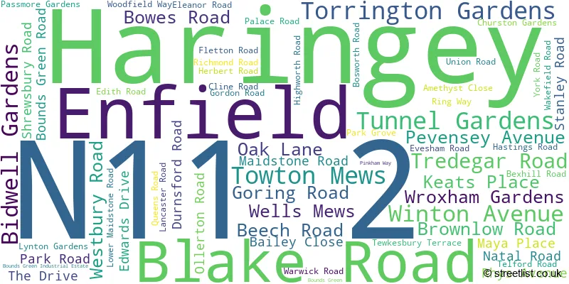
Official List of Streets
Haringey (38 Streets)
Enfield (28 Streets)
Unofficial Streets or Alternative Spellings
Weather Forecast for N11 2
Press Button to Show Forecast for Wood Green
| Time Period | Icon | Description | Temperature | Rain Probability | Wind |
|---|---|---|---|---|---|
| 03:00 to 06:00 | Heavy rain | 7.0°C (feels like 5.0°C) | 85.00% | NE 7 mph | |
| 06:00 to 09:00 | Heavy rain | 6.0°C (feels like 4.0°C) | 87.00% | NE 7 mph | |
| 09:00 to 12:00 | Overcast | 8.0°C (feels like 5.0°C) | 41.00% | NE 9 mph | |
| 12:00 to 15:00 | Overcast | 11.0°C (feels like 9.0°C) | 13.00% | ENE 9 mph | |
| 15:00 to 18:00 | Cloudy | 12.0°C (feels like 11.0°C) | 17.00% | NE 7 mph | |
| 18:00 to 21:00 | Light rain | 11.0°C (feels like 9.0°C) | 61.00% | NE 9 mph | |
| 21:00 to 00:00 | Heavy rain | 10.0°C (feels like 7.0°C) | 89.00% | NE 9 mph |
Press Button to Show Forecast for Wood Green
| Time Period | Icon | Description | Temperature | Rain Probability | Wind |
|---|---|---|---|---|---|
| 00:00 to 03:00 | Heavy rain | 9.0°C (feels like 6.0°C) | 92.00% | NNE 11 mph | |
| 03:00 to 06:00 | Heavy rain | 9.0°C (feels like 7.0°C) | 92.00% | NE 9 mph | |
| 06:00 to 09:00 | Heavy rain | 9.0°C (feels like 7.0°C) | 86.00% | NNW 7 mph | |
| 09:00 to 12:00 | Heavy rain | 9.0°C (feels like 7.0°C) | 83.00% | WNW 9 mph | |
| 12:00 to 15:00 | Light rain | 9.0°C (feels like 7.0°C) | 56.00% | W 13 mph | |
| 15:00 to 18:00 | Overcast | 10.0°C (feels like 8.0°C) | 16.00% | W 11 mph | |
| 18:00 to 21:00 | Cloudy | 11.0°C (feels like 9.0°C) | 8.00% | W 9 mph | |
| 21:00 to 00:00 | Partly cloudy (night) | 9.0°C (feels like 8.0°C) | 4.00% | SW 7 mph |
Press Button to Show Forecast for Wood Green
| Time Period | Icon | Description | Temperature | Rain Probability | Wind |
|---|---|---|---|---|---|
| 00:00 to 03:00 | Clear night | 8.0°C (feels like 7.0°C) | 2.00% | SW 4 mph | |
| 03:00 to 06:00 | Clear night | 7.0°C (feels like 5.0°C) | 1.00% | SSW 4 mph | |
| 06:00 to 09:00 | Sunny day | 7.0°C (feels like 6.0°C) | 1.00% | S 4 mph | |
| 09:00 to 12:00 | Partly cloudy (day) | 12.0°C (feels like 10.0°C) | 1.00% | SSW 9 mph | |
| 12:00 to 15:00 | Cloudy | 14.0°C (feels like 12.0°C) | 6.00% | S 9 mph | |
| 15:00 to 18:00 | Partly cloudy (day) | 15.0°C (feels like 13.0°C) | 2.00% | S 11 mph | |
| 18:00 to 21:00 | Sunny day | 14.0°C (feels like 12.0°C) | 3.00% | S 9 mph | |
| 21:00 to 00:00 | Clear night | 11.0°C (feels like 10.0°C) | 1.00% | SSE 7 mph |
Press Button to Show Forecast for Wood Green
| Time Period | Icon | Description | Temperature | Rain Probability | Wind |
|---|---|---|---|---|---|
| 00:00 to 03:00 | Clear night | 10.0°C (feels like 8.0°C) | 1.00% | SE 7 mph | |
| 03:00 to 06:00 | Clear night | 9.0°C (feels like 7.0°C) | 2.00% | ESE 7 mph | |
| 06:00 to 09:00 | Cloudy | 9.0°C (feels like 8.0°C) | 7.00% | ESE 7 mph | |
| 09:00 to 12:00 | Cloudy | 13.0°C (feels like 12.0°C) | 6.00% | ESE 7 mph | |
| 12:00 to 15:00 | Cloudy | 16.0°C (feels like 14.0°C) | 8.00% | SE 9 mph | |
| 15:00 to 18:00 | Cloudy | 17.0°C (feels like 15.0°C) | 10.00% | SE 9 mph | |
| 18:00 to 21:00 | Cloudy | 16.0°C (feels like 14.0°C) | 11.00% | SE 9 mph | |
| 21:00 to 00:00 | Cloudy | 13.0°C (feels like 12.0°C) | 15.00% | ESE 7 mph |
Schools and Places of Education Within the N11 2 Postcode Sector
Alexandra Park School
Academy converter
Bidwell Gardens, London, , N11 2AZ
Head: Mr Michael McKenzie
Ofsted Rating: Outstanding
Inspection: 2023-03-01 (423 days ago)
Website: Visit Alexandra Park School Website
Phone: 02088264880
Number of Pupils: 1810
Bounds Green Infant School
Community school
Bounds Green Road, London, , N11 2QG
Head: Mrs Nadine Lewis
Ofsted Rating: Outstanding
Inspection: 2023-03-23 (401 days ago)
Website: Visit Bounds Green Infant School Website
Phone: 02088888824
Number of Pupils: 327
Bounds Green Junior School
Community school
Bounds Green Road, London, , N11 2QG
Head: Mrs Nadine Lewis
Ofsted Rating: Good
Inspection: 2022-03-16 (773 days ago)
Website: Visit Bounds Green Junior School Website
Phone: 02088888824
Number of Pupils: 357
St Martin of Porres Catholic Primary School
Voluntary aided school
Blake Road, London, , N11 2AF
Head: Ms Anne Thomas
Ofsted Rating: Good
Inspection: 2023-02-09 (443 days ago)
Website: Visit St Martin of Porres Catholic Primary School Website
Phone: 02083611445
Number of Pupils: 151

House Prices in the N11 2 Postcode Sector
| Type of Property | 2018 Average | 2018 Sales | 2017 Average | 2017 Sales | 2016 Average | 2016 Sales | 2015 Average | 2015 Sales |
|---|---|---|---|---|---|---|---|---|
| Detached | £790,000 | 1 | £445,000 | 1 | £1,400,000 | 2 | £0 | 0 |
| Semi-Detached | £841,053 | 15 | £839,239 | 23 | £809,094 | 16 | £668,454 | 23 |
| Terraced | £655,489 | 46 | £621,085 | 36 | £636,849 | 40 | £582,850 | 58 |
| Flats | £364,274 | 29 | £359,559 | 36 | £325,118 | 54 | £328,350 | 45 |
Important Postcodes N11 2 in the Postcode Sector
N11 2AF is the postcode for St. Martin of Porres RC Primary School, Blake Road
N11 2AZ is the postcode for SPORTS HALL, Alexandra Park Secondary School, Bidwell Gardens, MODULAR CLASSROOM BLOCK, Alexandra Park Secondary School, Bidwell Gardens, Alexandra Park Secondary School, Bidwell Gardens, and SCIENCE BLOCK, Alexandra Park Secondary School, Bidwell Gardens
N11 2HD is the postcode for 1-3 Edwards Drive
N11 2HL is the postcode for Bowes Primary School, Bowes Road
N11 2PA is the postcode for Bounds Green Health Centre, Gordon Road
N11 2QG is the postcode for Bounds Green Infant School, Bounds Green Road, Junior Building, Bounds Green School, Bounds Green Road, and Infant Building, Bounds Green School, Bounds Green Road
| The N11 2 Sector is within these Local Authorities |
|
|---|---|
| The N11 2 Sector is within these Counties |
|
| The N11 2 Sector is within these Water Company Areas |
|