The N11 3 postcode sector is within the county of Greater London.
Did you know? According to the 2021 Census, the N11 3 postcode sector is home to a bustling 9,504 residents!
Given that each sector allows for 400 unique postcode combinations. Letters C, I, K, M, O and V are not allowed in the last two letters of a postcode. With 192 postcodes already in use, this leaves 208 units available.
The largest settlement in the N11 3 postal code is NEW SOUTHGATE followed by FRIERN BARNET , and COLNEY HATCH .
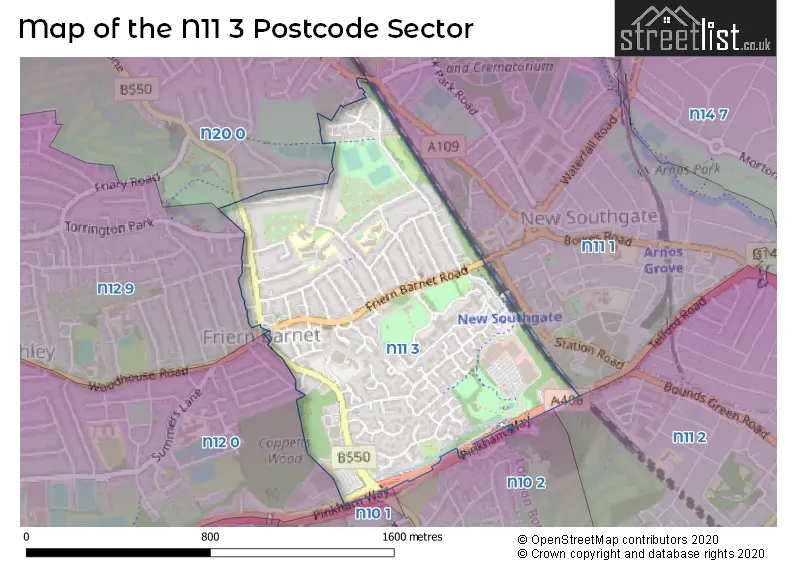
The N11 3 Postcode shares a border with N10 1 (HORNSEY , MUSWELL HILL , COLNEY HATCH ), N10 2 (HORNSEY , MUSWELL HILL ), N11 1 (NEW SOUTHGATE , SOUTHGATE , BRUNSWICK PARK ), N12 0 (NORTH FINCHLEY , COLNEY HATCH , FINCHLEY ), N12 9 (NORTH FINCHLEY ), N20 0 (WHETSTONE , FRIERN BARNET , OAKLEIGH PARK ) and N11 2 (WOOD GREEN , SOUTHGATE , NEW SOUTHGATE ).
The sector is within the post town of LONDON.
N11 3 is a postcode sector within the N11 postcode district which is within the N North London postcode area.
The Royal Mail delivery office for the N11 3 postal sector is the New Southgate Sdelivery Office.
The area of the N11 3 postcode sector is 0.55 square miles which is 1.43 square kilometres or 352.33 square acres.

Map of the N11 3 Postcode Sector
Explore the N11 3 postcode sector by using our free interactive map.
| N | 1 | 1 | - | 3 | X | X |
| N | 1 | 1 | Space | 3 | Letter | Letter |
Official List of Streets
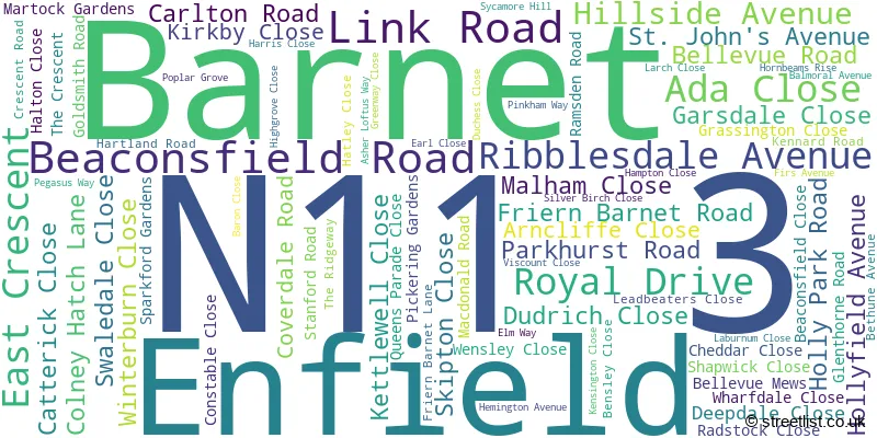
Barnet (78 Streets)
Unofficial Streets or Alternative Spellings
Weather Forecast for N11 3
Press Button to Show Forecast for Wood Green
| Time Period | Icon | Description | Temperature | Rain Probability | Wind |
|---|---|---|---|---|---|
| 06:00 to 09:00 | Cloudy | 5.0°C (feels like 2.0°C) | 4.00% | NE 7 mph | |
| 09:00 to 12:00 | Partly cloudy (day) | 8.0°C (feels like 6.0°C) | 2.00% | ENE 7 mph | |
| 12:00 to 15:00 | Cloudy | 11.0°C (feels like 9.0°C) | 9.00% | E 4 mph | |
| 15:00 to 18:00 | Overcast | 11.0°C (feels like 10.0°C) | 14.00% | ENE 7 mph | |
| 18:00 to 21:00 | Cloudy | 10.0°C (feels like 9.0°C) | 11.00% | E 7 mph | |
| 21:00 to 00:00 | Cloudy | 7.0°C (feels like 5.0°C) | 11.00% | E 7 mph |
Press Button to Show Forecast for Wood Green
| Time Period | Icon | Description | Temperature | Rain Probability | Wind |
|---|---|---|---|---|---|
| 00:00 to 03:00 | Cloudy | 5.0°C (feels like 3.0°C) | 12.00% | ENE 7 mph | |
| 03:00 to 06:00 | Cloudy | 5.0°C (feels like 3.0°C) | 18.00% | NE 7 mph | |
| 06:00 to 09:00 | Cloudy | 6.0°C (feels like 3.0°C) | 21.00% | NE 7 mph | |
| 09:00 to 12:00 | Overcast | 10.0°C (feels like 8.0°C) | 19.00% | ENE 9 mph | |
| 12:00 to 15:00 | Cloudy | 12.0°C (feels like 10.0°C) | 18.00% | E 9 mph | |
| 15:00 to 18:00 | Light rain | 12.0°C (feels like 10.0°C) | 52.00% | E 11 mph | |
| 18:00 to 21:00 | Light rain | 11.0°C (feels like 9.0°C) | 53.00% | ENE 9 mph | |
| 21:00 to 00:00 | Light rain | 10.0°C (feels like 7.0°C) | 50.00% | ENE 11 mph |
Press Button to Show Forecast for Wood Green
| Time Period | Icon | Description | Temperature | Rain Probability | Wind |
|---|---|---|---|---|---|
| 00:00 to 03:00 | Light rain | 9.0°C (feels like 7.0°C) | 54.00% | NE 9 mph | |
| 03:00 to 06:00 | Light rain | 10.0°C (feels like 8.0°C) | 56.00% | ESE 9 mph | |
| 06:00 to 09:00 | Overcast | 10.0°C (feels like 8.0°C) | 51.00% | SE 7 mph | |
| 09:00 to 12:00 | Light rain shower (day) | 11.0°C (feels like 9.0°C) | 45.00% | SE 9 mph | |
| 12:00 to 15:00 | Heavy rain shower (day) | 13.0°C (feels like 11.0°C) | 61.00% | SSW 9 mph | |
| 15:00 to 18:00 | Light rain shower (day) | 14.0°C (feels like 12.0°C) | 42.00% | SW 11 mph | |
| 18:00 to 21:00 | Cloudy | 12.0°C (feels like 10.0°C) | 17.00% | SW 11 mph | |
| 21:00 to 00:00 | Cloudy | 10.0°C (feels like 9.0°C) | 8.00% | SW 7 mph |
Schools and Places of Education Within the N11 3 Postcode Sector
Friern Barnet School
Community school
Hemington Avenue, London, , N11 3LS
Head: Mr Simon Horne
Ofsted Rating: Good
Inspection: 2018-10-31 (2004 days ago)
Website: Visit Friern Barnet School Website
Phone: 02083682777
Number of Pupils: 726
Holly Park Primary School
Community school
Bellevue Road, London, , N11 3HG
Head: Mrs Ann Pelham
Ofsted Rating: Good
Inspection: 2018-11-21 (1983 days ago)
Website: Visit Holly Park Primary School Website
Phone: 02083681434
Number of Pupils: 480
St John's CofE Junior Mixed and Infant School
Voluntary aided school
Crescent Road, London, , N11 3LB
Head: Mr Graham Gunn
Ofsted Rating: Good
Inspection: 2023-09-20 (219 days ago)
Website: Visit St John's CofE Junior Mixed and Infant School Website
Phone: 02083681154
Number of Pupils: 239
House Prices in the N11 3 Postcode Sector
| Type of Property | 2018 Average | 2018 Sales | 2017 Average | 2017 Sales | 2016 Average | 2016 Sales | 2015 Average | 2015 Sales |
|---|---|---|---|---|---|---|---|---|
| Detached | £0 | 0 | £645,000 | 2 | £707,500 | 6 | £760,000 | 6 |
| Semi-Detached | £655,625 | 8 | £635,292 | 12 | £681,513 | 19 | £663,708 | 12 |
| Terraced | £572,832 | 25 | £568,630 | 23 | £597,637 | 36 | £563,984 | 31 |
| Flats | £361,351 | 48 | £400,229 | 65 | £383,143 | 66 | £365,842 | 71 |
Important Postcodes N11 3 in the Postcode Sector
N11 3HG is the postcode for Holly Park Nursery School, Bellevue Road, Holly Park Primary School, Bellevue Road, JUNIOR BUILDING, Holly Park Primary School, Bellevue Road, and INFANT BUILDING, Holly Park Primary School, Bellevue Road
N11 3LB is the postcode for St John's C of E Primary School, Crescent Road, Friern Barnet, and St. Johns C of E Primary School, Crescent Road
N11 3LS is the postcode for MAIN BUILDING, Friern Barnet School, Hemington Avenue, and USHER BUILDING, Friern Barnet School, Hemington Avenue
| The N11 3 Sector is within these Local Authorities |
|
|---|---|
| The N11 3 Sector is within these Counties |
|
| The N11 3 Sector is within these Water Company Areas |
|