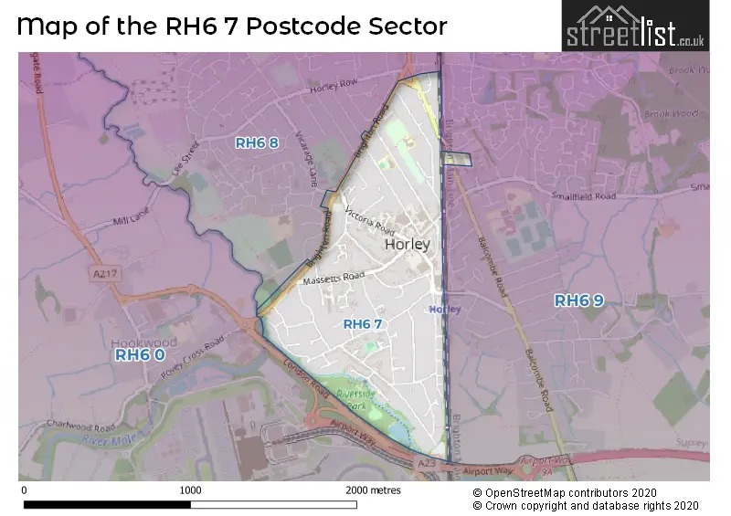
The RH6 7 postcode sector stands on the West Sussex and Surrey border.
Did you know? According to the 2021 Census, the RH6 7 postcode sector is home to a bustling 6,674 residents!
Given that each sector allows for 400 unique postcode combinations. Letters C, I, K, M, O and V are not allowed in the last two letters of a postcode. With 165 postcodes already in use, this leaves 235 units available.
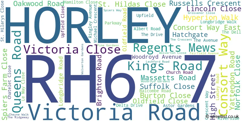
The RH6 7 postal code covers the settlement of HORLEY.
The RH6 7 Postcode shares a border with RH6 0 (London Gatwick Airport, Charlwood, Hookwood), RH6 8 (HORLEY) and RH6 9 (HORLEY, Smallfield, Shipley Bridge).
The sector is within the post town of HORLEY.
RH6 7 is a postcode sector within the RH6 postcode district which is within the RH Redhill postcode area.
The Royal Mail delivery office for the RH6 7 postal sector is the Horley Delivery Office.
The area of the RH6 7 postcode sector is 0.60 square miles which is 1.57 square kilometres or 387.01 square acres.

Map of the RH6 7 Postcode Sector
Explore the RH6 7 postcode sector by using our free interactive map.
| R | H | 6 | - | 7 | X | X |
| R | H | 6 | Space | 7 | Letter | Letter |
Official List of Streets
HORLEY (57 Streets)
Unofficial Streets or Alternative Spellings
Weather Forecast for RH6 7
Press Button to Show Forecast for Horley
| Time Period | Icon | Description | Temperature | Rain Probability | Wind |
|---|---|---|---|---|---|
| 03:00 to 06:00 | Cloudy | 5.0°C (feels like 3.0°C) | 6.00% | NE 7 mph | |
| 06:00 to 09:00 | Cloudy | 5.0°C (feels like 2.0°C) | 7.00% | NE 7 mph | |
| 09:00 to 12:00 | Cloudy | 7.0°C (feels like 5.0°C) | 8.00% | ENE 9 mph | |
| 12:00 to 15:00 | Overcast | 10.0°C (feels like 8.0°C) | 15.00% | ENE 7 mph | |
| 15:00 to 18:00 | Cloudy | 10.0°C (feels like 9.0°C) | 13.00% | ENE 7 mph | |
| 18:00 to 21:00 | Cloudy | 9.0°C (feels like 8.0°C) | 12.00% | ENE 7 mph | |
| 21:00 to 00:00 | Cloudy | 6.0°C (feels like 4.0°C) | 11.00% | E 7 mph |
Press Button to Show Forecast for Horley
| Time Period | Icon | Description | Temperature | Rain Probability | Wind |
|---|---|---|---|---|---|
| 00:00 to 03:00 | Cloudy | 5.0°C (feels like 3.0°C) | 16.00% | E 7 mph | |
| 03:00 to 06:00 | Cloudy | 5.0°C (feels like 3.0°C) | 18.00% | ENE 7 mph | |
| 06:00 to 09:00 | Cloudy | 6.0°C (feels like 3.0°C) | 18.00% | ENE 9 mph | |
| 09:00 to 12:00 | Overcast | 10.0°C (feels like 7.0°C) | 18.00% | E 9 mph | |
| 12:00 to 15:00 | Overcast | 12.0°C (feels like 10.0°C) | 19.00% | E 11 mph | |
| 15:00 to 18:00 | Light rain | 12.0°C (feels like 9.0°C) | 50.00% | E 11 mph | |
| 18:00 to 21:00 | Light rain | 10.0°C (feels like 8.0°C) | 52.00% | ENE 11 mph | |
| 21:00 to 00:00 | Light rain | 9.0°C (feels like 7.0°C) | 55.00% | NE 11 mph |
Press Button to Show Forecast for Horley
| Time Period | Icon | Description | Temperature | Rain Probability | Wind |
|---|---|---|---|---|---|
| 00:00 to 03:00 | Heavy rain | 9.0°C (feels like 6.0°C) | 73.00% | ENE 11 mph | |
| 03:00 to 06:00 | Heavy rain shower (night) | 9.0°C (feels like 7.0°C) | 59.00% | SE 11 mph | |
| 06:00 to 09:00 | Light rain | 9.0°C (feels like 7.0°C) | 48.00% | SE 9 mph | |
| 09:00 to 12:00 | Light rain shower (day) | 10.0°C (feels like 8.0°C) | 46.00% | SSE 11 mph | |
| 12:00 to 15:00 | Heavy rain shower (day) | 12.0°C (feels like 10.0°C) | 61.00% | SSW 11 mph | |
| 15:00 to 18:00 | Light rain shower (day) | 13.0°C (feels like 11.0°C) | 40.00% | SW 11 mph | |
| 18:00 to 21:00 | Light rain shower (day) | 11.0°C (feels like 9.0°C) | 33.00% | WSW 11 mph | |
| 21:00 to 00:00 | Partly cloudy (night) | 9.0°C (feels like 7.0°C) | 7.00% | WSW 7 mph |
Schools and Places of Education Within the RH6 7 Postcode Sector
Horley Infant School
Community school
Lumley Road, Horley, Surrey, RH6 7JF
Head: Mr Jason Walters
Ofsted Rating: Good
Inspection: 2018-05-23 (2165 days ago)
Website: Visit Horley Infant School Website
Phone: 01293782263
Number of Pupils: 267
Yattendon School
Foundation school
Oakwood Road, Horley, Surrey, RH6 7BZ
Head: Mr Guy Perkins
Ofsted Rating: Good
Inspection: 2022-03-23 (765 days ago)
Website: Visit Yattendon School Website
Phone: 01293734100
Number of Pupils: 382
House Prices in the RH6 7 Postcode Sector
| Type of Property | 2018 Average | 2018 Sales | 2017 Average | 2017 Sales | 2016 Average | 2016 Sales | 2015 Average | 2015 Sales |
|---|---|---|---|---|---|---|---|---|
| Detached | £577,750 | 19 | £597,916 | 24 | £611,565 | 23 | £461,073 | 20 |
| Semi-Detached | £373,277 | 26 | £364,015 | 36 | £357,145 | 34 | £320,364 | 43 |
| Terraced | £360,409 | 11 | £358,415 | 12 | £323,744 | 8 | £309,833 | 9 |
| Flats | £232,846 | 104 | £195,652 | 71 | £198,196 | 119 | £184,818 | 45 |
Important Postcodes RH6 7 in the Postcode Sector
RH6 7AA is the postcode for Royal Mail, Horley Delivery Office, 107 Victoria Road
RH6 7AD is the postcode for Wayside Surgery, Kings Road
RH6 7AG is the postcode for Surrey County Council, Horley Library, 102 Victoria Road
RH6 7BL is the postcode for Beechcroft, 120 Victoria Road
RH6 7BZ is the postcode for Yattendon School, Oakwood Road
RH6 7DE is the postcode for NHS, Yorke House, 18-20 Massetts Road, NHS South East Coast Strategic Health Authority, Yorke House, 18-20 Massetts Road, and York House, 18-20 Massetts Road
RH6 7DG is the postcode for Horley Health Centre, Kings Road
RH6 7JA is the postcode for Horley Young Peoples Centre, The Old Fire Station, Albert Road
RH6 7JF is the postcode for Horley Infant School, Lumley Road
RH6 7LA is the postcode for BARNFIELD, 24 UPFIELD, HORLEY, and Barnfield Care Home, 24 Upfield
RH6 7ND is the postcode for Cheyne Walk Children's Home, 55 Cheyne Walk
RH6 7QH is the postcode for HORLEY LIBRARY, 55-57 Victoria Road
| The RH6 7 Sector is within these Local Authorities |
|
|---|---|
| The RH6 7 Sector is within these Counties |
|
| The RH6 7 Sector is within these Water Company Areas |
|