S9 4EN is a postal code used within the United Kingdom for delivering mail.
Postcodes are made up of two parts. The part before the space (S9) is called the outward code. The part after the space (4EN) is called the inward code. The letters C, I, K, M, O and V are not allowed in the inward code. In addition to the inward and outward code, the postcode can be broken up into four parts:
- Postal Area. In our case S which means Sheffield.
- Postal District. In our case S9.
- Postal Sector. In our case S9 4.
- Postcode Unit. The last two letters. In our case EN.
The regional mail center for the post area S is the Yorkshire Distribution Centre, which is located at Silkstone House, Express Way, Wakefield Europort, NORMANTON, WF6 2XX.
The final port of call for any post addressed to the S9 4EN postcode is the local delivery office (DO) which is SHEFFIELD EPDO. Here the post will be sorted ready for delivery.
The properties in the S9 4EN postcode have the street address of Prince Of Wales Road
A close-knit community! The 2021 Census indicates that only 7 individuals call the S9 4EN postcode their home.
It is situated within the post town of SHEFFIELD within the old postal county of Yorkshire.
S9 4EN is within the city of Sheffield.
The S9 4EN postcode area is composed of 100% residential properties, 0% commercial properties, and 0% public properties.
According to our data. Most dwellings in S9 4EN are houses. Of these houses, most are semi-detached.
Most properties in S9 4EN are owned by the occupiers with the rest being unknown tenure.
Interactive Mapping Showing UPRNs within the S9 4EN Postcode Boundaries
Use the search box to search for other postcodes or places.
| Property Type | Percentage |
|---|---|
| Residential | 100% |
| Commercial | 0% |
| Public | 0% |
Telephone Area Code for S9 4EN
The telephone area code for S9 4EN is 0114 Sheffield.
Map Coordinates for S9 4EN
| Latitude | 53.376197649 |
|---|---|
| Longitude | -1.41471165495 |
Ordnance Survey Maps for S9 4EN
| Map Series | Amazon | Ordnance Survey |
| Explorer 1:25,000 278 Sheffield and Barnsley | Check Price on Amazon | Buy Direct from the Ordnance Survey |
| Landranger 1:50,000 110 Sheffield & Huddersfield | Check Price on Amazon | Buy Direct from the Ordnance Survey |
| Landranger 1:50,000 111 Sheffield & Doncaster | Check Price on Amazon | Buy Direct from the Ordnance Survey |
Weather Forecast for S9 4EN
Tue 30th Apr
Press Button to Show Forecast for Woodthorpe
| Time Period | Icon | Description | Temperature | Rain Probability | Wind |
|---|---|---|---|---|---|
| 03:00 to 06:00 | Partly cloudy (night) | 8.0°C (feels like 5.0°C) | 2.00% | SSE 11 mph | |
| 06:00 to 09:00 | Partly cloudy (day) | 8.0°C (feels like 5.0°C) | 2.00% | SSE 11 mph | |
| 09:00 to 12:00 | Sunny day | 12.0°C (feels like 9.0°C) | 1.00% | SSE 13 mph | |
| 12:00 to 15:00 | Sunny day | 15.0°C (feels like 12.0°C) | 4.00% | SSE 16 mph | |
| 15:00 to 18:00 | Partly cloudy (day) | 16.0°C (feels like 13.0°C) | 5.00% | SSE 13 mph | |
| 18:00 to 21:00 | Partly cloudy (day) | 14.0°C (feels like 13.0°C) | 6.00% | SSE 9 mph | |
| 21:00 to 00:00 | Partly cloudy (night) | 11.0°C (feels like 9.0°C) | 6.00% | SSE 7 mph |
Wed 1st May
Press Button to Show Forecast for Woodthorpe
| Time Period | Icon | Description | Temperature | Rain Probability | Wind |
|---|---|---|---|---|---|
| 00:00 to 03:00 | Partly cloudy (night) | 9.0°C (feels like 8.0°C) | 6.00% | SSE 4 mph | |
| 03:00 to 06:00 | Cloudy | 9.0°C (feels like 8.0°C) | 8.00% | SSE 4 mph | |
| 06:00 to 09:00 | Cloudy | 9.0°C (feels like 8.0°C) | 11.00% | SE 4 mph | |
| 09:00 to 12:00 | Cloudy | 12.0°C (feels like 11.0°C) | 10.00% | SE 4 mph | |
| 12:00 to 15:00 | Cloudy | 14.0°C (feels like 13.0°C) | 11.00% | ESE 7 mph | |
| 15:00 to 18:00 | Overcast | 15.0°C (feels like 14.0°C) | 13.00% | ESE 4 mph | |
| 18:00 to 21:00 | Cloudy | 14.0°C (feels like 13.0°C) | 11.00% | NE 7 mph | |
| 21:00 to 00:00 | Cloudy | 12.0°C (feels like 11.0°C) | 13.00% | NNE 7 mph |
Thu 2nd May
Press Button to Show Forecast for Woodthorpe
| Time Period | Icon | Description | Temperature | Rain Probability | Wind |
|---|---|---|---|---|---|
| 00:00 to 03:00 | Light rain | 10.0°C (feels like 9.0°C) | 41.00% | N 7 mph | |
| 03:00 to 06:00 | Overcast | 10.0°C (feels like 8.0°C) | 15.00% | NNW 9 mph | |
| 06:00 to 09:00 | Light rain | 10.0°C (feels like 8.0°C) | 41.00% | NNW 7 mph | |
| 09:00 to 12:00 | Cloudy | 12.0°C (feels like 10.0°C) | 10.00% | NW 9 mph | |
| 12:00 to 15:00 | Cloudy | 15.0°C (feels like 13.0°C) | 5.00% | NNW 11 mph | |
| 15:00 to 18:00 | Cloudy | 16.0°C (feels like 14.0°C) | 5.00% | NNW 11 mph | |
| 18:00 to 21:00 | Partly cloudy (day) | 15.0°C (feels like 13.0°C) | 3.00% | NNW 11 mph | |
| 21:00 to 00:00 | Cloudy | 11.0°C (feels like 9.0°C) | 4.00% | NNW 9 mph |
Schools within a five minute drive of S9 4EN Postcode
England Secondary Schools
Outwood Academy City
Address: Outwood Academy City, Stradbroke Road, Sheffield, South Yorkshire, S13 8SS
Distance: 1.55 miles
Contact: 01142358120
Sheffield Park Academy
Address: Sheffield Park Academy, Beaumont Road North, Sheffield, South Yorkshire, S2 1SN
Distance: 0.18 miles
Contact: 01142392661
UTC Sheffield Olympic Legacy Park
Address: UTC Sheffield Olympic Legacy Park, 2 Old Hall Road, Sheffield, South Yorkshire, S9 3TU
Distance: 1.51 miles
Contact: 01143084000
Sheffield Springs Academy
Address: Sheffield Springs Academy, Hurlfield Road, Sheffield, South Yorkshire, S12 2SF
Distance: 1.48 miles
Contact: 01142392631
Oasis Academy Don Valley
Address: Oasis Academy Don Valley, Leeds Road, Sheffield, South Yorkshire, S9 3TY
Distance: 1.48 miles
Contact: 01142200400
England Primary Schools
Woodhouse West Primary School
Address: Woodhouse West Primary School, Coisley Hill, Sheffield, South Yorkshire, S13 7BP
Distance: 1.81 miles
Contact:
St Joseph's Primary School
Address: St Joseph's Primary School, St Joseph's Road, Handsworth, Sheffield, South Yorkshire, S13 9AT
Distance: 1.23 miles
Contact: 01142692773
Athelstan Primary School
Address: Athelstan Primary School, Richmond Park Way, Sheffield, South Yorkshire, S13 8HH
Distance: 0.70 miles
Contact: 01142692301
Stradbroke Primary School
Address: Stradbroke Primary School, Richmond Road, Sheffield, South Yorkshire, S13 8LT
Distance: 0.98 miles
Contact: 01142399320
Woodthorpe Primary School
Address: Woodthorpe Primary School, Lewis Road, Sheffield, South Yorkshire, S13 8DA
Distance: 0.81 miles
Contact:
Phillimore Community Primary School
Address: Phillimore Community Primary School, Phillimore Road, Darnall, Sheffield, South Yorkshire, S9 5EF
Distance: 1.27 miles
Contact: 01142494036
Phillimore Community Primary School
Address: Phillimore Community Primary School, Phillimore Road, Darnall, Sheffield, South Yorkshire, S9 5EF
Distance: 1.27 miles
Contact:
High Hazels Junior School
Address: High Hazels Junior School, Fisher Lane, Darnall, Sheffield, South Yorkshire, S9 4RP
Distance: 0.80 miles
Contact: 01142442189
High Hazels Nursery Infant Academy
Address: High Hazels Nursery Infant Academy, Fisher Lane, Darnall, Sheffield, South Yorkshire, S9 4RP
Distance: 0.80 miles
Contact: 01142442189
Intake Primary School
Address: Intake Primary School, Mansfield Road, Intake, Sheffield, South Yorkshire, S12 2AR
Distance: 1.33 miles
Contact: 01142399824
Acres Hill Community Primary School
Address: Acres Hill Community Primary School, Mather Road, Littledale, Sheffield, South Yorkshire, S9 4GQ
Distance: 0.25 miles
Contact: 01142441512
Acres Hill Community Primary School
Address: Acres Hill Community Primary School, Mather Road, Littledale, Sheffield, South Yorkshire, S9 4GQ
Distance: 0.25 miles
Contact:
St Theresa's Catholic Primary School
Address: St Theresa's Catholic Primary School, Prince of Wales Road, Sheffield, South Yorkshire, S2 1EY
Distance: 0.83 miles
Contact: 01142397251
Pipworth Community Primary School
Address: Pipworth Community Primary School, Pipworth Road, Sheffield, South Yorkshire, S2 1AA
Distance: 0.24 miles
Contact: 01142391078
Gleadless Primary School
Address: Gleadless Primary School, Hollinsend Road, Sheffield, South Yorkshire, S12 2EJ
Distance: 1.70 miles
Contact: 01142399705
Prince Edward Primary School
Address: Prince Edward Primary School, Queen Mary Road, Sheffield, South Yorkshire, S2 1EE
Distance: 1.16 miles
Contact: 01142281900
Norfolk Community Primary School
Address: Norfolk Community Primary School, Guildford Avenue, Sheffield, South Yorkshire, S2 2PJ
Distance: 1.51 miles
Contact:
Nearest Dentists
Dentists near S9 4EN
MANOR DENTAL PRACTICE
Address: 1A MOTEHALL ROAD, SHEFFIELD, SOUTH YORKSHIRE, S2 1RA
Distance: 0.34 miles
Contact: :
STANIFORTH ROAD (DENTAL SURGERY)
Address: 652-654 STANIFORTH ROAD, SHEFFIELD, SOUTH YORKSHIRE, S9 4LP
Distance: 0.70 miles
Contact: :
RICHMOND DENTAL CARE
Address: 427-429 RICHMOND ROAD, SHEFFIELD, SOUTH YORKSHIRE, S13 8LU
Distance: 1.04 miles
Contact: :
269 HANDSWORTH ROAD (DENTAL PRACTICE)
Address: 269 HANDSWORTH ROAD, HANDSWORTH, SHEFFIELD, SOUTH YORKSHIRE, S13 9BN
Distance: 1.05 miles
Contact: :
CASTLE DENTAL PRACTICE
Address: 309 CITY ROAD, SHEFFIELD, SOUTH YORKSHIRE, S2 5HJ
Distance: 1.22 miles
Contact: :
RIDGEWAY ROAD (DENTAL SURGERY)
Address: 18 RIDGEWAY ROAD, SHEFFIELD, SOUTH YORKSHIRE, S12 2ST
Distance: 1.27 miles
Contact: :
Nearest Chemists
Pharmacies near S9 4EN
OPTIMUM PHARMACY
Address: UNITR3, ALISON BUSINESS CENTRE, 39-40 ALISON CRESCENT, SHEFFIELD, SOUTH YORKSHIRE, S2 1AS
Distance: 0.39 miles
Contact: tel: 07876 417856
WELL
Address: THE NEW WHITEHOUSE SURGERY, 1 FAIRFAX RISE, SHEFFIELD, SOUTH YORKSHIRE, S2 1SL
Distance: 0.59 miles
Contact: tel: 01142 530130
BOOTS
Address: 50 MANOR PARK CENTRE, SHEFFIELD, SOUTH YORKSHIRE, S2 1WE
Distance: 0.60 miles
Contact: tel: 0114 2396321
WELDRICKS PHARMACY
Address: DARNALL PRIMARY CARE CENTRE, MAIN ROAD, SHEFFIELD, SOUTH YORKSHIRE, S9 4QH
Distance: 0.64 miles
Contact: tel: 0114 2441749
WELDRICKS PHARMACY
Address: 209-213 MAIN ROAD, SHEFFIELD, SOUTH YORKSHIRE, S9 5HP
Distance: 0.73 miles
Contact: tel: 01142 431890
ASDA PHARMACY
Address: ASDA STORES LTD, HANDSWORTH ROAD, HANDSWORTH, SHEFFIELD, SOUTH YORKSHIRE, S13 9LR
Distance: 0.75 miles
Contact: tel: 0114 2635010
Nearest Opticians
Opticians near S9 4EN
COSTCO OPTICAL
Address: UNIT 8, PARKWAY BUSINESS PARK, PARKWAY DRIVE, SHEFFIELD, SOUTH YORKSHIRE, S9 4WU
Distance: 0.66 miles
Contact: :
EYECARE OPTICAL
Address: 197-199 MAIN ROAD, SHEFFIELD, S9 5HP
Distance: 0.73 miles
Contact: :
4684 SHEFFIELD
Address: ASDA STORES LTD, HANDSWORTH ROAD, HANDSWORTH, SHEFFIELD, SOUTH YORKSHIRE, S13 9LR
Distance: 0.75 miles
Contact: :
MARTYN KEMP OPTICIANS (MANOR TOP)
Address: 926-928 CITY ROAD, SHEFFIELD, SOUTH YORKSHIRE, S2 1GQ
Distance: 1.20 miles
Contact: :
CHEC SHEFFIELD
Address: 12 EUROPA VIEW, SHEFFIELD, SOUTH YORKSHIRE, S9 1XH
Distance: 1.80 miles
Contact: :
SPECSAVERS (CATCLIFFE)
Address: CATCLIFFE RETAIL PARK, POPLAR WAY, CATCLIFFE, ROTHERHAM, SOUTH YORKSHIRE, S60 5TR
Distance: 1.98 miles
Contact: :
Nearest GP Surgeries
Doctors near S9 4EN
MANOR AND PARK GROUP PRACTICE
Address: 204 HARBOROUGH AVENUE, SHEFFIELD, SOUTH YORKSHIRE, S2 1QU
Distance: 0.54 miles
Contact: tel: 0114 2727768
MANOR PARK MEDICAL CENTRE - COVID LOCAL VACCINATION SERVICE 2
Address: 204 HARBOROUGH AVENUE, SHEFFIELD, S2 1QU
Distance: 0.54 miles
Contact: :
WHITE HOUSE SURGERY
Address: 1 FAIRFAX RISE, SHEFFIELD, SOUTH YORKSHIRE, S2 1SL
Distance: 0.59 miles
Contact: tel: 0114 2245878
DARNALL HALL SURGERY
Address: 290 MAIN ROAD, SHEFFIELD, S9 4QH
Distance: 0.64 miles
Contact: :
DARNALL PCC - COVID LOCAL VACCINATION SERVICE 3
Address: DARNALL PRIMARY CARE CENTRE, 290 MAIN ROAD, SHEFFIELD, S9 4QH
Distance: 0.64 miles
Contact: :
CLOVER GROUP PRACTICE
Address: DARNALL PRIMARY CARE CENTRE, 290 MAIN ROAD, SHEFFIELD, SOUTH YORKSHIRE, S9 4QH
Distance: 0.64 miles
Contact: tel: 0114 2260000
Transport Links near S9 4EN
Train Stations
Nearest stations for postcode: S9 4EN
- Darnall
Darnall station, Station Road, Darnall, South Yorkshire, S9 4JUDistance: 0.68 milesDriving Time: 1.97 minutes - Sheffield
Sheffield station, Sheaf Street, Sheffield, South Yorkshire, S1 2BPDistance: 3.04 milesDriving Time: 5.20 minutes - Meadowhall
Meadowhall station, Meadowhall Road, Meadowhall, South Yorkshire, S9 1JQDistance: 3.98 milesDriving Time: 7.41 minutes - Woodhouse
Woodhouse station, Station Road, Woodhouse, South Yorkshire, S13 7RFDistance: 4.13 milesDriving Time: 6.90 minutes - Rotherham Central
Rotherham Central station, Central Road, Rotherham, South Yorkshire, S60 1QHDistance: 6.92 milesDriving Time: 10.24 minutes
Distances represent the quickest route by car.
Motorway Junctions near S9 4EN
Train Stations
Motorway Junctions near S9 4EN
Distances represent the quickest route by car.
Who are my Elected Representatives in the S9 4EN Postcode?
| Westminster Constituency | Sheffield South East Boro Const |
|---|---|
| Member or Parliament | 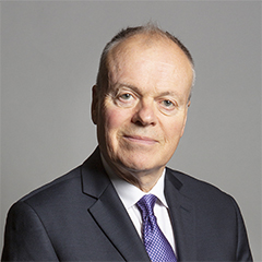 |
| Contact Details | Contact Mr Clive Betts |
| Political Party | Labour |
What Council is the S9 4EN Postcode in?
The Council for this Postcode is Sheffield District Council, who are a Unitary authority. This means that they are responsible for providing education, libraries and maintaining highways as well as normal council duties such as council tax, rubbish collection, housing, environmental health and planning.
You can visit the website for Sheffield District at the following link Sheffield District.How much is the Council Tax?
Sheffield District Council is responsible for collecting council tax. This will vary depending on which council tax band the property falls within. You can check the council tax band at the gov.uk website.
Once you know the council tax band you can view how much Sheffield District charge for that band by visiting the The Council Tax section of their website.
Planning Applications
When moving house to a new post code it is worth checking out what will be built in the neighbourhood.
Few people want to live next door to a building site, have their garden overlooked or have the views from their property ruined.
Visit the local planning department and search for planning applications in this postcode granted within the last three years or still awaiting a decision. This will give an indication of what could still be built.
Where can I find out where the nearest Library to the S9 4EN Postcode is?
Libraries are the responsibility of Sheffield council
Visit the link for more information. Please note that some councils outsource library services to private companies and community groups ran by volunteers.
Libraries and ArchivesHouse Sales in S9 4EN
| Year | High | Low | Average | Sales |
|---|---|---|---|---|
| 2013 | £78,000 | £78,000 | £78,000 | 1 |
Contains HM Land Registry data © Crown copyright and database right 2024. This data is licensed under the Open Government Licence v3.0.
Postcodes near the S9 4EN Postcode
What Popular Supermarkets are near the S9 4EN Postcode?
| Supermarket | Distance | Directions |
|---|---|---|
| Asda, Handsworth Road, Handsworth, SHEFFIELD, S13 9LR | 1.20 miles | Directions from S9 4EN to Asda |
| Aldi, Handsworth Road, Handsworth, SHEFFIELD, S13 9BS | 1.48 miles | Directions from S9 4EN to Aldi |
| Asda, City Road, SHEFFIELD, S12 2AB | 1.97 miles | Directions from S9 4EN to Asda |
| Iceland, Cricket Inn Road, SHEFFIELD, S2 5AU | 2.07 miles | Directions from S9 4EN to Iceland |
| Morrisons, Poplar Way, Catcliffe, ROTHERHAM, S60 5TR | 3.06 miles | Directions from S9 4EN to Morrisons |
What Popular Restaurants are near the S9 4EN Postcode?
| Burger King | Distance | Directions |
|---|---|---|
| Sheffield Parkway Retail Park, Sheffield, S2 5AU | 1.23 miles | Directions from S9 4EN to Sheffield Parkway Retail Park |
| Valley Centertainment, Sheffield, S9 2EP | 1.69 miles | Directions from S9 4EN to Valley Centertainment |
| Sheffield Station, Sheaf Street, Sheffield, S1 2BQ | 1.99 miles | Directions from S9 4EN to Sheffield Station, Sheaf Street |
| Leppings Lane, Sheffield, S6 1LR | 4.47 miles | Directions from S9 4EN to Leppings Lane |
| Mcdonald's | Distance | Directions |
|---|---|---|
| McDonald's, Handsworth Road, Handsworth, SHEFFIELD, S13 9BS | 0.92 miles | Directions from S9 4EN to McDonald's, Handsworth Road, Handsworth, SHEFFIELD, S13 9BS |
| McDonald's, Coleford Road, SHEFFIELD, S9 5PA | 1.09 miles | Directions from S9 4EN to McDonald's, Coleford Road, SHEFFIELD, S9 5PA |
| McDonald's, Farm Road, SHEFFIELD, S2 2TP | 1.96 miles | Directions from S9 4EN to McDonald's, Farm Road, SHEFFIELD, S2 2TP |
| McDonald's, Meadowhall Retail Park, Attercliffe Common, SHEFFIELD, S9 2YZ | 1.99 miles | Directions from S9 4EN to McDonald's, Meadowhall Retail Park, Attercliffe Common, SHEFFIELD, S9 2YZ |
| Restaurant | Distance | Directions |
|---|---|---|
| KFC, City Road, SHEFFIELD, S2 1GJ | 1.16 miles | Directions from S9 4EN to KFC Sheffield - City Road |
| KFC, Broughton Lane, SHEFFIELD, S9 2DD | 1.83 miles | Directions from S9 4EN to KFC Sheffield Arena - Broughton Lane |
| KFC, Haymarket, SHEFFIELD, S1 2AW | 2.11 miles | Directions from S9 4EN to KFC Sheffield - Haymarket |
| KFC, The Oasis, Meadowhall Centre, SHEFFIELD, S9 1EP | 2.61 miles | Directions from S9 4EN to KFC Sheffield - Meadowhall Shopping Centre |
| KFC, West Street, SHEFFIELD, S1 4EW | 2.66 miles | Directions from S9 4EN to KFC Sheffield - West Street |