The S9 postcode district is a postal district located in the S Sheffield postcode area with a population of 29,041 residents according to the 2021 England and Wales Census.
The area of the S9 postcode district is 6.89 square miles which is 17.84 square kilometres or 4,407.34 acres.
Currently, the S9 district has about 706 postcode units spread across 5 geographic postcode sectors.
Given that each sector allows for 400 unique postcode combinations, the district has a capacity of 2,000 postcodes. With 706 postcodes already in use, this leaves 1294 units available.
The largest settlements in the S9 postal code are SHEFFIELD and Tinsley.
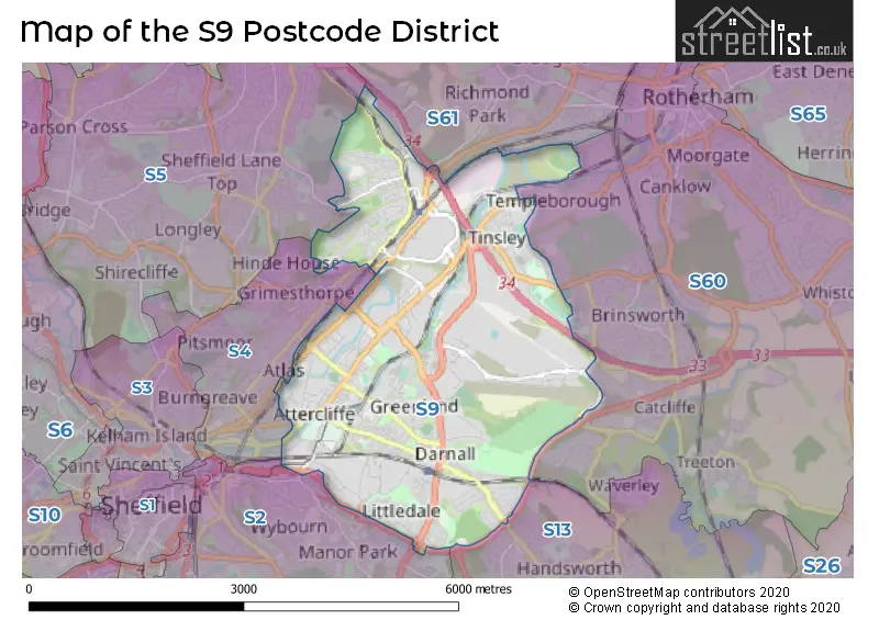
The S9 Postcode shares a border with S13 (SHEFFIELD, Woodhouse, Handsworth), S2 (SHEFFIELD, Park Hill), S4 (SHEFFIELD), S5 (SHEFFIELD), S60 (ROTHERHAM, Brinsworth, Whiston) and S61 (ROTHERHAM, Thorpe Hesley, Scholes).
The primary settlement in the S9 postcode district is Sheffield, which is located in the county of South Yorkshire in England. Other significant settlements in the district include Tinsley and Wincobank. The most significant post town in the district is Sheffield.
For the district S9, we have data on 6 postcode sectors. Here's a breakdown: The sector S9 1, covers Sheffield in South Yorkshire. The sector S9 2, covers Sheffield in South Yorkshire. The sector S9 3, covers Sheffield in South Yorkshire. The sector S9 4, covers Sheffield in South Yorkshire. The sector S9 5, covers Sheffield in South Yorkshire. The sector S9 9 is non-geographic. It's often designated for PO Boxes, large organisations, or special services.


Map of the S9 Postcode District
Explore the S9 postcode district by using our free interactive map.
When it comes to local government, postal geography often disregards political borders. However, for a breakdown in the S9 District: the district mostly encompasses the Sheffield District (B) area with a total of 712 postcodes.
Recent House Sales in S9
| Date | Price | Address |
|---|---|---|
| 19/10/2023 | £150,000 | Halsall Drive, Sheffield, S9 4JE |
| 29/09/2023 | £100,000 | Poole Place, Sheffield, S9 4JR |
| 28/09/2023 | £50,000 | Sandstone Road, Sheffield, S9 1AG |
| 18/09/2023 | £85,000 | Norborough Road, Tinsley, Sheffield, S9 1SJ |
| 15/09/2023 | £145,000 | Fort Hill Road, Sheffield, S9 1BB |
| 08/09/2023 | £139,000 | Tansley Street, Sheffield, S9 1LJ |
| 01/09/2023 | £120,000 | Jenkin Road, Sheffield, S9 1AX |
| 31/08/2023 | £157,500 | Parker Way, Sheffield, S9 3DE |
| 30/08/2023 | £80,000 | Ecclesfield Road, Sheffield, S9 1NW |
| 29/08/2023 | £162,500 | Clifton Avenue, Sheffield, S9 4BA |
Where is the S9 Postcode District?
The postcode district of S9 is located in Sheffield. It is situated near several towns: Rotherham to the North East, Dronfield to the South, Barnsley to the North, Worksop to the South East, and Bakewell to the South West. Additionally, S9 is approximately 141.64 miles away from the center of London.
The district is within the post town of SHEFFIELD.
The sector has postcodes within the nation of England.
The S9 Postcode District is in the Sheffield region of South Yorkshire within the Yorkshire and The Humber.
Weather Forecast for S9
Press Button to Show Forecast for Greenland
| Time Period | Icon | Description | Temperature | Rain Probability | Wind |
|---|---|---|---|---|---|
| 09:00 to 12:00 | Cloudy | 14.0°C (feels like 12.0°C) | 4.00% | SSE 7 mph | |
| 12:00 to 15:00 | Cloudy | 18.0°C (feels like 16.0°C) | 4.00% | S 9 mph | |
| 15:00 to 18:00 | Cloudy | 19.0°C (feels like 17.0°C) | 8.00% | SSW 9 mph | |
| 18:00 to 21:00 | Cloudy | 19.0°C (feels like 18.0°C) | 6.00% | WSW 4 mph | |
| 21:00 to 00:00 | Cloudy | 16.0°C (feels like 15.0°C) | 4.00% | NW 4 mph |
Press Button to Show Forecast for Greenland
| Time Period | Icon | Description | Temperature | Rain Probability | Wind |
|---|---|---|---|---|---|
| 00:00 to 03:00 | Cloudy | 14.0°C (feels like 14.0°C) | 5.00% | NW 4 mph | |
| 03:00 to 06:00 | Cloudy | 13.0°C (feels like 13.0°C) | 4.00% | WNW 4 mph | |
| 06:00 to 09:00 | Cloudy | 13.0°C (feels like 13.0°C) | 4.00% | WSW 2 mph | |
| 09:00 to 12:00 | Cloudy | 16.0°C (feels like 16.0°C) | 4.00% | SW 2 mph | |
| 12:00 to 15:00 | Cloudy | 19.0°C (feels like 19.0°C) | 3.00% | NW 4 mph | |
| 15:00 to 18:00 | Cloudy | 21.0°C (feels like 20.0°C) | 3.00% | WNW 4 mph | |
| 18:00 to 21:00 | Cloudy | 20.0°C (feels like 19.0°C) | 3.00% | NW 4 mph | |
| 21:00 to 00:00 | Cloudy | 17.0°C (feels like 16.0°C) | 3.00% | N 4 mph |
Press Button to Show Forecast for Greenland
| Time Period | Icon | Description | Temperature | Rain Probability | Wind |
|---|---|---|---|---|---|
| 00:00 to 03:00 | Cloudy | 14.0°C (feels like 14.0°C) | 4.00% | N 2 mph | |
| 03:00 to 06:00 | Cloudy | 12.0°C (feels like 12.0°C) | 4.00% | W 2 mph | |
| 06:00 to 09:00 | Cloudy | 13.0°C (feels like 13.0°C) | 4.00% | WSW 2 mph | |
| 09:00 to 12:00 | Cloudy | 17.0°C (feels like 17.0°C) | 4.00% | SSE 2 mph | |
| 12:00 to 15:00 | Cloudy | 20.0°C (feels like 20.0°C) | 4.00% | SSE 4 mph | |
| 15:00 to 18:00 | Cloudy | 21.0°C (feels like 20.0°C) | 4.00% | S 4 mph | |
| 18:00 to 21:00 | Partly cloudy (day) | 20.0°C (feels like 20.0°C) | 2.00% | SSE 4 mph | |
| 21:00 to 00:00 | Partly cloudy (night) | 17.0°C (feels like 16.0°C) | 1.00% | SE 7 mph |
Press Button to Show Forecast for Greenland
| Time Period | Icon | Description | Temperature | Rain Probability | Wind |
|---|---|---|---|---|---|
| 00:00 to 03:00 | Clear night | 15.0°C (feels like 14.0°C) | 0.00% | SSE 4 mph | |
| 03:00 to 06:00 | Clear night | 13.0°C (feels like 12.0°C) | 0.00% | SSE 4 mph | |
| 06:00 to 09:00 | Sunny day | 14.0°C (feels like 14.0°C) | 0.00% | SSE 4 mph | |
| 09:00 to 12:00 | Sunny day | 18.0°C (feels like 18.0°C) | 0.00% | SSE 4 mph | |
| 12:00 to 15:00 | Partly cloudy (day) | 21.0°C (feels like 19.0°C) | 0.00% | SSE 7 mph | |
| 15:00 to 18:00 | Partly cloudy (day) | 22.0°C (feels like 20.0°C) | 3.00% | SSE 9 mph | |
| 18:00 to 21:00 | Partly cloudy (day) | 21.0°C (feels like 19.0°C) | 1.00% | SSE 9 mph | |
| 21:00 to 00:00 | Clear night | 17.0°C (feels like 16.0°C) | 1.00% | SE 7 mph |
Press Button to Show Forecast for Greenland
| Time Period | Icon | Description | Temperature | Rain Probability | Wind |
|---|---|---|---|---|---|
| 00:00 to 03:00 | Clear night | 15.0°C (feels like 14.0°C) | 1.00% | SE 7 mph | |
| 03:00 to 06:00 | Clear night | 13.0°C (feels like 12.0°C) | 1.00% | SE 4 mph | |
| 06:00 to 09:00 | Sunny day | 13.0°C (feels like 13.0°C) | 1.00% | ESE 4 mph | |
| 09:00 to 12:00 | Partly cloudy (day) | 17.0°C (feels like 16.0°C) | 2.00% | SE 7 mph | |
| 12:00 to 15:00 | Cloudy | 21.0°C (feels like 19.0°C) | 8.00% | SE 9 mph | |
| 15:00 to 18:00 | Cloudy | 21.0°C (feels like 19.0°C) | 12.00% | SSE 11 mph | |
| 18:00 to 21:00 | Cloudy | 19.0°C (feels like 18.0°C) | 14.00% | SSE 9 mph | |
| 21:00 to 00:00 | Cloudy | 16.0°C (feels like 15.0°C) | 11.00% | SSE 7 mph |
| Postcode Sector | Delivery Office |
|---|---|
| S9 1 | Sheffield Epostal Delivery Office |
| S9 2 | Sheffield Epostal Delivery Office |
| S9 3 | Sheffield Epostal Delivery Office |
| S9 4 | Sheffield Epostal Delivery Office |
| S9 5 | Sheffield Epostal Delivery Office |
| S | 9 | - | X | X | X |
| S | 9 | Space | Numeric | Letter | Letter |
Current Monthly Rental Prices
| # Bedrooms | Min Price | Max Price | Avg Price |
|---|---|---|---|
| 3 | £750 | £750 | £750 |
Current House Prices
| # Bedrooms | Min Price | Max Price | Avg Price |
|---|---|---|---|
| £130,000 | £249,995 | £189,998 | |
| 1 | £70,000 | £85,000 | £77,500 |
| 2 | £80,000 | £165,000 | £124,773 |
| 3 | £95,000 | £265,000 | £164,198 |
| 4 | £155,000 | £270,000 | £211,250 |
| 6 | £300,000 | £300,000 | £300,000 |
Estate Agents who Operate in the S9 District
| Logo | Name | Brand Name | Address | Contact Number | Total Properties |
|---|---|---|---|---|---|
 | Sheffield | 2Roost | 27 Main Street, Swallownest, Sheffield, S26 4TZ | 0114 287 8696 | 7 |
 | Dronfield | Whitegates | Unit 23 The Forge, Church Street, Dronfield, Sheffield, S18 1QX | 01246 383434 | 6 |
 | Gleadless | Haybrook | 202a White Lane, Gleadless, Sheffield, S12 3GL | 0114 697 2733 | 4 |
 | Chapeltown | Haybrook | 4 Lound Side, Chapeltown, Sheffield, S35 2UP | 0114 697 2559 | 4 |
 | Chapeltown | Blundells | Unit 4 Market Street, Chapeltown, S35 2UW | 0114 697 1186 | 4 |
Yearly House Price Averages for the S9 Postcode District
| Type of Property | 2018 Average | 2018 Sales | 2017 Average | 2017 Sales | 2016 Average | 2016 Sales | 2015 Average | 2015 Sales |
|---|---|---|---|---|---|---|---|---|
| Detached | £168,292 | 12 | £163,143 | 7 | £125,812 | 8 | £126,666 | 9 |
| Semi-Detached | £108,671 | 138 | £104,292 | 160 | £103,108 | 148 | £98,701 | 168 |
| Terraced | £82,620 | 106 | £86,530 | 124 | £79,998 | 115 | £70,826 | 122 |
| Flats | £63,389 | 9 | £73,250 | 14 | £77,779 | 12 | £73,540 | 10 |