The SA33 5 postcode sector is within the county of Dyfed.
Did you know? According to the 2021 Census, the SA33 5 postcode sector is home to a bustling 3,282 residents!
Given that each sector allows for 400 unique postcode combinations. Letters C, I, K, M, O and V are not allowed in the last two letters of a postcode. With 187 postcodes already in use, this leaves 213 units available.
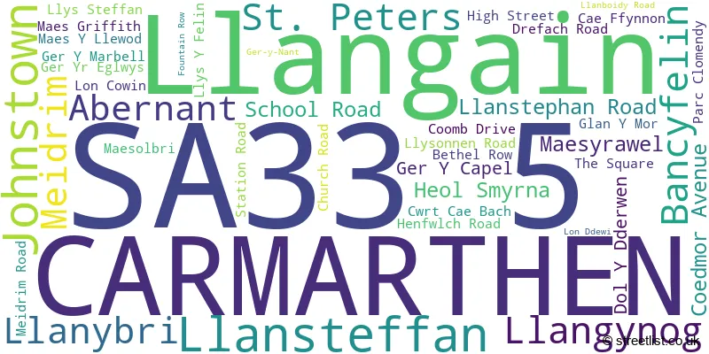
The largest settlement in the SA33 5 postal code is LLANGAIN followed by LLANSTEFFAN, and MEIDRIM.
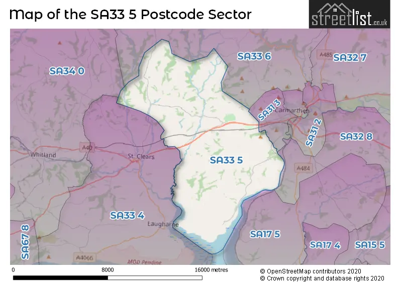
The SA33 5 Postcode shares a border with SA33 6 (CYNWYL ELFED, BRONWYDD, LLANPUMSAINT), SA34 0 (WHITLAND, LLANBOIDY, HEBRON), SA31 3 (CARMARTHEN, JOHNSTOWN, LLANLLWCH) and SA33 4 (ST CLEARS, Laugharne, PENDINE).
The sector is within the post town of CARMARTHEN.
SA33 5 is a postcode sector within the SA3 postcode district which is within the SA Swansea postcode area.
The Royal Mail delivery office for the SA33 5 postal sector is the Mumbles Delivery Office.
The area of the SA33 5 postcode sector is 45.48 square miles which is 117.80 square kilometres or 29,108.96 square acres.

Map of the SA33 5 Postcode Sector
Explore the SA33 5 postcode sector by using our free interactive map.
| S | A | 3 | 3 | - | 5 | X | X |
| S | A | 3 | 3 | Space | 5 | Letter | Letter |
Official List of Streets
Llansteffan (8 Streets)
Bancyfelin (6 Streets)
Llangain (6 Streets)
Llangynog (1 Streets)
CARMARTHEN (4 Streets)
Meidrim (5 Streets)
Llanybri (2 Streets)
Unofficial Streets or Alternative Spellings
Llanllwch
MANOR WAY CWRT MELIN DOL-Y-DDERWEN FIRST STEPS GER-Y-CAPEL GLAN-Y-MOR HEOL PENTREHYDD ISFRYN LLAIN DELYN LLYSONEN ROAD LON CENDY LON Y DERI LON-CYWYN MAESGRIFFITH MILL POND LANE OLD ROAD OLD SCHOOL ROAD PANT YR ATHRO PARC Y DELYN WATER LANEJohnstown
ALLTYCNAP ROADMeidrim
GER-Y-NANTSt. Clears
MEIDRIM ROADWeather Forecast for SA33 5
Press Button to Show Forecast for St Clears
| Time Period | Icon | Description | Temperature | Rain Probability | Wind |
|---|---|---|---|---|---|
| 00:00 to 03:00 | Heavy rain | 11.0°C (feels like 7.0°C) | 85.00% | SSE 18 mph | |
| 03:00 to 06:00 | Heavy rain | 11.0°C (feels like 7.0°C) | 88.00% | SSE 20 mph | |
| 06:00 to 09:00 | Heavy rain | 11.0°C (feels like 7.0°C) | 86.00% | SSE 20 mph | |
| 09:00 to 12:00 | Heavy rain | 11.0°C (feels like 7.0°C) | 93.00% | SSE 20 mph | |
| 12:00 to 15:00 | Heavy rain | 11.0°C (feels like 8.0°C) | 82.00% | S 13 mph | |
| 15:00 to 18:00 | Light rain | 11.0°C (feels like 8.0°C) | 57.00% | S 11 mph | |
| 18:00 to 21:00 | Light rain shower (day) | 11.0°C (feels like 8.0°C) | 38.00% | S 11 mph | |
| 21:00 to 00:00 | Partly cloudy (night) | 9.0°C (feels like 7.0°C) | 7.00% | SSE 9 mph |
Press Button to Show Forecast for St Clears
| Time Period | Icon | Description | Temperature | Rain Probability | Wind |
|---|---|---|---|---|---|
| 00:00 to 03:00 | Clear night | 9.0°C (feels like 7.0°C) | 3.00% | SSE 9 mph | |
| 03:00 to 06:00 | Partly cloudy (night) | 8.0°C (feels like 6.0°C) | 2.00% | SE 9 mph | |
| 06:00 to 09:00 | Cloudy | 9.0°C (feels like 7.0°C) | 4.00% | SE 9 mph | |
| 09:00 to 12:00 | Partly cloudy (day) | 11.0°C (feels like 9.0°C) | 4.00% | SE 11 mph | |
| 12:00 to 15:00 | Cloudy | 13.0°C (feels like 11.0°C) | 6.00% | SSE 9 mph | |
| 15:00 to 18:00 | Cloudy | 13.0°C (feels like 12.0°C) | 8.00% | SSW 7 mph | |
| 18:00 to 21:00 | Cloudy | 12.0°C (feels like 11.0°C) | 14.00% | SW 4 mph | |
| 21:00 to 00:00 | Cloudy | 10.0°C (feels like 9.0°C) | 16.00% | W 4 mph |
Press Button to Show Forecast for St Clears
| Time Period | Icon | Description | Temperature | Rain Probability | Wind |
|---|---|---|---|---|---|
| 00:00 to 03:00 | Cloudy | 10.0°C (feels like 9.0°C) | 17.00% | N 4 mph | |
| 03:00 to 06:00 | Cloudy | 9.0°C (feels like 8.0°C) | 20.00% | NW 7 mph | |
| 06:00 to 09:00 | Overcast | 10.0°C (feels like 9.0°C) | 19.00% | NW 7 mph | |
| 09:00 to 12:00 | Cloudy | 11.0°C (feels like 10.0°C) | 16.00% | NNW 9 mph | |
| 12:00 to 15:00 | Cloudy | 14.0°C (feels like 13.0°C) | 9.00% | NNW 9 mph | |
| 15:00 to 18:00 | Partly cloudy (day) | 15.0°C (feels like 13.0°C) | 8.00% | NNW 9 mph | |
| 18:00 to 21:00 | Cloudy | 14.0°C (feels like 13.0°C) | 7.00% | NNW 9 mph | |
| 21:00 to 00:00 | Partly cloudy (night) | 11.0°C (feels like 10.0°C) | 4.00% | NNW 7 mph |
House Prices in the SA33 5 Postcode Sector
| Type of Property | 2018 Average | 2018 Sales | 2017 Average | 2017 Sales | 2016 Average | 2016 Sales | 2015 Average | 2015 Sales |
|---|---|---|---|---|---|---|---|---|
| Detached | £235,480 | 25 | £226,754 | 39 | £230,130 | 25 | £218,217 | 23 |
| Semi-Detached | £153,555 | 8 | £149,357 | 14 | £144,500 | 4 | £147,732 | 7 |
| Terraced | £136,106 | 9 | £110,125 | 8 | £128,625 | 8 | £144,000 | 3 |
| Flats | £0 | 0 | £314,000 | 1 | £35,000 | 1 | £0 | 0 |
Important Postcodes SA33 5 in the Postcode Sector
SA33 5AE is the postcode for Llangain Cp School, U2137 From, Llangain
SA33 5LN is the postcode for Llansteffan Cp School, Glan Y Mor, Llansteffan
SA33 5ND is the postcode for Bancyfelin Cp School, High Street, Bancyfelin
SA33 5NT is the postcode for Werndale Hospital, Bancyfelin
| The SA33 5 Sector is within these Local Authorities |
|
|---|---|
| The SA33 5 Sector is within these Counties |
|
| The SA33 5 Sector is within these Water Company Areas |
|