The SK17 6 postcode sector lies where the three counties of Derbyshire, Cheshire, and Staffordshire meet.
Did you know? According to the 2021 Census, the SK17 6 postcode sector is home to a bustling 7,269 residents!
Given that each sector allows for 400 unique postcode combinations. Letters C, I, K, M, O and V are not allowed in the last two letters of a postcode. With 281 postcodes already in use, this leaves 119 units available.
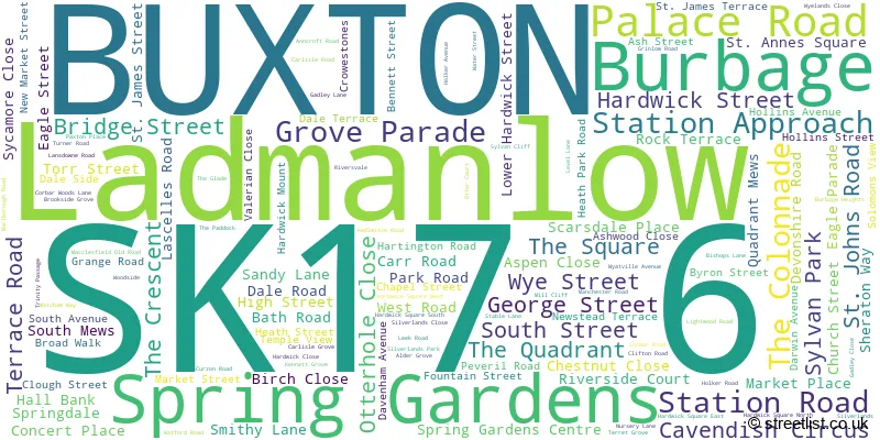
The largest settlements in the SK17 6 postal code are BUXTON and Ladmanlow.
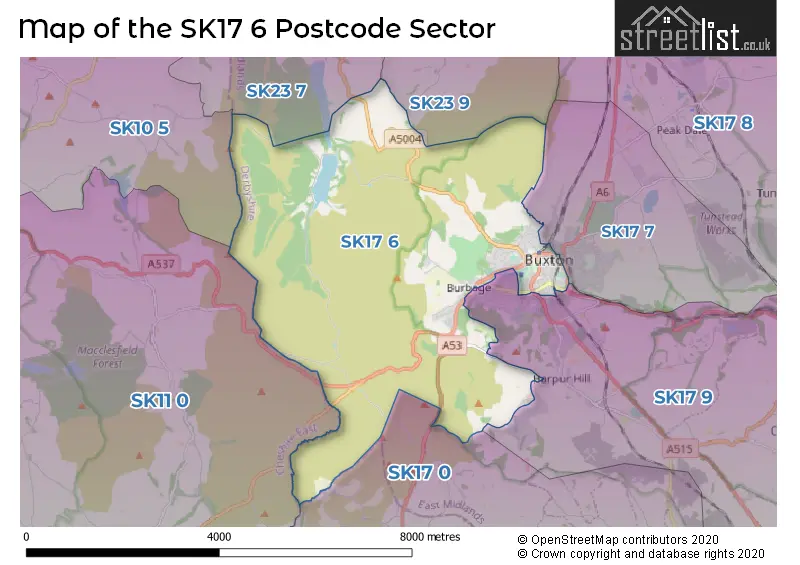
The SK17 6 Postcode shares a border with SK10 5 (Bollington, Rainow, Pott Shrigley), SK11 0 (Sutton, Rushton Spencer, Langley), SK17 7 (BUXTON, Fairfield, Green Fairfield), SK17 0 (Longnor, Hartington, Quarnford), SK17 9 (BUXTON, Taddington, Flagg), SK23 7 (Whaley Bridge, Furness Vale, Buxworth) and SK23 9 (Chapel-en-le-Frith, Combs).
The sector is within the post town of BUXTON.
SK17 6 is a postcode sector within the SK17 postcode district which is within the SK Stockport postcode area.
The Royal Mail delivery office for the SK17 6 postal sector is the Buxton (sk) Delivery Office.
The area of the SK17 6 postcode sector is 13.72 square miles which is 35.54 square kilometres or 8,782.91 square acres.
Waterways within the SK17 6 postcode sector include the River Goyt.


Map of the SK17 6 Postcode Sector
Explore the SK17 6 postcode sector by using our free interactive map.
| S | K | 1 | 7 | - | 6 | X | X |
| S | K | 1 | 7 | Space | 6 | Letter | Letter |
Official List of Streets
BUXTON (128 Streets)
Ladmanlow (1 Streets)
Unofficial Streets or Alternative Spellings
BUXTON
BAKEWELL ROAD BURLINGTON ROAD CAVENDISH AVENUE CHARLES STREET FAIRFIELD ROAD GREEN LANE HOLMFIELD LONDON ROAD MACCLESFIELD ROAD BACK TORR STREET BROADWALK BUXTON OLD COACH ROAD BYRON LODGE DALESIDE DERBYSHIRE BRIDGE DRY STONES EDGE ROAD EMBRIDGE CAUSEWAY GOYTS LANE GRIN LOW ROAD HEATHFIELD GARDENS HIGH PEAK HALLS KENTS BANK ROAD LONG HILL MACCLESFIELD MAIN ROAD NEW WYE STREET ODDFELLOWS COTTAGES OLD LONGHILL ROAD OLD ROAD OTTER HOLT DRIVE PANNIERSPOOL BRIDGE PARKFIELD COURT PARKSIDE PRIMITIVE COURT PUNCH BOWL PARK SHOOTERS CLOUGH BRIDGE THE OLD TENNIS COURTS THE SLOPES THE STREET THORNWOOD COURT TRINITY STABLESLongnor
LEEK ROADBosley
BUXTON ROADWeather Forecast for SK17 6
Press Button to Show Forecast for Pavilion Gardens Buxton
| Time Period | Icon | Description | Temperature | Rain Probability | Wind |
|---|---|---|---|---|---|
| 03:00 to 06:00 | Partly cloudy (night) | 11.0°C (feels like 10.0°C) | 5.00% | SE 4 mph | |
| 06:00 to 09:00 | Mist | 12.0°C (feels like 12.0°C) | 15.00% | SSE 4 mph | |
| 09:00 to 12:00 | Cloudy | 15.0°C (feels like 13.0°C) | 4.00% | S 11 mph | |
| 12:00 to 15:00 | Cloudy | 17.0°C (feels like 14.0°C) | 4.00% | SSE 13 mph | |
| 15:00 to 18:00 | Cloudy | 18.0°C (feels like 15.0°C) | 8.00% | SSE 13 mph | |
| 18:00 to 21:00 | Cloudy | 16.0°C (feels like 14.0°C) | 11.00% | SSE 11 mph | |
| 21:00 to 00:00 | Cloudy | 13.0°C (feels like 12.0°C) | 14.00% | SE 9 mph |
Press Button to Show Forecast for Pavilion Gardens Buxton
| Time Period | Icon | Description | Temperature | Rain Probability | Wind |
|---|---|---|---|---|---|
| 00:00 to 03:00 | Cloudy | 13.0°C (feels like 11.0°C) | 49.00% | SE 11 mph | |
| 03:00 to 06:00 | Light rain | 12.0°C (feels like 10.0°C) | 55.00% | ESE 11 mph | |
| 06:00 to 09:00 | Light rain | 12.0°C (feels like 10.0°C) | 58.00% | ESE 11 mph | |
| 09:00 to 12:00 | Heavy rain | 13.0°C (feels like 11.0°C) | 82.00% | ESE 13 mph | |
| 12:00 to 15:00 | Heavy rain | 14.0°C (feels like 12.0°C) | 82.00% | ESE 13 mph | |
| 15:00 to 18:00 | Heavy rain shower (day) | 15.0°C (feels like 12.0°C) | 64.00% | SE 11 mph | |
| 18:00 to 21:00 | Light rain shower (day) | 14.0°C (feels like 12.0°C) | 46.00% | SE 9 mph | |
| 21:00 to 00:00 | Cloudy | 12.0°C (feels like 10.0°C) | 18.00% | SE 9 mph |
Press Button to Show Forecast for Pavilion Gardens Buxton
| Time Period | Icon | Description | Temperature | Rain Probability | Wind |
|---|---|---|---|---|---|
| 00:00 to 03:00 | Cloudy | 10.0°C (feels like 9.0°C) | 10.00% | SE 7 mph | |
| 03:00 to 06:00 | Partly cloudy (night) | 9.0°C (feels like 8.0°C) | 4.00% | ESE 7 mph | |
| 06:00 to 09:00 | Mist | 11.0°C (feels like 9.0°C) | 17.00% | E 9 mph | |
| 09:00 to 12:00 | Cloudy | 13.0°C (feels like 11.0°C) | 12.00% | ESE 9 mph | |
| 12:00 to 15:00 | Light rain shower (day) | 15.0°C (feels like 13.0°C) | 36.00% | ESE 9 mph | |
| 15:00 to 18:00 | Light rain shower (day) | 16.0°C (feels like 14.0°C) | 36.00% | SE 9 mph | |
| 18:00 to 21:00 | Light rain shower (day) | 15.0°C (feels like 14.0°C) | 33.00% | SE 7 mph | |
| 21:00 to 00:00 | Clear night | 10.0°C (feels like 9.0°C) | 2.00% | ESE 4 mph |
Press Button to Show Forecast for Pavilion Gardens Buxton
| Time Period | Icon | Description | Temperature | Rain Probability | Wind |
|---|---|---|---|---|---|
| 00:00 to 03:00 | Clear night | 9.0°C (feels like 8.0°C) | 3.00% | E 4 mph | |
| 03:00 to 06:00 | Fog | 8.0°C (feels like 7.0°C) | 14.00% | ENE 4 mph | |
| 06:00 to 09:00 | Mist | 11.0°C (feels like 10.0°C) | 15.00% | ESE 4 mph | |
| 09:00 to 12:00 | Sunny day | 15.0°C (feels like 14.0°C) | 5.00% | SSW 4 mph | |
| 12:00 to 15:00 | Cloudy | 17.0°C (feels like 16.0°C) | 12.00% | SW 7 mph | |
| 15:00 to 18:00 | Cloudy | 17.0°C (feels like 16.0°C) | 12.00% | SW 7 mph | |
| 18:00 to 21:00 | Sunny day | 16.0°C (feels like 15.0°C) | 6.00% | WSW 7 mph | |
| 21:00 to 00:00 | Partly cloudy (night) | 11.0°C (feels like 10.0°C) | 5.00% | WSW 7 mph |
Schools and Places of Education Within the SK17 6 Postcode Sector
Buxton Infant School
Community school
Hardwick Square, Buxton, Derbyshire, SK17 6QB
Head: Mrs Jude Boyd
Ofsted Rating: Good
Inspection: 2023-12-07 (158 days ago)
Website: Visit Buxton Infant School Website
Phone: 0129822499
Number of Pupils: 160
St Thomas More Catholic Voluntary Academy
Academy converter
Palace Fields, Buxton, Derbyshire, SK17 6AF
Head: Mr David Redfern
Ofsted Rating: Requires improvement
Inspection: 2023-01-11 (488 days ago)
Website: Visit St Thomas More Catholic Voluntary Academy Website
Phone: 0129823167
Number of Pupils: 437

House Prices in the SK17 6 Postcode Sector
| Type of Property | 2018 Average | 2018 Sales | 2017 Average | 2017 Sales | 2016 Average | 2016 Sales | 2015 Average | 2015 Sales |
|---|---|---|---|---|---|---|---|---|
| Detached | £394,188 | 28 | £356,891 | 23 | £397,748 | 24 | £329,638 | 24 |
| Semi-Detached | £259,433 | 27 | £256,200 | 38 | £260,326 | 29 | £247,088 | 29 |
| Terraced | £171,523 | 52 | £172,976 | 34 | £157,935 | 43 | £159,340 | 44 |
| Flats | £133,624 | 56 | £149,751 | 74 | £121,633 | 68 | £123,595 | 73 |
Important Postcodes SK17 6 in the Postcode Sector
SK17 6AF is the postcode for SPORTS HALL, St. Thomas More Catholic School & Science College, Palace Road, and MAIN BUILDING, St. Thomas More Catholic School & Science College, Palace Road
SK17 6BB is the postcode for HIGH PEAK HALLS, BRIDGE STREET
SK17 6BE is the postcode for Pavilion Gardens, St. Johns Road, Buxton Swimming And Fitness Centre, St Johns Road, and Buxton Spa Swimming Pool
SK17 6BU is the postcode for 84-86 Spring Gardens
SK17 6DA is the postcode for Buxton Museum & Art Gallery, Terrace Road, and BUXTON MUSEUM & ART GALLERY, Buxton Museum & Art Gallery, Terrace Road
SK17 6DH is the postcode for National Probation Service, Chesterfield House
SK17 6DY is the postcode for High Peak Glossop & West Derbyshire, Peak Buildings, Terrace Road
SK17 6EL is the postcode for High Peak Borough Council, Town Hall,, and High Peak Borough Council, Town Hall
SK17 6HH is the postcode for BUXTON HEALTH CENTRE,, BATH ROAD,
SK17 6HU is the postcode for Community Mental Health Team, Corbar View, 1-3 Fountain Street
SK17 6JP is the postcode for The Stewart Medical Centre, 15 Hartington Road
SK17 6QB is the postcode for Buxton Infant School, Hardwick Square South, and Main Building, Buxton Infant School, Hardwick Square South
SK17 6QJ is the postcode for Buxton Police Station, Silverlands, and Derbyshire Constabulary, Divisional H Q, Silverlands
SK17 6RD is the postcode for University of Derby, Clarendon House
SK17 6RQ is the postcode for University of Derby, Northwood House
SK17 6RY is the postcode for University of Derby, Devonshire Royal Campus, Devonshire Road, DEVONSHIRE DOME, DEVONSHIRE ROAD, and University of Derby, Devonshire Royal Campus
SK17 6SN is the postcode for Buxton Ambulance Station, Park Road
SK17 6ST is the postcode for Oaklands Manor, Manchester Road
SK17 6SX is the postcode for White Hall Centre, Manchester Road, and Main Building, White Hall Centre, Manchester Road
SK17 6TE is the postcode for Cavendish Hospital, Manchester Road, Derbyshire County PCT, Cavendish Hospital, and CAVENDISH HOSPITAL, 24 MANCHESTER ROAD, BUXTON
| The SK17 6 Sector is within these Local Authorities |
|
|---|---|
| The SK17 6 Sector is within these Counties |
|
| The SK17 6 Sector is within these Water Company Areas |
|
Tourist Attractions within the SK17 6 Postcode Area
We found 1 visitor attractions within the SK17 postcode area
| Pavilion Gardens |
|---|
| Historic Properties |
| Historic House / House and Garden / Palace |
| View Pavilion Gardens on Google Maps |