The SK17 postcode district is a postal district located in the SK Stockport postcode area with a population of 30,717 residents according to the 2021 England and Wales Census.
The area of the SK17 postcode district is 128.60 square miles which is 333.07 square kilometres or 82,302.18 acres.
Currently, the SK17 district has about 1192 postcode units spread across 5 geographic postcode sectors.
Given that each sector allows for 400 unique postcode combinations, the district has a capacity of 2,000 postcodes. With 1192 postcodes already in use, this leaves 808 units available.
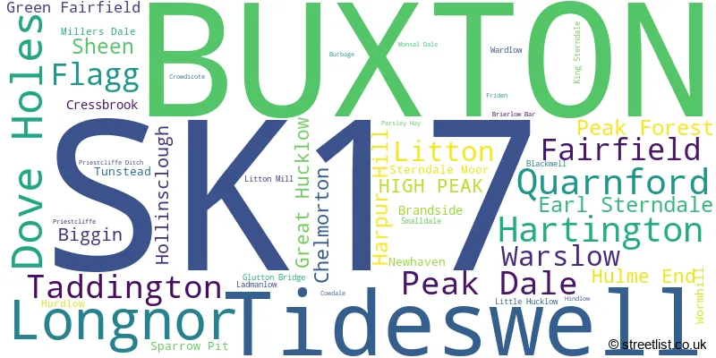
The largest settlement in the SK17 postal code is BUXTON followed by Tideswell, and Dove Holes.
The SK17 Postcode shares a border with S33 (Bamford, Bradwell, Hope), ST13 (LEEK, Cheddleton, Rudyard), DE45 (BAKEWELL, Youlgrave, Baslow), S32 (Hathersage, Calver, Eyam), SK10 (MACCLESFIELD, Bollington, Prestbury), SK11 (MACCLESFIELD, Gawsworth, Chelford), SK23 (Chapel-en-le-Frith, Whaley Bridge, Chinley) and DE6 (ASHBOURNE, Brailsford, Dalbury Lees).
The primary settlement in the SK17 postcode district is Buxton, located in the county of Derbyshire, England. Additionally, there are several other significant settlements in the district, including Fairfield, Green Fairfield, and Burbage, all located in Derbyshire.
For the district SK17, we have data on 6 postcode sectors. Here's a breakdown: The sector SK17 0, covers Longnor and Quarnford in Staffordshire. The sector SK17 0, covers Hartington in Derbyshire. The sector SK17 1 is non-geographic. It's often designated for PO Boxes, large organisations, or special services. The sector SK17 6, covers Buxton in Derbyshire. The sector SK17 7, covers Buxton in Derbyshire. The sector SK17 8, covers Tideswell and Dove Holes in Derbyshire. The sector SK17 9, covers Buxton in Derbyshire.

Map of the SK17 Postcode District
Explore the SK17 postcode district by using our free interactive map.

When it comes to local government, postal geography often disregards political borders. However, for a breakdown in the SK17 District: the district mostly encompasses the High Peak District (B) (856 postcodes), followed by the Derbyshire Dales District area (231 postcodes), and finally, the Staffordshire Moorlands District area (134 postcodes).
Recent House Sales in SK17
| Date | Price | Address |
|---|---|---|
| 20/10/2023 | £195,000 | Hastings Road, Buxton, SK17 9XD |
| 18/10/2023 | £380,000 | Quarnford, Buxton, SK17 0SW |
| 16/10/2023 | £600,000 | Carlisle Grove, Buxton, SK17 6XP |
| 06/10/2023 | £295,000 | Central Drive, Buxton, SK17 9RU |
| 29/09/2023 | £700,000 | Green Lane, Buxton, SK17 9DL |
| 29/09/2023 | £235,000 | Brightmore Terrace, Tideswell, Buxton, SK17 8LZ |
| 28/09/2023 | £415,000 | Ecclesbourne Drive, Buxton, SK17 9BS |
| 28/09/2023 | £239,000 | Hardwick Mount, Buxton, SK17 6PL |
| 28/09/2023 | £425,000 | Ashwood Close, Buxton, SK17 6PH |
| 27/09/2023 | £195,000 | Brown Edge Road, Buxton, SK17 7AL |
Weather Forecast for SK17
Press Button to Show Forecast for Harpur Hill
| Time Period | Icon | Description | Temperature | Rain Probability | Wind |
|---|---|---|---|---|---|
| 03:00 to 06:00 | Partly cloudy (night) | -1.0°C (feels like -3.0°C) | 2.00% | ENE 4 mph | |
| 06:00 to 09:00 | Sunny day | 1.0°C (feels like -1.0°C) | 1.00% | NE 4 mph | |
| 09:00 to 12:00 | Cloudy | 5.0°C (feels like 2.0°C) | 8.00% | ENE 7 mph | |
| 12:00 to 15:00 | Overcast | 6.0°C (feels like 5.0°C) | 10.00% | E 4 mph | |
| 15:00 to 18:00 | Cloudy | 7.0°C (feels like 6.0°C) | 7.00% | ESE 4 mph | |
| 18:00 to 21:00 | Cloudy | 6.0°C (feels like 4.0°C) | 8.00% | E 7 mph | |
| 21:00 to 00:00 | Partly cloudy (night) | 2.0°C (feels like 0.0°C) | 5.00% | ENE 7 mph |
Press Button to Show Forecast for Harpur Hill
| Time Period | Icon | Description | Temperature | Rain Probability | Wind |
|---|---|---|---|---|---|
| 00:00 to 03:00 | Cloudy | 1.0°C (feels like -1.0°C) | 10.00% | NE 4 mph | |
| 03:00 to 06:00 | Cloudy | 1.0°C (feels like -2.0°C) | 9.00% | NE 4 mph | |
| 06:00 to 09:00 | Cloudy | 2.0°C (feels like -1.0°C) | 10.00% | NE 7 mph | |
| 09:00 to 12:00 | Cloudy | 6.0°C (feels like 2.0°C) | 11.00% | E 9 mph | |
| 12:00 to 15:00 | Overcast | 7.0°C (feels like 4.0°C) | 20.00% | E 11 mph | |
| 15:00 to 18:00 | Light rain | 8.0°C (feels like 5.0°C) | 48.00% | ENE 11 mph | |
| 18:00 to 21:00 | Cloudy | 7.0°C (feels like 4.0°C) | 18.00% | ENE 11 mph | |
| 21:00 to 00:00 | Cloudy | 5.0°C (feels like 1.0°C) | 16.00% | ENE 11 mph |
Press Button to Show Forecast for Harpur Hill
| Time Period | Icon | Description | Temperature | Rain Probability | Wind |
|---|---|---|---|---|---|
| 00:00 to 03:00 | Cloudy | 4.0°C (feels like 0.0°C) | 17.00% | NE 13 mph | |
| 03:00 to 06:00 | Light rain | 4.0°C (feels like 0.0°C) | 48.00% | NE 11 mph | |
| 06:00 to 09:00 | Heavy rain | 5.0°C (feels like 0.0°C) | 74.00% | NNE 13 mph | |
| 09:00 to 12:00 | Heavy rain | 6.0°C (feels like 2.0°C) | 75.00% | NNE 13 mph | |
| 12:00 to 15:00 | Light rain | 7.0°C (feels like 4.0°C) | 55.00% | NNE 13 mph | |
| 15:00 to 18:00 | Light rain | 8.0°C (feels like 5.0°C) | 54.00% | N 11 mph | |
| 18:00 to 21:00 | Cloudy | 7.0°C (feels like 4.0°C) | 18.00% | N 9 mph | |
| 21:00 to 00:00 | Partly cloudy (night) | 5.0°C (feels like 2.0°C) | 9.00% | WSW 9 mph |
Where is the SK17 Postcode District?
The postcode district SK17 is located in the town of Buxton. Buxton is surrounded by several nearby towns. To the east is Bakewell, which is approximately 7.24 miles away. To the south-west is Leek, which is approximately 11.67 miles away. To the west is Macclesfield, which is approximately 12.42 miles away. To the south-east is Ashbourne, which is approximately 13.39 miles away. And to the north is Glossop, which is approximately 15.19 miles away. Additionally, the distance from Buxton to the center of London is approximately 139.40 miles.
The district covers the post towns of BUXTON, HIGH PEAK.
The sector has postcodes within the nation of England.
The SK17 Postcode District is covers the following regions.
- South and West Derbyshire - Derbyshire and Nottinghamshire - East Midlands (England)
- Staffordshire CC - Shropshire and Staffordshire - West Midlands (England)
| Postcode Sector | Delivery Office |
|---|---|
| SK17 0 | Buxton (sk) Delivery Office |
| SK17 6 | Buxton (sk) Delivery Office |
| SK17 7 | Buxton (sk) Delivery Office |
| SK17 8 | Buxton (sk) Delivery Office |
| SK17 8 | Tideswell Scale Payment Delivery Office |
| SK17 9 | Buxton (sk) Delivery Office |
| S | K | 1 | 7 | - | X | X | X |
| S | K | 1 | 7 | Space | Numeric | Letter | Letter |
Tourist Attractions within the Postcode Area
We found 3 visitor attractions within the SK17 postcode area
| Go Ape! Tree Top Adventure - Buxton |
|---|
| Country Parks |
| Country Park |
| View Go Ape! Tree Top Adventure - Buxton on Google Maps |
| Poole's Cavern & Country Park |
| Country Parks |
| Country Park |
| View Poole's Cavern & Country Park on Google Maps |
| Pavilion Gardens |
| Historic Properties |
| Historic House / House and Garden / Palace |
| View Pavilion Gardens on Google Maps |
Current Monthly Rental Prices
| # Bedrooms | Min Price | Max Price | Avg Price |
|---|---|---|---|
| 1 | £499 | £750 | £587 |
| 2 | £675 | £900 | £745 |
| 3 | £760 | £1,250 | £880 |
| 4 | £1,000 | £1,300 | £1,150 |
| 5 | £1,200 | £1,200 | £1,200 |
Current House Prices
| # Bedrooms | Min Price | Max Price | Avg Price |
|---|---|---|---|
| £1,000 | £750,000 | £288,964 | |
| 1 | £35,000 | £275,000 | £130,179 |
| 2 | £99,950 | £700,000 | £260,819 |
| 3 | £125,000 | £1,100,000 | £325,753 |
| 4 | £160,000 | £2,250,000 | £454,528 |
| 5 | £199,500 | £1,275,000 | £561,381 |
| 6 | £475,000 | £900,000 | £670,000 |
| 8 | £895,000 | £1,500,000 | £1,197,500 |
| 9 | £700,000 | £725,000 | £712,500 |
| 12 | £750,000 | £750,000 | £750,000 |
| 19 | £1,225,000 | £1,225,000 | £1,225,000 |
| 23 | £1,500,000 | £1,500,000 | £1,500,000 |
Estate Agents who Operate in the SK17 District
| Logo | Name | Brand Name | Address | Contact Number | Total Properties |
|---|---|---|---|---|---|
 | Buxton | Wright Marshall Estate Agents | 8 The Quadrant Buxton SK17 6AW | 01298 605409 | 60 |
 | Buxton | Bridgfords | 4 Grove Parade, Buxton, Derbyshire, SK17 6AJ | 01298 608981 | 52 |
 | Buxton | Jon Mellor & Co Estate Agents | 1 Grove Parade, Buxton, SK17 6AJ | 01298 24383 | 41 |
 | Buxton | Key Online Sales | Crowther House, The Quadrant, Buxton, Derbyshire, SK17 6AW | 01298 608424 | 39 |
 | Buxton | Bury & Hilton | 17 High Street Buxton SK17 6ET | 01298 605425 | 23 |
- Batham Gate
- Biggin
- Bradwell
- Buxton
- Chapel-en-le-Frith
- Chelmorton
- Cressbrook
- Dove Holes
- Earl Sterndale
- Flagg
- Flash
- Harpur Hill
- Hartington
- Hollinsclough
- Ladmanlow
- Litton
- Longnor
- Monyash
- Peak Dale
- Peak Forest
- Priestcliffe
- Sheen
- Sparrowpit
- Sterndale Moor
- Taddington
- The Raikes
- Tideswell
- Upper Elkstone
- Upper End
- Warslow
| Type of Property | 2018 Average | 2018 Sales | 2017 Average | 2017 Sales | 2016 Average | 2016 Sales | 2015 Average | 2015 Sales |
|---|---|---|---|---|---|---|---|---|
| Detached | £375,560 | 107 | £334,653 | 98 | £340,401 | 113 | £312,885 | 114 |
| Semi-Detached | £216,463 | 136 | £212,463 | 168 | £208,924 | 154 | £186,838 | 157 |
| Terraced | £174,721 | 164 | £161,920 | 160 | £159,930 | 173 | £158,218 | 169 |
| Flats | £135,161 | 82 | £162,761 | 98 | £133,828 | 87 | £126,748 | 88 |