The SN11 postcode district is a postal district located in the SN Swindon postcode area with a population of 24,803 residents according to the 2021 England and Wales Census.
The area of the SN11 postcode district is 41.14 square miles which is 106.56 square kilometres or 26,331.32 acres.
Currently, the SN11 district has about 761 postcode units spread across 3 geographic postcode sectors.
Given that each sector allows for 400 unique postcode combinations, the district has a capacity of 1,200 postcodes. With 761 postcodes already in use, this leaves 439 units available.
The largest settlement in the SN11 postal code is CALNE followed by Derry Hill, and Hilmarton.
The SN11 Postcode shares a border with SN4 (Royal Wootton Bassett, Wroughton, Chiseldon), SN10 (DEVIZES, Market Lavington, Potterne), SN8 (MARLBOROUGH, Ramsbury, Aldbourne) and SN15 (CHIPPENHAM, Lyneham, Bromham).
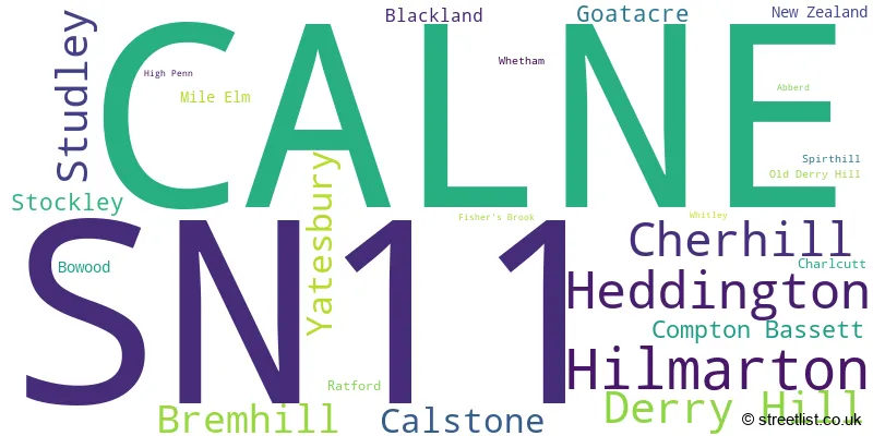
The primary settlement in the SN11 postcode district is Calne, located in the county of Wiltshire. Other significant settlements in the area include Bowood, Heddington, Mile Elm, Stockley, Whetham, Abberd, Blackland, Calstone, Cherhill, Compton Bassett, High Penn, Hilmarton, Yatesbury, Bremhill, Charlcutt, Derry Hill, Fisher's Brook, Goatacre, New Zealand, Old Derry Hill, Ratford, Spirthill, Studley, and Whitley. The main post town for this postcode district is Calne.
For the district SN11, we have data on 4 postcode sectors. Here's a breakdown: The sector SN11 0, covers Calne and Heddington in Wiltshire. The sector SN11 7 is non-geographic. It's often designated for PO Boxes, large organisations, or special services. The sector SN11 8, covers Calne in Wiltshire. The sector SN11 9, covers Calne in Wiltshire.

Map of the SN11 Postcode District
Explore the SN11 postcode district by using our free interactive map.

When it comes to local government, postal geography often disregards political borders. However, for a breakdown in the SN11 District: the district mostly encompasses the Wiltshire area with a total of 775 postcodes.
Recent House Sales in SN11
| Date | Price | Address |
|---|---|---|
| 13/10/2023 | £330,000 | Wansdyke Drive, Calne, SN11 0EW |
| 13/10/2023 | £210,000 | New Road, Calne, SN11 0JQ |
| 12/10/2023 | £230,000 | Newbury Avenue, Calne, SN11 9UN |
| 06/10/2023 | £153,500 | Highgrove Close, Calne, SN11 8NE |
| 05/10/2023 | £515,000 | Stickleback Road, Calne, SN11 9RB |
| 29/09/2023 | £305,000 | Springfield Drive, Calne, SN11 0UF |
| 08/09/2023 | £202,000 | Duncan Street, Calne, SN11 9BU |
| 01/09/2023 | £359,000 | Portland Way, Calne, SN11 8LJ |
| 01/09/2023 | £124,000 | London Road, Calne, SN11 0AB |
| 31/08/2023 | £235,000 | Highgrove Close, Calne, SN11 8NF |
Weather Forecast for SN11
Press Button to Show Forecast for Calne
| Time Period | Icon | Description | Temperature | Rain Probability | Wind |
|---|---|---|---|---|---|
| 06:00 to 09:00 | Heavy rain | 5.0°C (feels like 1.0°C) | 93.00% | NNW 13 mph | |
| 09:00 to 12:00 | Heavy rain | 5.0°C (feels like 2.0°C) | 82.00% | NW 11 mph | |
| 12:00 to 15:00 | Light rain | 8.0°C (feels like 5.0°C) | 52.00% | WNW 11 mph | |
| 15:00 to 18:00 | Cloudy | 11.0°C (feels like 9.0°C) | 8.00% | W 11 mph | |
| 18:00 to 21:00 | Sunny day | 10.0°C (feels like 8.0°C) | 2.00% | WSW 11 mph | |
| 21:00 to 00:00 | Clear night | 6.0°C (feels like 4.0°C) | 0.00% | SW 7 mph |
Press Button to Show Forecast for Calne
| Time Period | Icon | Description | Temperature | Rain Probability | Wind |
|---|---|---|---|---|---|
| 00:00 to 03:00 | Clear night | 5.0°C (feels like 3.0°C) | 0.00% | SSW 7 mph | |
| 03:00 to 06:00 | Partly cloudy (night) | 5.0°C (feels like 2.0°C) | 0.00% | S 7 mph | |
| 06:00 to 09:00 | Partly cloudy (day) | 7.0°C (feels like 4.0°C) | 4.00% | S 9 mph | |
| 09:00 to 12:00 | Cloudy | 12.0°C (feels like 9.0°C) | 7.00% | SSW 16 mph | |
| 12:00 to 15:00 | Cloudy | 13.0°C (feels like 10.0°C) | 9.00% | SSW 18 mph | |
| 15:00 to 18:00 | Cloudy | 13.0°C (feels like 10.0°C) | 7.00% | SSW 18 mph | |
| 18:00 to 21:00 | Partly cloudy (day) | 12.0°C (feels like 10.0°C) | 2.00% | S 13 mph | |
| 21:00 to 00:00 | Clear night | 10.0°C (feels like 7.0°C) | 2.00% | SSE 11 mph |
Press Button to Show Forecast for Calne
| Time Period | Icon | Description | Temperature | Rain Probability | Wind |
|---|---|---|---|---|---|
| 00:00 to 03:00 | Clear night | 8.0°C (feels like 6.0°C) | 1.00% | SSE 11 mph | |
| 03:00 to 06:00 | Clear night | 8.0°C (feels like 6.0°C) | 1.00% | SSE 9 mph | |
| 06:00 to 09:00 | Sunny day | 8.0°C (feels like 6.0°C) | 2.00% | SE 9 mph | |
| 09:00 to 12:00 | Partly cloudy (day) | 13.0°C (feels like 11.0°C) | 2.00% | SSE 13 mph | |
| 12:00 to 15:00 | Cloudy | 15.0°C (feels like 12.0°C) | 11.00% | SSE 13 mph | |
| 15:00 to 18:00 | Cloudy | 15.0°C (feels like 13.0°C) | 12.00% | SSE 13 mph | |
| 18:00 to 21:00 | Sunny day | 14.0°C (feels like 12.0°C) | 5.00% | SSE 9 mph | |
| 21:00 to 00:00 | Clear night | 10.0°C (feels like 9.0°C) | 4.00% | SE 7 mph |
Press Button to Show Forecast for Calne
| Time Period | Icon | Description | Temperature | Rain Probability | Wind |
|---|---|---|---|---|---|
| 00:00 to 03:00 | Cloudy | 9.0°C (feels like 8.0°C) | 7.00% | SE 4 mph | |
| 03:00 to 06:00 | Cloudy | 9.0°C (feels like 8.0°C) | 11.00% | E 2 mph | |
| 06:00 to 09:00 | Overcast | 10.0°C (feels like 9.0°C) | 13.00% | ENE 4 mph | |
| 09:00 to 12:00 | Cloudy | 13.0°C (feels like 12.0°C) | 11.00% | E 4 mph | |
| 12:00 to 15:00 | Light rain shower (day) | 15.0°C (feels like 14.0°C) | 36.00% | ESE 7 mph | |
| 15:00 to 18:00 | Cloudy | 16.0°C (feels like 15.0°C) | 17.00% | SE 7 mph | |
| 18:00 to 21:00 | Cloudy | 14.0°C (feels like 14.0°C) | 20.00% | SE 4 mph | |
| 21:00 to 00:00 | Cloudy | 12.0°C (feels like 12.0°C) | 22.00% | SSE 4 mph |
Where is the SN11 Postcode District?
The postcode district SN11 is located in Calne. Calne is surrounded by several nearby towns. To the south, there is Devizes, which is approximately 6.16 miles away. In the south-west direction, there is Melksham, which is about 8.28 miles away. Chippenham is located to the west of Calne, and it is approximately 9.34 miles away. Moving towards the north-west, you will find Malmesbury, which is around 11.64 miles away. Marlborough is located towards the east, at a distance of 11.65 miles. In the north-east direction, Swindon is situated, approximately 12.09 miles away. Finally, to the south-east, there is Pewsey, which is about 12.36 miles away. Moreover, the distance between Calne and the center of London is approximately 80.09 miles.
The district is within the post town of CALNE.
The sector has postcodes within the nation of England.
The SN11 Postcode District is in the Wiltshire region of Gloucestershire, Wiltshire and Bath/Bristol area within the South West (England).
| Postcode Sector | Delivery Office |
|---|---|
| SN11 0 | Calne Delivery Office |
| SN11 8 | Calne Delivery Office |
| SN11 9 | Calne Delivery Office |
| S | N | 1 | 1 | - | X | X | X |
| S | N | 1 | 1 | Space | Numeric | Letter | Letter |
Tourist Attractions within the Postcode Area
We found 1 visitor attractions within the SN11 postcode area
| Calne Heritage Centre |
|---|
| Visitor Centres |
| Heritage / Visitor Centre |
| View Calne Heritage Centre on Google Maps |
Current Monthly Rental Prices
| # Bedrooms | Min Price | Max Price | Avg Price |
|---|---|---|---|
| 1 | £675 | £695 | £688 |
| 2 | £725 | £850 | £792 |
| 3 | £1,100 | £1,285 | £1,184 |
| 4 | £1,500 | £17,333 | £9,417 |
| 6 | £3,500 | £3,500 | £3,500 |
Current House Prices
| # Bedrooms | Min Price | Max Price | Avg Price |
|---|---|---|---|
| £150,000 | £150,000 | £150,000 | |
| 1 | £115,000 | £336,950 | £172,152 |
| 2 | £115,000 | £799,950 | £270,944 |
| 3 | £200,000 | £765,000 | £345,371 |
| 4 | £320,000 | £1,500,000 | £489,014 |
| 5 | £350,000 | £795,000 | £579,667 |
| 6 | £675,000 | £2,500,000 | £1,405,000 |
| 7 | £1,200,000 | £1,200,000 | £1,200,000 |
Estate Agents who Operate in the SN11 District
| Logo | Name | Brand Name | Address | Contact Number | Total Properties |
|---|---|---|---|---|---|
 | Calne | Butfield Breach | 2 The Square, Calne, SN11 0BY | 01249 471030 | 77 |
 | Calne | Allen & Harris | 17 High Street, Calne, Wiltshire, SN11 0BS | 01249 477773 | 38 |
 | Calne | Atwell Martin | 6 Bank Row, Church Street, Calne, SN11 0SG | 01249 471382 | 37 |
 | Calne | Charles Faye Estate Agents | 25 High Street, Calne, SN11 0BS | 01249 471567 | 19 |
 | Chippenham | Strakers | 33/34 Market Place Chippenham Wiltshire, SN15 3HP | 01249 471398 | 14 |
| Type of Property | 2018 Average | 2018 Sales | 2017 Average | 2017 Sales | 2016 Average | 2016 Sales | 2015 Average | 2015 Sales |
|---|---|---|---|---|---|---|---|---|
| Detached | £369,428 | 199 | £389,413 | 180 | £341,764 | 162 | £318,584 | 150 |
| Semi-Detached | £253,325 | 167 | £253,671 | 141 | £232,223 | 140 | £218,409 | 104 |
| Terraced | £202,990 | 129 | £199,586 | 148 | £187,867 | 180 | £172,797 | 183 |
| Flats | £127,140 | 50 | £135,697 | 60 | £132,318 | 59 | £106,890 | 59 |