The SN13 postcode district is a postal district located in the SN Swindon postcode area with a population of 17,773 residents according to the 2021 England and Wales Census.
The area of the SN13 postcode district is 18.52 square miles which is 47.97 square kilometres or 11,854.66 acres.
Currently, the SN13 district has about 665 postcode units spread across 3 geographic postcode sectors.
Given that each sector allows for 400 unique postcode combinations, the district has a capacity of 1,200 postcodes. With 665 postcodes already in use, this leaves 535 units available.
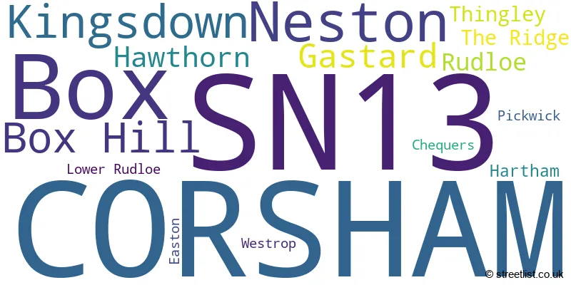
The largest settlement in the SN13 postal code is CORSHAM followed by Box, and Neston.
The SN13 Postcode shares a border with BA15 (BRADFORD-ON-AVON, Winsley, Lower Westwood), BA1 (BATH, Batheaston, Bathford), SN12 (MELKSHAM, Bowerhill, Seend), SN14 (CHIPPENHAM, Colerne, Marshfield) and SN15 (CHIPPENHAM, Lyneham, Bromham).
The primary settlement in the SN13 postcode district is Corsham, located in the county of Wiltshire, England. Other significant settlements within this postcode district include Box, Kingsdown, Gastard, and Neston. The most significant post town in this district is Corsham.
For the district SN13, we have data on 3 postcode sectors. Here's a breakdown: The sector SN13 0, covers Corsham in Wiltshire. The sector SN13 8, covers Box and Kingsdown and Box Hill in Wiltshire. The sector SN13 9, covers Corsham and Neston in Wiltshire.

Map of the SN13 Postcode District
Explore the SN13 postcode district by using our free interactive map.

When it comes to local government, postal geography often disregards political borders. However, for a breakdown in the SN13 District: the district mostly encompasses the Wiltshire area with a total of 666 postcodes.
Recent House Sales in SN13
| Date | Price | Address |
|---|---|---|
| 05/10/2023 | £400,000 | Birch Close, Corsham, SN13 9GQ |
| 03/10/2023 | £80,000 | Poynder Road, Corsham, SN13 9NB |
| 15/09/2023 | £193,000 | Priory Street, Corsham, SN13 0AS |
| 07/09/2023 | £395,000 | Rowan Lane, Corsham, SN13 9GN |
| 06/09/2023 | £615,000 | Chapel Knapp, Gastard, Corsham, SN13 9PS |
| 01/09/2023 | £325,000 | Pickwick, Corsham, SN13 0JB |
| 31/08/2023 | £490,000 | Hilly Fields, Corsham, SN13 9WG |
| 30/08/2023 | £390,000 | Purleigh Road, Corsham, SN13 9LJ |
| 29/08/2023 | £420,000 | Ethelred Place, Corsham, SN13 9NG |
| 25/08/2023 | £530,000 | Dovecote Drive, Corsham, SN13 9BN |
Weather Forecast for SN13
Press Button to Show Forecast for Corsham
| Time Period | Icon | Description | Temperature | Rain Probability | Wind |
|---|---|---|---|---|---|
| 18:00 to 21:00 | Overcast | 9.0°C (feels like 7.0°C) | 21.00% | E 7 mph | |
| 21:00 to 00:00 | Cloudy | 8.0°C (feels like 6.0°C) | 19.00% | ENE 7 mph |
Press Button to Show Forecast for Corsham
| Time Period | Icon | Description | Temperature | Rain Probability | Wind |
|---|---|---|---|---|---|
| 00:00 to 03:00 | Light rain | 7.0°C (feels like 4.0°C) | 54.00% | ENE 9 mph | |
| 03:00 to 06:00 | Light rain | 6.0°C (feels like 3.0°C) | 52.00% | ENE 11 mph | |
| 06:00 to 09:00 | Light rain | 5.0°C (feels like 2.0°C) | 51.00% | NE 11 mph | |
| 09:00 to 12:00 | Overcast | 6.0°C (feels like 3.0°C) | 47.00% | NE 11 mph | |
| 12:00 to 15:00 | Overcast | 8.0°C (feels like 5.0°C) | 15.00% | NE 11 mph | |
| 15:00 to 18:00 | Overcast | 10.0°C (feels like 7.0°C) | 16.00% | NE 11 mph | |
| 18:00 to 21:00 | Cloudy | 9.0°C (feels like 7.0°C) | 46.00% | NNE 11 mph | |
| 21:00 to 00:00 | Light rain | 8.0°C (feels like 4.0°C) | 57.00% | NNE 11 mph |
Press Button to Show Forecast for Corsham
| Time Period | Icon | Description | Temperature | Rain Probability | Wind |
|---|---|---|---|---|---|
| 00:00 to 03:00 | Heavy rain | 7.0°C (feels like 3.0°C) | 85.00% | NNE 13 mph | |
| 03:00 to 06:00 | Heavy rain | 6.0°C (feels like 2.0°C) | 86.00% | N 13 mph | |
| 06:00 to 09:00 | Heavy rain | 6.0°C (feels like 2.0°C) | 87.00% | N 13 mph | |
| 09:00 to 12:00 | Heavy rain | 6.0°C (feels like 3.0°C) | 80.00% | NNW 11 mph | |
| 12:00 to 15:00 | Cloudy | 9.0°C (feels like 6.0°C) | 20.00% | WNW 9 mph | |
| 15:00 to 18:00 | Cloudy | 10.0°C (feels like 8.0°C) | 14.00% | W 9 mph | |
| 18:00 to 21:00 | Sunny day | 10.0°C (feels like 8.0°C) | 4.00% | WSW 9 mph | |
| 21:00 to 00:00 | Clear night | 7.0°C (feels like 5.0°C) | 1.00% | WSW 7 mph |
Press Button to Show Forecast for Corsham
| Time Period | Icon | Description | Temperature | Rain Probability | Wind |
|---|---|---|---|---|---|
| 00:00 to 03:00 | Clear night | 5.0°C (feels like 3.0°C) | 1.00% | SW 4 mph | |
| 03:00 to 06:00 | Clear night | 4.0°C (feels like 2.0°C) | 1.00% | S 7 mph | |
| 06:00 to 09:00 | Sunny day | 6.0°C (feels like 3.0°C) | 1.00% | SSE 7 mph | |
| 09:00 to 12:00 | Cloudy | 11.0°C (feels like 8.0°C) | 4.00% | S 13 mph | |
| 12:00 to 15:00 | Cloudy | 13.0°C (feels like 10.0°C) | 7.00% | S 13 mph | |
| 15:00 to 18:00 | Cloudy | 13.0°C (feels like 10.0°C) | 6.00% | S 13 mph | |
| 18:00 to 21:00 | Sunny day | 12.0°C (feels like 9.0°C) | 4.00% | S 11 mph | |
| 21:00 to 00:00 | Clear night | 9.0°C (feels like 6.0°C) | 2.00% | SE 9 mph |
Press Button to Show Forecast for Corsham
| Time Period | Icon | Description | Temperature | Rain Probability | Wind |
|---|---|---|---|---|---|
| 00:00 to 03:00 | Clear night | 8.0°C (feels like 5.0°C) | 2.00% | SE 9 mph | |
| 03:00 to 06:00 | Clear night | 8.0°C (feels like 5.0°C) | 1.00% | SE 9 mph | |
| 06:00 to 09:00 | Sunny day | 8.0°C (feels like 6.0°C) | 5.00% | SE 9 mph | |
| 09:00 to 12:00 | Partly cloudy (day) | 13.0°C (feels like 10.0°C) | 9.00% | SE 11 mph | |
| 12:00 to 15:00 | Partly cloudy (day) | 14.0°C (feels like 12.0°C) | 10.00% | SE 13 mph | |
| 15:00 to 18:00 | Cloudy | 15.0°C (feels like 12.0°C) | 16.00% | SE 11 mph | |
| 18:00 to 21:00 | Partly cloudy (day) | 13.0°C (feels like 12.0°C) | 8.00% | SE 9 mph | |
| 21:00 to 00:00 | Cloudy | 10.0°C (feels like 9.0°C) | 8.00% | ESE 7 mph |
Where is the SN13 Postcode District?
The data shows that the postcode district for SN13 is located in Corsham. Corsham is a district town that is nearby several other towns. To the North, there is Chippenham which is approximately 2.85 miles away. To the South East, there is Melksham which is approximately 4.65 miles away. To the South, there is Bradford-on-Avon which is approximately 5.67 miles away. To the West, there is Bath which is approximately 7.84 miles away. To the North West, there is Badminton which is approximately 8.64 miles away. Additionally, the distance from the postcode district to the centre of London is approximately 90.12 miles.
The district is within the post town of CORSHAM.
The sector has postcodes within the nation of England.
The SN13 Postcode District is in the Wiltshire region of Gloucestershire, Wiltshire and Bath/Bristol area within the South West (England).
| Postcode Sector | Delivery Office |
|---|---|
| SN13 0 | Corsham Delivery Office |
| SN13 0 | Chippenham Delivery Office |
| SN13 8 | Corsham Delivery Office |
| SN13 8 | Chippenham Delivery Office |
| SN13 9 | Corsham Delivery Office |
| SN13 9 | Chippenham Delivery Office |
| S | N | 1 | 3 | - | X | X | X |
| S | N | 1 | 3 | Space | Numeric | Letter | Letter |
Current Monthly Rental Prices
| # Bedrooms | Min Price | Max Price | Avg Price |
|---|---|---|---|
| 1 | £895 | £900 | £898 |
| 3 | £1,175 | £2,800 | £1,723 |
| 4 | £1,850 | £1,850 | £1,850 |
| 5 | £2,750 | £2,750 | £2,750 |
Current House Prices
| # Bedrooms | Min Price | Max Price | Avg Price |
|---|---|---|---|
| 1 | £100,000 | £190,000 | £146,250 |
| 2 | £80,000 | £550,000 | £324,929 |
| 3 | £190,000 | £1,250,000 | £468,333 |
| 4 | £300,000 | £1,950,000 | £765,476 |
| 5 | £425,000 | £1,250,000 | £704,158 |
| 6 | £1,250,000 | £1,250,000 | £1,250,000 |
| 10 | £9,750,000 | £9,750,000 | £9,750,000 |
Estate Agents who Operate in the SN13 District
| Logo | Name | Brand Name | Address | Contact Number | Total Properties |
|---|---|---|---|---|---|
 | Corsham | Hunter French | 3 High Street, Corsham, SN13 0ES | 01249 471430 | 21 |
 | Corsham | Allen & Harris | 28 High Street, Corsham, Wiltshire, SN13 0HB | 01249 479065 | 19 |
 | Corsham | Strakers | 6 High Street Corsham Wiltshire, SN13 0HB | 01249 471116 | 14 |
 | Corsham | David Ingram Residential | 7 High Street Corsham SN13 0ES | 01249 471042 | 6 |
 | South West | eXp UK | 1 Northumberland Avenue, Trafalgar Square, London, WC2N 5BW | 03304 609968 | 3 |
| Type of Property | 2018 Average | 2018 Sales | 2017 Average | 2017 Sales | 2016 Average | 2016 Sales | 2015 Average | 2015 Sales |
|---|---|---|---|---|---|---|---|---|
| Detached | £437,830 | 162 | £471,397 | 136 | £455,686 | 91 | £426,119 | 113 |
| Semi-Detached | £298,715 | 108 | £301,160 | 89 | £280,270 | 70 | £255,289 | 90 |
| Terraced | £242,721 | 76 | £245,650 | 77 | £244,105 | 73 | £216,015 | 81 |
| Flats | £188,523 | 33 | £250,319 | 58 | £282,533 | 81 | £317,080 | 53 |