The SR4 postcode district is a postal district located in the SR Sunderland postcode area with a population of 41,644 residents according to the 2021 England and Wales Census.
The area of the SR4 postcode district is 5.85 square miles which is 15.14 square kilometres or 3,741.50 acres.
Currently, the SR4 district has about 952 postcode units spread across 5 geographic postcode sectors.
Given that each sector allows for 400 unique postcode combinations, the district has a capacity of 2,000 postcodes. With 952 postcodes already in use, this leaves 1048 units available.
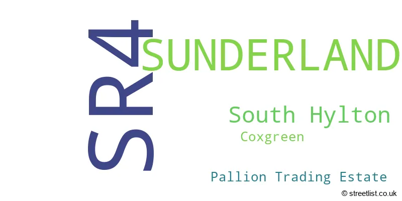
The largest settlements in the SR4 postal code are SUNDERLAND and South Hylton.
The SR4 Postcode shares a border with DH4 (HOUGHTON LE SPRING, West Rainton, Penshaw), NE38 (WASHINGTON), SR3 (SUNDERLAND, New Silksworth, East Herrington), SR5 (SUNDERLAND, Castletown, Southwick), SR1 (SUNDERLAND) and SR2 (SUNDERLAND, Ryhope).
The primary settlement in the SR4 postcode district is Sunderland, located in the county of Tyne & Wear, England. Other significant settlements in this district include South Hylton and Coxgreen. Sunderland is also the main post town in this district.
For the district SR4, we have data on 5 postcode sectors. Here's a breakdown: The sector SR4 0, covers Sunderland and South Hylton in Tyne & Wear. The sector SR4 6, covers Sunderland in Tyne & Wear. The sector SR4 7, covers Sunderland in Tyne & Wear. The sector SR4 8, covers Sunderland in Tyne & Wear. The sector SR4 9, covers Sunderland in Tyne & Wear.

Map of the SR4 Postcode District
Explore the SR4 postcode district by using our free interactive map.

When it comes to local government, postal geography often disregards political borders. However, for a breakdown in the SR4 District: the district mostly encompasses the Sunderland District (B) area with a total of 957 postcodes.
Recent House Sales in SR4
| Date | Price | Address |
|---|---|---|
| 24/10/2023 | £39,950 | Ancona Street, Sunderland, SR4 6TJ |
| 05/10/2023 | £50,000 | Warennes Street, Sunderland, SR4 6PA |
| 02/10/2023 | £35,000 | Millburn Street, Sunderland, SR4 6AU |
| 02/10/2023 | £45,000 | Exeter Street, Sunderland, SR4 6QX |
| 29/09/2023 | £156,000 | Kirkwood Avenue, Sunderland, SR4 9NE |
| 29/09/2023 | £160,000 | Foxton Close, Sunderland, SR4 0BE |
| 21/09/2023 | £60,000 | Brunton Terrace, Sunderland, SR4 7DN |
| 18/09/2023 | £95,000 | Gainsborough Square, Sunderland, SR4 8HZ |
| 15/09/2023 | £215,000 | Belmont Road, Sunderland, SR4 7SY |
| 15/09/2023 | £37,500 | Romford Street, Sunderland, SR4 6LX |
Weather Forecast for SR4
Press Button to Show Forecast for South Hylton
| Time Period | Icon | Description | Temperature | Rain Probability | Wind |
|---|---|---|---|---|---|
| 09:00 to 12:00 | Cloudy | 7.0°C (feels like 5.0°C) | 5.00% | ENE 7 mph | |
| 12:00 to 15:00 | Cloudy | 8.0°C (feels like 5.0°C) | 8.00% | ENE 9 mph | |
| 15:00 to 18:00 | Cloudy | 8.0°C (feels like 5.0°C) | 9.00% | ENE 9 mph | |
| 18:00 to 21:00 | Cloudy | 7.0°C (feels like 5.0°C) | 11.00% | ENE 9 mph | |
| 21:00 to 00:00 | Partly cloudy (night) | 7.0°C (feels like 4.0°C) | 7.00% | ENE 7 mph |
Press Button to Show Forecast for South Hylton
| Time Period | Icon | Description | Temperature | Rain Probability | Wind |
|---|---|---|---|---|---|
| 00:00 to 03:00 | Cloudy | 6.0°C (feels like 4.0°C) | 7.00% | NNE 7 mph | |
| 03:00 to 06:00 | Cloudy | 6.0°C (feels like 3.0°C) | 7.00% | NNE 9 mph | |
| 06:00 to 09:00 | Cloudy | 6.0°C (feels like 3.0°C) | 9.00% | N 11 mph | |
| 09:00 to 12:00 | Light rain | 7.0°C (feels like 3.0°C) | 47.00% | N 13 mph | |
| 12:00 to 15:00 | Light rain | 8.0°C (feels like 4.0°C) | 50.00% | NNW 13 mph | |
| 15:00 to 18:00 | Light rain | 9.0°C (feels like 6.0°C) | 45.00% | NNW 11 mph | |
| 18:00 to 21:00 | Cloudy | 9.0°C (feels like 7.0°C) | 11.00% | WNW 7 mph | |
| 21:00 to 00:00 | Clear night | 7.0°C (feels like 5.0°C) | 3.00% | SW 9 mph |
Press Button to Show Forecast for South Hylton
| Time Period | Icon | Description | Temperature | Rain Probability | Wind |
|---|---|---|---|---|---|
| 00:00 to 03:00 | Clear night | 6.0°C (feels like 3.0°C) | 1.00% | SW 9 mph | |
| 03:00 to 06:00 | Clear night | 5.0°C (feels like 2.0°C) | 0.00% | SSW 9 mph | |
| 06:00 to 09:00 | Sunny day | 6.0°C (feels like 3.0°C) | 1.00% | S 9 mph | |
| 09:00 to 12:00 | Partly cloudy (day) | 10.0°C (feels like 8.0°C) | 2.00% | S 11 mph | |
| 12:00 to 15:00 | Cloudy | 13.0°C (feels like 10.0°C) | 5.00% | S 13 mph | |
| 15:00 to 18:00 | Cloudy | 14.0°C (feels like 11.0°C) | 6.00% | S 13 mph | |
| 18:00 to 21:00 | Cloudy | 13.0°C (feels like 10.0°C) | 6.00% | SSE 13 mph | |
| 21:00 to 00:00 | Partly cloudy (night) | 10.0°C (feels like 8.0°C) | 3.00% | SE 11 mph |
Press Button to Show Forecast for South Hylton
| Time Period | Icon | Description | Temperature | Rain Probability | Wind |
|---|---|---|---|---|---|
| 00:00 to 03:00 | Partly cloudy (night) | 9.0°C (feels like 6.0°C) | 1.00% | SSE 11 mph | |
| 03:00 to 06:00 | Clear night | 8.0°C (feels like 5.0°C) | 1.00% | SE 9 mph | |
| 06:00 to 09:00 | Sunny day | 8.0°C (feels like 6.0°C) | 3.00% | SE 9 mph | |
| 09:00 to 12:00 | Partly cloudy (day) | 11.0°C (feels like 8.0°C) | 6.00% | ESE 11 mph | |
| 12:00 to 15:00 | Cloudy | 12.0°C (feels like 10.0°C) | 12.00% | E 11 mph | |
| 15:00 to 18:00 | Cloudy | 12.0°C (feels like 9.0°C) | 14.00% | E 11 mph | |
| 18:00 to 21:00 | Cloudy | 11.0°C (feels like 9.0°C) | 15.00% | E 11 mph | |
| 21:00 to 00:00 | Cloudy | 9.0°C (feels like 8.0°C) | 11.00% | E 7 mph |
Where is the SR4 Postcode District?
The postcode district SR4 is located in the town of Sunderland, which is a district town. It is surrounded by several nearby towns, including Washington to the west, East Boldon to the north, Houghton Le Spring to the southwest, Hebburn to the northwest, and Seaham to the southeast. The distance from SR4 to the center of London is approximately 240.65 miles.
The district is within the post town of SUNDERLAND.
The sector has postcodes within the nation of England.
The SR4 Postcode District is in the Sunderland region of Northumberland and Tyne and Wear within the North East (England).
| Postcode Sector | Delivery Office |
|---|---|
| SR4 0 | Sunderland Delivery Office |
| SR4 6 | Sunderland Delivery Office |
| SR4 7 | Sunderland Delivery Office |
| SR4 8 | Sunderland Delivery Office |
| SR4 9 | Sunderland Delivery Office |
| S | R | 4 | - | X | X | X |
| S | R | 4 | Space | Numeric | Letter | Letter |
Tourist Attractions within the Postcode Area
We found 1 visitor attractions within the SR4 postcode area
| Penshaw Monument |
|---|
| Historic Properties |
| Historic Monument / Archaeological Site |
| View Penshaw Monument on Google Maps |
Current Monthly Rental Prices
| # Bedrooms | Min Price | Max Price | Avg Price |
|---|---|---|---|
| 1 | £395 | £395 | £395 |
| 2 | £495 | £600 | £549 |
| 3 | £750 | £995 | £873 |
| 4 | £950 | £950 | £950 |
Current House Prices
| # Bedrooms | Min Price | Max Price | Avg Price |
|---|---|---|---|
| 1 | £43,500 | £95,000 | £65,863 |
| 2 | £28,000 | £241,995 | £117,046 |
| 3 | £57,000 | £325,000 | £147,824 |
| 4 | £120,000 | £580,000 | £243,891 |
| 5 | £187,000 | £595,000 | £459,000 |
Estate Agents who Operate in the SR4 District
| Logo | Name | Brand Name | Address | Contact Number | Total Properties |
|---|---|---|---|---|---|
 | Sunderland | Good Life Homes Sales and Lettings | 46 Windsor Terrace, Ryhope Road, Grangetown, Sunderland, SR2 9QF | 0191 625 0272 | 21 |
 | Sunderland | Peter Heron Residential Sales and Lettings | City Office, 20 Fawcett Street, Sunderland, SR1 1RH | 0191 607 7211 | 21 |
 | Sunderland | Dowen | 21, Athenaeum Street, Sunderland, SR1 1DH | 0191 625 0947 | 15 |
 | Sunderland | YOUR MOVE Chris Stonock | 4A Athenaeum Street, Sunderland, SR1 1QX | 0191 625 0175 | 13 |
 | Sunderland | Andrew Craig | 9 Frederick Street, Sunderland, SR1 1NA | 0191 625 0130 | 11 |
| Type of Property | 2018 Average | 2018 Sales | 2017 Average | 2017 Sales | 2016 Average | 2016 Sales | 2015 Average | 2015 Sales |
|---|---|---|---|---|---|---|---|---|
| Detached | £174,882 | 58 | £179,001 | 43 | £177,178 | 52 | £168,843 | 44 |
| Semi-Detached | £117,811 | 255 | £113,845 | 197 | £111,792 | 181 | £117,687 | 191 |
| Terraced | £83,392 | 299 | £84,038 | 247 | £86,260 | 263 | £86,160 | 263 |
| Flats | £59,829 | 17 | £72,911 | 23 | £54,098 | 15 | £61,722 | 9 |