This section of the site is all about the SS Postcode area, also known as the Southend-on-Sea Postal Area. Explore links to the next level to learn more about specific postcode districts such as SS0.
The SS postcode area represents a group of postal districts in the Southend-on-Sea area of the United Kingdom. The area code SS stands for the letters s and s in Southend-on Sea. SS has a population of 518,677 and covers an area of 385,773 hectares. Fun fact: 0.80% of the population of Great Britain lives in this area.
The postcode area falls within the following counties: Essex (100.00%).
Post Towns and Postcode Districts for the SS Postcode
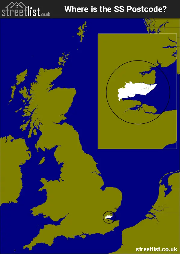
Where is the SS Postcode Area?
The SS Southend-on-Sea Postcode is in the East of England. The postal area borders the following neighbouring postal areas: CM - Chelmsford, RM - Romford and ME - Medway, It also borders The Thames Estuary,
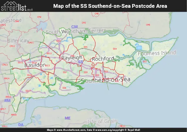
Map of the SS Southend-on-Sea Postcode Area
Explore the SS Southend-on-Sea postcode area by using our interactive map.
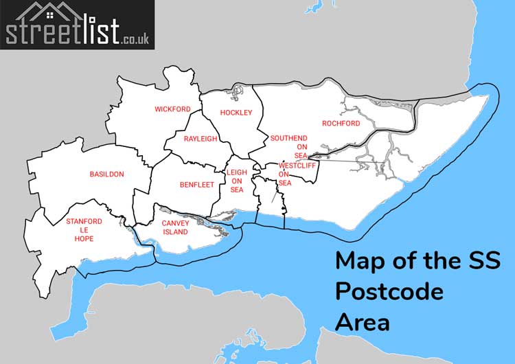
Postcode Districts within the SS Southend-on-Sea Postcode Area
There are 17 postcode districts within the Southend-on-Sea postcode area
A map showing the boundary of in relation to other areas
There are 8 towns within the Southend-on-Sea postcode area.
| Unit | Area² |
|---|---|
| Hectares | 385,773² |
| Miles | 1,489² |
| Feet | 41,524,219,947² |
| Kilometres | 3,858² |
Postal Delivery Offices serving the SS Southend-on-Sea Postcode Area
- Basildon Delivery Office
- Benfleet Delivery Office
- Canew Delivery Office N Scale Payment Delivery Office
- Canvey Island Delivery Office
- Great Wakering Scale Payment Delivery Office
- Hockley (ss) Delivery Office
- Leigh On Sea Delivery Office
- Rayleigh Delivery Office
- Rochford Delivery Office
- Shoeburyness Delivery Office
- Southend-on-sea Delivery Office
- Stanford Le Hope Delivery Office
- Wickford Delivery Office