
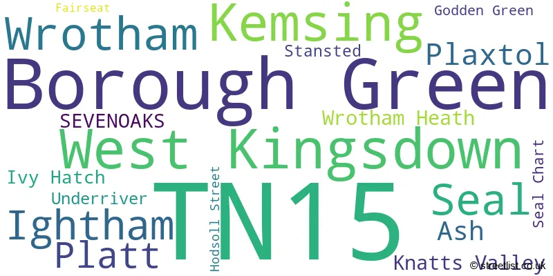
Map of the Postcode District
Explore the postcode district by using our interactive map.
Circles represent recorded crime; the larger the circle, the higher the crime rates.
Your support helps keep this site running!
If you enjoy using this website, consider buying me a coffee to help cover hosting costs.
The postcode district located in the TN Tonbridge postal area , TN15 has a population of 25,728 residents according to the 2021 England and Wales Census.
The area of the district is 43.59 square miles (112.89 square kilometers or 27,896.48 acres).
Where is the TN15 District?
To give you an idea where the district is located we have created the following table showing nearby towns.
Nearest Towns to TN15
| Town | Distance (miles) | Direction |
|---|---|---|
| Sevenoaks | 4.20 | WSW |
| West Malling | 5.82 | E |
| Snodland | 7.51 | ENE |
| Tonbridge | 7.57 | S |
| Swanley | 7.95 | NNW |
| Westerham | 9.13 | WSW |
| Paddock Wood | 9.70 | SSE |
| Southborough | 9.81 | S |
| Northfleet | 9.97 | NNE |
| Swanscombe | 10.45 | N |
| Gravesend | 10.54 | NNE |
| Dartford | 10.72 | N |
| Maidstone | 10.84 | E |
| Rochester | 11.61 | ENE |
| Edenbridge | 11.67 | SW |
| Royal Tunbridge Wells | 11.67 | S |
| Tilbury | 11.68 | NNE |
| Chatham | 12.27 | ENE |
| Grays | 12.46 | N |
| Oxted | 12.46 | WSW |
The post town for this district is SEVENOAKS.
Postcode Information for District TN15 (Total Geographical Postcodes: 1017)
| Location | Post Town | Sector | Number of Postcodes |
|---|---|---|---|
| Borough Green | SEVENOAKS | TN15 8 | 159 |
| West Kingsdown | SEVENOAKS | TN15 6 | 139 |
| Kemsing | SEVENOAKS | TN15 6 | 126 |
| Wrotham | SEVENOAKS | TN15 7 | 98 |
| Seal | SEVENOAKS | TN15 0 | 92 |
| Ightham | SEVENOAKS | TN15 9 | 84 |
| Platt | SEVENOAKS | TN15 8 | 61 |
| Ash | SEVENOAKS | TN15 7 | 42 |
| Plaxtol | SEVENOAKS | TN15 0 | 37 |
| Knatts Valley | SEVENOAKS | TN15 6 | 28 |
| Wrotham Heath | SEVENOAKS | TN15 7 | 22 |
| SEVENOAKS | SEVENOAKS | TN15 0 | 22 |
| Ivy Hatch | SEVENOAKS | TN15 0 | 20 |
| Stansted | SEVENOAKS | TN15 7 | 20 |
| Underriver | SEVENOAKS | TN15 0 | 16 |
| Seal Chart | SEVENOAKS | TN15 0 | 14 |
| Godden Green | SEVENOAKS | TN15 0 | 12 |
| Fairseat | SEVENOAKS | TN15 7 | 10 |
| Hodsoll Street | SEVENOAKS | TN15 7 | 9 |
| Wrotham Heath | SEVENOAKS | TN15 8 | 4 |
| SEVENOAKS | SEVENOAKS | TN15 8 | 1 |
| SEVENOAKS | SEVENOAKS | TN15 7 | 1 |
Retail and Shopping in TN15
Street
Town
Locality
Number of Shops
Central Postcode
View on Google Maps
HIGH STREET
SEVENOAKS
BOROUGH GREEN
19
TN15 8BT
View on Google Maps
WESTERN ROAD
SEVENOAKS
BOROUGH GREEN
15
TN15 8AH
View on Google Maps
HEVER ROAD
SEVENOAKS
WEST KINGSDOWN
10
TN15 6HD
View on Google Maps
HIGH STREET
SEVENOAKS
SEAL
8
TN15 0AN
View on Google Maps
DYNES ROAD
SEVENOAKS
KEMSING
7
TN15 6RE
View on Google Maps
FAWKHAM ROAD
SEVENOAKS
WEST KINGSDOWN
6
TN15 6JP
View on Google Maps
| Street | Town | Locality | Number of Shops | Central Postcode | View on Google Maps |
|---|---|---|---|---|---|
| HIGH STREET | SEVENOAKS | BOROUGH GREEN | 19 | TN15 8BT | View on Google Maps |
| WESTERN ROAD | SEVENOAKS | BOROUGH GREEN | 15 | TN15 8AH | View on Google Maps |
| HEVER ROAD | SEVENOAKS | WEST KINGSDOWN | 10 | TN15 6HD | View on Google Maps |
| HIGH STREET | SEVENOAKS | SEAL | 8 | TN15 0AN | View on Google Maps |
| DYNES ROAD | SEVENOAKS | KEMSING | 7 | TN15 6RE | View on Google Maps |
| FAWKHAM ROAD | SEVENOAKS | WEST KINGSDOWN | 6 | TN15 6JP | View on Google Maps |
The primary settlement in the TN15 postcode district is Sevenoaks, located in the county of Kent, England. Other significant settlements in this district include Godden Green, Ivy Hatch, Plaxtol, Seal, Seal Chart, Underriver, Kemsing, Knatts Valley, West Kingsdown, Ash, Fairseat, Hodsoll Street, Stansted, Wrotham, Borough Green, and Platt. The most significant Postal Town in this district is Sevenoaks.
When it comes to local government, postal geography often disregards political borders. However, this district intersects the following councils: the district mostly encompasses the Tonbridge and Malling District (B) (478 postal codes), and finally, the Sevenoaks District area (458 postal codes).
The largest settlement in the TN15 postal code is West Kingsdown followed by Borough Green, and KEMSING.
The TN15 Postcode shares a border with DA3 (LONGFIELD, New Ash Green, Hartley), DA4 (South Darenth, EYNSFORD, Sutton At Hone), ME18 (Wateringbury, Yalding, Mereworth), ME19 (Kings Hill, East Malling, WEST MALLING), TN11 (Hildenborough, Hadlow, TONBRIDGE) and TN14 (OTFORD, SEVENOAKS, HALSTEAD).


Schools in the Sector
Seal Church of England Voluntary Controlled Primary School
Phase: Primary
Address: Zambra Way , Seal , Sevenoaks
Postcode: TN15 0DJ
Headteacher: Mrs Lorraine Butler (Headteacher)
Ofsted Rating: Good
Knole Development Centre
Phase: Not applicable
Address: Cygnet Hospital , Godden Green , Sevenoaks
Postcode: TN15 0JR
Headteacher: Mrs Wendy Day ()
Ofsted Rating: Good
St Lawrence Church of England Primary School
Phase: Primary
Address: Church Road , Stone Street , Sevenoaks
Postcode: TN15 0LN
Headteacher: Mr Daniel Eaton (Headteacher)
Ofsted Rating: Good
Plaxtol Primary School
Phase: Primary
Address: School Lane , Plaxtol , Sevenoaks
Postcode: TN15 0QD
Headteacher: Mrs Claire Rowley (Headteacher)
Ofsted Rating: Good
Birtley House Independent School
Phase: Not applicable
Address: Fawkham Road , West Kingsdown , Sevenoaks
Postcode: TN15 6AY
Headteacher: Mrs Emma Palmer ()
Ofsted Rating: Good
St. Edmund's Church of England Primary School
Phase: Primary
Address: Fawkham Road , West Kingsdown , Sevenoaks
Postcode: TN15 6JP
Headteacher: Mr Benjamin Hulme (Headteacher)
Ofsted Rating: Good
Kemsing Primary School
Phase: Primary
Address: West End , Kemsing , Sevenoaks
Postcode: TN15 6PU
Headteacher: Mr Tom Hardwick (Headteacher)
Ofsted Rating: Good
St George's Church of England Voluntary Controlled Primary School
Phase: Primary
Address: Old London Road , Wrotham , Sevenoaks
Postcode: TN15 7DL
Headteacher: Mrs Elizabeth Rye (Headteacher)
Ofsted Rating: Good
Grange Park School
Phase: Not applicable
Address: Borough Green Road , Wrotham , Sevenoaks
Postcode: TN15 7RD
Headteacher: Miss Renukah Atwell (Headteacher)
Ofsted Rating: Good
Wrotham School
Phase: Secondary
Address: Borough Green Road , Wrotham , Sevenoaks
Postcode: TN15 7RD
Headteacher: Mr Michael Cater (Executive Headteacher)
Ofsted Rating: Good
Platt Church of England Voluntary Aided Primary School
Phase: Primary
Address: Platinum Way , St Mary's Platt , Sevenoaks
Postcode: TN15 8FH
Headteacher: Mrs Emma Smith (Headteacher)
Ofsted Rating: Good
Borough Green Primary School
Phase: Primary
Address: School Approach , Borough Green , Sevenoaks
Postcode: TN15 8JZ
Headteacher: Mr Ben Cooper (Headteacher)
Ofsted Rating: Good
Ightham Primary School
Phase: Primary
Address: Oldbury Lane , Ightham , Sevenoaks
Postcode: TN15 9DD
Headteacher: Mr David Sherhod (Head Teacher)
Ofsted Rating: Outstanding
Stations in the Sector
Borough Green & Wrotham
CRS Code: BRG
Operator: SE
Line: Maidstone Line
Company: Southeastern
Kemsing
CRS Code: KMS
Operator: SE
Line: Maidstone Line
Company: Southeastern
Accessable Motorway Junctions
M20 J2
Average Driving Time from within the district: 6.60
Average Driving Distance: 4.12
Number of Postcodes that can access the Motorway Junction: 938
M26 J2A
Average Driving Time from within the district: 6.86
Average Driving Distance: 4.24
Number of Postcodes that can access the Motorway Junction: 938
M20 J4
Average Driving Time from within the district: 8.40
Average Driving Distance: 6.56
Number of Postcodes that can access the Motorway Junction: 483
M25 J3
Average Driving Time from within the district: 9.47
Average Driving Distance: 6.46
Number of Postcodes that can access the Motorway Junction: 304
M20 J5
Average Driving Time from within the district: 9.48
Average Driving Distance: 8.36
Number of Postcodes that can access the Motorway Junction: 118
M25 J2
Average Driving Time from within the district: 9.96
Average Driving Distance: 7.70
Number of Postcodes that can access the Motorway Junction: 80
M25 J5
Average Driving Time from within the district: 12.06
Average Driving Distance: 7.00
Number of Postcodes that can access the Motorway Junction: 603
M2 J1
Average Driving Time from within the district: 15.24
Average Driving Distance: 8.36
Number of Postcodes that can access the Motorway Junction: 11
Weather Forecast for Kemsing
| Time Period | Icon | Description | Temperature | Rain Probability | Wind |
|---|---|---|---|---|---|
| 12:00 to 15:00 | Cloudy | 14.0°C (feels like 12.0°C) | 6.00% | SW 11 mph | |
| 15:00 to 18:00 | Cloudy | 14.0°C (feels like 13.0°C) | 9.00% | SW 9 mph | |
| 18:00 to 21:00 | Clear night | 12.0°C (feels like 11.0°C) | 1.00% | SW 4 mph | |
| 21:00 to 00:00 | Partly cloudy (night) | 11.0°C (feels like 10.0°C) | 3.00% | SW 4 mph |
| Time Period | Icon | Description | Temperature | Rain Probability | Wind |
|---|---|---|---|---|---|
| 00:00 to 03:00 | Fog | 9.0°C (feels like 9.0°C) | 17.00% | SW 2 mph | |
| 03:00 to 06:00 | Fog | 8.0°C (feels like 8.0°C) | 16.00% | S 4 mph | |
| 06:00 to 09:00 | Fog | 9.0°C (feels like 8.0°C) | 17.00% | S 4 mph | |
| 09:00 to 12:00 | Mist | 11.0°C (feels like 11.0°C) | 13.00% | SSE 4 mph | |
| 12:00 to 15:00 | Cloudy | 15.0°C (feels like 14.0°C) | 5.00% | S 7 mph | |
| 15:00 to 18:00 | Partly cloudy (day) | 15.0°C (feels like 14.0°C) | 5.00% | S 7 mph | |
| 18:00 to 21:00 | Clear night | 11.0°C (feels like 10.0°C) | 0.00% | SSE 7 mph | |
| 21:00 to 00:00 | Clear night | 10.0°C (feels like 9.0°C) | 0.00% | SE 7 mph |
| Time Period | Icon | Description | Temperature | Rain Probability | Wind |
|---|---|---|---|---|---|
| 00:00 to 03:00 | Clear night | 10.0°C (feels like 8.0°C) | 0.00% | SE 7 mph | |
| 03:00 to 06:00 | Clear night | 10.0°C (feels like 8.0°C) | 1.00% | SE 7 mph | |
| 06:00 to 09:00 | Clear night | 9.0°C (feels like 8.0°C) | 1.00% | SE 7 mph | |
| 09:00 to 12:00 | Partly cloudy (day) | 12.0°C (feels like 10.0°C) | 1.00% | SSE 11 mph | |
| 12:00 to 15:00 | Sunny day | 15.0°C (feels like 13.0°C) | 2.00% | S 11 mph | |
| 15:00 to 18:00 | Partly cloudy (day) | 15.0°C (feels like 13.0°C) | 2.00% | S 11 mph | |
| 18:00 to 21:00 | Partly cloudy (night) | 13.0°C (feels like 12.0°C) | 2.00% | SSE 9 mph | |
| 21:00 to 00:00 | Partly cloudy (night) | 14.0°C (feels like 12.0°C) | 6.00% | S 11 mph |
| Time Period | Icon | Description | Temperature | Rain Probability | Wind |
|---|---|---|---|---|---|
| 00:00 to 03:00 | Cloudy | 14.0°C (feels like 12.0°C) | 19.00% | S 11 mph | |
| 03:00 to 06:00 | Light rain shower (night) | 13.0°C (feels like 11.0°C) | 41.00% | SSW 11 mph | |
| 06:00 to 09:00 | Light rain shower (night) | 11.0°C (feels like 10.0°C) | 33.00% | SSW 9 mph | |
| 09:00 to 12:00 | Partly cloudy (day) | 12.0°C (feels like 10.0°C) | 7.00% | SSW 9 mph | |
| 12:00 to 15:00 | Light rain shower (day) | 13.0°C (feels like 11.0°C) | 36.00% | SW 13 mph | |
| 15:00 to 18:00 | Light rain shower (day) | 12.0°C (feels like 10.0°C) | 33.00% | SW 11 mph | |
| 18:00 to 21:00 | Clear night | 10.0°C (feels like 8.0°C) | 2.00% | SW 9 mph | |
| 21:00 to 00:00 | Clear night | 9.0°C (feels like 7.0°C) | 1.00% | SW 9 mph |
| Time Period | Icon | Description | Temperature | Rain Probability | Wind |
|---|---|---|---|---|---|
| 00:00 to 03:00 | Clear night | 8.0°C (feels like 6.0°C) | 1.00% | SW 9 mph | |
| 03:00 to 06:00 | Clear night | 8.0°C (feels like 5.0°C) | 2.00% | SW 9 mph | |
| 06:00 to 09:00 | Partly cloudy (night) | 8.0°C (feels like 5.0°C) | 6.00% | SW 9 mph | |
| 09:00 to 12:00 | Partly cloudy (day) | 10.0°C (feels like 8.0°C) | 10.00% | SW 9 mph | |
| 12:00 to 15:00 | Partly cloudy (day) | 12.0°C (feels like 10.0°C) | 11.00% | SW 13 mph | |
| 15:00 to 18:00 | Partly cloudy (day) | 12.0°C (feels like 10.0°C) | 13.00% | SW 11 mph | |
| 18:00 to 21:00 | Cloudy | 11.0°C (feels like 9.0°C) | 11.00% | SW 11 mph | |
| 21:00 to 00:00 | Cloudy | 11.0°C (feels like 9.0°C) | 8.00% | SW 9 mph |
| Postal Sector | Delivery Office |
|---|---|
| TN15 0 | Sevenoaks Delivery Office |
| TN15 6 | Sevenoaks Delivery Office |
| TN15 7 | Sevenoaks Delivery Office |
| TN15 8 | Sevenoaks Delivery Office |
| TN15 9 | Sevenoaks Delivery Office |
| T | N | 1 | 5 | - | X | X | X |
| T | N | 1 | 5 | Space | Numeric | Letter | Letter |
Tourist Attractions
We found 2 visitor attractions.
| Knole |
|---|
| Historic Properties |
| Historic House / House and Garden / Palace |
| View Knole on Google Maps |
| Ightham Mote |
| Historic Properties |
| Historic House / House and Garden / Palace |
| View Ightham Mote on Google Maps |
Street List for the TN15 District
Current Monthly Rental Prices
| # Bedrooms | Min Price | Max Price | Avg Price |
|---|---|---|---|
| 2 | £1,400 | £1,400 | £1,400 |
| 3 | £1,550 | £3,300 | £2,383 |
| 4 | £2,250 | £3,950 | £3,190 |
| 5 | £3,950 | £9,000 | £5,650 |
Current House Prices
| # Bedrooms | Min Price | Max Price | Avg Price |
|---|---|---|---|
| £20,000 | £799,950 | £279,983 | |
| 1 | £95,000 | £1,000,000 | £244,333 |
| 2 | £105,000 | £2,200,000 | £385,922 |
| 3 | £248,000 | £1,295,000 | £593,732 |
| 4 | £281,000 | £2,250,000 | £810,567 |
| 5 | £600,000 | £3,495,000 | £1,454,483 |
| 6 | £850,000 | £4,500,000 | £2,277,857 |
| 7 | £1,350,000 | £3,395,000 | £2,713,333 |
| 10 | £5,500,000 | £5,500,000 | £5,500,000 |
| 12 | £1,400,000 | £1,400,000 | £1,400,000 |
Estate Agents
| Logo | Name | Brand Name | Address | Contact Number |
|---|---|---|---|---|
 | West Kingsdown | Wards | 44 Hever Road, West Kingsdown, Kent, TN15 6HD | 01474 552514 |
 | Borough Green | Kings Estate Agents | 51 Western Road, Borough Green, TN15 8AN | 01732 448035 |
 | Sevenoaks | Savills | 74 High Street, Sevenoaks, TN13 1JR | 01732 444945 |
 | Borough Green | Hillier Reynolds | 3 Sevenoaks Road, Borough Green, TN15 8AX | 01732 446323 |
 | Borough Green | Ibbett Mosely | Pluckley House, High Street, Borough Green, Kent, TN15 8BJ | 01732 447469 |
- Ash
- Basted
- Borough Green
- Claygate Cross
- Crouch
- Culverstone Green
- Fairseat
- Godden Green
- Heaverham
- Hildenborough
- Hodsoll Street
- Ightham
- Ivy Hatch
- Kemsing
- Labour-in-vain
- New Ash Green
- New Street
- Oldbury
- Otford
- Platt
- Plaxtol
- Ridley
- Roughway
- Seal
- Sevenoaks
- Sevenoaks Weald
- Stansted
- Stone Street
- Styants Bottom
- Trottiscliffe
- Underriver
- Vigo Village
- West Kingsdown
- West Kingsdown
- West Yoke
- Woodlands
- Wrotham Heath
- Wrotham
- Yopps Green
Yearly House Price Averages for the District
| Type of Property | 2018 Average | 2018 Sales | 2017 Average | 2017 Sales | 2016 Average | 2016 Sales | 2015 Average | 2015 Sales |
|---|---|---|---|---|---|---|---|---|
| Detached | £771,213 | 159 | £878,433 | 152 | £739,786 | 195 | £699,152 | 171 |
| Semi-Detached | £433,374 | 99 | £424,440 | 109 | £395,466 | 142 | £357,105 | 114 |
| Terraced | £345,410 | 81 | £355,254 | 96 | £361,514 | 107 | £310,702 | 126 |
| Flats | £281,795 | 28 | £202,461 | 27 | £202,777 | 26 | £178,972 | 39 |