The TN26 1 postcode sector is within the county of Kent.
Did you know? According to the 2021 Census, the TN26 1 postcode sector is home to a bustling 2,877 residents!
Given that each sector allows for 400 unique postcode combinations. Letters C, I, K, M, O and V are not allowed in the last two letters of a postcode. With 113 postcodes already in use, this leaves 287 units available.
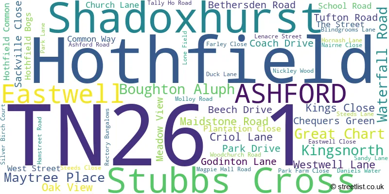
The largest settlement in the TN26 1 postal code is Shadoxhurst followed by Hothfield, and Great Chart.
The TN26 1 Postcode shares a border with TN27 0 (Charing, Pluckley, Charing Heath), TN25 4 (ASHFORD, Challock, Kennington), TN25 7 (Aldington, Kingsnorth, Finberry), TN26 2 (Hamstreet, Ruckinge, Appledore), TN26 3 (Bethersden, Woodchurch, High Halden) and TN23 3 (Kingsnorth, ASHFORD, Great Chart).
The sector is within the post town of ASHFORD.
TN26 1 is a postcode sector within the TN26 postcode district which is within the TN Tonbridge postcode area.
The Royal Mail delivery office for the TN26 1 postal sector is the Ashford (tn) Delivery Office.
The area of the TN26 1 postcode sector is 11.32 square miles which is 29.33 square kilometres or 7,246.90 square acres.
The TN26 1 postcode sector is crossed by the M20 motorway.
Waterways within the TN26 1 postcode sector include the Upper Great Stour.

Map of the TN26 1 Postcode Sector
Explore the TN26 1 postcode sector by using our free interactive map.
| T | N | 2 | 6 | - | 1 | X | X |
| T | N | 2 | 6 | Space | 1 | Letter | Letter |
Official List of Streets
Kingsnorth (3 Streets)
Hothfield (19 Streets)
Shadoxhurst (22 Streets)
Great Chart (3 Streets)
Boughton Aluph (1 Streets)
Eastwell (1 Streets)
Stubbs Cross (2 Streets)
ASHFORD (1 Streets)
Unofficial Streets or Alternative Spellings
ASHFORD
SANDYHURST LANE AW214 AW215 AW216 AW301 AW332 BEARS LANE BLINDGROOMS BYWAY CADES ROAD CRIOL ROAD ETCHDEN ROAD GODINGTON LANE GOLDWELL LANE KINGSLAND LANE LONG LENGTH NICKLEY WOOD ROAD PLUCKLEY ROAD PURCHASE LANE SILVERBIRCH COURT THE WILLOWSKingsnorth
BOND LANE STUMBLE LANERuckinge
BROMLEY GREEN ROADHamstreet
HAMSTREET ROADWestwell
WATERY LANE WESTWELL LANEHothfield
CHAPEL ROAD RAM LANEBethersden
ASHFORD ROAD BETHERSDEN ROAD OLD SURRENDEN MANOR ROADCharing
MAIDSTONE ROAD WESTWELL LANE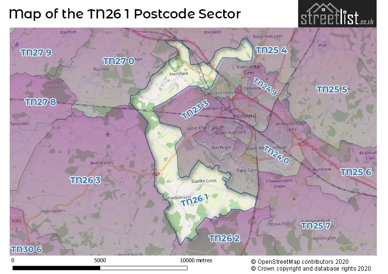
House Prices in the TN26 1 Postcode Sector
| Type of Property | 2018 Average | 2018 Sales | 2017 Average | 2017 Sales | 2016 Average | 2016 Sales | 2015 Average | 2015 Sales |
|---|---|---|---|---|---|---|---|---|
| Detached | £501,761 | 23 | £494,942 | 24 | £482,250 | 24 | £365,214 | 21 |
| Semi-Detached | £308,125 | 8 | £334,286 | 7 | £308,667 | 9 | £277,406 | 8 |
| Terraced | £226,250 | 4 | £232,333 | 6 | £214,875 | 6 | £197,500 | 1 |
| Flats | £0 | 0 | £0 | 0 | £0 | 0 | £0 | 0 |
| The TN26 1 Sector is within these Local Authorities |
|
|---|---|
| The TN26 1 Sector is within these Counties |
|
| The TN26 1 Sector is within these Water Company Areas |
|