The WN8 9 postcode sector lies where the three counties of Lancashire, Merseyside, and Greater Manchester meet.
Did you know? According to the 2021 Census, the WN8 9 postcode sector is home to a bustling 8,647 residents!
Given that each sector allows for 400 unique postcode combinations. Letters C, I, K, M, O and V are not allowed in the last two letters of a postcode. With 184 postcodes already in use, this leaves 216 units available.
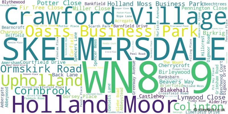
The largest settlement in the WN8 9 postal code is SKELMERSDALE followed by Crawford Village, and Upholland.
The WN8 9 Postcode shares a border with WN8 8 (SKELMERSDALE, Lathom, Chapel House), WA11 7 (ST. HELENS, Rainford, Crank), WA11 8 (Rainford, ST. HELENS, Crank), WN5 7 (Billinge, Orrell), WN5 8 (Orrell, WIGAN, Pemberton), WN8 0 (Upholland, SKELMERSDALE, Roby Mill), WN8 6 (SKELMERSDALE) and L39 0 (Bickerstaffe).
The sector is within the post town of SKELMERSDALE.
WN8 9 is a postcode sector within the WN8 postcode district which is within the WN Wigan postcode area.
The Royal Mail delivery office for the WN8 9 postal sector is the Skelmersdale Delivery Office.
The area of the WN8 9 postcode sector is 4.37 square miles which is 11.33 square kilometres or 2,799.90 square acres.
The WN8 9 postcode sector is crossed by the M58 motorway.

Map of the WN8 9 Postcode Sector
Explore the WN8 9 postcode sector by using our free interactive map.
| W | N | 8 | - | 9 | X | X |
| W | N | 8 | Space | 9 | Letter | Letter |
Official List of Streets
SKELMERSDALE (82 Streets)
Upholland (3 Streets)
Crawford Village (3 Streets)
Oasis Business Park (1 Streets)
Unofficial Streets or Alternative Spellings
Upholland
CHEQUER LANE ORMSKIRK ROAD BEAVERS LANE BEECHTREES MEWS BONE ISLAND BRIARFIELD CLAY BROW ROAD DUKES WOOD LANE EXCHANGE ISLAND GLENBURN ROAD INTERCHANGE HEYES JUNCTION HOPE ISLAND LONG LANE MAPLE VIEW MARTINS LANE MEADOW CLOSE MOOR DRIVE NEWLYN DRIVE NIXONS LANE ORMSKIRK ROAD SERVICE STATION PREISTWOOD PLACE QUARRY JUNCTION RAVENHEAD WAY STANNANOUGHT ROAD SUTCHES MEWS THORN ISLAND WHITEHEY ISLAND WHITEHEY ROAD WHITELEDGE ROAD WHITEMOSS ROAD SOUTH WHITSTONE DRIVESKELMERSDALE
BLAYDON PARK DIGMOOR ROAD GLENBURN ROAD RAILWAY ROAD TANHOUSE ROADKings Moss
PIMBO ROADRainford
FERNY KNOLL ROADWeather Forecast for WN8 9
Press Button to Show Forecast for Skelmersdale
| Time Period | Icon | Description | Temperature | Rain Probability | Wind |
|---|---|---|---|---|---|
| 00:00 to 03:00 | Partly cloudy (night) | 5.0°C (feels like 3.0°C) | 1.00% | E 7 mph | |
| 03:00 to 06:00 | Clear night | 3.0°C (feels like 1.0°C) | 1.00% | E 4 mph | |
| 06:00 to 09:00 | Sunny day | 3.0°C (feels like 1.0°C) | 1.00% | ENE 4 mph | |
| 09:00 to 12:00 | Partly cloudy (day) | 7.0°C (feels like 6.0°C) | 2.00% | E 4 mph | |
| 12:00 to 15:00 | Cloudy | 9.0°C (feels like 8.0°C) | 6.00% | ESE 4 mph | |
| 15:00 to 18:00 | Cloudy | 10.0°C (feels like 9.0°C) | 8.00% | E 4 mph | |
| 18:00 to 21:00 | Cloudy | 9.0°C (feels like 8.0°C) | 6.00% | NE 4 mph | |
| 21:00 to 00:00 | Cloudy | 6.0°C (feels like 3.0°C) | 6.00% | NE 7 mph |
Press Button to Show Forecast for Skelmersdale
| Time Period | Icon | Description | Temperature | Rain Probability | Wind |
|---|---|---|---|---|---|
| 00:00 to 03:00 | Partly cloudy (night) | 4.0°C (feels like 2.0°C) | 6.00% | E 7 mph | |
| 03:00 to 06:00 | Partly cloudy (night) | 3.0°C (feels like 0.0°C) | 4.00% | E 4 mph | |
| 06:00 to 09:00 | Partly cloudy (day) | 4.0°C (feels like 1.0°C) | 4.00% | E 7 mph | |
| 09:00 to 12:00 | Partly cloudy (day) | 8.0°C (feels like 6.0°C) | 5.00% | ESE 7 mph | |
| 12:00 to 15:00 | Overcast | 10.0°C (feels like 8.0°C) | 15.00% | E 7 mph | |
| 15:00 to 18:00 | Overcast | 11.0°C (feels like 9.0°C) | 19.00% | ENE 9 mph | |
| 18:00 to 21:00 | Cloudy | 9.0°C (feels like 7.0°C) | 14.00% | ENE 9 mph | |
| 21:00 to 00:00 | Cloudy | 7.0°C (feels like 5.0°C) | 15.00% | ENE 9 mph |
Press Button to Show Forecast for Skelmersdale
| Time Period | Icon | Description | Temperature | Rain Probability | Wind |
|---|---|---|---|---|---|
| 00:00 to 03:00 | Overcast | 5.0°C (feels like 3.0°C) | 18.00% | NE 7 mph | |
| 03:00 to 06:00 | Cloudy | 5.0°C (feels like 2.0°C) | 14.00% | NNE 9 mph | |
| 06:00 to 09:00 | Light rain | 6.0°C (feels like 3.0°C) | 49.00% | NNE 9 mph | |
| 09:00 to 12:00 | Heavy rain | 8.0°C (feels like 5.0°C) | 70.00% | NNE 9 mph | |
| 12:00 to 15:00 | Heavy rain | 9.0°C (feels like 6.0°C) | 73.00% | N 11 mph | |
| 15:00 to 18:00 | Heavy rain | 10.0°C (feels like 7.0°C) | 75.00% | N 9 mph | |
| 18:00 to 21:00 | Light rain shower (day) | 10.0°C (feels like 8.0°C) | 37.00% | N 9 mph | |
| 21:00 to 00:00 | Clear night | 7.0°C (feels like 5.0°C) | 11.00% | NNW 7 mph |
Schools and Places of Education Within the WN8 9 Postcode Sector
Crawford Village Primary School
Community school
Crawford Road, Skelmersdale, Lancashire, WN8 9QP
Head: Mrs Debra Eaton
Ofsted Rating: Outstanding
Inspection: 2022-12-06 (507 days ago)
Website: Visit Crawford Village Primary School Website
Phone: 01695622333
Number of Pupils: 82
Holland Moor Primary School
Community school
Cornbrook, Skelmersdale, Lancashire, WN8 9AG
Head: Mr M Beale
Ofsted Rating: Good
Inspection: 2020-02-12 (1535 days ago)
Website: Visit Holland Moor Primary School Website
Phone: 01695725062
Number of Pupils: 467
Hope High School
Community special school
Carfield, Skelmersdale, Lancashire, WN8 9DP
Head: Mrs Helen Dunbavin
Ofsted Rating: Good
Inspection: 2019-12-18 (1591 days ago)
Website: Visit Hope High School Website
Phone: 01695721066
Number of Pupils: 84
Little Digmoor Primary School
Community school
Abbeystead, Skelmersdale, Lancashire, WN8 9NF
Head: Ms Karen Houldsworth
Ofsted Rating: Good
Inspection: 2019-12-05 (1604 days ago)
Website: Visit Little Digmoor Primary School Website
Phone: 01695724539
Number of Pupils: 137
Moorside Community Primary Academy School
Academy converter
Back Lane, Skelmersdale, Lancashire, WN8 9EA
Head: Mr RICHARD DAVIS
Ofsted Rating: Good
Inspection: 2020-03-04 (1514 days ago)
Website: Visit Moorside Community Primary Academy School Website
Phone: 01695722931
Number of Pupils: 265
St Francis of Assisi Catholic Primary School
Voluntary aided school
Blakehall, Skelmersdale, Lancashire, WN8 9AZ
Head: Mrs Ann Naylor
Ofsted Rating: Good
Inspection: 2019-05-21 (1802 days ago)
Website: Visit St Francis of Assisi Catholic Primary School Website
Phone: 01695558560
Number of Pupils: 164

House Prices in the WN8 9 Postcode Sector
| Type of Property | 2018 Average | 2018 Sales | 2017 Average | 2017 Sales | 2016 Average | 2016 Sales | 2015 Average | 2015 Sales |
|---|---|---|---|---|---|---|---|---|
| Detached | £339,720 | 5 | £245,250 | 11 | £215,735 | 10 | £255,227 | 11 |
| Semi-Detached | £113,400 | 5 | £111,818 | 17 | £113,633 | 15 | £116,429 | 14 |
| Terraced | £72,697 | 59 | £75,186 | 43 | £78,826 | 35 | £71,558 | 49 |
| Flats | £86,000 | 2 | £55,750 | 2 | £62,475 | 2 | £0 | 0 |
Important Postcodes WN8 9 in the Postcode Sector
WN8 9AG is the postcode for Holland Moor Primary School, Cornbrook, Holland Moor Cp School, Cornbrook, and Nursery Building, Skelmersdale Holland Moor Primary School, Cornbrook
WN8 9AZ is the postcode for St. Francis RC Primary School, Blakehall, and St Francis Of Assisi Catholic Primary School, Blakehall
WN8 9BL is the postcode for The Willows Community Home, 354 Birleywood
WN8 9BN is the postcode for Bishop Martins Junior & Infant School, Birkrig, BISHOP MARTIN INFANT SCHOOL, Bishop Martins Junior & Infant School, Birkrig, and BISHOP MARTIN JUNIOR SCHOOL, Bishop Martins Junior & Infant School, Birkrig
WN8 9BW is the postcode for Birleywood Health Centre, Birleywood
WN8 9DP is the postcode for Hope High School, Carfield
WN8 9EA is the postcode for Moorside Cp School, Back Lane
WN8 9JP is the postcode for West Lancashire Construction Centre, Glebe Road
WN8 9NF is the postcode for Little Digmoor Cp School, Abbeystead, Little Digmoor Primary School, Abbeystead, Digmoor, and MAIN BUILDING, Little Digmoor Cp School, Abbeystead
WN8 9NL is the postcode for Skelmersdale Sports Centre, Digmoor Road
WN8 9NN is the postcode for Lancashire Fire & Rescue Service, Fire Station, Digmoor Road
WN8 9PN is the postcode for Southport & Ormskirk Wheelchair Service, Unit 2, Pendle Place
WN8 9QP is the postcode for Crawford Village Primary School, Crawford Road, Crawford Village
| The WN8 9 Sector is within these Local Authorities |
|
|---|---|
| The WN8 9 Sector is within these Counties |
|
| The WN8 9 Sector is within these Water Company Areas |
|