The B42 1 postcode sector is within the county of West Midlands.
Did you know? According to the 2021 Census, the B42 1 postcode sector is home to a bustling 10,981 residents!
Given that each sector allows for 400 unique postcode combinations. Letters C, I, K, M, O and V are not allowed in the last two letters of a postcode. With 176 postcodes already in use, this leaves 224 units available.
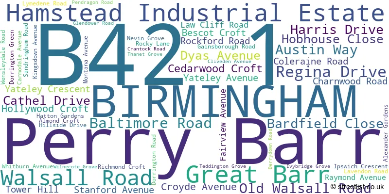
The largest settlement in the B42 1 postal code is BIRMINGHAM followed by Perry Barr, and Great Barr.
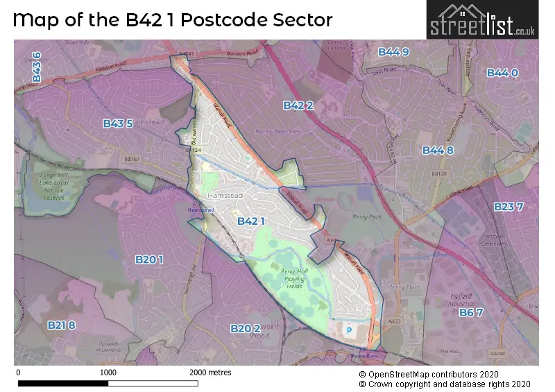
The B42 1 Postcode shares a border with B20 1 (BIRMINGHAM), B43 5 (BIRMINGHAM, Great Barr), B20 2 (BIRMINGHAM, Handsworth), B20 3 (BIRMINGHAM, Handsworth), B42 2 (BIRMINGHAM, Perry Barr, Great Barr) and B43 6 (BIRMINGHAM, Great Barr).
The sector is within the post town of BIRMINGHAM.
B42 1 is a postcode sector within the B42 postcode district which is within the B Birmingham postcode area.
The Royal Mail delivery office for the B42 1 postal sector is the Great Barr Delivery Office.
The area of the B42 1 postcode sector is 1.09 square miles which is 2.81 square kilometres or 695.27 square acres.
Waterways within the B42 1 postcode sector include the River Tame, Tame Valley Canal.

Map of the B42 1 Postcode Sector
Explore the B42 1 postcode sector by using our free interactive map.
| B | 4 | 2 | - | 1 | X | X |
| B | 4 | 2 | Space | 1 | Letter | Letter |
Official List of Streets
Perry Barr (5 Streets)
BIRMINGHAM (47 Streets)
Hamstead Industrial Estate (2 Streets)
Unofficial Streets or Alternative Spellings
BIRMINGHAM
BEECHES ROAD BIRCHFIELD ROAD BOOTHS FARM ROAD BRADFORD CLOSE CALSHOT ROAD HAMSTEAD HILL JAYSHAW AVENUE LANGDALE ROAD QUESLETT ROAD SPOUTHOUSE LANEGreat Barr
ALDRIDGE ROAD BIRMINGHAM ROAD HAMSTEAD ROAD NEWTON ROADPerry Barr
CHURCH ROAD FREETH BRIDGE GROVE COURT PERRY BARR LOCKS BRIDGE RIVER TAME WAY SANDRINGHAM COURT STADIUM WAY TAME VALLEY WAY WALSALL ROAD BRIDGE WEAVERS GREENSchools and Places of Education Within the B42 1 Postcode Sector
Dorrington Academy
Academy converter
Dorrington Road, Birmingham, West Midlands, B42 1QR
Head: Loretta Barratt
Ofsted Rating: Outstanding
Inspection: 2019-11-07 (1668 days ago)
Website: Visit Dorrington Academy Website
Phone: 01214645330
Number of Pupils: 648
House Prices in the B42 1 Postcode Sector
| Type of Property | 2018 Average | 2018 Sales | 2017 Average | 2017 Sales | 2016 Average | 2016 Sales | 2015 Average | 2015 Sales |
|---|---|---|---|---|---|---|---|---|
| Detached | £273,111 | 9 | £231,375 | 8 | £225,125 | 8 | £233,500 | 2 |
| Semi-Detached | £170,210 | 85 | £161,323 | 69 | £145,878 | 89 | £137,691 | 79 |
| Terraced | £159,416 | 39 | £150,776 | 45 | £143,325 | 52 | £131,732 | 31 |
| Flats | £108,595 | 22 | £95,333 | 3 | £57,000 | 1 | £83,500 | 3 |
Important Postcodes B42 1 in the Postcode Sector
B42 1BT is the postcode for EXCLUDING PHARMACY, Tower Hill Partnership Medical Practice, 433 Walsall Road, Tower Hill Partnership Medical Practice, 433 Walsall Road, and Tower Hill Partnership Medical Practice, 435 Walsall Road
B42 1NU is the postcode for St. Marks Catholic Primary School, Almond Croft, and St Mark's Catholic Primary School, Almond Croft, Great Barr
B42 1QR is the postcode for Dorrington Junior & Infant School, Dorrington Road, and DORRINGTON ACADEMY, DORRINGTON ROAD
B42 1SF is the postcode for National Probation Service, 76 Walsall Road
| The B42 1 Sector is within these Local Authorities |
|
|---|---|
| The B42 1 Sector is within these Counties |
|
| The B42 1 Sector is within these Water Company Areas |
|