The NR13 postcode district is a postal district located in the NR Norwich postcode area with a population of 28,677 residents according to the 2021 England and Wales Census.
The area of the NR13 postcode district is 74.03 square miles which is 191.75 square kilometres or 47,381.66 acres.
Currently, the NR13 district has about 1002 postcode units spread across 4 geographic postcode sectors.
Given that each sector allows for 400 unique postcode combinations, the district has a capacity of 1,600 postcodes. With 1002 postcodes already in use, this leaves 598 units available.
The largest settlement in the NR13 postal code is Brundall followed by Rackheath, and Blofield.
The postcode area has a boundary with The North Sea.
The NR13 Postcode shares a border with NR7 (NORWICH, Sprowston, Thorpe St. Andrew), NR14 (Poringland, Mulbarton, Loddon), NR12 (Stalham, Hoveton, Bacton), NR29 (Hemsby, Martham, Ormesby), NR30 (GREAT YARMOUTH, Caister-on-Sea) and NR31 (Gorleston, Bradwell, GREAT YARMOUTH).
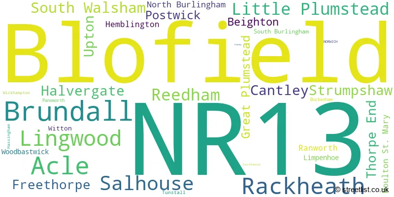
Based on the data for the NR13 postcode district in Norfolk, England, the primary settlement is Acle, with a count of 91. Other significant settlements in the district include Blofield, with a count of 125, Brundall with a count of 110, and Lingwood with a count of 70. The post town for the district is Norwich.
For the district NR13, we have data on 4 postcode sectors. Here's a breakdown: The sector NR13 3, covers Acle and Reedham and Cantley and Halvergate in Norfolk. The sector NR13 4, covers Blofield and Lingwood and Strumpshaw in Norfolk. The sector NR13 5, covers Brundall and Little Plumstead and Thorpe End in Norfolk. The sector NR13 6, covers Rackheath and Salhouse and South Walsham and Upton in Norfolk.

Map of the NR13 Postcode District
Explore the NR13 postcode district by using our free interactive map.

When it comes to local government, postal geography often disregards political borders. However, for a breakdown in the NR13 District: the district mostly encompasses the Broadland District (1070 postcodes), and finally, the Great Yarmouth District (B) area (3 postcodes).
Recent House Sales in NR13
| Date | Price | Address |
|---|---|---|
| 16/10/2023 | £580,000 | Blofield Corner Road, Little Plumstead, Norwich, NR13 5HU |
| 16/10/2023 | £340,000 | Harker Way, Blofield, Norwich, NR13 4QZ |
| 16/10/2023 | £204,500 | Langley Road, Cantley, Norwich, NR13 3SR |
| 12/10/2023 | £315,000 | De Carle Smith Road, Acle, Norwich, NR13 3RB |
| 12/10/2023 | £172,000 | Finch Way, Brundall, Norwich, NR13 5NB |
| 02/10/2023 | £120,000 | The Street, Brundall, Norwich, NR13 5JY |
| 29/09/2023 | £710,000 | Toad Lane, Great Plumstead, Norwich, NR13 5EH |
| 28/09/2023 | £400,000 | Panxworth Road, South Walsham, Norwich, NR13 6DY |
| 28/09/2023 | £210,000 | Finch Way, Brundall, Norwich, NR13 5NB |
| 22/09/2023 | £310,000 | Fir Tree Close, Brundall, Norwich, NR13 5RN |
Weather Forecast for NR13
Press Button to Show Forecast for Acle
| Time Period | Icon | Description | Temperature | Rain Probability | Wind |
|---|---|---|---|---|---|
| 03:00 to 06:00 | Cloudy | 6.0°C (feels like 4.0°C) | 7.00% | NE 7 mph | |
| 06:00 to 09:00 | Overcast | 8.0°C (feels like 6.0°C) | 17.00% | ENE 7 mph | |
| 09:00 to 12:00 | Light rain | 8.0°C (feels like 5.0°C) | 54.00% | ENE 11 mph | |
| 12:00 to 15:00 | Overcast | 9.0°C (feels like 6.0°C) | 17.00% | ENE 13 mph | |
| 15:00 to 18:00 | Overcast | 9.0°C (feels like 7.0°C) | 11.00% | ENE 11 mph | |
| 18:00 to 21:00 | Overcast | 9.0°C (feels like 7.0°C) | 11.00% | ENE 11 mph | |
| 21:00 to 00:00 | Heavy rain | 9.0°C (feels like 6.0°C) | 83.00% | NE 11 mph |
Press Button to Show Forecast for Acle
| Time Period | Icon | Description | Temperature | Rain Probability | Wind |
|---|---|---|---|---|---|
| 00:00 to 03:00 | Heavy rain | 9.0°C (feels like 6.0°C) | 90.00% | NE 11 mph | |
| 03:00 to 06:00 | Heavy rain | 10.0°C (feels like 7.0°C) | 93.00% | E 11 mph | |
| 06:00 to 09:00 | Light rain | 10.0°C (feels like 8.0°C) | 57.00% | SE 11 mph | |
| 09:00 to 12:00 | Light rain shower (day) | 11.0°C (feels like 9.0°C) | 45.00% | SSW 13 mph | |
| 12:00 to 15:00 | Heavy rain shower (day) | 12.0°C (feels like 9.0°C) | 70.00% | WSW 16 mph | |
| 15:00 to 18:00 | Light rain shower (day) | 10.0°C (feels like 7.0°C) | 44.00% | W 13 mph | |
| 18:00 to 21:00 | Cloudy | 9.0°C (feels like 7.0°C) | 12.00% | WSW 9 mph | |
| 21:00 to 00:00 | Partly cloudy (night) | 8.0°C (feels like 5.0°C) | 2.00% | SW 9 mph |
Press Button to Show Forecast for Acle
| Time Period | Icon | Description | Temperature | Rain Probability | Wind |
|---|---|---|---|---|---|
| 00:00 to 03:00 | Clear night | 7.0°C (feels like 4.0°C) | 2.00% | SW 9 mph | |
| 03:00 to 06:00 | Clear night | 6.0°C (feels like 3.0°C) | 1.00% | SSW 7 mph | |
| 06:00 to 09:00 | Sunny day | 7.0°C (feels like 4.0°C) | 1.00% | SSW 7 mph | |
| 09:00 to 12:00 | Partly cloudy (day) | 12.0°C (feels like 10.0°C) | 1.00% | S 9 mph | |
| 12:00 to 15:00 | Partly cloudy (day) | 14.0°C (feels like 11.0°C) | 2.00% | S 11 mph | |
| 15:00 to 18:00 | Partly cloudy (day) | 14.0°C (feels like 11.0°C) | 2.00% | SSE 13 mph | |
| 18:00 to 21:00 | Sunny day | 12.0°C (feels like 10.0°C) | 1.00% | SE 9 mph | |
| 21:00 to 00:00 | Partly cloudy (night) | 9.0°C (feels like 7.0°C) | 1.00% | SE 9 mph |
Press Button to Show Forecast for Acle
| Time Period | Icon | Description | Temperature | Rain Probability | Wind |
|---|---|---|---|---|---|
| 00:00 to 03:00 | Cloudy | 8.0°C (feels like 6.0°C) | 5.00% | SE 7 mph | |
| 03:00 to 06:00 | Partly cloudy (night) | 8.0°C (feels like 7.0°C) | 4.00% | ESE 7 mph | |
| 06:00 to 09:00 | Mist | 10.0°C (feels like 9.0°C) | 18.00% | E 7 mph | |
| 09:00 to 12:00 | Cloudy | 13.0°C (feels like 12.0°C) | 13.00% | ESE 9 mph | |
| 12:00 to 15:00 | Cloudy | 14.0°C (feels like 13.0°C) | 10.00% | ESE 9 mph | |
| 15:00 to 18:00 | Cloudy | 15.0°C (feels like 13.0°C) | 7.00% | ESE 9 mph | |
| 18:00 to 21:00 | Cloudy | 13.0°C (feels like 12.0°C) | 7.00% | ESE 9 mph | |
| 21:00 to 00:00 | Cloudy | 11.0°C (feels like 10.0°C) | 18.00% | E 7 mph |
Where is the NR13 Postcode District?
The NR13 postcode district is located in Norwich. Norwich is surrounded by several nearby towns, including Great Yarmouth to the east, Beccles to the south, North Walsham to the north, Lowestoft to the southeast, Harleston to the southwest, and Wymondham to the west. The distance from NR13 to London is approximately 103.96 miles.
The district is within the post town of NORWICH.
The sector has postcodes within the nation of England.
The NR13 Postcode District is covers the following regions.
- Norwich and East Norfolk - East Anglia - East of England
- Breckland and South Norfolk - East Anglia - East of England
| Postcode Sector | Delivery Office |
|---|---|
| NR13 3 | Acle Scale Payment Delivery Office |
| NR13 3 | Reedham Scale Payment Delivery Office |
| NR13 4 | Blofield Scale Payment Delivery Office |
| NR13 5 | Blofield Scale Payment Delivery Office |
| NR13 5 | Brundall Scale Payment Delivery Office |
| NR13 6 | Acle Scale Payment Delivery Office |
| NR13 6 | Salhouse Scale Payment Delivery Office |
| N | R | 1 | 3 | - | X | X | X |
| N | R | 1 | 3 | Space | Numeric | Letter | Letter |
Tourist Attractions within the Postcode Area
We found 1 visitor attractions within the NR13 postcode area
| Fairhaven Woodland and Water Garden |
|---|
| Gardens |
| Garden |
| View Fairhaven Woodland and Water Garden on Google Maps |
Current Monthly Rental Prices
| # Bedrooms | Min Price | Max Price | Avg Price |
|---|---|---|---|
| 1 | £725 | £725 | £725 |
| 2 | £695 | £1,150 | £908 |
| 3 | £1,000 | £1,680 | £1,332 |
| 4 | £1,600 | £1,695 | £1,648 |
Current House Prices
| # Bedrooms | Min Price | Max Price | Avg Price |
|---|---|---|---|
| £225,000 | £900,000 | £418,750 | |
| 1 | £145,000 | £200,000 | £172,500 |
| 2 | £75,625 | £600,000 | £261,938 |
| 3 | £138,000 | £695,000 | £336,728 |
| 4 | £300,000 | £925,000 | £499,209 |
| 5 | £350,000 | £1,500,000 | £664,054 |
| 6 | £400,000 | £2,500,000 | £1,408,333 |
| 7 | £550,000 | £550,000 | £550,000 |
| 8 | £1,995,000 | £1,995,000 | £1,995,000 |
Estate Agents who Operate in the NR13 District
| Logo | Name | Brand Name | Address | Contact Number | Total Properties |
|---|---|---|---|---|---|
 | Brundall | Starkings & Watson | 2 Cucumber Lane, Brundall, NR13 5QY | 01603 336556 | 83 |
 | Brundall | Gilson Bailey | 1 Station Road, Brundall, NR13 5LA | 01603 717717 | 52 |
 | Wroxham | Minors & Brady | Church Road, Wroxham, NR12 8UG | 01603 361595 | 37 |
 | Acle | The Property Shop | Old Bank House The Street Acle NR13 3DY | 01493 800909 | 19 |
 | Norwich | William H. Brown | 5 Bank Plain, Norwich, NR2 4SF | 01603 361933 | 14 |
- Acle
- Beighton
- Blofield Heath
- Blofield
- Brundall
- Buckenham
- Burlingham Green
- Cantley
- Damgate
- Freethorpe
- Fritton
- Great Plumstead
- Halvergate
- Hassingham
- Horning
- Limpenhoe
- Lingwood
- Little Plumstead
- Moulton St Mary
- North Burlingham
- Norwich
- Panxworth
- Pedham
- Pilson Green
- Postwick
- Rackheath
- Ranworth
- Reedham
- Salhouse
- South Burlingham
- South Walsham
- Stokesby
- Strumpshaw
- Thorpe End
- Tunstall
- Upton
- Wickhampton
- Witton
- Woodbastwick
- Wroxham
| Type of Property | 2018 Average | 2018 Sales | 2017 Average | 2017 Sales | 2016 Average | 2016 Sales | 2015 Average | 2015 Sales |
|---|---|---|---|---|---|---|---|---|
| Detached | £350,263 | 272 | £350,978 | 295 | £319,454 | 285 | £298,257 | 345 |
| Semi-Detached | £237,946 | 154 | £233,092 | 136 | £205,794 | 118 | £196,323 | 170 |
| Terraced | £205,944 | 61 | £223,775 | 74 | £191,916 | 64 | £177,621 | 71 |
| Flats | £161,125 | 12 | £171,423 | 13 | £157,685 | 10 | £173,188 | 12 |