The SK15 postcode district is a postal district located in the SK Stockport postcode area with a population of 28,591 residents according to the 2021 England and Wales Census.
The area of the SK15 postcode district is 9.60 square miles which is 24.86 square kilometres or 6,141.89 acres.
Currently, the SK15 district has about 668 postcode units spread across 3 geographic postcode sectors.
Given that each sector allows for 400 unique postcode combinations, the district has a capacity of 1,200 postcodes. With 668 postcodes already in use, this leaves 532 units available.
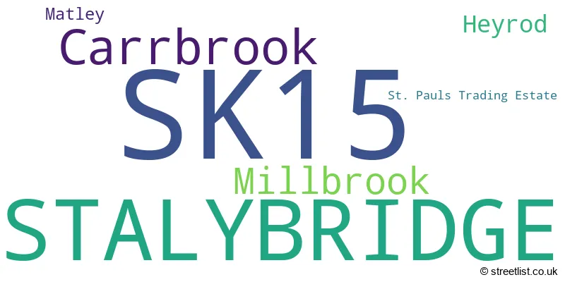
The largest settlement in the SK15 postal code is STALYBRIDGE followed by Carrbrook, and Millbrook.
The SK15 Postcode shares a border with SK14 (HYDE, Mottram, Hollingworth), SK16 (DUKINFIELD), OL5 (Mossley), OL6 (ASHTON-UNDER-LYNE), SK13 (GLOSSOP, Hadfield, Tintwistle) and OL3 (Greenfield, Uppermill, Delph).
The primary settlement in the SK15 postcode district is Stalybridge, which is located in Greater Manchester. Additionally, there are other significant settlements such as Carrbrook, Heyrod, Millbrook, and Matley. These settlements are also located in Greater Manchester. The most significant post town in the SK15 postcode district is Stalybridge.
For the district SK15, we have data on 4 postcode sectors. Here's a breakdown: The sector SK15 1, covers Stalybridge in Greater Manchester. The sector SK15 2, covers Stalybridge in Greater Manchester. The sector SK15 3, covers Stalybridge and Carrbrook and Millbrook in Greater Manchester. The sector SK15 9 is non-geographic. It's often designated for PO Boxes, large organisations, or special services.

Map of the SK15 Postcode District
Explore the SK15 postcode district by using our free interactive map.

When it comes to local government, postal geography often disregards political borders. However, for a breakdown in the SK15 District: the district mostly encompasses the Tameside District (B) area with a total of 668 postcodes.
Recent House Sales in SK15
| Date | Price | Address |
|---|---|---|
| 03/10/2023 | £190,000 | Newlyn Avenue, Stalybridge, SK15 3HL |
| 15/09/2023 | £100,000 | Bramble Court, Millbrook, Stalybridge, SK15 3BH |
| 06/09/2023 | £65,000 | Huddersfield Road, Millbrook, Stalybridge, SK15 3EP |
| 01/09/2023 | £135,000 | The Close, Stalybridge, SK15 1HU |
| 29/08/2023 | £256,500 | Staley Hall Road, Stalybridge, SK15 3DP |
| 29/08/2023 | £175,000 | Regina Avenue, Stalybridge, SK15 1DN |
| 25/08/2023 | £420,000 | Melbourne Street, Stalybridge, SK15 2JJ |
| 23/08/2023 | £83,000 | Buckley Street, Stalybridge, SK15 1TT |
| 21/08/2023 | £139,000 | Warrington Street, Stalybridge, SK15 2HA |
| 18/08/2023 | £155,000 | Moorland Road, Carrbrook, Stalybridge, SK15 3JY |
Where is the SK15 Postcode District?
The postcode district SK15 is located in the town of Stalybridge. Stalybridge is situated near several nearby towns. To the west is Ashton-under-Lyne, which is approximately 2.16 miles away. To the south-west is Dukinfield, which is around 2.85 miles away. In the south-east direction, there is Glossop, located approximately 4.71 miles away. Oldham is situated in the north-west, approximately 4.93 miles away. Finally, to the north-east is Holmfirth, which is about 10.53 miles away. Stalybridge is also 158.69 miles away from the center of London.
The district is within the post town of STALYBRIDGE.
The sector has postcodes within the nation of England.
The SK15 Postcode District is in the Greater Manchester South East region of Greater Manchester within the North West (England).
Weather Forecast for SK15
Press Button to Show Forecast for Millbrook (Greater Manchester)
| Time Period | Icon | Description | Temperature | Rain Probability | Wind |
|---|---|---|---|---|---|
| 00:00 to 03:00 | Cloudy | 15.0°C (feels like 13.0°C) | 3.00% | ESE 11 mph | |
| 03:00 to 06:00 | Cloudy | 13.0°C (feels like 12.0°C) | 4.00% | E 7 mph | |
| 06:00 to 09:00 | Cloudy | 15.0°C (feels like 13.0°C) | 3.00% | E 9 mph | |
| 09:00 to 12:00 | Cloudy | 18.0°C (feels like 16.0°C) | 3.00% | ESE 11 mph | |
| 12:00 to 15:00 | Cloudy | 21.0°C (feels like 19.0°C) | 3.00% | ESE 11 mph | |
| 15:00 to 18:00 | Partly cloudy (day) | 22.0°C (feels like 19.0°C) | 32.00% | SE 13 mph | |
| 18:00 to 21:00 | Light rain shower (day) | 20.0°C (feels like 19.0°C) | 34.00% | SE 9 mph | |
| 21:00 to 00:00 | Cloudy | 18.0°C (feels like 16.0°C) | 14.00% | ESE 9 mph |
Press Button to Show Forecast for Millbrook (Greater Manchester)
| Time Period | Icon | Description | Temperature | Rain Probability | Wind |
|---|---|---|---|---|---|
| 00:00 to 03:00 | Partly cloudy (night) | 16.0°C (feels like 15.0°C) | 13.00% | SE 9 mph | |
| 03:00 to 06:00 | Cloudy | 14.0°C (feels like 14.0°C) | 13.00% | SSE 7 mph | |
| 06:00 to 09:00 | Overcast | 13.0°C (feels like 12.0°C) | 15.00% | S 7 mph | |
| 09:00 to 12:00 | Cloudy | 15.0°C (feels like 13.0°C) | 13.00% | SSE 11 mph | |
| 12:00 to 15:00 | Cloudy | 17.0°C (feels like 14.0°C) | 16.00% | SSE 13 mph | |
| 15:00 to 18:00 | Cloudy | 17.0°C (feels like 14.0°C) | 19.00% | SSE 13 mph | |
| 18:00 to 21:00 | Light rain | 15.0°C (feels like 13.0°C) | 54.00% | SSE 13 mph | |
| 21:00 to 00:00 | Light rain | 14.0°C (feels like 12.0°C) | 57.00% | SE 13 mph |
Press Button to Show Forecast for Millbrook (Greater Manchester)
| Time Period | Icon | Description | Temperature | Rain Probability | Wind |
|---|---|---|---|---|---|
| 00:00 to 03:00 | Light rain | 14.0°C (feels like 12.0°C) | 56.00% | SE 11 mph | |
| 03:00 to 06:00 | Light rain | 13.0°C (feels like 11.0°C) | 50.00% | SSE 9 mph | |
| 06:00 to 09:00 | Light rain | 12.0°C (feels like 11.0°C) | 52.00% | SE 9 mph | |
| 09:00 to 12:00 | Partly cloudy (day) | 14.0°C (feels like 12.0°C) | 21.00% | SE 11 mph | |
| 12:00 to 15:00 | Light rain shower (day) | 16.0°C (feels like 13.0°C) | 42.00% | SSE 11 mph | |
| 15:00 to 18:00 | Heavy rain shower (day) | 16.0°C (feels like 14.0°C) | 57.00% | SSE 11 mph | |
| 18:00 to 21:00 | Light rain shower (day) | 15.0°C (feels like 13.0°C) | 40.00% | SSE 11 mph | |
| 21:00 to 00:00 | Light rain shower (night) | 14.0°C (feels like 12.0°C) | 33.00% | SSE 9 mph |
Press Button to Show Forecast for Millbrook (Greater Manchester)
| Time Period | Icon | Description | Temperature | Rain Probability | Wind |
|---|---|---|---|---|---|
| 00:00 to 03:00 | Partly cloudy (night) | 12.0°C (feels like 10.0°C) | 8.00% | SSE 9 mph | |
| 03:00 to 06:00 | Cloudy | 11.0°C (feels like 10.0°C) | 9.00% | SE 9 mph | |
| 06:00 to 09:00 | Partly cloudy (day) | 12.0°C (feels like 10.0°C) | 6.00% | SE 9 mph | |
| 09:00 to 12:00 | Partly cloudy (day) | 14.0°C (feels like 12.0°C) | 11.00% | SSE 11 mph | |
| 12:00 to 15:00 | Light rain shower (day) | 16.0°C (feels like 13.0°C) | 36.00% | SSE 11 mph | |
| 15:00 to 18:00 | Light rain shower (day) | 16.0°C (feels like 14.0°C) | 36.00% | S 11 mph | |
| 18:00 to 21:00 | Light rain shower (day) | 15.0°C (feels like 14.0°C) | 39.00% | S 9 mph | |
| 21:00 to 00:00 | Clear night | 13.0°C (feels like 12.0°C) | 9.00% | S 7 mph |
| Postcode Sector | Delivery Office |
|---|---|
| SK15 1 | Ashton Under Lyne Delivery Office |
| SK15 2 | Ashton Under Lyne Delivery Office |
| SK15 3 | Ashton Under Lyne Delivery Office |
| S | K | 1 | 5 | - | X | X | X |
| S | K | 1 | 5 | Space | Numeric | Letter | Letter |
Tourist Attractions within the SK15 Postcode Area
We found 1 visitor attractions within the SK15 postcode area
| Astley Cheetham Art Gallery |
|---|
| Museums & Art Galleries |
| Museum and / or Art Gallery |
| View Astley Cheetham Art Gallery on Google Maps |
Current Monthly Rental Prices
| # Bedrooms | Min Price | Max Price | Avg Price |
|---|---|---|---|
| 1 | £650 | £700 | £675 |
| 2 | £725 | £725 | £725 |
| 3 | £750 | £1,750 | £1,132 |
| 4 | £1,050 | £1,050 | £1,050 |
Current House Prices
| # Bedrooms | Min Price | Max Price | Avg Price |
|---|---|---|---|
| £205,000 | £205,000 | £205,000 | |
| 1 | £110,000 | £160,000 | £130,000 |
| 2 | £68,000 | £365,000 | £170,363 |
| 3 | £120,000 | £595,000 | £259,312 |
| 4 | £250,000 | £1,200,000 | £493,037 |
| 5 | £399,995 | £1,100,000 | £662,912 |
| 6 | £295,000 | £810,000 | £501,667 |
| 7 | £550,000 | £550,000 | £550,000 |
Estate Agents who Operate in the SK15 District
| Logo | Name | Brand Name | Address | Contact Number | Total Properties |
|---|---|---|---|---|---|
 | Stalybridge | Home Estate Agents Ltd | Phoenix House, 4 Huddersfield Road, Stalybridge, SK15 2QA | 0161 524 4847 | 55 |
 | Stalybridge | A Wilson Estates | 122 Mottram Road, Stalybridge, SK15 2QU | 0161 303 9886 | 12 |
 | Stalybridge | W C Dawson & Son Ltd | 18-20 Stamford Street, Stalybridge, SK15 1JZ | 0161 524 9998 | 11 |
 | Stalybridge | Bridgfords | 53 Mottram Road, Stalybridge, Cheshire, SK15 2QP | 0161 524 4767 | 9 |
 | Mossley | Ryder & Dutton | 4 Lees Road, Mossley, OL5 0PF | 01457 600867 | 8 |
Yearly House Price Averages for the SK15 Postcode District
| Type of Property | 2018 Average | 2018 Sales | 2017 Average | 2017 Sales | 2016 Average | 2016 Sales | 2015 Average | 2015 Sales |
|---|---|---|---|---|---|---|---|---|
| Detached | £302,051 | 114 | £313,438 | 79 | £285,303 | 103 | £236,341 | 111 |
| Semi-Detached | £174,703 | 122 | £163,225 | 93 | £152,642 | 133 | £142,082 | 124 |
| Terraced | £122,845 | 201 | £114,696 | 194 | £116,382 | 191 | £105,492 | 166 |
| Flats | £101,405 | 34 | £97,600 | 35 | £99,119 | 27 | £79,817 | 26 |