The TN26 postcode district is a postal district located in the TN Tonbridge postcode area with a population of 12,395 residents according to the 2021 England and Wales Census.
The area of the TN26 postcode district is 63.51 square miles which is 164.50 square kilometres or 40,649.35 acres.
Currently, the TN26 district has about 506 postcode units spread across 3 geographic postcode sectors.
Given that each sector allows for 400 unique postcode combinations, the district has a capacity of 1,200 postcodes. With 506 postcodes already in use, this leaves 694 units available.
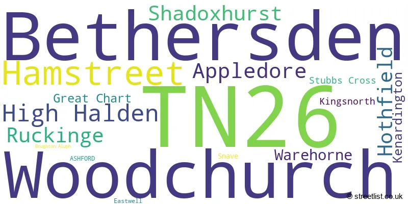
The largest settlement in the TN26 postal code is Bethersden followed by Woodchurch, and High Halden.
The TN26 Postcode shares a border with TN27 (Headcorn, Biddenden, Charing), TN30 (TENTERDEN, St. Michaels, Wittersham), TN29 (Dymchurch, Lydd, St. Marys Bay), TN23 (ASHFORD, Kingsnorth, Great Chart) and TN25 (Wye, Sellindge, ASHFORD).
The primary settlement in the TN26 postcode district is Hothfield, located in the county of Kent, England. Other significant settlements in this district include Great Chart, Shadoxhurst, Kingsnorth, Boughton Aluph, Eastwell, Stubbs Cross, Appledore, Hamstreet, Kenardington, Ruckinge, Snave, Warehorne, Bethersden, High Halden, and Woodchurch. The main post town for this district is Ashford.
For the district TN26, we have data on 3 postcode sectors. Here's a breakdown: The sector TN26 1, covers Hothfield and Shadoxhurst and Great Chart in Kent. The sector TN26 2, covers Hamstreet and Appledore and Ruckinge and Warehorne in Kent. The sector TN26 3, covers Bethersden and Woodchurch and High Halden in Kent.

Map of the TN26 Postcode District
Explore the TN26 postcode district by using our free interactive map.

When it comes to local government, postal geography often disregards political borders. However, for a breakdown in the TN26 District: the district mostly encompasses the Ashford District (B) (509 postcodes), and finally, the Folkestone and Hythe District area (10 postcodes).
Recent House Sales in TN26
| Date | Price | Address |
|---|---|---|
| 27/09/2023 | £690,000 | Front Road, Woodchurch, Ashford, TN26 3SF |
| 08/09/2023 | £370,000 | Durrant Green, High Halden, Ashford, TN26 3BU |
| 01/09/2023 | £850,000 | High Halden, Ashford, TN26 3HX |
| 01/09/2023 | £660,000 | Bromley Green Road, Ruckinge, Ashford, TN26 2EG |
| 31/08/2023 | £1,025,000 | Bromley Green Road, Ruckinge, Ashford, TN26 2EF |
| 29/08/2023 | £365,000 | Ruckinge Road, Hamstreet, Ashford, TN26 2HP |
| 25/08/2023 | £475,000 | Lenacre Street, Boughton Aluph, Ashford, TN26 1JH |
| 24/08/2023 | £660,000 | Park Farm Close, Shadoxhurst, Ashford, TN26 1LD |
| 15/08/2023 | £895,000 | Redbrook Street, Woodchurch, Ashford, TN26 3QR |
| 15/08/2023 | £280,000 | Farm Road, Hamstreet, Ashford, TN26 2JA |
Where is the TN26 Postcode District?
The postcode district TN26 is located in Ashford, a town in the county of Kent. Ashford is surrounded by several nearby towns. To the southwest of Ashford is Tenterden, which is approximately 4.7 miles away. Rye lies to the south, about 10.4 miles from Ashford. In the east, you will find New Romney at a distance of 11.0 miles, while Cranbrook is situated to the west, around 12.0 miles away. Faversham lies to the north, approximately 16.7 miles from Ashford. Furthermore, the distance from Ashford to the center of London is approximately 49.4 miles.
The district is within the post town of ASHFORD.
The sector has postcodes within the nation of England.
The TN26 Postcode District is covers the following regions.
- Mid Kent - Kent - South East (England)
- East Kent - Kent - South East (England)
Weather Forecast for TN26
Press Button to Show Forecast for Bethersden
| Time Period | Icon | Description | Temperature | Rain Probability | Wind |
|---|---|---|---|---|---|
| 03:00 to 06:00 | Cloudy | 12.0°C (feels like 11.0°C) | 7.00% | SSW 7 mph | |
| 06:00 to 09:00 | Cloudy | 13.0°C (feels like 11.0°C) | 7.00% | SSW 7 mph | |
| 09:00 to 12:00 | Cloudy | 16.0°C (feels like 15.0°C) | 4.00% | SSW 9 mph | |
| 12:00 to 15:00 | Cloudy | 17.0°C (feels like 15.0°C) | 4.00% | S 11 mph | |
| 15:00 to 18:00 | Partly cloudy (day) | 18.0°C (feels like 16.0°C) | 1.00% | S 11 mph | |
| 18:00 to 21:00 | Cloudy | 17.0°C (feels like 16.0°C) | 5.00% | SE 7 mph | |
| 21:00 to 00:00 | Cloudy | 15.0°C (feels like 13.0°C) | 8.00% | ESE 9 mph |
Press Button to Show Forecast for Bethersden
| Time Period | Icon | Description | Temperature | Rain Probability | Wind |
|---|---|---|---|---|---|
| 00:00 to 03:00 | Cloudy | 15.0°C (feels like 13.0°C) | 11.00% | SE 9 mph | |
| 03:00 to 06:00 | Cloudy | 14.0°C (feels like 13.0°C) | 19.00% | SE 7 mph | |
| 06:00 to 09:00 | Light rain | 14.0°C (feels like 13.0°C) | 53.00% | SE 9 mph | |
| 09:00 to 12:00 | Heavy rain | 15.0°C (feels like 13.0°C) | 78.00% | SSE 11 mph | |
| 12:00 to 15:00 | Heavy rain | 15.0°C (feels like 14.0°C) | 80.00% | S 11 mph | |
| 15:00 to 18:00 | Heavy rain | 15.0°C (feels like 14.0°C) | 73.00% | S 9 mph | |
| 18:00 to 21:00 | Cloudy | 15.0°C (feels like 13.0°C) | 16.00% | SE 9 mph | |
| 21:00 to 00:00 | Cloudy | 13.0°C (feels like 12.0°C) | 11.00% | SE 9 mph |
Press Button to Show Forecast for Bethersden
| Time Period | Icon | Description | Temperature | Rain Probability | Wind |
|---|---|---|---|---|---|
| 00:00 to 03:00 | Cloudy | 13.0°C (feels like 12.0°C) | 9.00% | SE 9 mph | |
| 03:00 to 06:00 | Cloudy | 12.0°C (feels like 11.0°C) | 12.00% | SSE 7 mph | |
| 06:00 to 09:00 | Partly cloudy (day) | 13.0°C (feels like 12.0°C) | 11.00% | SSE 7 mph | |
| 09:00 to 12:00 | Partly cloudy (day) | 15.0°C (feels like 14.0°C) | 8.00% | SSE 9 mph | |
| 12:00 to 15:00 | Partly cloudy (day) | 17.0°C (feels like 15.0°C) | 8.00% | S 9 mph | |
| 15:00 to 18:00 | Partly cloudy (day) | 17.0°C (feels like 16.0°C) | 4.00% | S 9 mph | |
| 18:00 to 21:00 | Sunny day | 16.0°C (feels like 16.0°C) | 2.00% | SSE 4 mph | |
| 21:00 to 00:00 | Clear night | 12.0°C (feels like 11.0°C) | 1.00% | SE 4 mph |
Press Button to Show Forecast for Bethersden
| Time Period | Icon | Description | Temperature | Rain Probability | Wind |
|---|---|---|---|---|---|
| 00:00 to 03:00 | Clear night | 10.0°C (feels like 10.0°C) | 1.00% | ESE 4 mph | |
| 03:00 to 06:00 | Partly cloudy (night) | 10.0°C (feels like 9.0°C) | 6.00% | SSE 4 mph | |
| 06:00 to 09:00 | Partly cloudy (day) | 12.0°C (feels like 12.0°C) | 3.00% | WNW 4 mph | |
| 09:00 to 12:00 | Cloudy | 16.0°C (feels like 16.0°C) | 8.00% | SE 7 mph | |
| 12:00 to 15:00 | Light rain shower (day) | 18.0°C (feels like 17.0°C) | 30.00% | NE 7 mph | |
| 15:00 to 18:00 | Cloudy | 18.0°C (feels like 17.0°C) | 14.00% | SSW 7 mph | |
| 18:00 to 21:00 | Sunny day | 17.0°C (feels like 16.0°C) | 7.00% | SSE 7 mph | |
| 21:00 to 00:00 | Partly cloudy (night) | 12.0°C (feels like 12.0°C) | 4.00% | SSE 4 mph |
| Postcode Sector | Delivery Office |
|---|---|
| TN26 1 | Ashford (tn) Delivery Office |
| TN26 2 | Ashford (tn) Delivery Office |
| TN26 2 | Appledelivery Officere Scale Payment Delivery Office |
| TN26 3 | Ashford (tn) Delivery Office |
| TN26 3 | Bethersden Scale Payment Delivery Office |
| TN26 3 | Woodchurch Scale Payment Delivery Office |
| T | N | 2 | 6 | - | X | X | X |
| T | N | 2 | 6 | Space | Numeric | Letter | Letter |
Tourist Attractions within the TN26 Postcode Area
We found 1 visitor attractions within the TN26 postcode area
| Rare Breeds Centre |
|---|
| Farms |
| Farm / Rare Breeds / Farm Animals |
| View Rare Breeds Centre on Google Maps |
Current Monthly Rental Prices
| # Bedrooms | Min Price | Max Price | Avg Price |
|---|---|---|---|
| 1 | £1,300 | £1,300 | £1,300 |
| 3 | £1,500 | £1,500 | £1,500 |
Current House Prices
| # Bedrooms | Min Price | Max Price | Avg Price |
|---|---|---|---|
| £5,000 | £1,450,000 | £535,714 | |
| 1 | £230,000 | £280,000 | £255,000 |
| 2 | £110,000 | £525,000 | £299,258 |
| 3 | £270,000 | £850,000 | £500,805 |
| 4 | £350,000 | £1,350,000 | £753,829 |
| 5 | £450,000 | £2,195,000 | £953,042 |
| 6 | £895,000 | £1,500,000 | £1,123,333 |
| 7 | £950,000 | £1,595,000 | £1,161,250 |
Estate Agents who Operate in the TN26 District
| Logo | Name | Brand Name | Address | Contact Number | Total Properties |
|---|---|---|---|---|---|
 | Folkestone | Smith Woolley | The Manor Office, 43 Castle Hill Avenue, Folkestone, Kent, CT20 2RB | 01303 761723 | 17 |
 | Tenterden | Hobbs Parker Estate Agents | 9 The Fairings, Oaks Road, Tenterden, TN30 6QX | 01580 234752 | 13 |
 | Ashford | Hobbs Parker Estate Agents | Romney House Monument Way, Orbital Park, Ashford, TN24 0HB | 01233 542521 | 12 |
 | Tenterden | Warner Gray | 13 East Cross, Tenterden, TN30 6AD | 01580 234698 | 8 |
 | Ashford | Andrew & Co Estate Agents | 5 Kings Parade, Ashford, Kent, TN24 8TA | 01233 632383 | 8 |
- Appledore
- Appledore Heath
- Ashford
- Bethersden
- Brenzett
- Bromley Green
- Brook Street
- Chambers' Green
- Chilmington Green
- Durrant Green
- Further Quarter
- Hamstreet
- High Halden
- Hothfield
- Ivychurch
- Kenardington
- Kingsnorth
- London Beach
- Middle Quarter
- Newchurch
- Potters Corner
- Ram Lane
- Ruckinge
- Shadoxhurst
- Shirkoak
- Smarden
- Snargate
- Stede Quarter
- Stone Cross
- Stubb's Cross
- Tenterden
- Tutt Hill
- Warehorne
- Wissenden
- Woodchurch
Yearly House Price Averages for the TN26 Postcode District
| Type of Property | 2018 Average | 2018 Sales | 2017 Average | 2017 Sales | 2016 Average | 2016 Sales | 2015 Average | 2015 Sales |
|---|---|---|---|---|---|---|---|---|
| Detached | £574,922 | 97 | £522,638 | 81 | £532,262 | 103 | £460,342 | 115 |
| Semi-Detached | £300,838 | 34 | £302,567 | 45 | £291,299 | 44 | £277,339 | 45 |
| Terraced | £259,833 | 24 | £243,721 | 26 | £240,427 | 31 | £229,464 | 40 |
| Flats | £195,000 | 1 | £122,500 | 1 | £204,500 | 1 | £101,500 | 2 |