The WS9 postcode district is a postal district located in the WS Walsall postcode area with a population of 26,473 residents according to the 2021 England and Wales Census.
The area of the WS9 postcode district is 12.11 square miles which is 31.37 square kilometres or 7,751.59 acres.
Currently, the WS9 district has about 629 postcode units spread across 3 geographic postcode sectors.
Given that each sector allows for 400 unique postcode combinations, the district has a capacity of 1,200 postcodes. With 629 postcodes already in use, this leaves 571 units available.
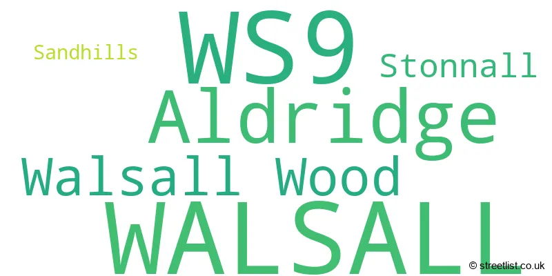
The largest settlement in the WS9 postal code is WALSALL followed by Aldridge, and Walsall Wood.
The WS9 Postcode shares a border with B74 (SUTTON COLDFIELD, Streetly, Little Aston), WS3 (WALSALL, Pelsall, Bloxwich), WS8 (WALSALL, Brownhills, Clayhanger), B43 (BIRMINGHAM, Great Barr) and WS4 (WALSALL, Rushall, Shelfield).
The primary settlement in the WS9 postcode district is Aldridge. Other significant settlements include Sandhills, Stonnall, and Walsall Wood. The post town is Walsall, which is located in Staffordshire and West Midlands. The county of Staffordshire is in England.
For the district WS9, we have data on 4 postcode sectors. Here's a breakdown: The sector WS9 0, covers Walsall and Aldridge in West Midlands. The sector WS9 1 is non-geographic. It's often designated for PO Boxes, large organisations, or special services. The sector WS9 8, covers Walsall and Aldridge in West Midlands. The sector WS9 9, covers Walsall Wood and Walsall in West Midlands. The sector WS9 9, covers Stonnall in Staffordshire.

Map of the WS9 Postcode District
Explore the WS9 postcode district by using our free interactive map.

When it comes to local government, postal geography often disregards political borders. However, for a breakdown in the WS9 District: the district mostly encompasses the Walsall District (B) (593 postcodes), and finally, the Lichfield District area (41 postcodes).
Recent House Sales in WS9
| Date | Price | Address |
|---|---|---|
| 20/10/2023 | £85,000 | Northgate, Aldridge, Walsall, WS9 8QB |
| 16/10/2023 | £235,000 | Heygate Way, Aldridge, Walsall, WS9 8SD |
| 29/09/2023 | £277,500 | Redhouse Lane, Walsall, WS9 0DQ |
| 29/09/2023 | £165,000 | The Briars, Aldridge, Walsall, WS9 8AQ |
| 29/09/2023 | £120,000 | Leighswood Road, Walsall, WS9 8AB |
| 27/09/2023 | £365,000 | Old Oak Close, Walsall, WS9 8SE |
| 25/09/2023 | £307,500 | Moorfields Close, Aldridge, Walsall, WS9 8BP |
| 23/09/2023 | £140,000 | Mountford Crescent, Walsall, WS9 8LD |
| 14/09/2023 | £182,000 | Twyford Close, Aldridge, Walsall, WS9 0SN |
| 08/09/2023 | £162,000 | Broadmeadow, Walsall, WS9 8JA |
Where is the WS9 Postcode District?
The postcode district WS9 is located in Walsall, a town in the West Midlands. It is in close proximity to several nearby towns. To the South East is Sutton Coldfield, which is approximately 4.35 miles away. Burntwood is situated in the North and is around 4.86 miles away. Towards the South West is Wednesbury, which is approximately 5.58 miles away. Willenhall is in the West and is around 6.01 miles away. Lichfield lies in the North East and is approximately 6.04 miles away. Finally, Cannock is situated in the North West and is around 7.44 miles away. The postcode district WS9 is also located approximately 107.59 miles away from the centre of London.
The district is within the post town of WALSALL.
The sector has postcodes within the nation of England.
The WS9 Postcode District is covers the following regions.
- Walsall - West Midlands - West Midlands (England)
- Staffordshire CC - Shropshire and Staffordshire - West Midlands (England)
Weather Forecast for WS9
Press Button to Show Forecast for Aldridge
| Time Period | Icon | Description | Temperature | Rain Probability | Wind |
|---|---|---|---|---|---|
| 18:00 to 21:00 | Heavy rain | 15.0°C (feels like 12.0°C) | 87.00% | SSE 13 mph | |
| 21:00 to 00:00 | Heavy rain | 14.0°C (feels like 11.0°C) | 93.00% | SE 13 mph |
Press Button to Show Forecast for Aldridge
| Time Period | Icon | Description | Temperature | Rain Probability | Wind |
|---|---|---|---|---|---|
| 00:00 to 03:00 | Heavy rain | 13.0°C (feels like 11.0°C) | 86.00% | SE 11 mph | |
| 03:00 to 06:00 | Heavy rain | 13.0°C (feels like 11.0°C) | 91.00% | SE 11 mph | |
| 06:00 to 09:00 | Heavy rain | 13.0°C (feels like 12.0°C) | 89.00% | SE 9 mph | |
| 09:00 to 12:00 | Light rain | 13.0°C (feels like 12.0°C) | 56.00% | SSE 9 mph | |
| 12:00 to 15:00 | Light rain | 15.0°C (feels like 13.0°C) | 43.00% | SSE 11 mph | |
| 15:00 to 18:00 | Cloudy | 16.0°C (feels like 14.0°C) | 12.00% | SSE 13 mph | |
| 18:00 to 21:00 | Cloudy | 16.0°C (feels like 13.0°C) | 8.00% | SE 11 mph | |
| 21:00 to 00:00 | Cloudy | 13.0°C (feels like 12.0°C) | 6.00% | SE 9 mph |
Press Button to Show Forecast for Aldridge
| Time Period | Icon | Description | Temperature | Rain Probability | Wind |
|---|---|---|---|---|---|
| 00:00 to 03:00 | Cloudy | 12.0°C (feels like 11.0°C) | 5.00% | ESE 9 mph | |
| 03:00 to 06:00 | Clear night | 11.0°C (feels like 9.0°C) | 5.00% | ESE 7 mph | |
| 06:00 to 09:00 | Cloudy | 11.0°C (feels like 10.0°C) | 10.00% | ESE 9 mph | |
| 09:00 to 12:00 | Cloudy | 15.0°C (feels like 13.0°C) | 18.00% | SE 9 mph | |
| 12:00 to 15:00 | Cloudy | 17.0°C (feels like 15.0°C) | 17.00% | SE 9 mph | |
| 15:00 to 18:00 | Cloudy | 18.0°C (feels like 16.0°C) | 13.00% | SE 9 mph | |
| 18:00 to 21:00 | Sunny day | 17.0°C (feels like 16.0°C) | 8.00% | SE 7 mph | |
| 21:00 to 00:00 | Clear night | 13.0°C (feels like 12.0°C) | 3.00% | ESE 7 mph |
Press Button to Show Forecast for Aldridge
| Time Period | Icon | Description | Temperature | Rain Probability | Wind |
|---|---|---|---|---|---|
| 00:00 to 03:00 | Clear night | 11.0°C (feels like 10.0°C) | 2.00% | ESE 4 mph | |
| 03:00 to 06:00 | Clear night | 10.0°C (feels like 9.0°C) | 4.00% | ESE 4 mph | |
| 06:00 to 09:00 | Fog | 11.0°C (feels like 10.0°C) | 14.00% | ESE 4 mph | |
| 09:00 to 12:00 | Cloudy | 15.0°C (feels like 15.0°C) | 7.00% | ESE 4 mph | |
| 12:00 to 15:00 | Cloudy | 18.0°C (feels like 17.0°C) | 11.00% | ESE 4 mph | |
| 15:00 to 18:00 | Light rain shower (day) | 17.0°C (feels like 16.0°C) | 35.00% | SW 4 mph | |
| 18:00 to 21:00 | Light rain shower (day) | 16.0°C (feels like 15.0°C) | 37.00% | WSW 7 mph | |
| 21:00 to 00:00 | Light rain shower (night) | 14.0°C (feels like 13.0°C) | 32.00% | WSW 7 mph |
Press Button to Show Forecast for Aldridge
| Time Period | Icon | Description | Temperature | Rain Probability | Wind |
|---|---|---|---|---|---|
| 00:00 to 03:00 | Cloudy | 12.0°C (feels like 11.0°C) | 8.00% | W 4 mph | |
| 03:00 to 06:00 | Cloudy | 11.0°C (feels like 10.0°C) | 6.00% | WNW 7 mph | |
| 06:00 to 09:00 | Cloudy | 12.0°C (feels like 11.0°C) | 8.00% | W 7 mph | |
| 09:00 to 12:00 | Overcast | 14.0°C (feels like 14.0°C) | 11.00% | WNW 7 mph | |
| 12:00 to 15:00 | Light rain shower (day) | 17.0°C (feels like 16.0°C) | 33.00% | NW 7 mph | |
| 15:00 to 18:00 | Light rain shower (day) | 17.0°C (feels like 16.0°C) | 35.00% | NW 9 mph | |
| 18:00 to 21:00 | Light rain shower (day) | 16.0°C (feels like 15.0°C) | 37.00% | NNW 9 mph | |
| 21:00 to 00:00 | Cloudy | 13.0°C (feels like 12.0°C) | 12.00% | NNW 9 mph |
| Postcode Sector | Delivery Office |
|---|---|
| WS9 8 | Aldridge Delivery Office |
| WS9 9 | Aldridge Delivery Office |
| W | S | 9 | - | X | X | X |
| W | S | 9 | Space | Numeric | Letter | Letter |
Tourist Attractions within the WS9 Postcode Area
We found 1 visitor attractions within the WS9 postcode area
| ASTON MANOR ROAD TRANSPORT MUSEUM LTD |
|---|
| Museums & Art Galleries |
| Museum and / or Art Gallery |
| View ASTON MANOR ROAD TRANSPORT MUSEUM LTD on Google Maps |
Current Monthly Rental Prices
| # Bedrooms | Min Price | Max Price | Avg Price |
|---|---|---|---|
| 2 | £750 | £800 | £775 |
| 3 | £1,100 | £3,000 | £1,833 |
| 5 | £1,950 | £1,950 | £1,950 |
Current House Prices
| # Bedrooms | Min Price | Max Price | Avg Price |
|---|---|---|---|
| £475,000 | £475,000 | £475,000 | |
| 1 | £35,000 | £155,000 | £112,709 |
| 2 | £70,250 | £695,000 | £185,277 |
| 3 | £77,000 | £900,000 | £323,612 |
| 4 | £237,750 | £1,500,000 | £453,942 |
| 5 | £402,000 | £1,000,000 | £632,125 |
| 6 | £625,000 | £1,200,000 | £912,500 |
| 8 | £2,000,000 | £2,000,000 | £2,000,000 |
Estate Agents who Operate in the WS9 District
| Logo | Name | Brand Name | Address | Contact Number | Total Properties |
|---|---|---|---|---|---|
 | Aldridge | Paul Carr | 5 High Street, Aldridge, Walsall, WS9 8LX | 01922 662062 | 48 |
 | Aldridge | Chris Foster & Daughter | 6-8 Beacon Buildings, Leighswood Road, Aldridge, Walsall, WS9 8AA | 01922 927006 | 44 |
 | Covering West Midlands | Homewise | B46 1DL | 01273 092409 | 34 |
 | Aldridge | Edwards Moore | 49A Anchor Road, Walsall, WS9 8PT | 01922 662084 | 18 |
 | Aldridge | Webbs Estate Agents | 28 High Street, Aldridge, Walsall, WS9 8LZ | 01922 927037 | 18 |
Yearly House Price Averages for the WS9 Postcode District
| Type of Property | 2018 Average | 2018 Sales | 2017 Average | 2017 Sales | 2016 Average | 2016 Sales | 2015 Average | 2015 Sales |
|---|---|---|---|---|---|---|---|---|
| Detached | £396,007 | 138 | £380,014 | 147 | £331,662 | 153 | £330,569 | 138 |
| Semi-Detached | £210,586 | 145 | £218,901 | 168 | £190,489 | 164 | £169,768 | 146 |
| Terraced | £193,597 | 76 | £173,096 | 84 | £179,952 | 95 | £152,620 | 78 |
| Flats | £145,791 | 74 | £147,379 | 98 | £105,748 | 47 | £111,265 | 47 |