The BS15 postcode district is a postal district located in the BS Bristol postcode area with a population of 49,775 residents according to the 2021 England and Wales Census.
The area of the BS15 postcode district is 4.38 square miles which is 11.34 square kilometres or 2,802.84 acres.
Currently, the BS15 district has about 1150 postcode units spread across 5 geographic postcode sectors.
Given that each sector allows for 400 unique postcode combinations, the district has a capacity of 2,000 postcodes. With 1150 postcodes already in use, this leaves 850 units available.
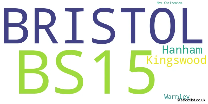
The largest settlement in the BS15 postal code is BRISTOL followed by Kingswood, and Hanham.
The BS15 Postcode shares a border with BS4 (BRISTOL, Brislington, Arnos Vale), BS31 (Keynsham, Saltford), BS5 (BRISTOL, St. George, Eastville), BS16 (BRISTOL, Emersons Green, Mangotsfield) and BS30 (BRISTOL, Longwell Green, Warmley).
The primary settlement in the BS15 postcode district is Kingswood, located in the county of Gloucestershire. It is the most significant settlement with a count of 40. Other significant settlements in the district include Hanham, located in the county of Bristol, and New Cheltenham and Warmley, both located in Gloucestershire. The post town for all settlements in the BS15 district is Bristol.
For the district BS15, we have data on 6 postcode sectors. Here's a breakdown: The sector BS15 0 is non-geographic. It's often designated for PO Boxes, large organisations, or special services. The sector BS15 1, covers Bristol and Kingswood in Bristol. The sector BS15 1, covers Bristol and Kingswood in Gloucestershire. The sector BS15 3, covers Hanham in Gloucestershire. The sector BS15 4, covers Bristol and Kingswood in Gloucestershire. The sector BS15 8, covers Kingswood and Bristol and Hanham in Gloucestershire. The sector BS15 8, covers Bristol in Bristol. The sector BS15 9, covers Bristol and Kingswood in Gloucestershire.

Map of the BS15 Postcode District
Explore the BS15 postcode district by using our free interactive map.

When it comes to local government, postal geography often disregards political borders. However, for a breakdown in the BS15 District: the district mostly encompasses the South Gloucestershire (938 postcodes), and finally, the City of Bristol (B) area (225 postcodes).
Weather Forecast for BS15
Press Button to Show Forecast for Kingswood
| Time Period | Icon | Description | Temperature | Rain Probability | Wind |
|---|---|---|---|---|---|
| 06:00 to 09:00 | Overcast | 5.0°C (feels like 3.0°C) | 10.00% | ENE 7 mph | |
| 09:00 to 12:00 | Cloudy | 7.0°C (feels like 5.0°C) | 9.00% | E 9 mph | |
| 12:00 to 15:00 | Overcast | 10.0°C (feels like 7.0°C) | 14.00% | E 9 mph | |
| 15:00 to 18:00 | Overcast | 10.0°C (feels like 8.0°C) | 18.00% | E 9 mph | |
| 18:00 to 21:00 | Overcast | 9.0°C (feels like 7.0°C) | 19.00% | E 7 mph | |
| 21:00 to 00:00 | Cloudy | 7.0°C (feels like 5.0°C) | 16.00% | E 7 mph |
Press Button to Show Forecast for Kingswood
| Time Period | Icon | Description | Temperature | Rain Probability | Wind |
|---|---|---|---|---|---|
| 00:00 to 03:00 | Cloudy | 6.0°C (feels like 4.0°C) | 13.00% | ENE 7 mph | |
| 03:00 to 06:00 | Overcast | 5.0°C (feels like 3.0°C) | 20.00% | ENE 7 mph | |
| 06:00 to 09:00 | Overcast | 5.0°C (feels like 2.0°C) | 23.00% | ENE 9 mph | |
| 09:00 to 12:00 | Light rain | 7.0°C (feels like 4.0°C) | 51.00% | ENE 11 mph | |
| 12:00 to 15:00 | Overcast | 10.0°C (feels like 7.0°C) | 21.00% | ENE 11 mph | |
| 15:00 to 18:00 | Cloudy | 11.0°C (feels like 9.0°C) | 18.00% | ENE 11 mph | |
| 18:00 to 21:00 | Light rain | 10.0°C (feels like 8.0°C) | 51.00% | NE 9 mph | |
| 21:00 to 00:00 | Light rain | 8.0°C (feels like 6.0°C) | 50.00% | NE 11 mph |
Press Button to Show Forecast for Kingswood
| Time Period | Icon | Description | Temperature | Rain Probability | Wind |
|---|---|---|---|---|---|
| 00:00 to 03:00 | Light rain | 7.0°C (feels like 5.0°C) | 50.00% | NE 9 mph | |
| 03:00 to 06:00 | Heavy rain | 7.0°C (feels like 4.0°C) | 72.00% | NE 9 mph | |
| 06:00 to 09:00 | Light rain | 7.0°C (feels like 5.0°C) | 53.00% | NE 9 mph | |
| 09:00 to 12:00 | Heavy rain | 9.0°C (feels like 6.0°C) | 72.00% | NNE 9 mph | |
| 12:00 to 15:00 | Light rain shower (day) | 11.0°C (feels like 8.0°C) | 42.00% | WNW 11 mph | |
| 15:00 to 18:00 | Light rain shower (day) | 11.0°C (feels like 9.0°C) | 43.00% | W 11 mph | |
| 18:00 to 21:00 | Light rain shower (day) | 11.0°C (feels like 9.0°C) | 36.00% | NNW 9 mph | |
| 21:00 to 00:00 | Partly cloudy (night) | 8.0°C (feels like 6.0°C) | 5.00% | WSW 7 mph |
Where is the BS15 Postcode District?
The postcode district for BS15 is located in Bristol. It is near several towns, including Bath, Badminton, Radstock, Corsham, Clevedon, and Chepstow. Additionally, the distance from BS15 to the center of London is approximately 102.7 miles.
The district is within the post town of BRISTOL.
The sector has postcodes within the nation of England.
The BS15 Postcode District is covers the following regions.
- Bath and North East Somerset, North Somerset and South Gloucestershire - Gloucestershire, Wiltshire and Bath/Bristol area - South West (England)
- Bristol, City of - Gloucestershire, Wiltshire and Bath/Bristol area - South West (England)
| Postcode Sector | Delivery Office |
|---|---|
| BS15 1 | Kingswood Delivery Office |
| BS15 3 | Kingswood Delivery Office |
| BS15 4 | Kingswood Delivery Office |
| BS15 8 | Kingswood Delivery Office |
| BS15 9 | Kingswood Delivery Office |
| B | S | 1 | 5 | - | X | X | X |
| B | S | 1 | 5 | Space | Numeric | Letter | Letter |
Current Monthly Rental Prices
| # Bedrooms | Min Price | Max Price | Avg Price |
|---|---|---|---|
| 1 | £500 | £900 | £763 |
| 2 | £950 | £1,550 | £1,256 |
| 3 | £1,325 | £1,550 | £1,444 |
| 4 | £2,000 | £3,280 | £2,458 |
| 5 | £3,050 | £3,050 | £3,050 |
Current House Prices
| # Bedrooms | Min Price | Max Price | Avg Price |
|---|---|---|---|
| 2 | £600,000 | £600,000 | £600,000 |
| 3 | £459,950 | £550,000 | £496,990 |
| 4 | £450,000 | £1,200,000 | £634,568 |
| 5 | £525,000 | £700,000 | £600,000 |
Estate Agents who Operate in the BS15 District
| Logo | Name | Brand Name | Address | Contact Number | Total Properties |
|---|---|---|---|---|---|
 | Kingswood | Taylors Estate Agents | 74 Regent Street, Kingswood, Bristol, Avon, BS15 8JA | 0117 463 8506 | 26 |
 | Hanham | D W Smith & Company | 54 High Street, Hanham, Bristol, BS15 3DR | 0117 428 9012 | 18 |
 | Kingswood | Connells | Regent Street, Kingswood, Bristol, Gloucestershire, BS15 8JX | 0117 463 8166 | 15 |
 | Kingswood | CJ Hole | 8 Regent Street, Kingswood, Bristol, BS15 8JS | 0117 463 4051 | 14 |
 | Longwell Green | Blue Sky Property | 28 Ellacombe Road, Longwell Green, Bristol, BS30 9BA | 0117 463 1317 | 9 |
| Type of Property | 2018 Average | 2018 Sales | 2017 Average | 2017 Sales | 2016 Average | 2016 Sales | 2015 Average | 2015 Sales |
|---|---|---|---|---|---|---|---|---|
| Detached | £347,761 | 57 | £346,972 | 88 | £328,499 | 74 | £324,630 | 76 |
| Semi-Detached | £259,982 | 252 | £253,470 | 243 | £236,469 | 233 | £216,023 | 244 |
| Terraced | £232,191 | 353 | £227,841 | 387 | £210,857 | 403 | £194,973 | 417 |
| Flats | £153,143 | 153 | £160,468 | 217 | £138,438 | 193 | £130,163 | 173 |