The E13 9 postcode sector is within the county of Greater London.
Did you know? According to the 2021 Census, the E13 9 postcode sector is home to a bustling 16,759 residents!
Given that each sector allows for 400 unique postcode combinations. Letters C, I, K, M, O and V are not allowed in the last two letters of a postcode. With 176 postcodes already in use, this leaves 224 units available.
The largest settlement in the E13 9 postal code is PLAISTOW followed by UPTON PARK , and EAST HAM .
The E13 9 Postcode shares a border with E13 0 (PLAISTOW , UPTON PARK , STRATFORD ), E6 1 (EAST HAM ), E6 3 (EAST HAM ) and E13 8 (PLAISTOW ).
The sector is within the post town of LONDON.
E13 9 is a postcode sector within the E13 postcode district which is within the E East London postcode area.
The Royal Mail delivery office for the E13 9 postal sector is the Plaistow Sdelivery Office.
The area of the E13 9 postcode sector is 0.38 square miles which is 0.97 square kilometres or 240.67 square acres.

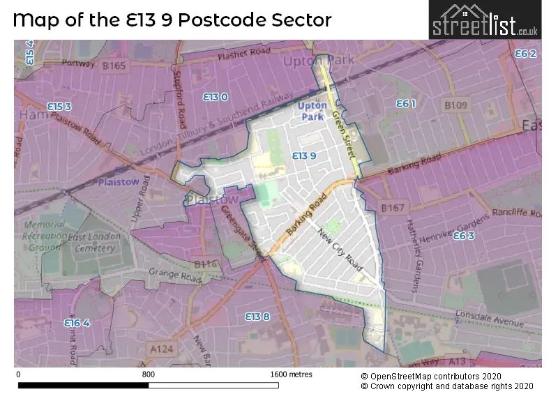
Map of the E13 9 Postcode Sector
Explore the E13 9 postcode sector by using our free interactive map.
| E | 1 | 3 | - | 9 | X | X |
| E | 1 | 3 | Space | 9 | Letter | Letter |
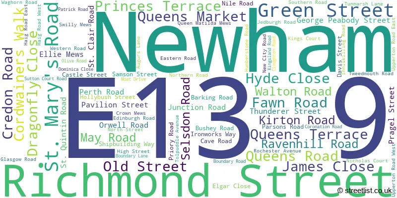
Official List of Streets
Newham (80 Streets)
Unofficial Streets or Alternative Spellings
Newham
BALAAM STREET BEAUMONT ROAD BENSON AVENUE CENTRAL PARK ROAD CLACTON ROAD CLEGG STREET CRESCENT ROAD DENBIGH ROAD DONGOLA ROAD FRINTON ROAD GLEN ROAD GREENGATE STREET HAROLD ROAD HERBERT STREET KENNEDY CLOSE KENT STREET LICHFIELD ROAD LONSDALE AVENUE PARK ROAD PELLY ROAD PLAISTOW PARK ROAD REDCLYFFE ROAD STIRLING ROAD SURREY STREET SWETE STREET TUDOR ROAD WILSON ROAD ANGUS ROAD CHERRY TREE WAY EILLIE MEWS GREENWAY HARVEY TERRACE KINGS ROAD MEMORIAL WALK NORTH STREET PASSAGE OBAN ROAD PASTEUR TERRACE QUEENS ROAD WEST THE BROADWAY UPPERTON ROADWeather Forecast for E13 9
Press Button to Show Forecast for West Ham United F.C.
| Time Period | Icon | Description | Temperature | Rain Probability | Wind |
|---|---|---|---|---|---|
| 12:00 to 15:00 | Cloudy | 11.0°C (feels like 10.0°C) | 9.00% | NNE 7 mph | |
| 15:00 to 18:00 | Cloudy | 13.0°C (feels like 11.0°C) | 47.00% | ENE 7 mph | |
| 18:00 to 21:00 | Heavy rain | 12.0°C (feels like 10.0°C) | 80.00% | ENE 9 mph | |
| 21:00 to 00:00 | Heavy rain | 10.0°C (feels like 8.0°C) | 86.00% | NE 9 mph |
Press Button to Show Forecast for West Ham United F.C.
| Time Period | Icon | Description | Temperature | Rain Probability | Wind |
|---|---|---|---|---|---|
| 00:00 to 03:00 | Heavy rain | 9.0°C (feels like 7.0°C) | 89.00% | NNE 9 mph | |
| 03:00 to 06:00 | Heavy rain | 9.0°C (feels like 7.0°C) | 89.00% | NNE 9 mph | |
| 06:00 to 09:00 | Heavy rain | 9.0°C (feels like 8.0°C) | 86.00% | N 7 mph | |
| 09:00 to 12:00 | Heavy rain | 10.0°C (feels like 8.0°C) | 80.00% | WNW 9 mph | |
| 12:00 to 15:00 | Light rain | 10.0°C (feels like 8.0°C) | 56.00% | W 11 mph | |
| 15:00 to 18:00 | Overcast | 11.0°C (feels like 9.0°C) | 21.00% | W 11 mph | |
| 18:00 to 21:00 | Cloudy | 11.0°C (feels like 9.0°C) | 10.00% | WSW 9 mph | |
| 21:00 to 00:00 | Partly cloudy (night) | 10.0°C (feels like 8.0°C) | 6.00% | SW 7 mph |
Press Button to Show Forecast for West Ham United F.C.
| Time Period | Icon | Description | Temperature | Rain Probability | Wind |
|---|---|---|---|---|---|
| 00:00 to 03:00 | Clear night | 8.0°C (feels like 7.0°C) | 2.00% | SW 4 mph | |
| 03:00 to 06:00 | Clear night | 7.0°C (feels like 6.0°C) | 1.00% | SSW 4 mph | |
| 06:00 to 09:00 | Sunny day | 8.0°C (feels like 6.0°C) | 1.00% | S 4 mph | |
| 09:00 to 12:00 | Partly cloudy (day) | 12.0°C (feels like 10.0°C) | 3.00% | S 9 mph | |
| 12:00 to 15:00 | Cloudy | 15.0°C (feels like 12.0°C) | 8.00% | S 11 mph | |
| 15:00 to 18:00 | Partly cloudy (day) | 15.0°C (feels like 13.0°C) | 2.00% | S 11 mph | |
| 18:00 to 21:00 | Sunny day | 14.0°C (feels like 12.0°C) | 2.00% | S 9 mph | |
| 21:00 to 00:00 | Clear night | 11.0°C (feels like 10.0°C) | 1.00% | SSE 7 mph |
Press Button to Show Forecast for West Ham United F.C.
| Time Period | Icon | Description | Temperature | Rain Probability | Wind |
|---|---|---|---|---|---|
| 00:00 to 03:00 | Clear night | 10.0°C (feels like 8.0°C) | 2.00% | SE 7 mph | |
| 03:00 to 06:00 | Clear night | 9.0°C (feels like 8.0°C) | 3.00% | ESE 7 mph | |
| 06:00 to 09:00 | Cloudy | 10.0°C (feels like 8.0°C) | 8.00% | ESE 7 mph | |
| 09:00 to 12:00 | Partly cloudy (day) | 13.0°C (feels like 12.0°C) | 5.00% | ESE 7 mph | |
| 12:00 to 15:00 | Cloudy | 16.0°C (feels like 14.0°C) | 12.00% | SE 9 mph | |
| 15:00 to 18:00 | Cloudy | 17.0°C (feels like 15.0°C) | 12.00% | SE 9 mph | |
| 18:00 to 21:00 | Cloudy | 16.0°C (feels like 14.0°C) | 11.00% | ESE 9 mph | |
| 21:00 to 00:00 | Light rain shower (night) | 13.0°C (feels like 12.0°C) | 35.00% | ESE 7 mph |
Schools and Places of Education Within the E13 9 Postcode Sector
New City Primary School
Academy converter
Tunmarsh Lane, London, , E13 9NE
Head: Ms C Stone
Ofsted Rating: Outstanding
Inspection: 2022-07-14 (653 days ago)
Website: Visit New City Primary School Website
Phone: 02084722743
Number of Pupils: 632
Plaistow Primary School
Community school
Junction Road, London, , E13 9DQ
Head: Mr Dean Benoit
Ofsted Rating: Good
Inspection: 2018-10-10 (2026 days ago)
Website: Visit Plaistow Primary School Website
Phone: 02085485620
Number of Pupils: 379
Southern Road Primary School
Community school
Southern Road, London, , E13 9JH
Head: Ms Dena Lawrence Helen Yearnshire
Ofsted Rating: Good
Inspection: 2023-09-13 (227 days ago)
Website: Visit Southern Road Primary School Website
Phone: 02084719048
Number of Pupils: 615
St Edward's Catholic Primary School
Academy converter
Green Street, London, , E13 9AX
Head: Mr Paul Underwood
Ofsted Rating: Good
Inspection: 2023-01-12 (471 days ago)
Website: Visit St Edward's Catholic Primary School Website
Phone: 02084724337
Number of Pupils: 428
Tunmarsh School
Pupil referral unit
The Tunmarsh Centre, London, , E13 9NB
Head: Ms Kirsten Macleod
Ofsted Rating: Good
Inspection: 2018-01-09 (2300 days ago)
Website: Visit Tunmarsh School Website
Phone: 02075040531
Number of Pupils: 64
House Prices in the E13 9 Postcode Sector
| Type of Property | 2018 Average | 2018 Sales | 2017 Average | 2017 Sales | 2016 Average | 2016 Sales | 2015 Average | 2015 Sales |
|---|---|---|---|---|---|---|---|---|
| Detached | £1,030,000 | 1 | £480,000 | 1 | £0 | 0 | £610,000 | 1 |
| Semi-Detached | £205,000 | 1 | £375,000 | 1 | £650,000 | 1 | £405,000 | 2 |
| Terraced | £371,044 | 63 | £396,384 | 89 | £358,611 | 89 | £313,444 | 94 |
| Flats | £390,899 | 150 | £284,635 | 33 | £271,696 | 28 | £219,279 | 43 |
Important Postcodes E13 9 in the Postcode Sector
E13 9AE is the postcode for MODULAR CLASSROOM ACCOMMODATION, Lister Community Secondary School, St. Mary's Road, LONDON BOROUGH OF NEWHAM DINING HALL, Lister Community Secondary School, St. Mary's Road, LONDON BOROUGH OF NEWHAM, Lister Community Secondary School, St. Mary's Road, and Lister Community Secondary School, St. Mary's Road
E13 9AX is the postcode for Main Building, St. Edwards RC Primary School, Green Street, LONDON BOROUGH OF NEWHAM, St. Edwards RC Primary School, Green Street, and St. Edwards RC Primary School, Green Street
E13 9BT is the postcode for Main Building, Upton Cross Primary School, Kirton Road, London Borough Of Newham, Upton Cross Annexe Primary, In Service Education Centre, Credon Centre, Kirton Road, and Annex Building, Upton Cross Primary School, Kirton Road
E13 9DQ is the postcode for Plaistow Primary School, Junction Road
E13 9DX is the postcode for Cave Road Centre, Cave Road
E13 9HB is the postcode for London Borough of Newham, 3 Pragel Street
E13 9HL is the postcode for Plaistow Library, North Street
E13 9HN is the postcode for Eleanor Smith School, North Street
E13 9JD is the postcode for LONDON BOROUGH OF NEWHAM BUILDING EXTENSION, Southern Road Infant School, Southern Road, LONDON BOROUGH OF NEWHAM MAIN BUILDING, Southern Road Infant School, Southern Road, and Southern Road Infant School, Southern Road
E13 9JH is the postcode for WEST BUILDING, Southern Road Primary School, Eastern Road, EAST BUILDING, Southern Road Primary School, Eastern Road, and Southern Road Primary School, Eastern Road
E13 9NB is the postcode for Tunmarsh School, Tunmarsh Lane, Plaistow, London Borough of Newham, New Tunmarsh Centre, Tunmarsh Lane, Behaviour & Learning Support Services, New Tunmarsh Centre, Tunmarsh Lane, and Tunmarsh School, Tunmarsh Lane
E13 9NE is the postcode for New City Primary School, 45 Tunmarsh Lane
E13 9PY is the postcode for LONDON BOROUGH OF NEWHAM, New City Primary School, New City Road, The Boleyn Trust, New City Primary School, New City Road, and New City Primary School, New City Road
| The E13 9 Sector is within these Local Authorities |
|
|---|---|
| The E13 9 Sector is within these Counties |
|
| The E13 9 Sector is within these Water Company Areas |
|